Down Under Decoded: A Hilariously Helpful Guide to the Map of Australia States and Regions
G'day, geography geeks and accidental tourists! Ever looked at a map of Australia and thought, "That's a big red blob with some green bits around the edges"? You're not wrong, but there's a whole lot more to this upside-down land than kangaroos, koalas, and Crocodile Dundee impersonators. In this guide, we're going to take a rollicking ride through the six states and two mainland territories of Australia—no passport required, but you might want to bring a shrimp for the metaphorical barbie. By the end, you'll know your Tassie from your Top End and will never confuse a Queenslander with a sandgroper again.
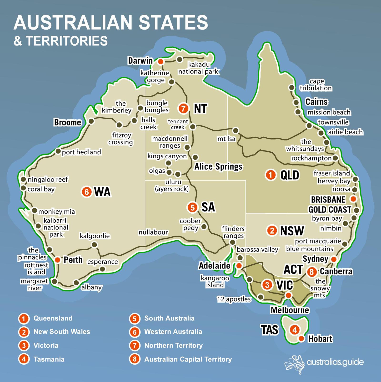
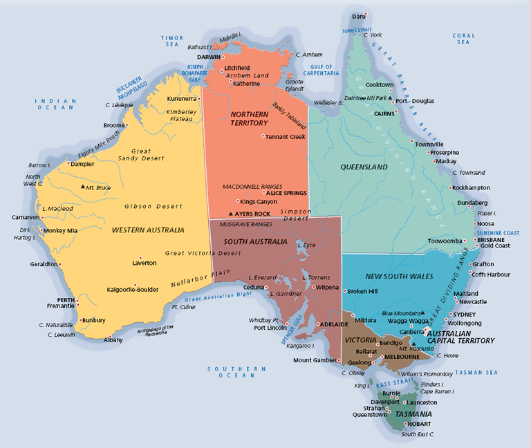
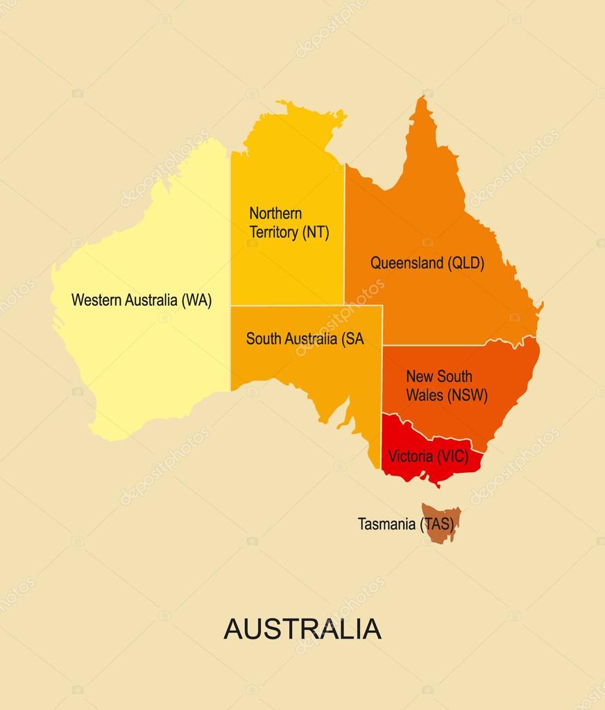
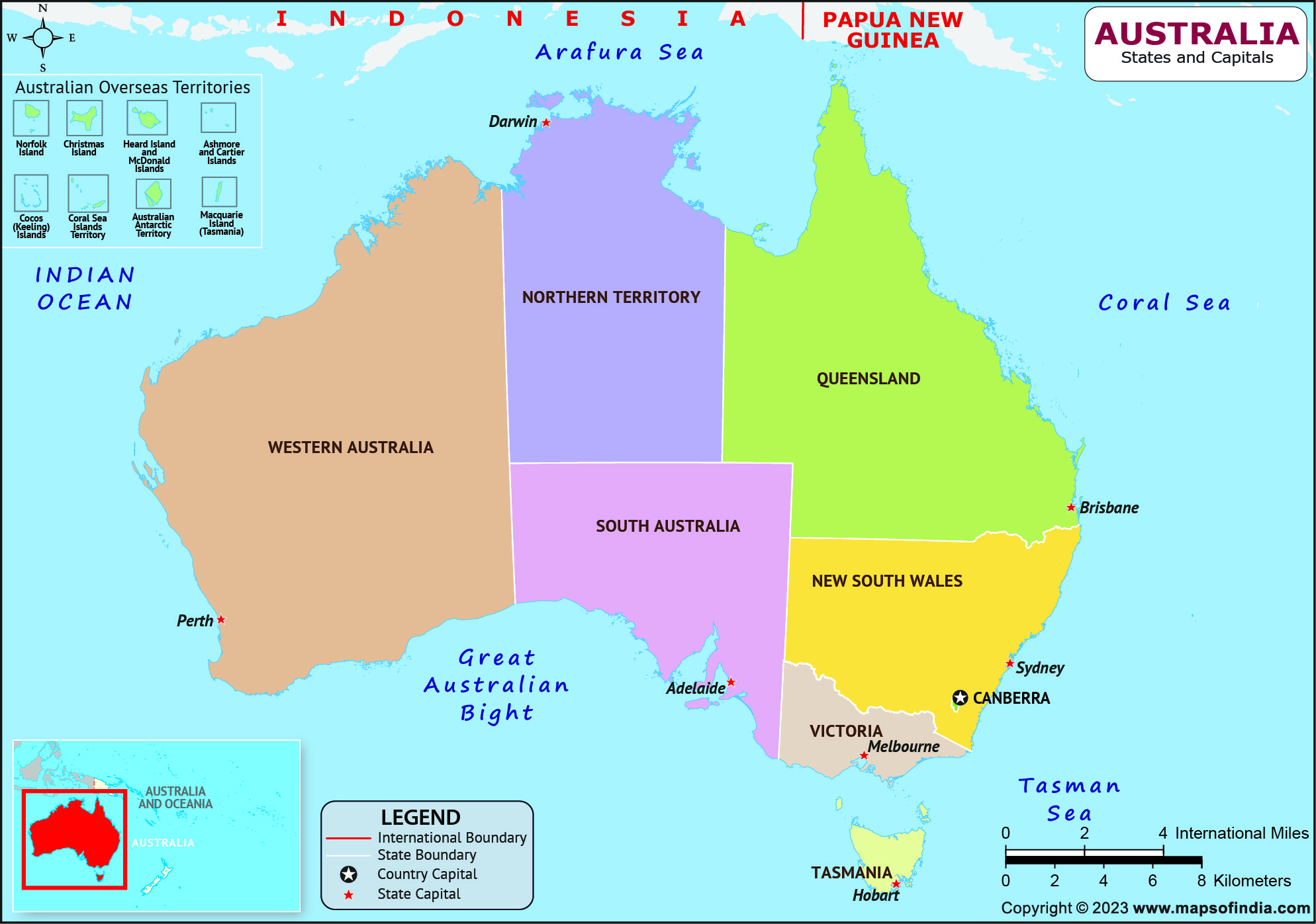
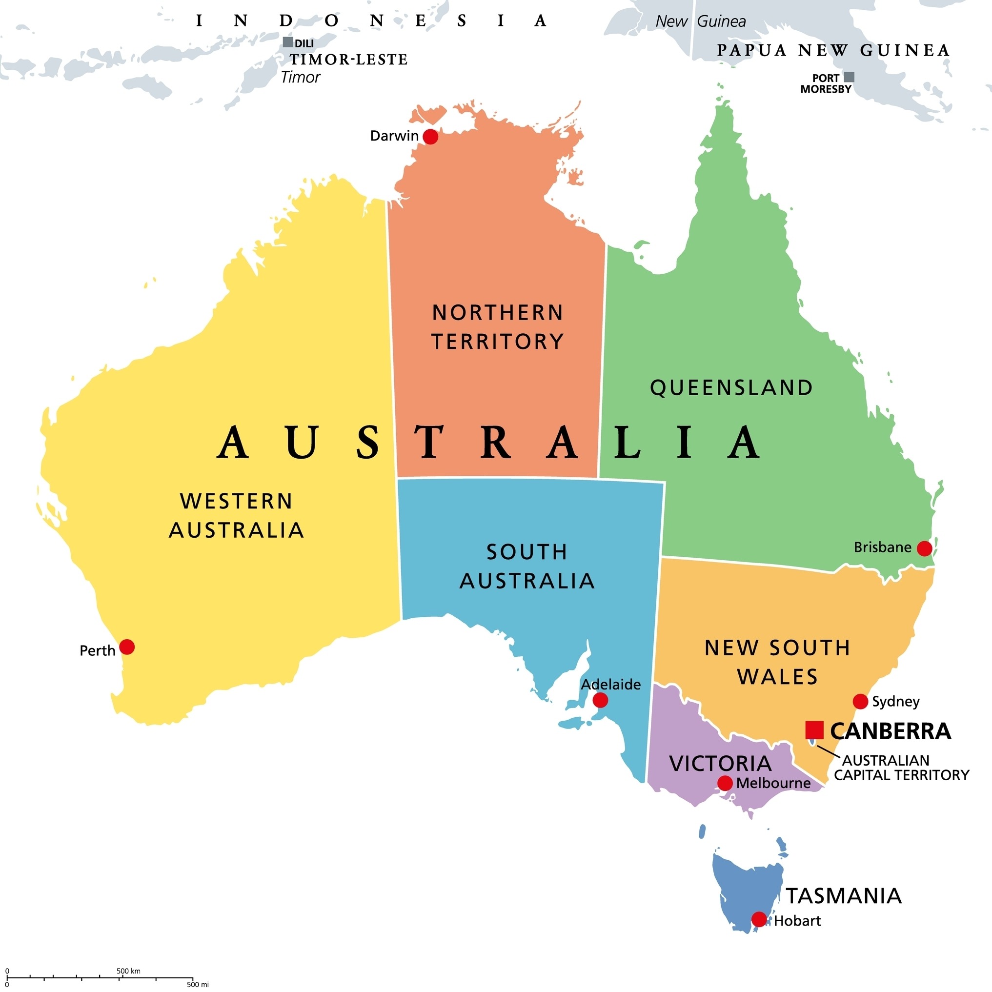
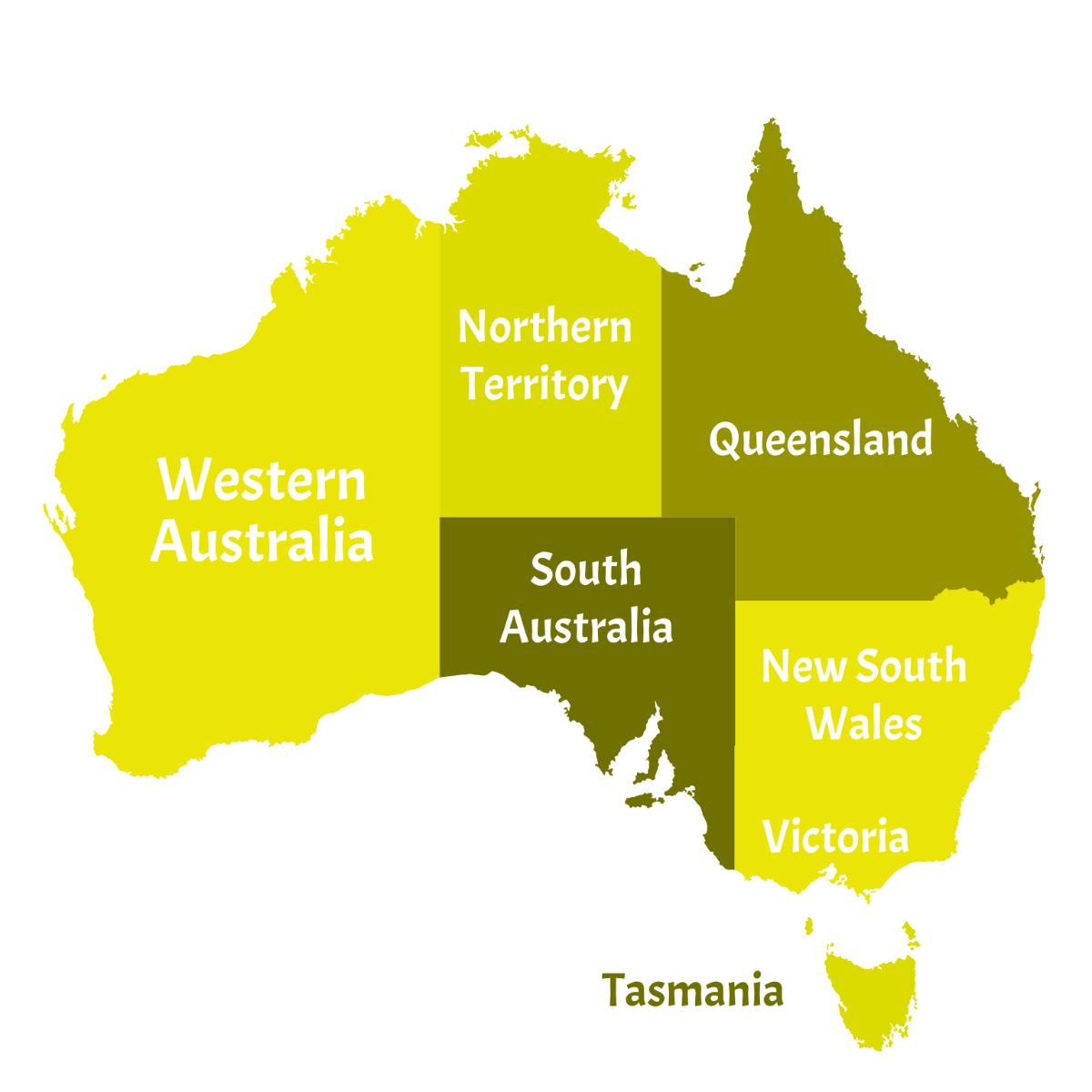
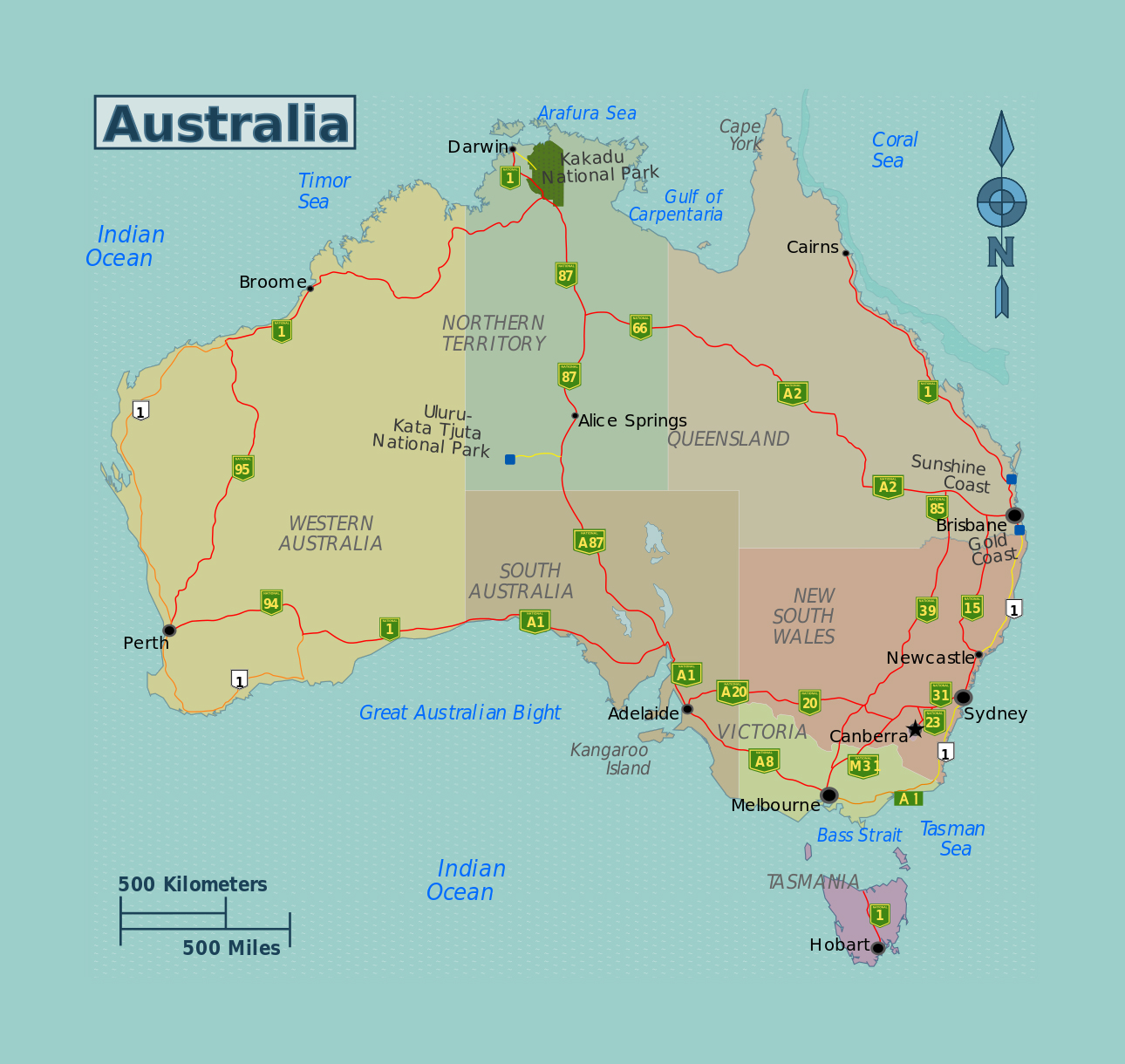
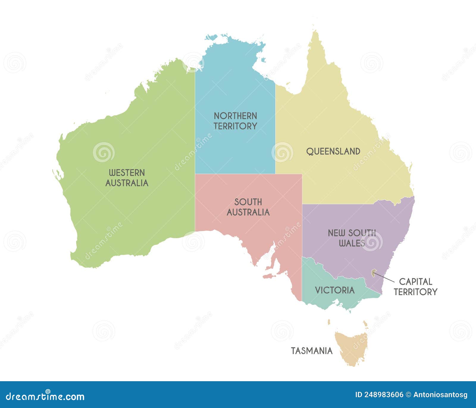
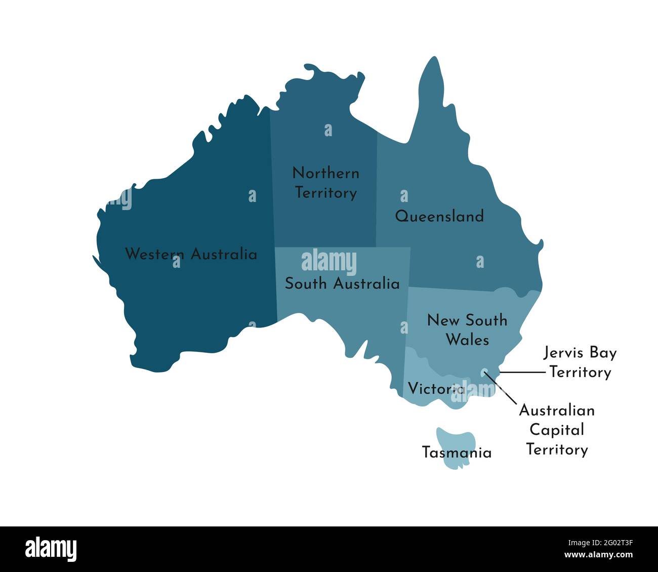
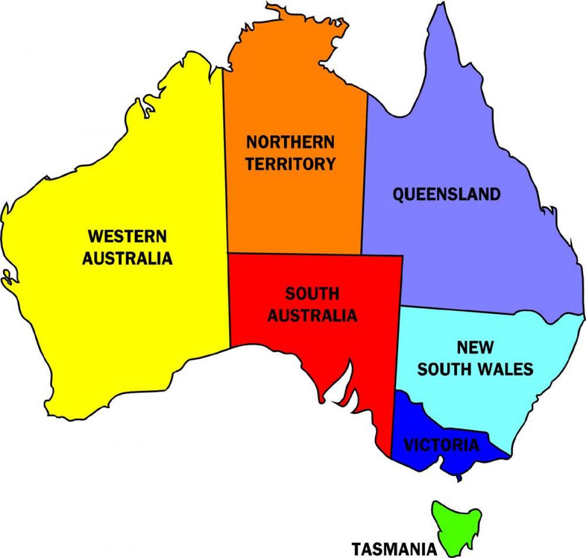
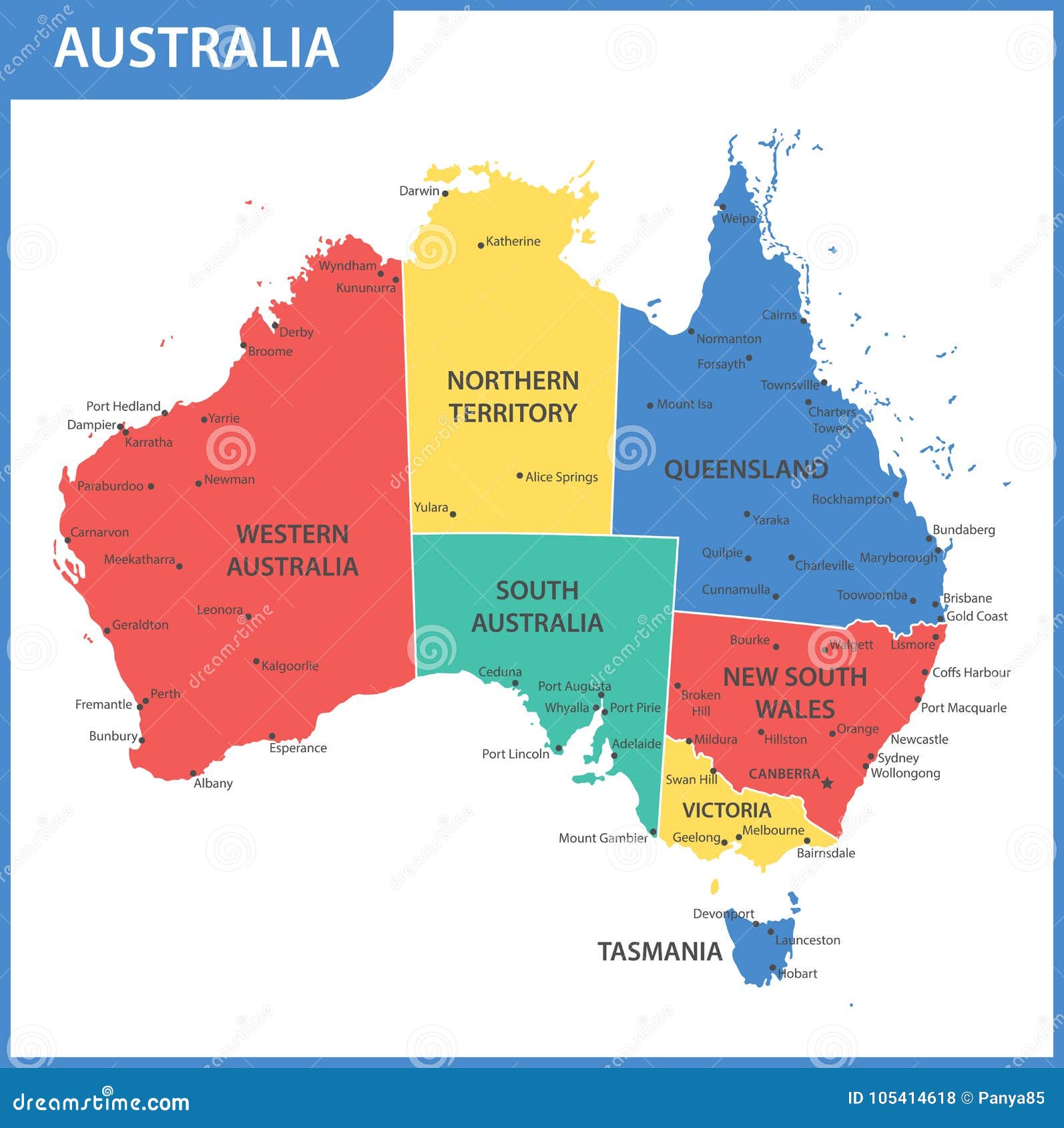
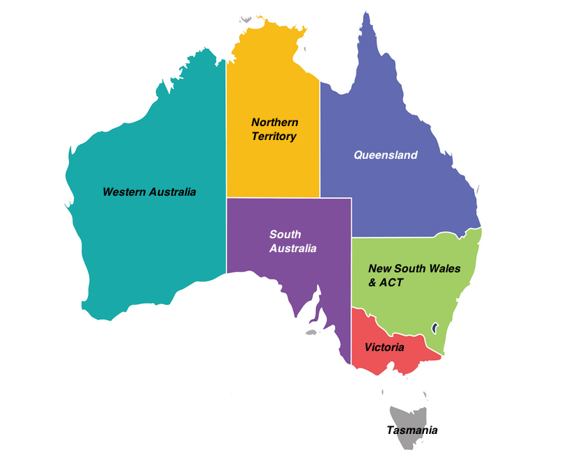
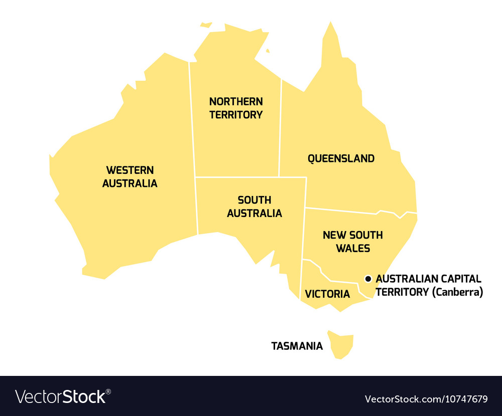
New South Wales (NSW): The "Look at Me!" State
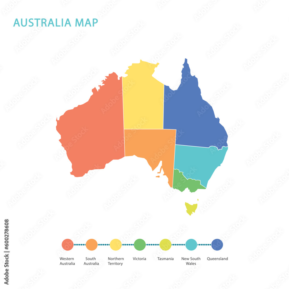
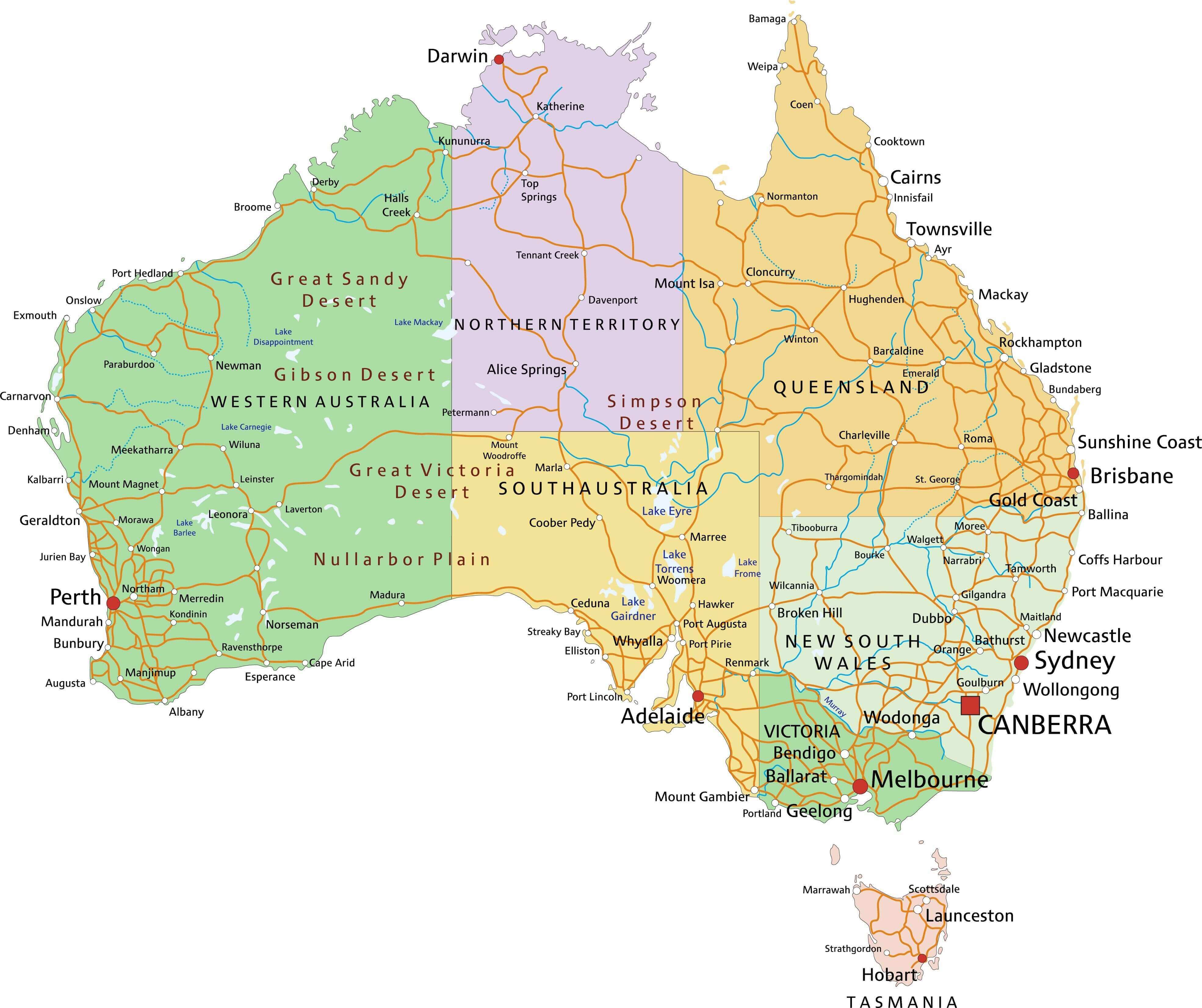
New South Wales is the diva of the Australian map. It's home to Sydney—the city that convinced the world opera houses look good wearing sailboat costumes. But don't stop at the Harbour Bridge selfies. NSW stretches from the sandy beaches of Byron Bay (where the biggest danger is a rogue kale smoothie) to the snowy peaks of the Snowy Mountains (yes, Australia has snow, get over it). The state is a chaotic, wonderful mess: you can hike through the Blue Mountains where the air smells like eucalyptus gum and your legs feel like jelly, then drive three hours to a town called "Wagga Wagga" (yes, it's fun to say). Politically, NSW is where the country's big decisions get made, usually while everyone else yells "Typical NSW!" from their sunburned patios.
Victoria (VIC): The Coffee Snob That Thinks It's Europe
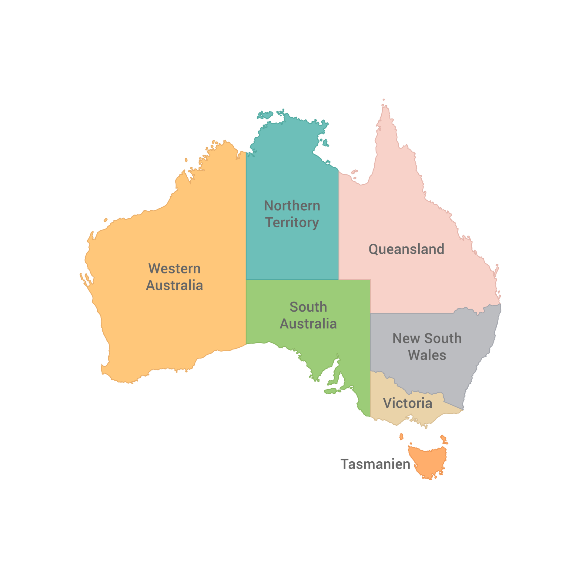
Victoria is the smallest mainland state, but it packs a mean caffeinated punch. Capital city Melbourne is famous for its "four seasons in one day" weather—meaning you can start the morning shivering in a parka, sweat through lunch, and get hailed on by dinner. The state claims to be the "cultural capital" of Australia, which mainly means it has world-class laneway graffiti, an obsession with AFL footy, and a rivalry with Sydney that borders on hilarious. Beyond the city, Victoria boasts the Great Ocean Road, a coastal drive that will make you weep at the sight of the Twelve Apostles (limestone stacks, not the disciples). Geographically, the map of Victoria looks like a little triangle wedged between NSW and South Australia, as if it's trying to sneak a nap in the corner of the continent.
Queensland (QLD): The Sunburnt Carnival Barker
Queensland is the "Sunshine State," and it radiates the kind of vacation energy that makes you want to quit your job and become a surf instructor. It's massive—like, embarrassingly big. The southeastern corner has Brisbane, a city that's like Sydney's chill, suntanned cousin. But the real stars are the Gold Coast (glitter strip of skyscrapers and theme parks) and the Great Barrier Reef (the world's largest living structure, best viewed while snorkeling and screaming "FISH!" at a clownfish). Up north, you'll find the Daintree Rainforest, where the trees are older than your grandmother's wisdom. One weird fact: Queenslanders call their state "Queensland," but they also call every other state "down south," even if those states are, you know, east. On the map, Queensland's coastline looks like a jagged dinosaur tail slapping the Coral Sea.
Western Australia (WA): The "We're Basically a Country" State
Western Australia is so enormous that it could swallow Texas, Alaska, and your sense of direction. It occupies a third of the continent but has only about 10% of the population—so basically, it's the introvert of states. Perth, the capital, is one of the most isolated cities on Earth (it's closer to Jakarta than to Sydney), which explains why locals have an accent that sounds like they're perpetually asking a question. The state's map is dominated by the Outback: think red dirt, ancient rock formations like Wave Rock, and the surreal Pinnacles Desert where stones stand up like alien toothpicks. WA also has a booming mining industry, so it's basically one giant, dusty ATM that occasionally explodes with wildflowers that will make you cry at their beauty. Just remember: in WA, the sun sets over the ocean—which feels wrong if you're from the eastern states.
South Australia (SA): The Wine-Fueled Underdog
South Australia sits at the bottom-middle of the map, like the quiet kid in class who secretly throws the best parties. Adelaide, the capital, is often called the "City of Churches," but honestly, it's more the city of incredible wine regions like Barossa and McLaren Vale. The state's biggest claim to fame is the "dumpling" shape of the Eyre Peninsula and the bizarre, pink-hued Lake Eyre (it's only pink sometimes, and scientists aren't entirely sure why—classic SA). South Australia also hosts the world's biggest lizard on a stick (waaait, that's not right). Actually, it has kangaroo island, a wildlife sanctuary where you can see koalas doing what they do best: sleeping so hard they look dead. Geographically, SA is the dry, flat, wine-soaked middle finger pointing at the Indian Ocean.
Tasmania (TAS): The Island of Scary Stories and Cute Puddings
Tasmania is the little island state that juts off the bottom of the mainland like a carbuncle that no one talks about, but it's secretly the most beautiful. They have the Tasmanian devil (a creature that sounds like a demon but looks like a grumpy teddy bear), World Heritage-listed wilderness, and the coolest capital city on the planet: Hobart, with its MONA museum (think: "modern art that might offend your grandma"). The map of Tassie is shaped like a wonky heart, which is fitting because everyone who visits falls in love with it. The weather is legitimately cold—Australians from the north will literally die if they visit in winter. But the payoff? Cradle Mountain, the Bay of Fires, and the fact that you can legally buy a dried-pea and scallop pie in a gas station.
Northern Territory (NT): The Wild, Red Heartbeat
The Northern Territory is not a state (it's a territory, a political spawn of the federal government), but it's as big and bold as any state. The map of NT is basically a giant, red rectangle with two famous dots: Darwin (top, tropical, crocodile-infested) and Alice Springs (middle, red dust, camel-riding central). The Territory is home to Uluru (Ayers Rock), a giant sandstone monolith that changes color at sunset—it's not a "rock," it's an emotion. Also, you've got Kakadu National Park, where the crocs are so big they can eat a cow and still have room for dessert. The NT is where you go to get existential, get heatstroke, and get bitten by a creature that hasn't been classified yet. Just don't ask locals about the "State of the Territory" debate unless you have two hours and a cold beer.
Australian Capital Territory (ACT): The Parliament Pimple
Last but thoroughly mini is the Australian Capital Territory—a tiny, donut-shaped territory swallowed by New South Wales. Inside this donut lies Canberra, the capital city that was deliberately chosen as a compromise between Sydney and Melbourne. It's basically a giant, purpose-built government campus with beautiful roundabouts and an enormous flagpole that makes everything look patriotic. The ACT has Lake Burley Griffin (man-made, but pretty), the Parliament House (where you can watch politicians argue live), and a whole lot of public servants eating avocado toast. Geographically, it's the most boring part of the map to look at—just a tiny green blob—but it's where all the adult decision-making happens (or doesn't, as the case may be).
Conclusion: Now You're a True Bosco-Blue Map Expert
So there you have it—the six states and two territories of Australia, each with its own flavor of weird, wonderful, and windburn. The map of Australia isn't just a big empty canvas; it's a story of convicts, gold rushes, scorching deserts, and oceans full of creatures that could kill you with a smile. Whether you're planning a trip, studying for a pub quiz, or just trying to sound smart at a cocktail party, you now know that New South Wales has the attitude, Victoria has the coffee, Queensland has the tan, WA has the space, SA has the wine, Tasmania has the spooky cool, the NT has the heat, and the ACT has the boring-but-necessary paperwork. Now go forth and impress—or confuse—your friends with your newfound Down Under knowledge. Cheers!
Map Of Australia Regions: Political And State Map Of Australia
Map of Australia regions: political and state map of Australia
Australia Regions Map
Australia Regions Map
File:Australia Regions Map.png - Wikitravel Shared

File:Australia regions map.png - Wikitravel Shared
Map Of Australia Regions: Political And State Map Of, 49% OFF
Map Of Australia Regions: Political And State Map Of, 49% OFF
Vector Image Australia Regions Map Stock Vector (Royalty Free

Vector Image Australia Regions Map Stock Vector (Royalty Free ...
Australia Map With Regions. Vector Illustration. Australian State

Australia Map with Regions. Vector Illustration. Australian State ...
Australia Map With Regions And Their Capitals Vector Image
Australia Map With Regions And Their Capitals Vector Image
30,182 Australia Map States Images, Stock Photos, 3D Objects, & Vectors

30,182 Australia Map States Images, Stock Photos, 3D objects, & Vectors ...
Region Map Of Australia

Region Map Of Australia
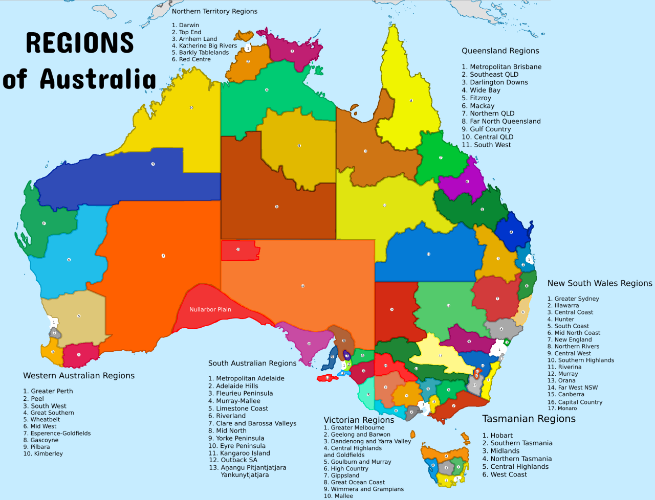
Regions Of Australia

Regions Of Australia
Australia States And Capitals List And Map | List Of States And
Australia States and Capitals List and Map | List of States and ...
Map Australia
Map Australia
The Detailed Map Of The Australia With Regions Or States And Cities

The Detailed Map of the Australia with Regions or States and Cities ...
Australia States And Territories Map | List Of Australia States And

Australia States And Territories Map | List of Australia States And ...
File:Australia Regions Map.svg - Wikipedia

File:Australia regions map.svg - Wikipedia
Regions Of Australia

Regions Of Australia
Political Features Of Australia Southeast Asia Political Map Stock
Political Features Of Australia Southeast Asia Political Map Stock
Map Of Australia Regions: Political And State Map Of Australia
Map of Australia regions: political and state map of Australia
Map Of Australia Showing Breakdown Of States And Regions (= Major

Map of Australia showing breakdown of states and regions (= major ...
Free Australia Map Clipart With States Template To Edit Online
Free Australia Map Clipart With States Template to Edit Online
Australia Map Free Vector Art - (2889 Free Downloads)
Australia Map Free Vector Art - (2889 Free Downloads)
My Forecast For Australia’s Voice Referendum – NO To Win By 17 Points

My forecast for Australia’s Voice Referendum – NO to win by 17 points ...
Detailed Regions Map Of Australia | Australia | Oceania | Mapsland
Detailed regions map of Australia | Australia | Oceania | Mapsland ...
Australia Map With Regions And Their Capitals Vector Illustration
Australia Map With Regions And Their Capitals Vector Illustration ...
Regions Of Australia
Regions Of Australia
Map Of Australia Showing States And Territories | Australia’s Defining

Map of Australia showing states and territories | Australia’s Defining ...
Map Of Regions In Australia | Australia Map, Australia, Map

Map of regions in Australia | Australia map, Australia, Map
Free PDF Maps Of Australia

Free PDF maps of Australia
Australia Map States - States Of Australia Map (Australia And New
Australia map states - States of Australia map (Australia and New ...
The Detailed Map Of The Australia With Regions Or States And Cities
The Detailed Map of the Australia with Regions or States and Cities ...
Map Of Australia Regions: Political And State Map Of, 49% OFF

Map Of Australia Regions: Political And State Map Of, 49% OFF
A Guide Australia’s 7 Beautiful Regions (+Map) - Touropia
A Guide Australia’s 7 Beautiful Regions (+Map) - Touropia
Map Of Australia Regions Download Australia Administrative Boundary
Map Of Australia Regions Download Australia Administrative Boundary