The Colonial Cartography of Australia: A Guide to State Formation and Historical Borders
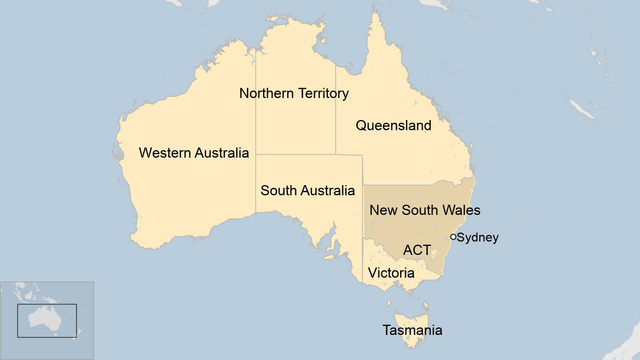
This comprehensive guide explores the colonial history of Australia as it is reflected in the modern map of its states and territories. Readers will learn how the original British colonies—New South Wales, Van Diemen’s Land, South Australia, Western Australia, Queensland, and Victoria—evolved through exploration, penal settlement, and political negotiation to form the federation we recognize today. By understanding the forces that shaped these borders, you will gain deeper insight into Australia’s demographic, economic, and cultural geography.
The Genesis of New South Wales and the East Coast
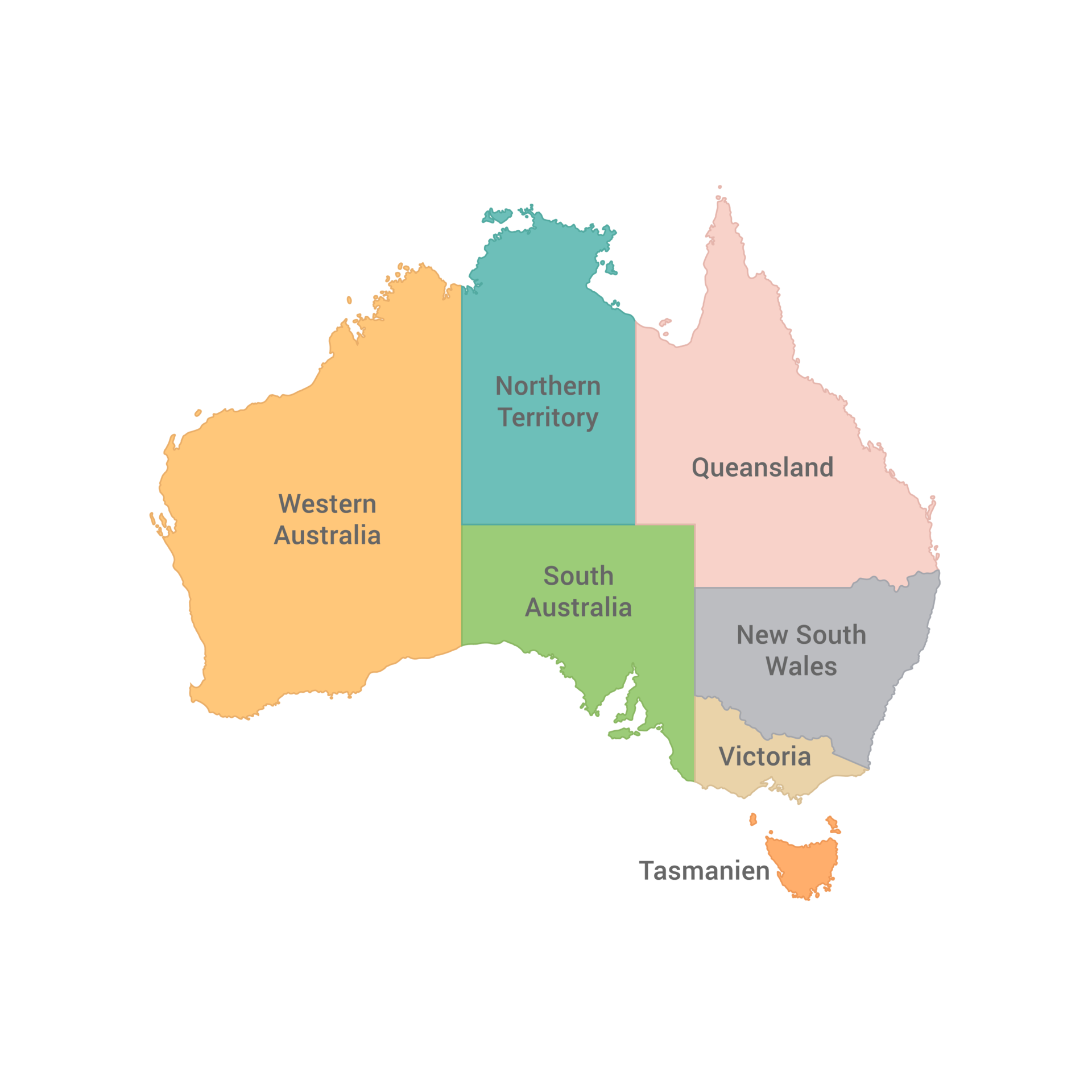
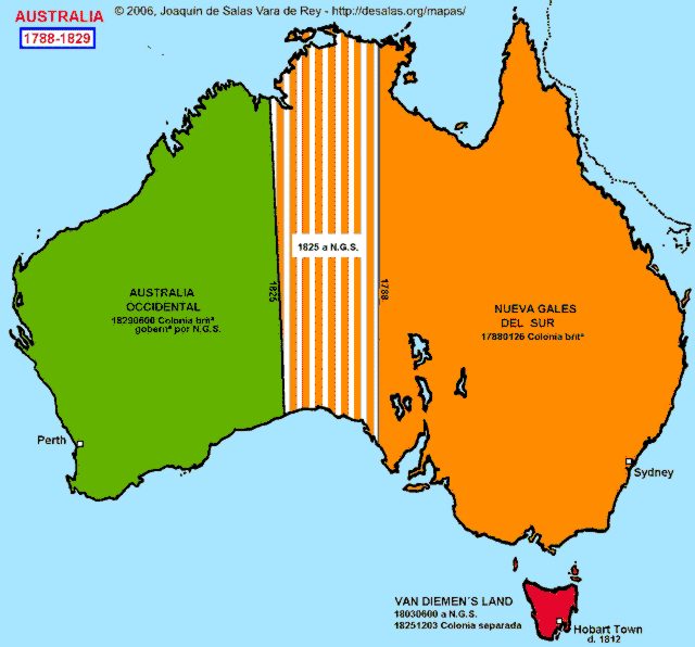
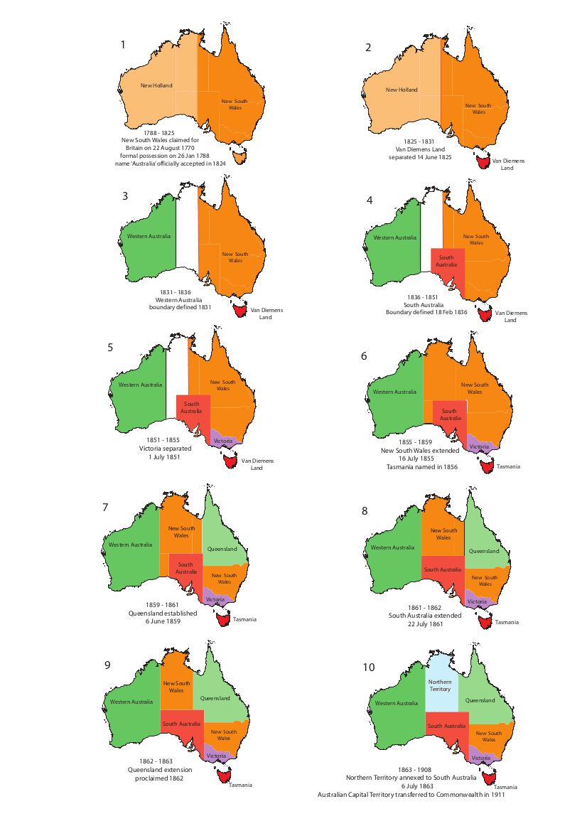
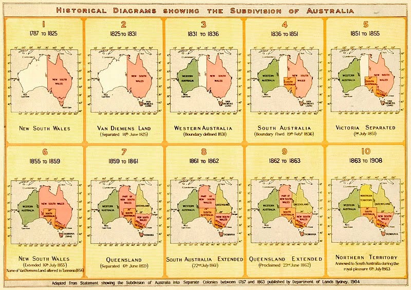
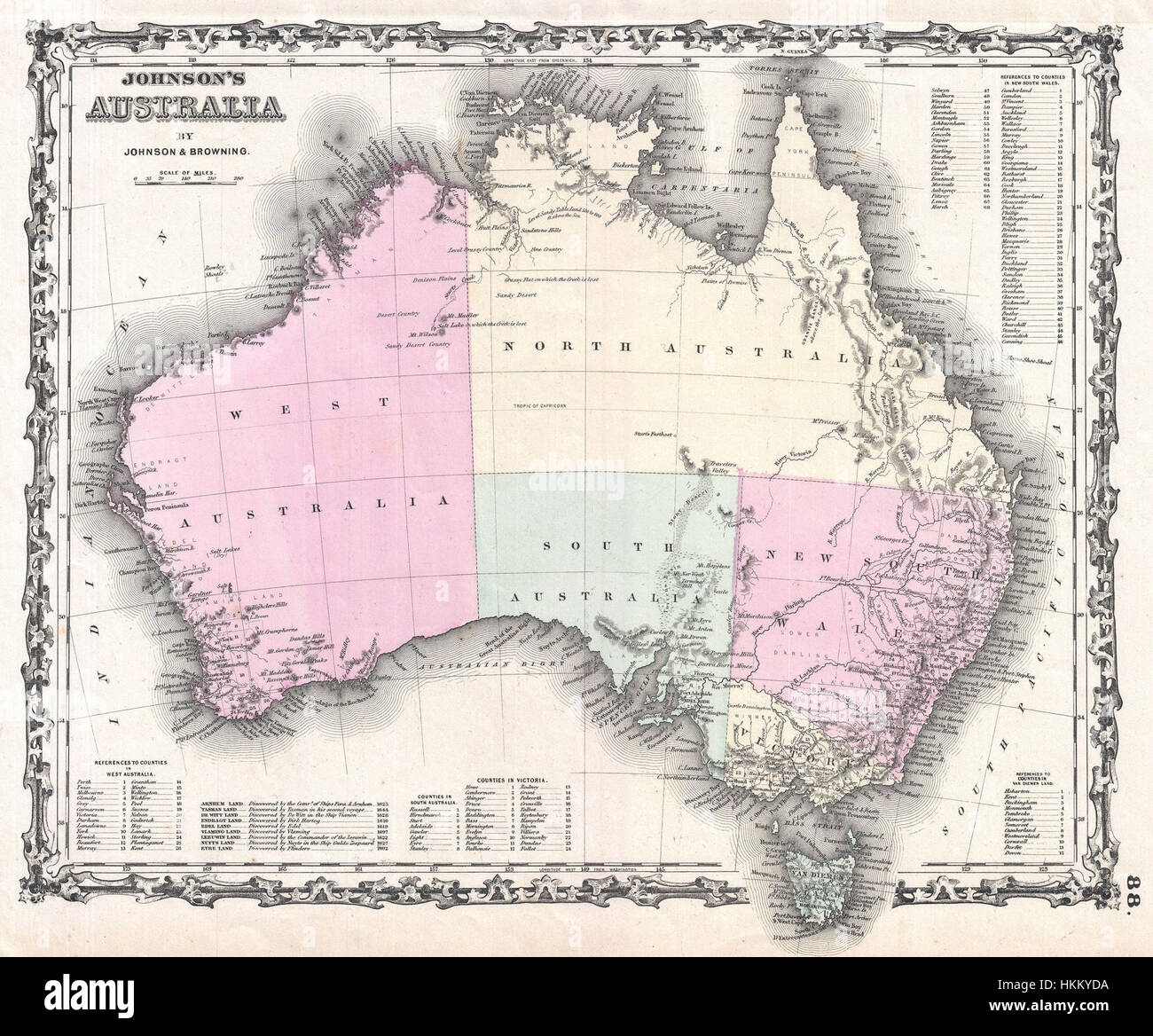
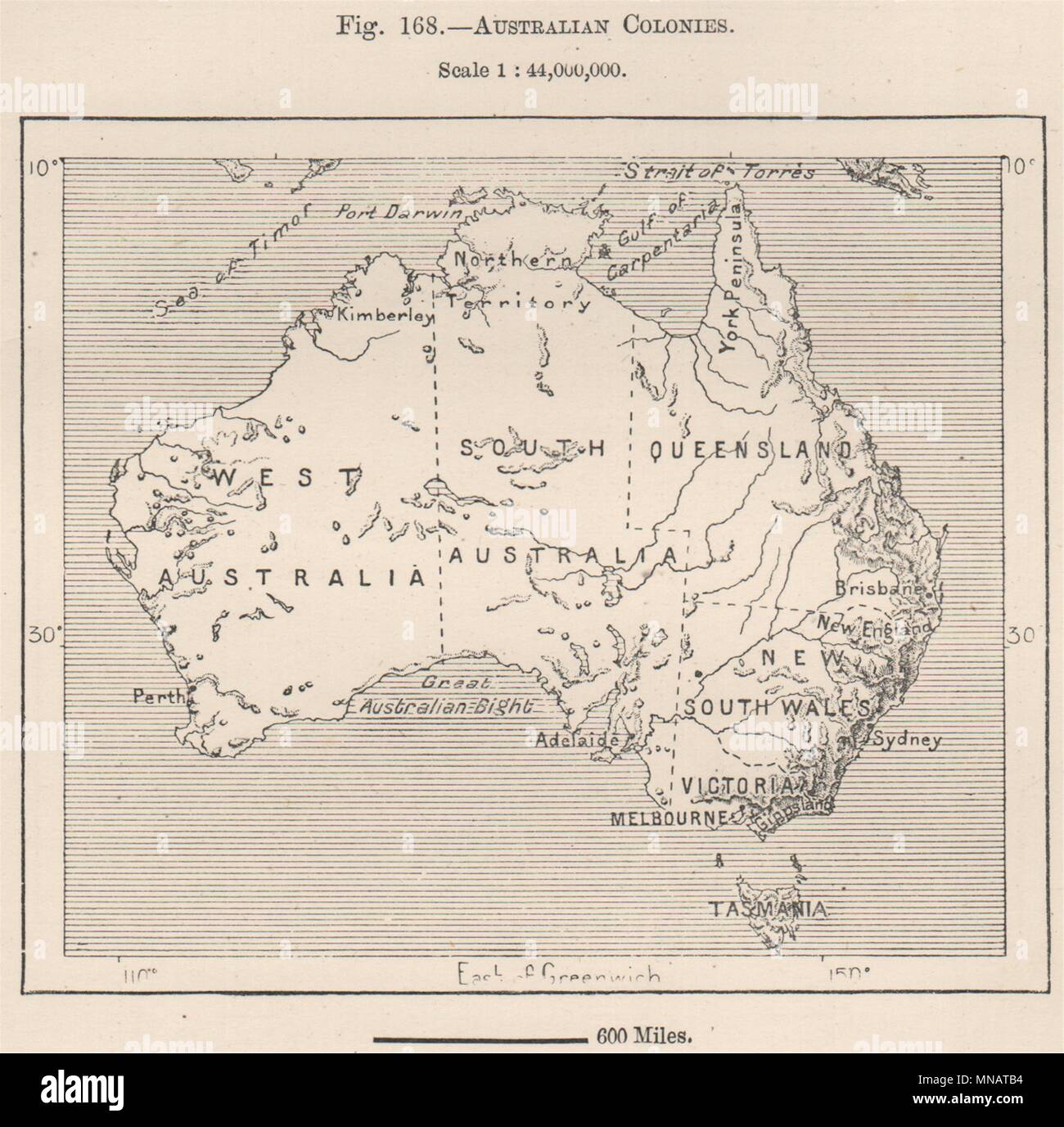
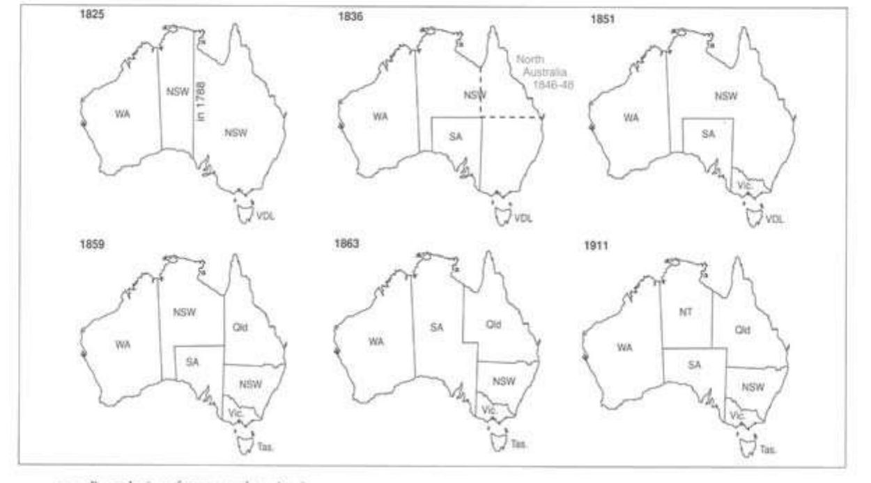
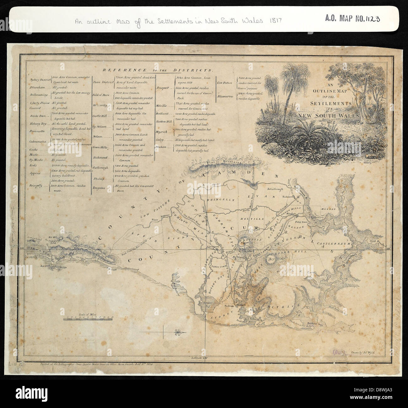
The colonial map of Australia begins with the establishment of the Colony of New South Wales in 1788. Initially, this single entity claimed sovereignty over the entire eastern half of the continent, from Cape York in the north to the southern coastline, and westward to the 135th meridian east. The first settlements clung to the coast, particularly around Sydney Cove and the Hawkesbury River. As exploration pushed inland across the Great Dividing Range, the sheer size of this territory became unmanageable. The creation of separate colonies was a direct response to administrative strain and the discovery of valuable resources, most notably gold and fertile pastoral land. The map of modern New South Wales, with its boundaries largely defined by rivers and meridians, bears the imprint of this early period of expansion from a single coastal foothold.
Van Diemen’s Land: From Penal Colony to Tasmania
The island south of the mainland, originally claimed by Abel Tasman and named Van Diemen’s Land, was separated from New South Wales as an independent colony in 1825. Its early cartographic identity was shaped by the harsh penal settlements at Port Arthur and Macquarie Harbour, which were strategically placed in remote, defensible locations. The name change to Tasmania in 1856 marked a deliberate shift away from the colony’s convict stigma toward a more aspirational agricultural and whaling economy. The border of Tasmania is uniquely an island boundary—natural and absolute—setting it apart from the arbitrary lines drawn across the mainland. Its colonial history is a story of maritime isolation, brutal transportation, and eventual rehabilitation into a distinct political entity.
The Separation of Victoria and Queensland
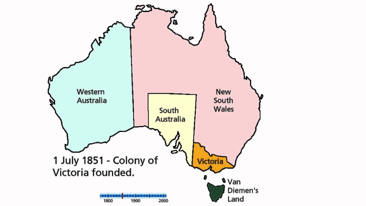
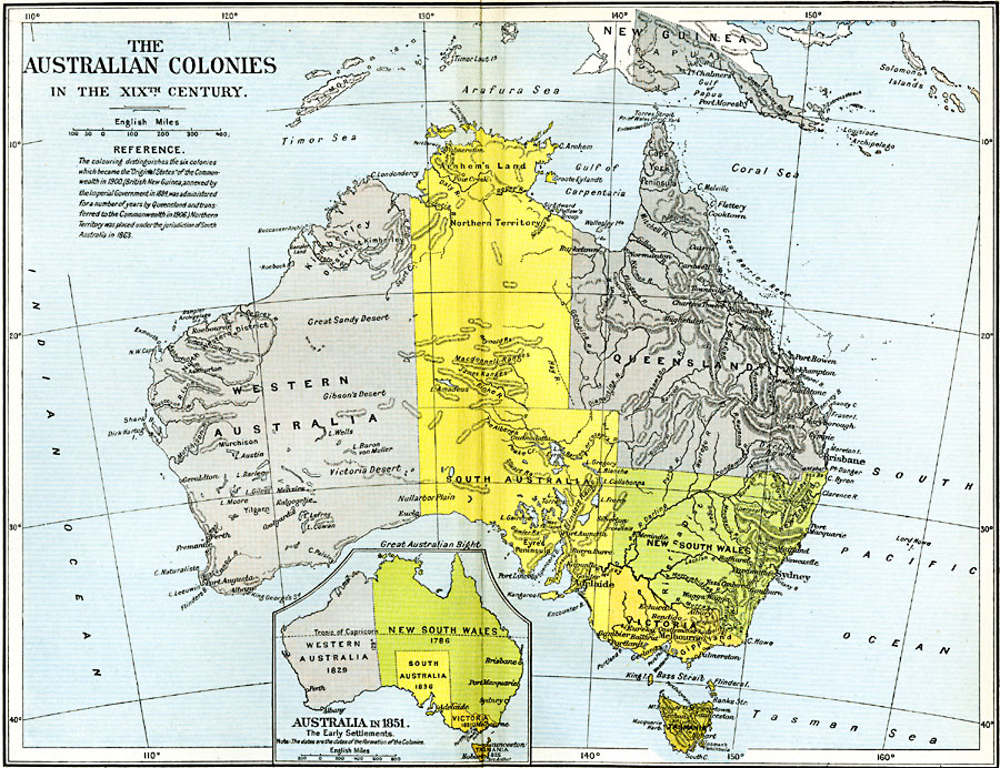
The discovery of gold in the 1850s was the primary driver for redrawing the map. The Port Phillip District of New South Wales, rapidly growing due to the Victorian gold rushes, became the independent Colony of Victoria in 1851. Its southern border was set at the Murray River, a logical hydrological boundary, while its eastern border followed the 141st meridian east. Similarly, the vast northern reaches of New South Wales, including the Moreton Bay settlement of Brisbane, were severed to form the Colony of Queensland in 1859. Queensland’s border was drawn arbitrarily along the 29th parallel south, a line that ignored existing Indigenous territories and pastoral runs. This division created two resource-rich colonies—Victoria with its gold and wool, Queensland with its sugar and tropical agriculture—each with distinct economies that influenced their later development within the federation.
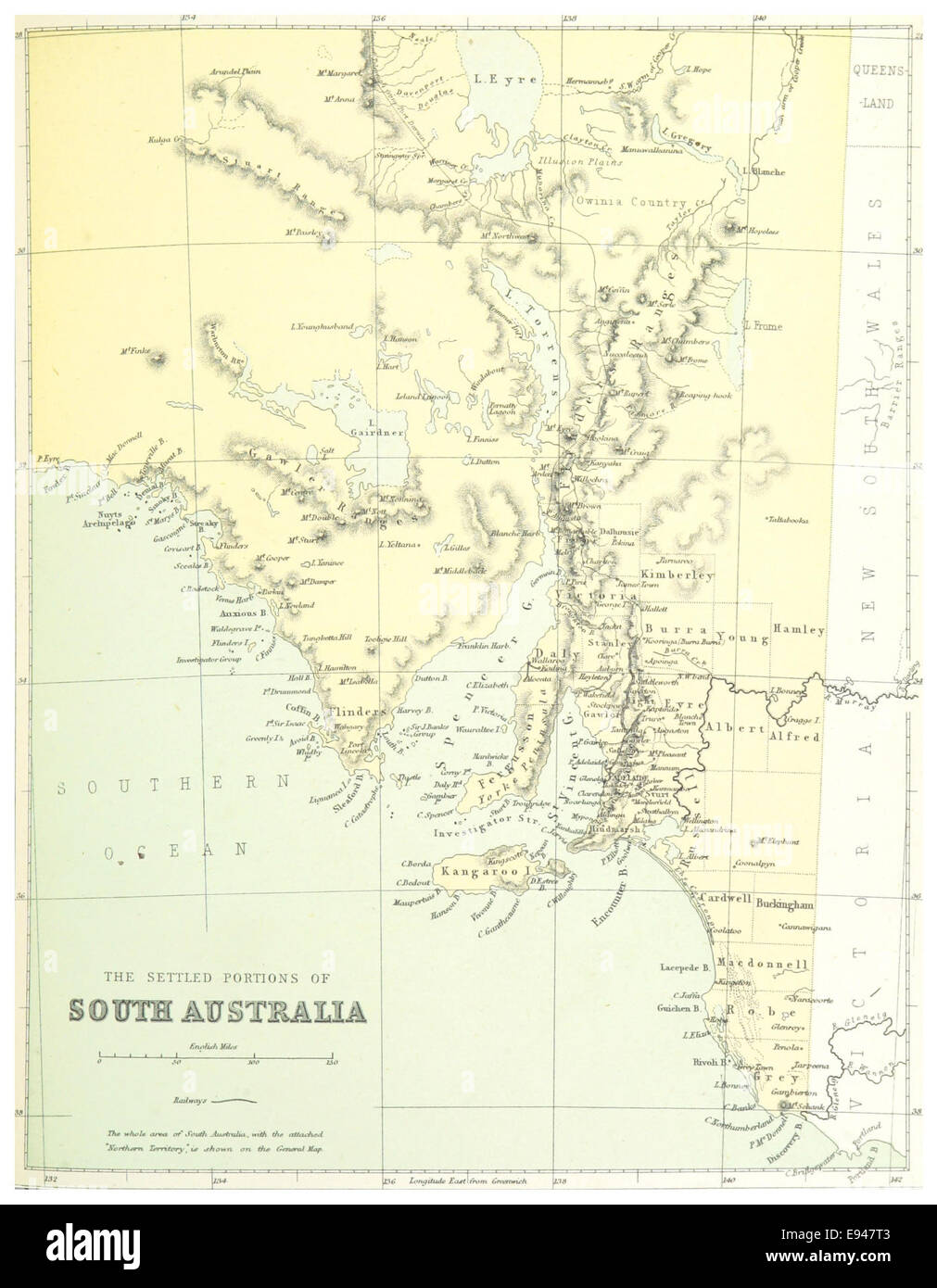
South Australia: A Planned Colony with Radical Borders
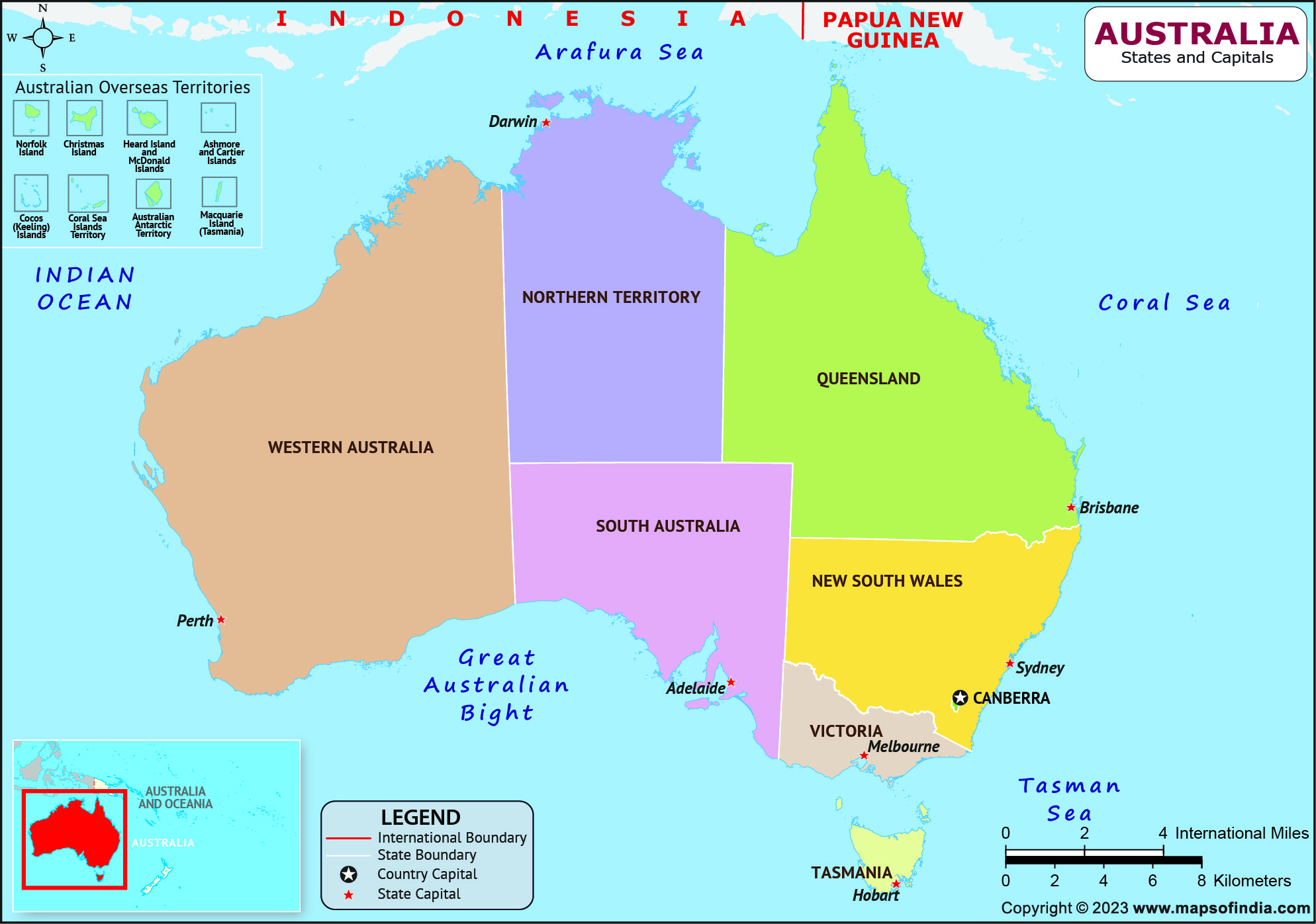
Unlike the haphazard growth of the eastern colonies, South Australia was founded in 1836 as a planned province based on Edward Gibbon Wakefield’s theories of systematic colonization. Its map reflects Enlightenment ideals: a square territory centered on the Gulf St Vincent, designed for orderly land sales and free settlement. Notably, South Australia was never a penal colony, a fact that shaped its social and political identity. Its western border is defined by the 129th meridian east, running through the Nullarbor Plain, while its northern extension, including the Northern Territory, was managed from Adelaide until 1911. The colony’s map is a testament to British imperial rationalism, yet its borders cut across the lands of the Kaurna, Ngarrindjeri, and Pitjantjatjara peoples with no regard for traditional boundaries.
Western Australia: The Swan River Colony and Vast Horizons
Western Australia’s colonial history is defined by its sheer scale. Founded as the Swan River Colony in 1829, it was the only British settlement on the western third of the continent. Its borders were initially the 129th meridian east on the mainland, and its northern boundary was drawn at 26° south until later adjustments. The colony’s growth was slow until the discovery of gold at Coolgardie and Kalgoorlie in the 1890s, which triggered a population boom and the construction of the Mundaring Weir–Kalgoorlie pipeline. The modern state of Western Australia is the largest in the federation, a legacy of its late development and its role as a resource frontier. The lack of significant internal geographic barriers allowed its colonial administrators to claim a swath of land that dwarfs many European nations.
The Island Colonies and Internal Borders
The colonial map also includes islands such as Kangaroo Island, part of South Australia, and the Torres Strait Islands, which fall under Queensland. These small outposts were often contested between colonies. For instance, the islands of Bass Strait were a point of dispute between Tasmania and Victoria until a boundary was settled. The Northern Territory, initially part of New South Wales, was briefly annexed to South Australia before being transferred to the Commonwealth in 1911. Each of these boundary adjustments reflects the pragmatic, often contentious nature of colonial administration. The final map, as seen today, is a palimpsest of political decisions—some based on geography, others on economic expediency, and many on the simple assertion of British power over the vast, inhabited continent.
Conclusion
The modern map of Australia’s states is not a natural given but a historical artifact shaped by penal policy, gold rushes, administrative necessity, and imperial ambition. From the penal geometry of Tasmania to the planned square of South Australia and the gold-stitched boundaries of Victoria and Queensland, each border tells a story of colonial priorities. Understanding this cartographic heritage is essential for appreciating Australia’s regional identities, its economic disparities, and the complex legacy of land demarcation that shaped its nationhood. While the states now operate within a federal system, their outlines remain a lasting monument to the colonial forces that carved a continent into administrative pieces.
Australia Colonisation Posters 1800–1900 By Teach Simple

Australia Colonisation Posters 1800–1900 by Teach Simple
Hisatlas - Map Of Australia 1788-1829
Hisatlas - Map of Australia 1788-1829
Australian Botanical Exploration - PlantsPeoplePlanet
Australian botanical exploration - PlantsPeoplePlanet
AUSTRALIAN COLONIES W/ Counties. Predates Queensland (Est. 1859). SDUK

AUSTRALIAN COLONIES w/ counties. Predates Queensland (Est. 1859). SDUK ...
Australia Map Generalised Regions Of Western Australia" By Philip M.

Australia Map Generalised Regions Of Western Australia" By Philip M.
Australian History And Brisbane
Australian History and Brisbane
Territorial History Of Australia - YouTube
Territorial History of Australia - YouTube
History Of British Settlement In Australia At Myrtle Bail Blog

History Of British Settlement In Australia at Myrtle Bail blog
Mapping Australia's History - Australian Geographic

Mapping Australia's history - Australian Geographic
Map British Colonization In Australia | Australia Map, Poster Prints

Map British Colonization in Australia | Australia map, Poster prints ...
Australia Colonial Map Hi-res Stock Photography And Images - Alamy
Australia colonial map hi-res stock photography and images - Alamy
444 Best Australian States Images On Pholder | Map Porn, Australia And
444 best Australian States images on Pholder | Map Porn, Australia and ...
Colonial Australia Mind Map
Colonial Australia Mind Map
Map Australia And Tasmania Hi-res Stock Photography And Images - Alamy
Map australia and tasmania hi-res stock photography and images - Alamy
Australia Silversmiths: The Directory Of Australian Silversmiths: A

Australia Silversmiths: The Directory of Australian silversmiths: A
"State-regions": Evolution Of Australia's Colonial/federal Divisions

"State-regions": Evolution of Australia's colonial/federal divisions ...
The Australian ‘Colonial Experiment’ | AM

The Australian ‘Colonial Experiment’ | AM
Map Of Pre Colonial Australia | Indigenous Studies, Aboriginal History

Map of pre colonial Australia | Indigenous studies, Aboriginal history ...
Colonial Australia | Britannica
Colonial Australia | Britannica
“state-regions”: Evolution Of Australia’s Colonial/federal
“state-regions”: evolution of australia’s colonial/federal
Australia Colonial Map Hi-res Stock Photography And Images - Alamy
Australia colonial map hi-res stock photography and images - Alamy
Here's The Evolution Of Australia's Colonies And Territories From 1788

Here's the evolution of Australia's colonies and territories from 1788 ...
Australia

Australia
682 Best Australia Images On Pinterest | Destinations, Australia Travel

682 best Australia images on Pinterest | Destinations, Australia travel ...
Rare Large Colonial Map Of Australia By Stanford, 1859: Large NSW, Tas

Rare Large Colonial Map of Australia by Stanford, 1859: Large NSW, Tas ...
The Australian Colonies (1853) | Map, Australia Map, Colonial

The Australian Colonies (1853) | Map, Australia map, Colonial
Colonial Australia Stock Photos, Pictures & Royalty-Free Images - IStock

Colonial Australia Stock Photos, Pictures & Royalty-Free Images - iStock
Australia Colonial Map Hi-res Stock Photography And Images - Alamy
Australia colonial map hi-res stock photography and images - Alamy
Australia's Colonial Beginnings Timeline | Timetoast Timelines
Australia's Colonial Beginnings timeline | Timetoast timelines
Australian Colonies Historical Map | Australia Maps | Australia Map

Australian Colonies Historical Map | Australia Maps | Australia map ...
Colonization Of Australia
Colonization Of Australia
Rare Large Colonial Map Of Australia By Stanford, 1859: Large NSW, Tas

Rare Large Colonial Map of Australia by Stanford, 1859: Large NSW, Tas ...
Australia, We Need To Talk About Who Governs Our City-states

Australia, we need to talk about who governs our city-states