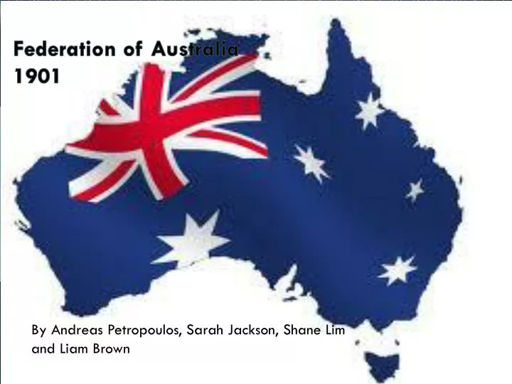
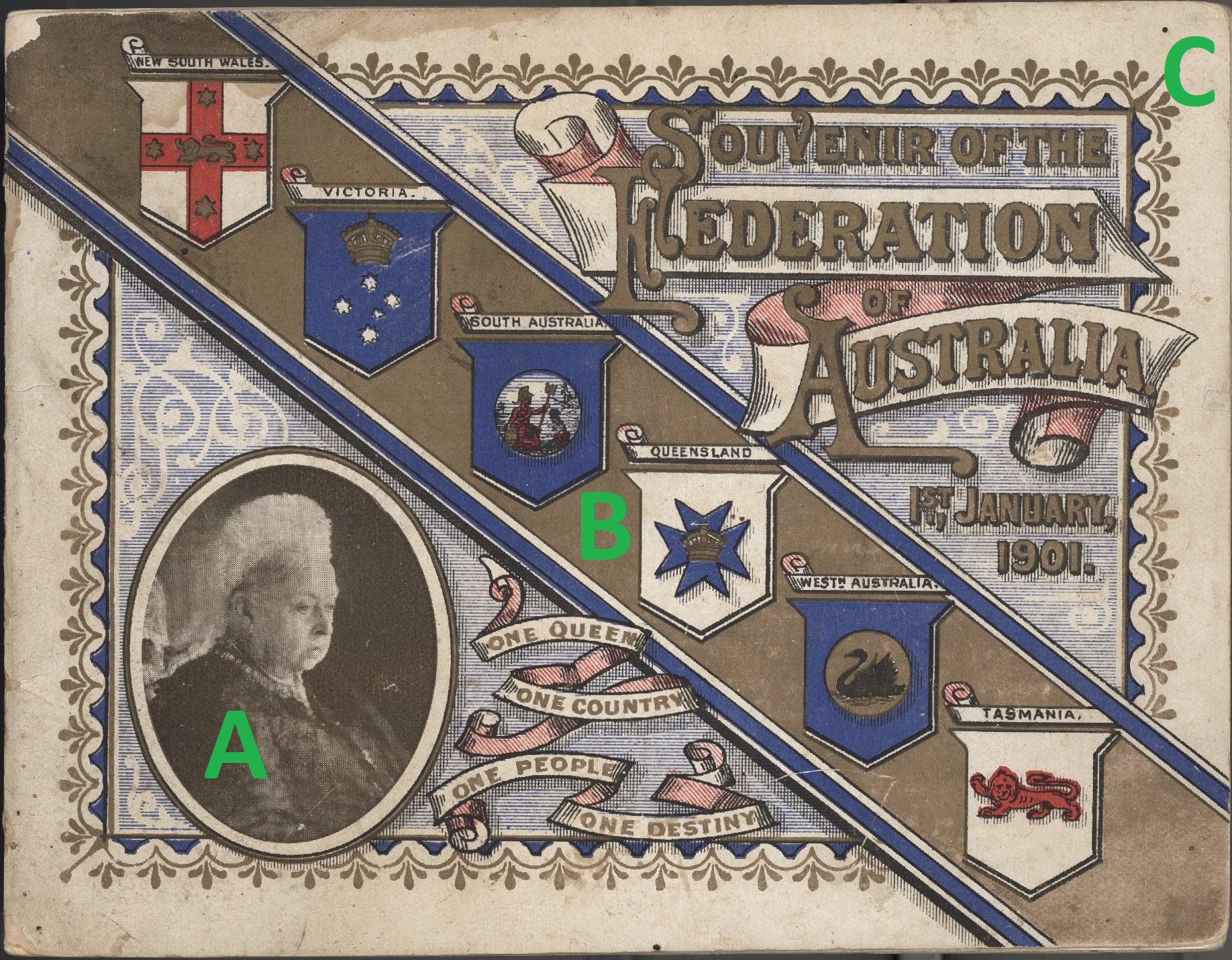
The Federation of Australia: A Visual Guide to the 1901 Map and State Unification
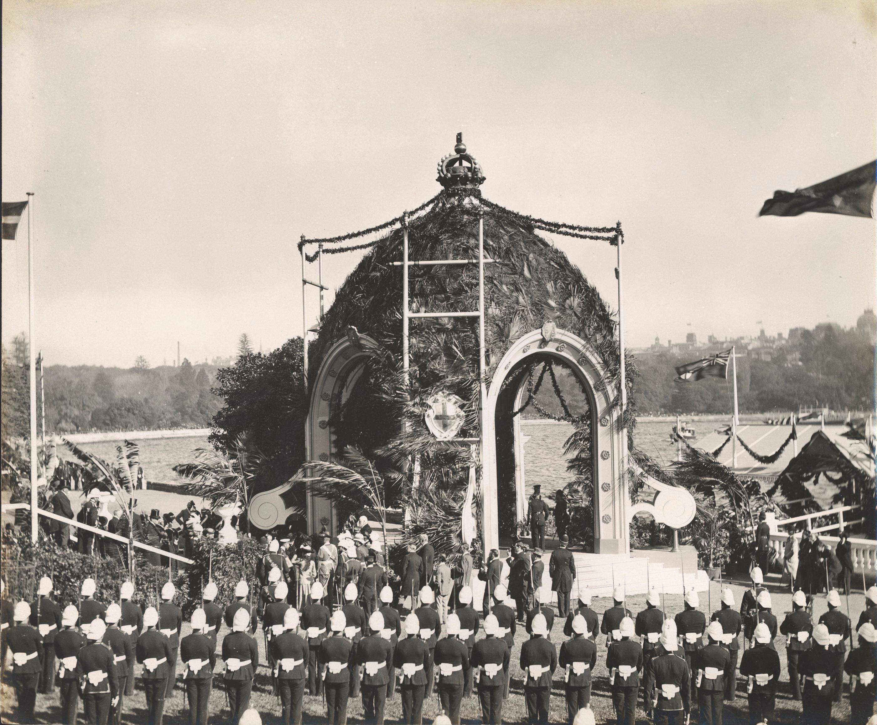
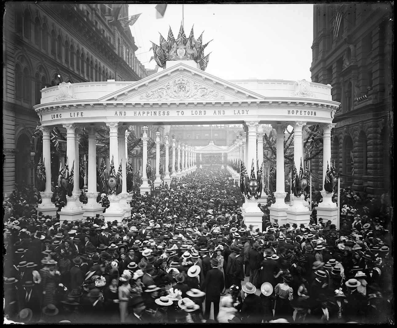
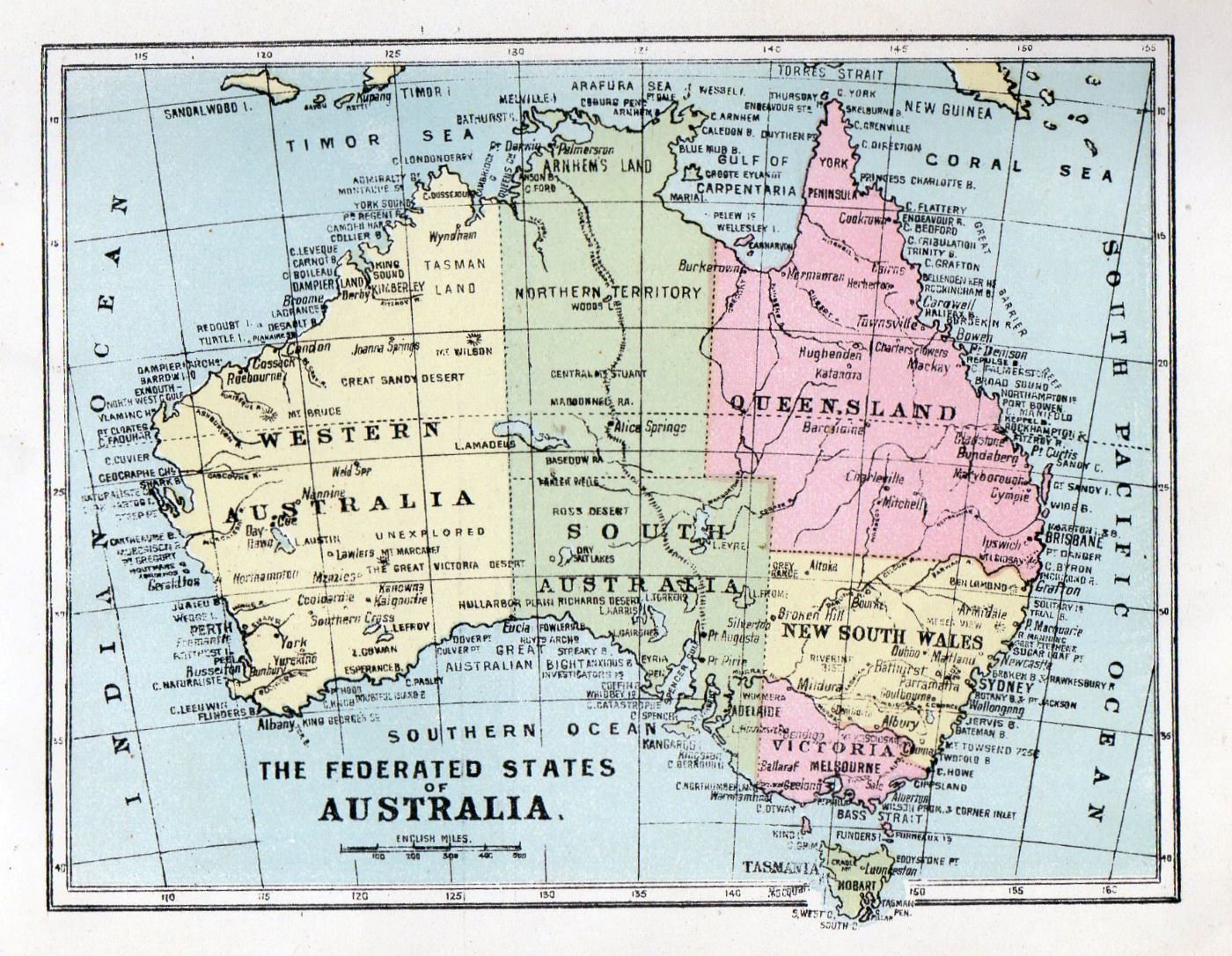
In 1901, a remarkable political experiment transformed the Australian continent. Six separate British colonies—New South Wales, Victoria, Queensland, South Australia, Western Australia, and Tasmania—agreed to unite under a single federal government, creating the Commonwealth of Australia. Understanding the map of Australia at the moment of federation is key to grasping how state boundaries were drawn, what territories were yet to be settled, and how the nation’s political landscape was literally mapped out. This guide will take you through the visual and historical details of the 1901 federation map, showing you the colonies-turned-states, their distinct borders, and the unique geographic context of that pivotal year.
The Six Founding States: Boundaries and Capitals
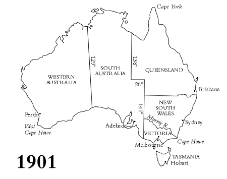
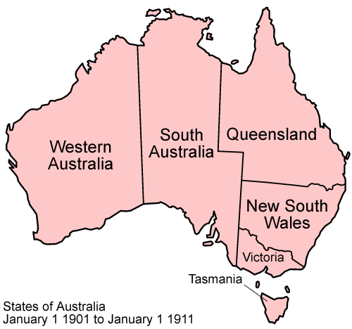
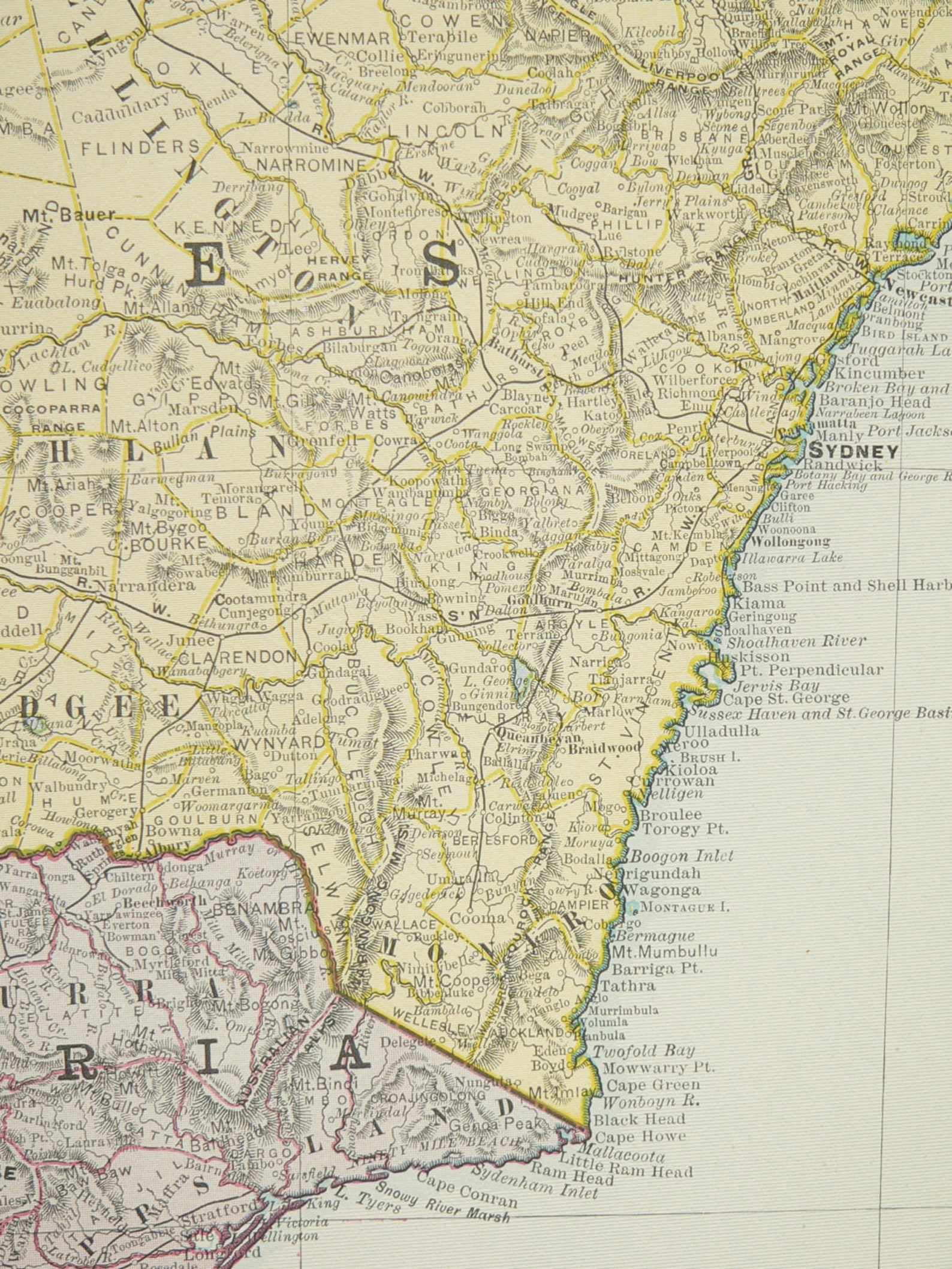
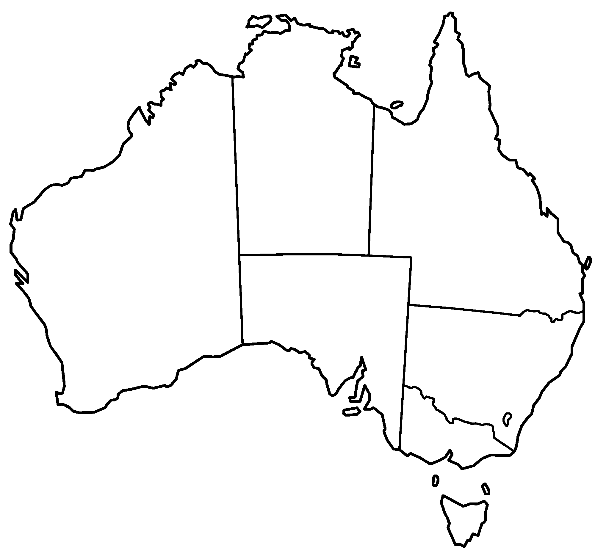
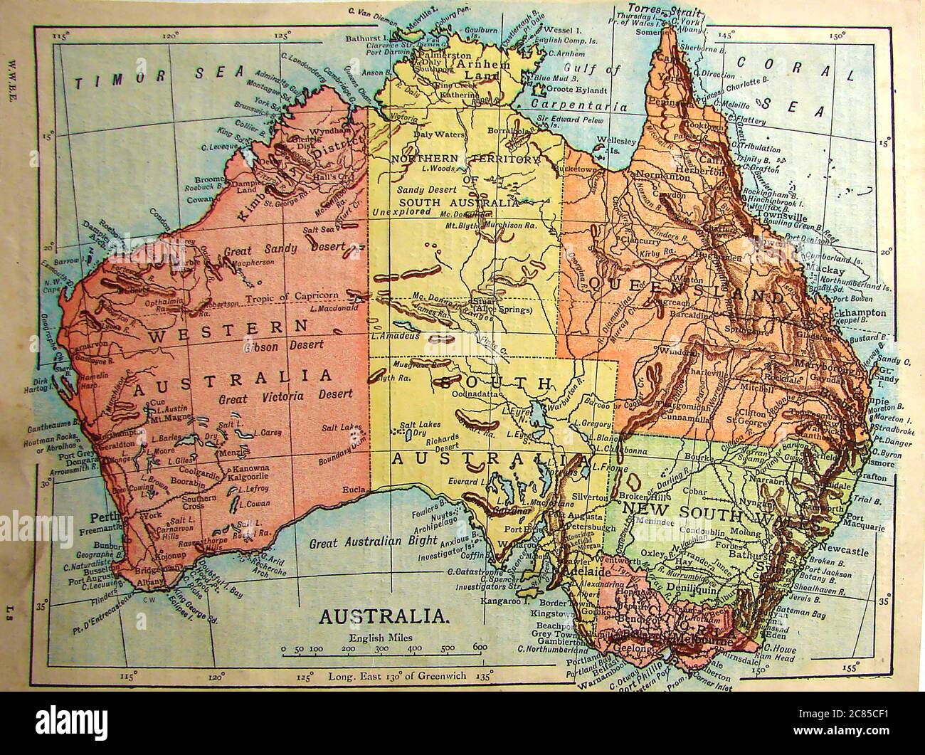
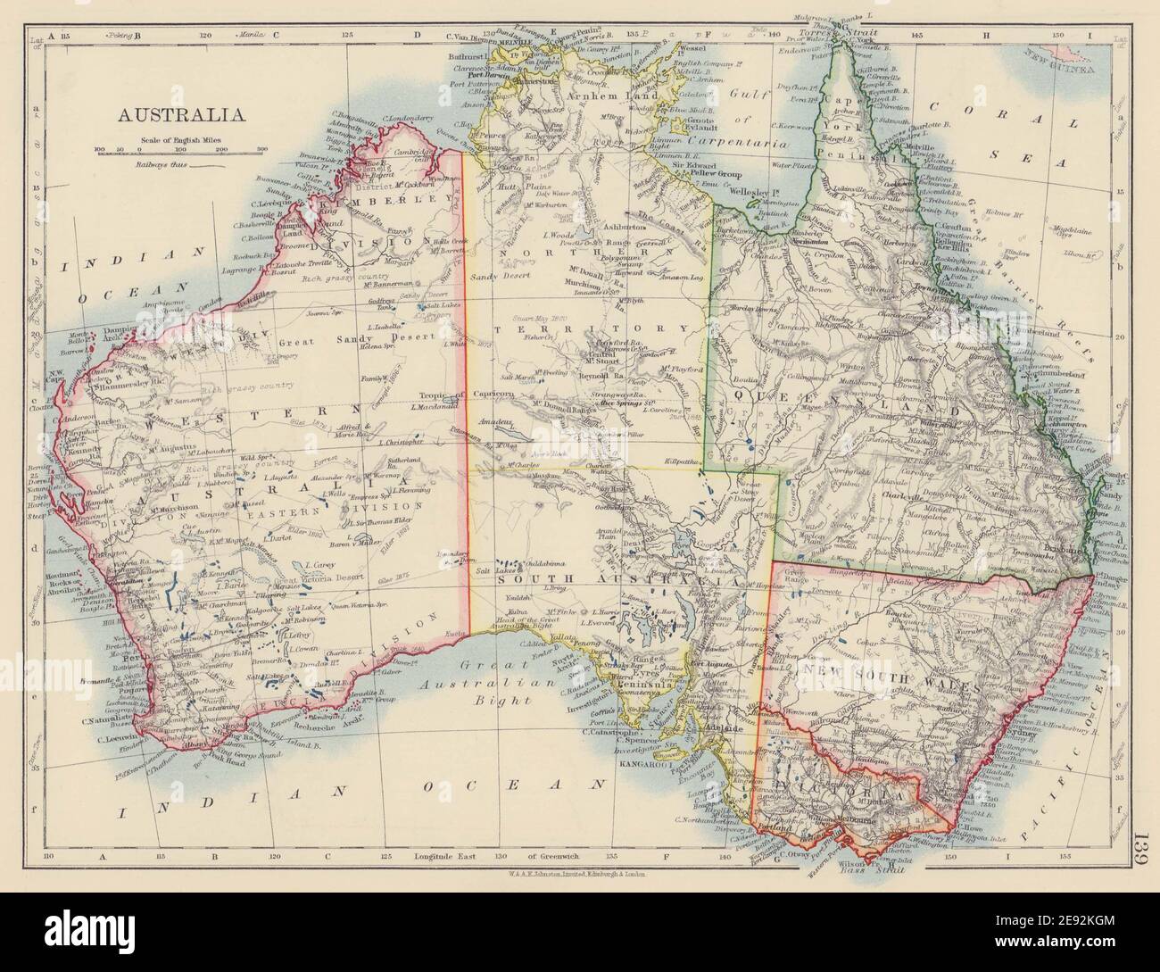
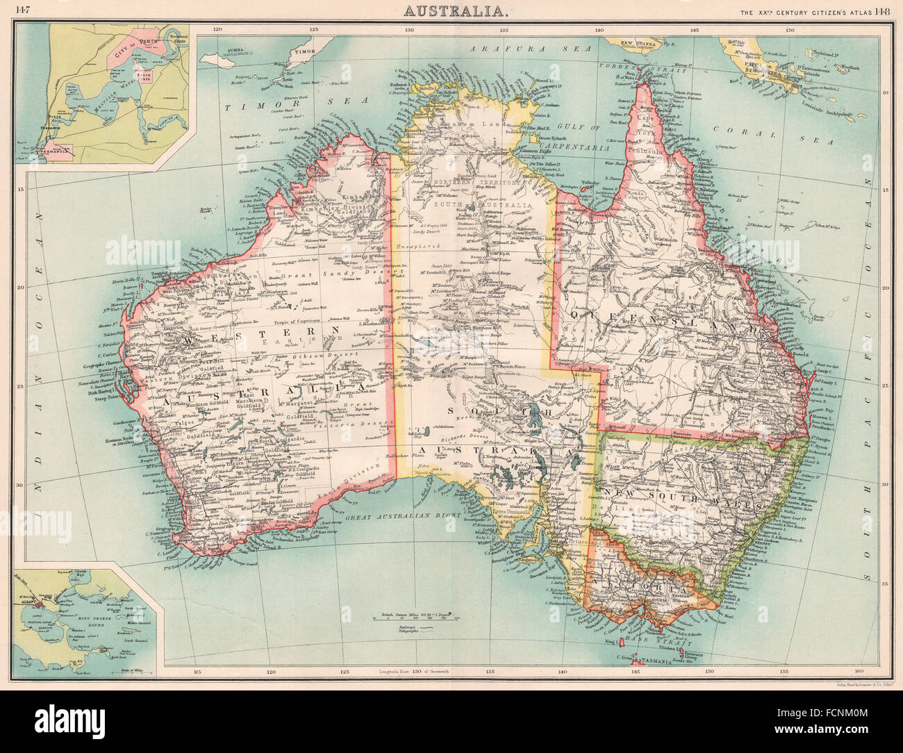
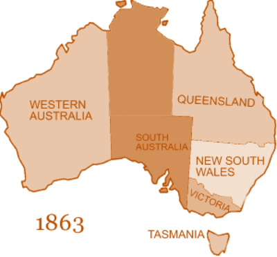
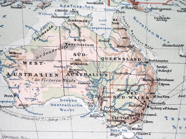
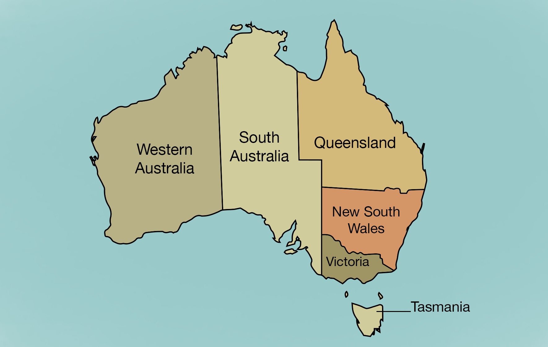
The core of the 1901 federation map is defined by the six original states. Each had its own established capital city and clear boundaries, many of which were inherited from earlier colonial charters. New South Wales, the oldest colony, stretched from the Pacific Ocean westward, containing Sydney as its capital, and its western border was marked by the 141st meridian east. Victoria, carved out of New South Wales in 1851, covered the country’s southeast corner with Melbourne as its hub. Queensland, separated in 1859, dominated the northeast with Brisbane. South Australia, founded as a free colony in 1836, occupied the vast central-southern region, with Adelaide at its core. Western Australia, the largest in area but sparsely populated, took up the entire western third of the continent, its capital at Perth. Tasmania, the island state, completed the federation with its capital Hobart. On the 1901 map, these states appear as massive, distinct blocks—their borders largely following straight lines of latitude and longitude, a stark contrast to many European borders based on rivers or mountain ranges.

The Great Unsettled Territory: Northern Territory Tensions
One of the most fascinating aspects of the 1901 map is the status of the Northern Territory. In the late 19th century, this vast, arid region was part of South Australia, having been annexed in 1863 for administration and development. However, it was not a separate colony. When the Commonwealth was formed, the Northern Territory remained under South Australian control. The 1901 map shows this huge swath of land—roughly from the 26th parallel south to the Timor Sea—colored the same as South Australia. This arrangement was always a source of political friction. South Australia struggled to govern such a remote area effectively, and the federal government in Melbourne saw it as an underexploited resource. It would not be until 1911 that the Northern Territory was transferred to the Commonwealth’s direct control, and even then, its borders would remain fluid for decades. For anyone studying the 1901 map, the Northern Territory’s absence from the list of original states is a crucial detail.
Defining the Borders: The 129th Meridian and Other Lines
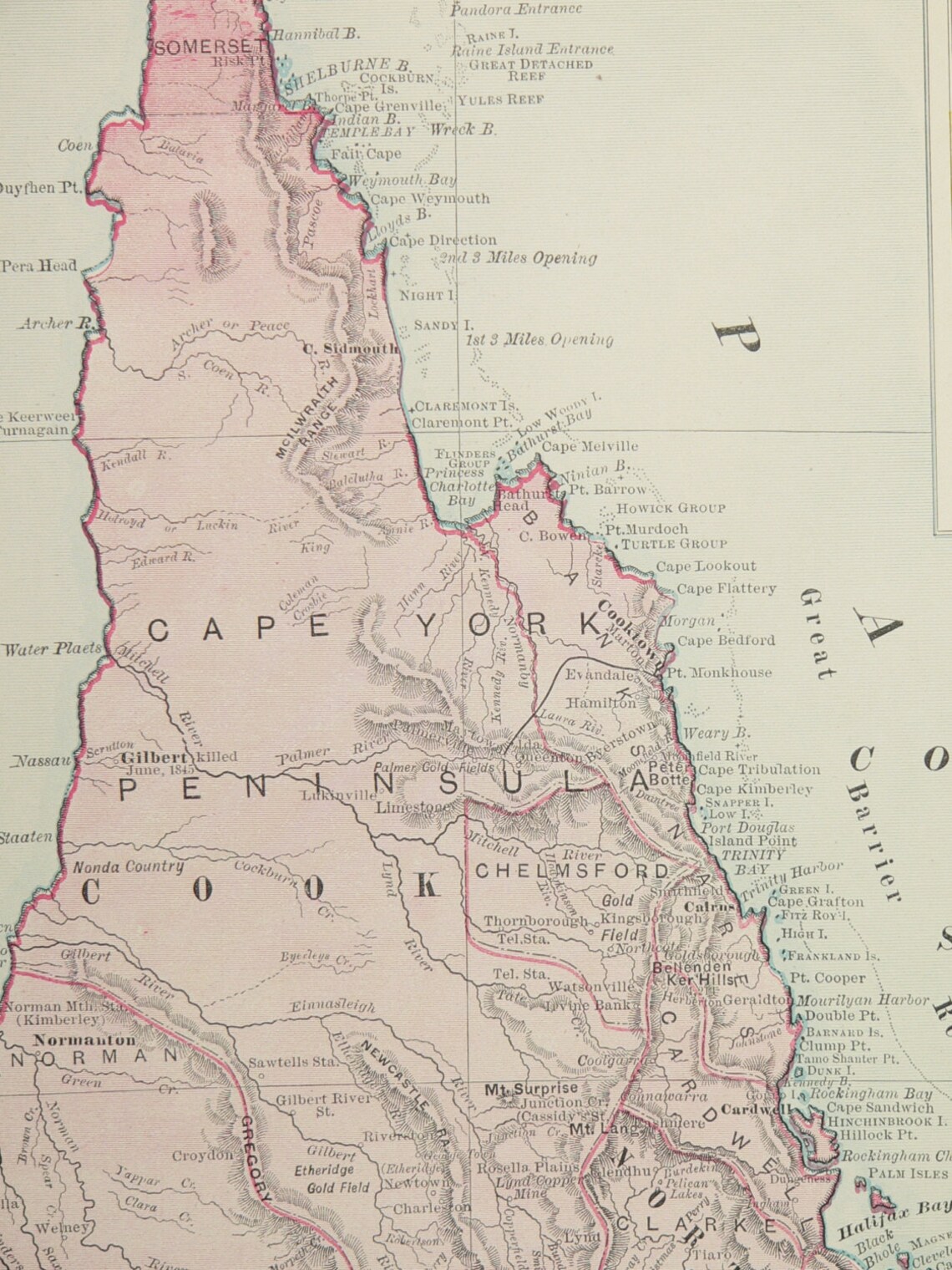
The borders between the Australian states on the 1901 map are a lesson in imperial surveying and political compromise. Western Australia’s eastern border with South Australia and the Northern Territory runs along the 129th meridian east, a perfectly straight line drawn from the coast to the 26th parallel south. This line, agreed upon in the 1860s, was chosen for administrative simplicity, ignoring any geographic or indigenous boundaries. Similarly, the border between Queensland and South Australia follows the 138th meridian east, while the line between New South Wales and Victoria is mostly based on the Murray River—one of the few natural borders. The map reveals these geometric boundaries clearly: long, ruler-straight lines that cut through desert, woodland, and grassland. To the colonizers, this was efficient; to the Aboriginal peoples, it was a drastic imposition that disregarded millennia-old traditions. The 1901 map thus captures a moment when colonial cartography reigned supreme, shaping the nation we know today.
Territories and External Dependencies: What Was Missing
While the six states formed the core, the 1901 federation map also highlights what was not yet part of Australia. The island of New Guinea to the north was a German colony (German New Guinea) and a British protectorate (Papua)—only later would Australia administer both. The Australian Capital Territory (ACT), where Canberra would be built, did not exist. On the 1901 map, the site of the future capital was still just a portion of New South Wales, an area of sheep runs and small towns. Tasmania, though a state, is shown as a separate landmass, not connected by any bridge (a physical impossibility then). Additionally, several external territories—like Norfolk Island, the Cocos Islands, and the Antarctic claims—were either under British control or not yet acquired. The map therefore presents a compact, mainland-focused nation, with no internal territories except the ambiguous Northern Territory under South Australian administration.
The Population and Economic Centers: A Map of Disparity
Reading the 1901 map alongside population data reveals stark inequalities. The southeastern states—New South Wales and Victoria—were home to over 70% of the nation’s 3.7 million people. Sydney and Melbourne were major urban centers, connected by rail and telegraph lines. In contrast, Western Australia remained vast and empty, despite a small gold rush in the 1890s. Queensland’s population was scattered along the coast and in mining towns. The map’s empty interior—the arid center of Australia—was virtually unpopulated by European settlers, though it remained home to many Aboriginal groups. This demographic imbalance heavily influenced federal politics: the smaller states demanded equal representation in the Senate to protect their interests against the larger ones. The map thus served not just a geographic purpose but also a political one, justifying the structure of the new federal Parliament.
Conclusion
The map of Australia at federation in 1901 is far more than a static image of lines and names. It is a living document of political ambition, colonial legacy, and geographic reality. It shows six proud states, each with distinct histories and economies, agreeing to form one nation while retaining their identities. It highlights the anomalous status of the Northern Territory as a South Australian appendage and reveals the purely geometric nature of most borders. Most importantly, it sets the stage for the century of expansion, change, and reconciliation that followed. By understanding this map, we understand the very foundation of modern Australia—a nation stitched together from separate colonies, drawn with straight lines on paper, and shaped by the determination of its people to unite under one flag.
14,298 Federation Australia Photos & High Res Pictures - Getty Images

14,298 Federation Australia Photos & High Res Pictures - Getty Images
Australia Since Federation Defining Moments, 1901–present | 1.3 What
Australia since Federation Defining Moments, 1901–present | 1.3 What ...
Proposed States Of Australia (1838) (X-post /r/mapporn) : Australia

Proposed states of Australia (1838) (X-post /r/mapporn) : australia
Large Vintage Map Of Australia 1901 Antique Australia Map, Australian
Large Vintage Map of Australia 1901 Antique Australia Map, Australian ...
Federation Of Australia (1901)

Federation of Australia (1901)
Federation Of Australia - Part 3: 1901-1914
Federation of Australia - Part 3: 1901-1914
‘State Governments Made Sense In 1901, But Things Have Moved On’: Joyce

‘State governments made sense in 1901, but things have moved on’: Joyce ...
Map Of Australia 1901 Bshad - Large Map Of Asia

Map Of Australia 1901 Bshad - Large Map of Asia
Federation Of Australia - Part 3: 1901-1914
Federation of Australia - Part 3: 1901-1914
Federation Of Australia - Part 3: 1901-1914
Federation of Australia - Part 3: 1901-1914
1900 Placard Map Of Australia Advocating For The Union Of Western

1900 placard map of Australia advocating for the union of Western ...
Federation Of Australia, 1st January 1901 Original Booklet. By Author
Federation of Australia, 1st January 1901 original booklet. by Author ...
Federation Of Australia (1901)

Federation of Australia (1901)
Map Of Australia Showing Progress Of Federation Up To Date, The

Map of Australia showing progress of Federation up to date, The ...
Australia States 1901 1911 - MapSof.net
Australia States 1901 1911 - MapSof.net
Large Vintage Map Of Australia 1901 Antique Australia Map, Australian
Large Vintage Map of Australia 1901 Antique Australia Map, Australian ...
Map Of Australia 1901 Bshad - Large Map Of Asia

Map Of Australia 1901 Bshad - Large Map of Asia
Map Of Proposed Australian States, 1900(ish) - Present : R/australia
Map of Proposed Australian States, 1900(ish) - Present : r/australia
Federation 1901 Australia Hi-res Stock Photography And Images - Alamy
Federation 1901 australia hi-res stock photography and images - Alamy
1901 ANTIQUE PHYSICAL Map Of Australia Oceania Pacific German Colonies
1901 ANTIQUE PHYSICAL Map Of Australia Oceania Pacific German Colonies ...
1901 Map Of Australia (including New Zealand And British Possessions In

1901 map of Australia (including New Zealand and British possessions in ...
PPT - Federation Of Australia 1901 PowerPoint Presentation, Free
PPT - Federation of Australia 1901 PowerPoint Presentation, free ...
Blank Australia Map - Australia Maps - Map Pictures
blank australia map - Australia Maps - Map Pictures
Map Of Australia 1901 Bshad - Large Map Of Asia
Map Of Australia 1901 Bshad - Large Map of Asia
Map Thread XIV: Map Of Australia In 1900

Map Thread XIV: Map of Australia in 1900
1901 Australia Hi-res Stock Photography And Images - Alamy
1901 australia hi-res stock photography and images - Alamy
AUSTRALIA: Showing States Goldfields Telegraph Cables. Perth/Fremantle
AUSTRALIA: Showing states goldfields Telegraph cables. Perth/Fremantle ...
The Federation Of Australia - Australia
The Federation Of Australia - Australia
1901 ANTIQUE PHYSICAL Map Of Australia Oceania Pacific German Colonies
1901 ANTIQUE PHYSICAL Map Of Australia Oceania Pacific German Colonies ...
Australian History- 1901 Timeline | Timetoast Timelines

Australian History- 1901 timeline | Timetoast timelines
Australia Since Federation Defining Moments, 1901–present | 1.5 The
Australia since Federation Defining Moments, 1901–present | 1.5 The ...
Large Vintage Map Of Australia 1901 Antique Australia Map, Australian
Large Vintage Map of Australia 1901 Antique Australia Map, Australian ...
Map Of Australia At The Time Of Federation | Australia’s Defining
Map of Australia at the time of Federation | Australia’s Defining ...