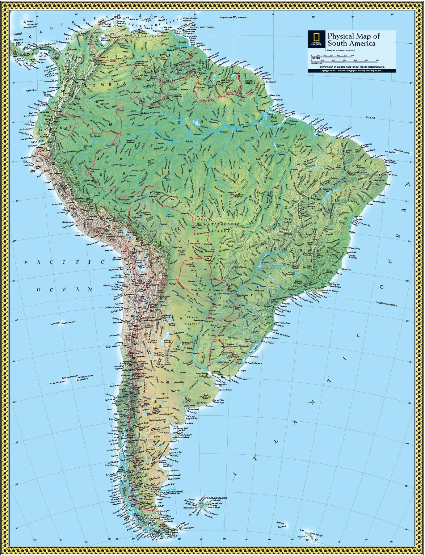
Map of South America with Oceans: A Comprehensive Physical Geography Guide
This guide provides a thorough exploration of the physical geography of South America, with a focus on the surrounding oceans, seas, and major water bodies that shape the continent. You will learn about the identifying features of the Atlantic and Pacific coastlines, the influence of the Southern Ocean, and how to interpret a physical map of South America, including key mountain ranges, river systems, and lowland basins. Understanding this layout is essential for grasping climate patterns, biodiversity, and human settlement across the continent.
Oceanic Boundaries of South America
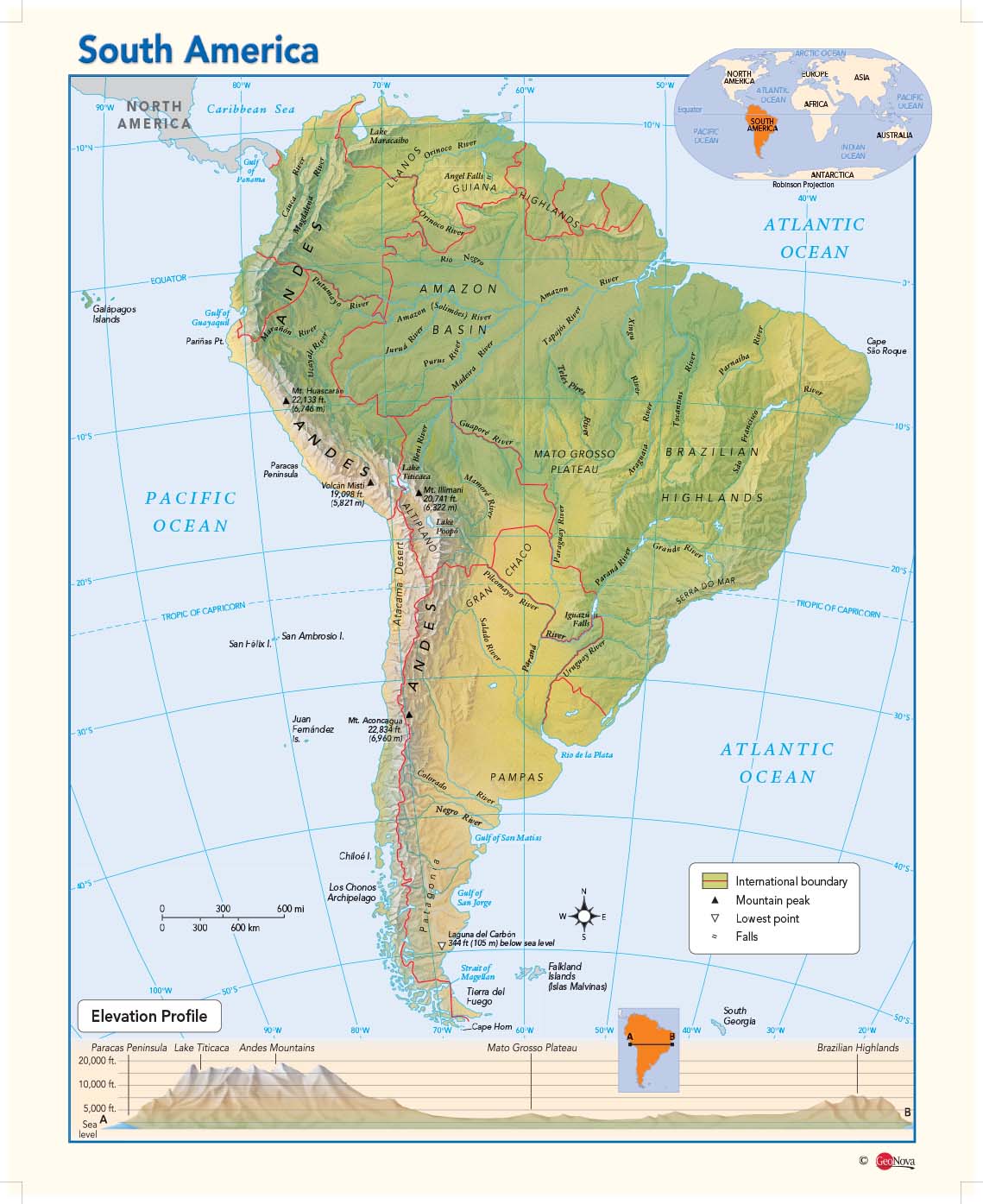
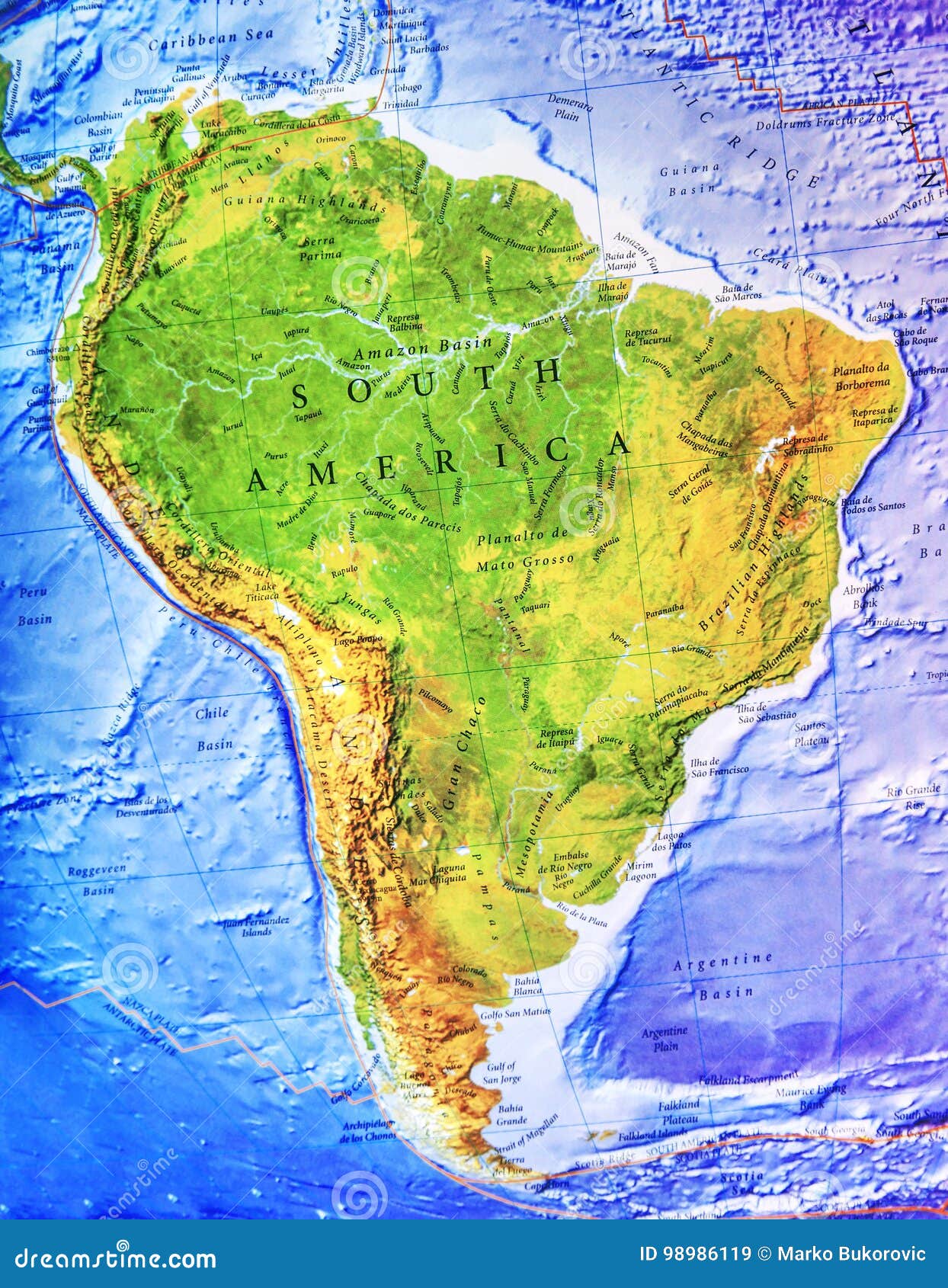
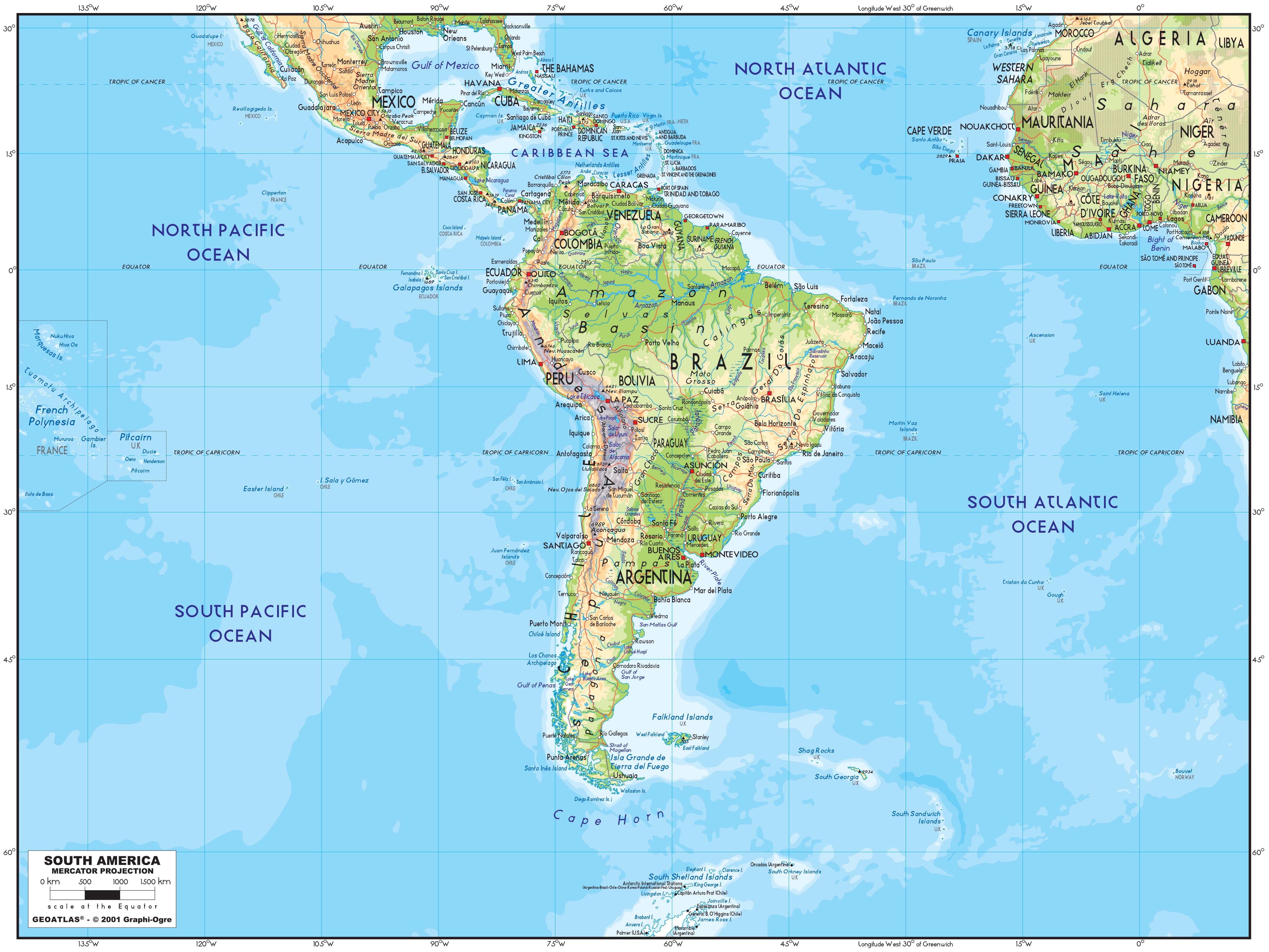
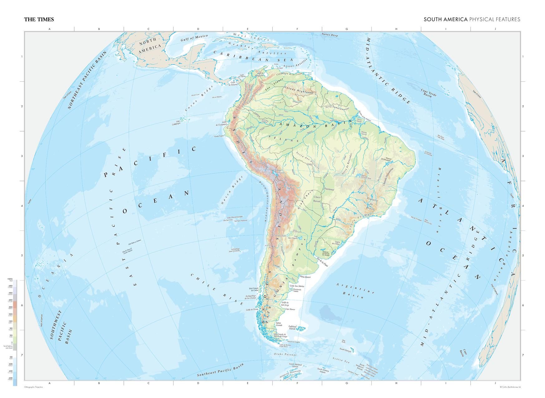
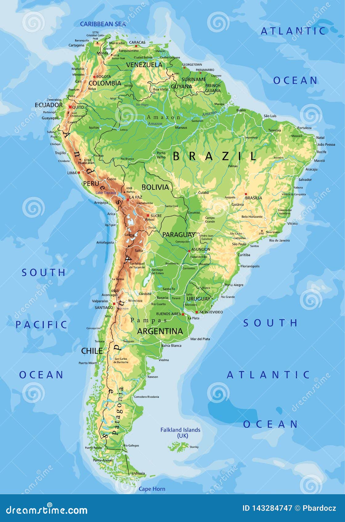
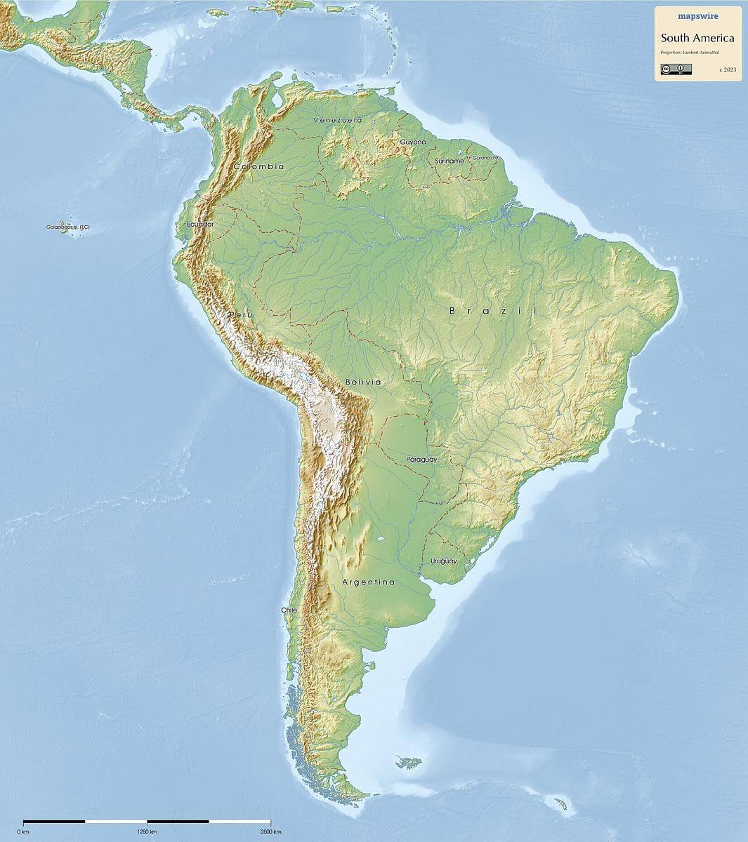
South America is almost entirely surrounded by water, giving it a distinctive maritime identity. To the east lies the vast Atlantic Ocean, which influences climates from the tropical north to the temperate south. The Atlantic coast is characterized by wide continental shelves, extensive mangrove swamps in the north, and the famous beaches of Brazil. To the west, the Pacific Ocean borders the continent along a narrow, seismically active coastline defined by the Andes Mountains. The interaction between these two oceans and the landmass creates distinct weather systems, including the El Niño–Southern Oscillation, which profoundly affects rainfall patterns.
The Pacific Ocean and the Andes Influence
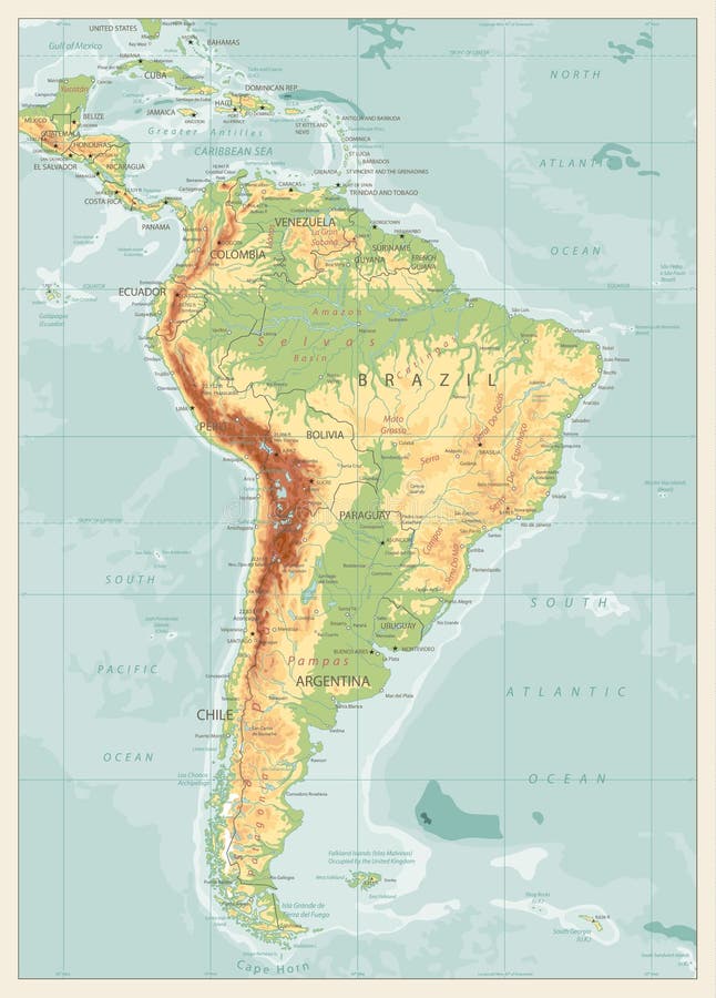
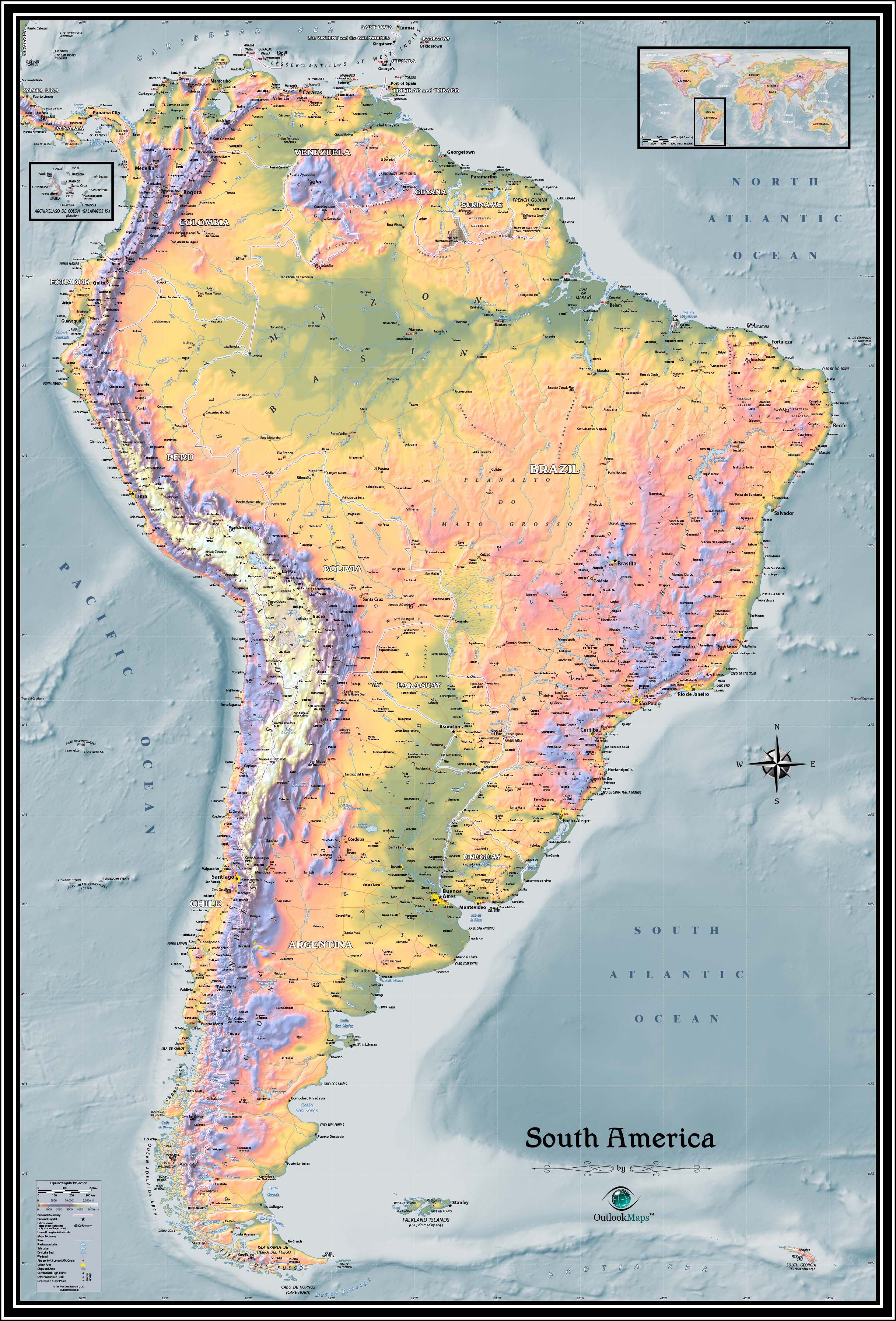
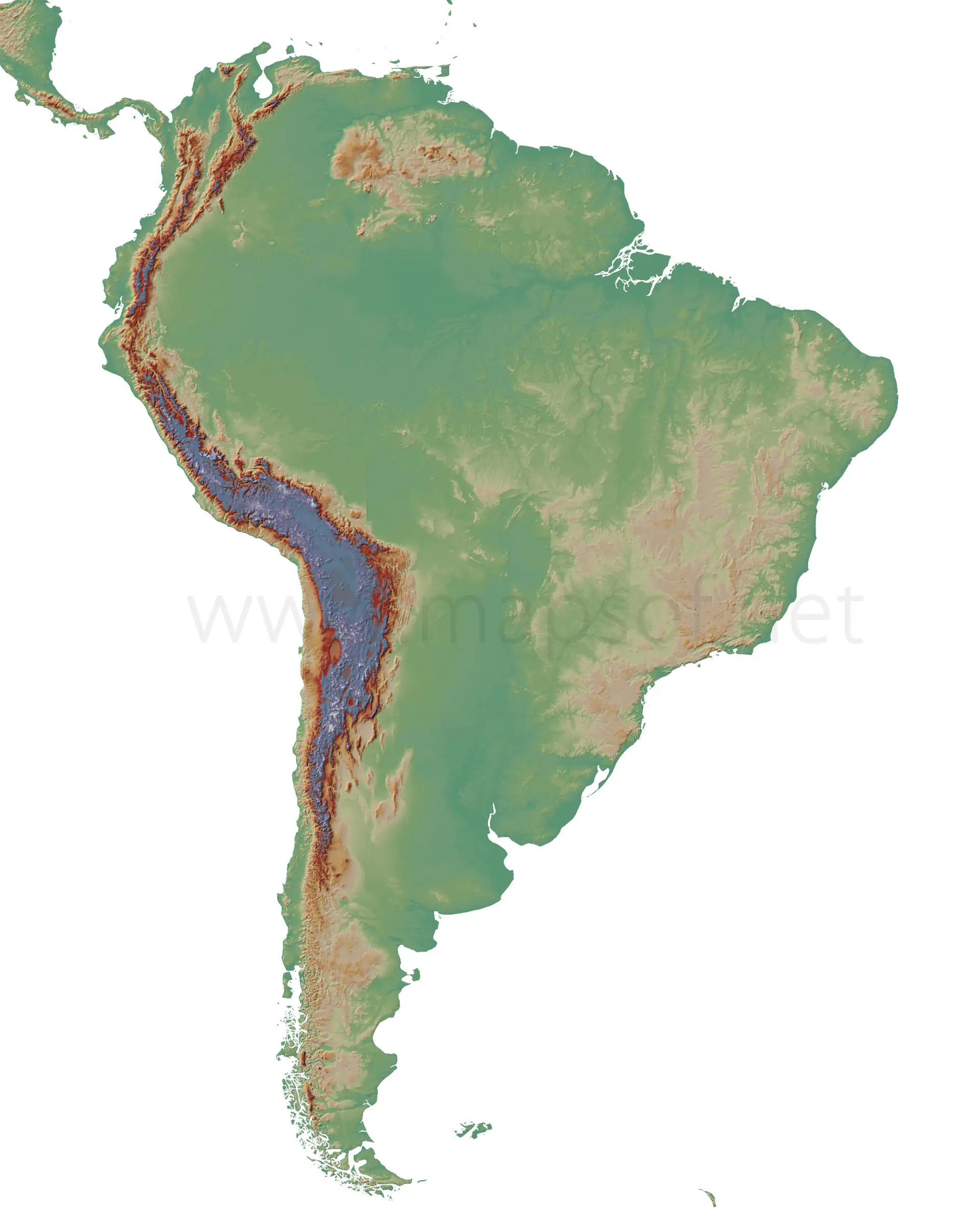
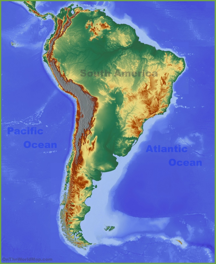
Along the western edge of the map, the Pacific Ocean meets the steep slopes of the Andes, the world’s longest continental mountain range. This coastline features deep oceanic trenches, such as the Peru–Chile Trench, which can exceed 8,000 meters in depth. The cold Humboldt Current flows northward along this coast, creating a rich marine ecosystem and the arid conditions of the Atacama Desert. A physical map will show a narrow coastal plain, quickly rising into high peaks. Key ports like Valparaíso (Chile) and Callao (Peru) are strategically positioned where rivers cut through the coastal range to reach the Pacific.
The Atlantic Ocean and the Eastern Seaboard
The Atlantic side is dramatically different. Here, the ocean meets broad lowlands, large river deltas, and the Amazon rainforest. The Atlantic Ocean’s warm currents, particularly the Brazil Current, bring moisture-laden air, supporting lush vegetation and dense settlement along the coast. Notable features include the Amazon River delta, which empties into the Atlantic in northern Brazil, and the Río de la Plata estuary between Uruguay and Argentina. The map will show a much more gradual shelf, with barrier islands and lagoons from Venezuela down to Patagonia.

The Caribbean Sea and Northern Coast
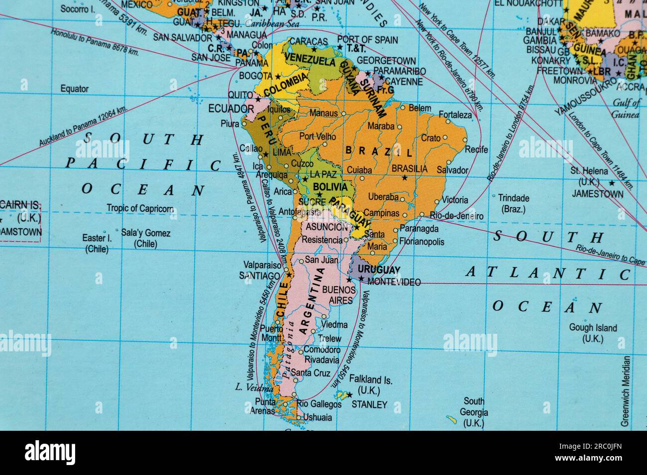
In the northwest, the map will illustrate how South America touches the Caribbean Sea, a marginal sea of the Atlantic. This region includes the coasts of Colombia, Venezuela, and the Guianas. The Caribbean is relatively shallow and warm, supporting coral reefs and the famous biodiversity of the region. The presence of the Caribbean opens South America to influences from Central America and the islands of the Antilles. Ports such as Cartagena and Maracaibo are critical for trade, and the map often highlights the Gulf of Venezuela and Lake Maracaibo as distinct features.
The Southern Ocean and Cape Horn
At the southern tip of the continent, the map shows the convergence of the Atlantic and Pacific around Cape Horn. This area is dominated by the Southern Ocean, which circles Antarctica. The waters here are cold, stormy, and rich in marine life. The Drake Passage, separating South America from the Antarctic Peninsula, is one of the roughest sea routes in the world. The physical map will depict the fragmented archipelago of Tierra del Fuego and the Strait of Magellan, a critical navigable passage before the Panama Canal was built.
Major River Systems and Inland Seas
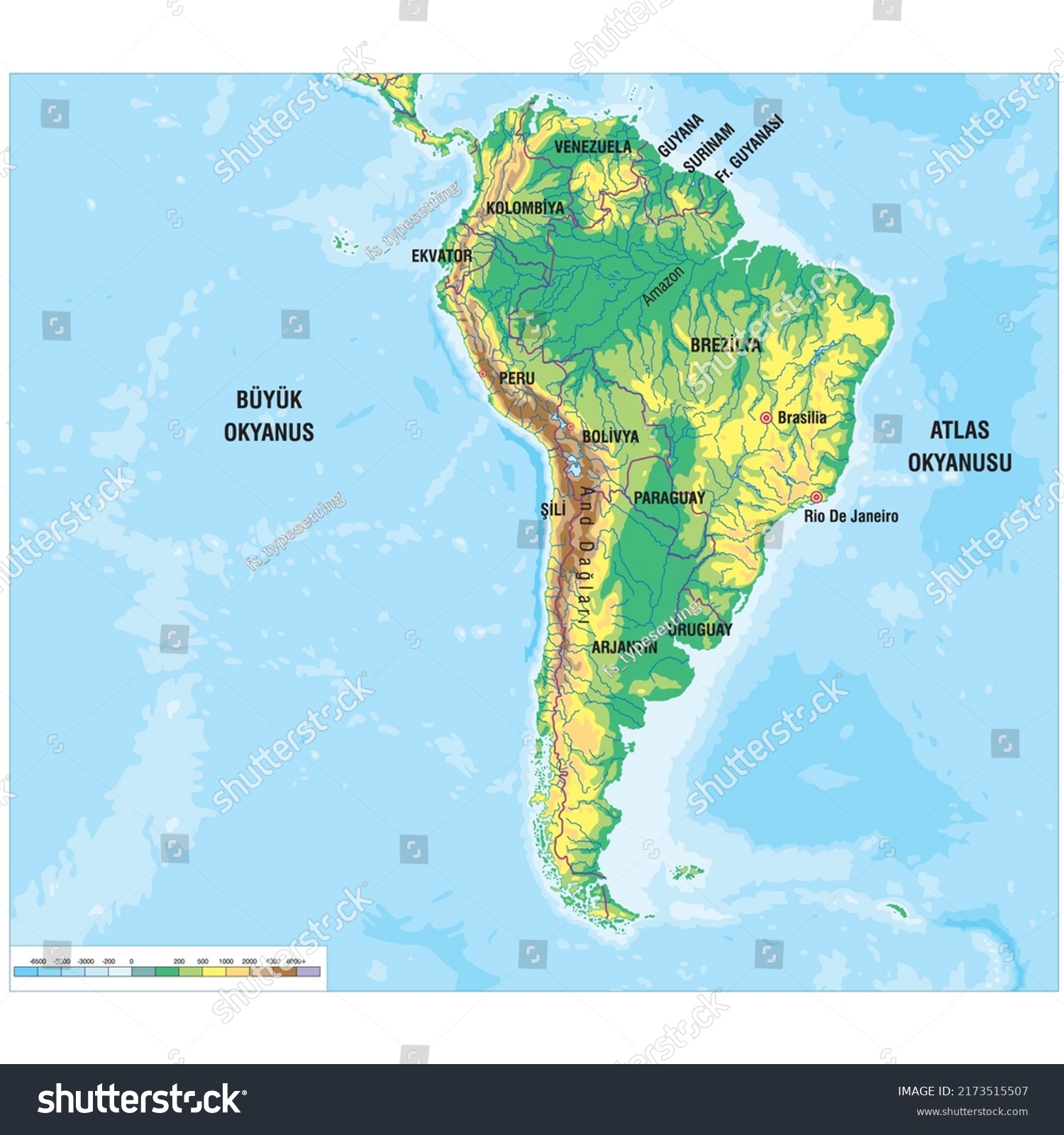
No map of South America is complete without highlighting its massive river basins. The Amazon River system, fed by rain from both the Atlantic and the Andes, drains an area larger than any other on Earth. The Orinoco River in the north and the Paraná–Paraguay–Río de la Plata system in the south form additional networks that connect the interior to the oceans. These rivers are depicted as thick blue lines, often with visible floodplains and wetlands such as the Pantanal. The map also reveals important inland seas like Lake Titicaca, shared by Peru and Bolivia, and Lake Maracaibo, a brackish tidal bay.
Climate Zones and Oceanic Influence
The surrounding oceans play a decisive role in South America’s climate zones as shown on a physical map. The Pacific coast’s cold current creates a rain shadow effect, producing the hyper-arid Atacama Desert and the Mediterranean-like climate of central Chile. In contrast, the Atlantic’s warm currents contribute to the tropical rainforests of Brazil and the Atlantic Forest. The southern tip experiences a subpolar oceanic climate, with constant westerly winds and high precipitation. A skilled reader of a physical map can identify these zones by correlating ocean currents, latitude, and elevation.
Ocean Resources and Economic Significance
The oceans surrounding South America are not just geographic boundaries; they are economic lifelines. The Pacific waters support one of the world’s largest fisheries, particularly for anchoveta, thanks to the nutrient-rich Humboldt Current. The Atlantic coast has major petroleum reserves, especially off Brazil and Venezuela. The map often includes exclusive economic zone boundaries, showing how countries claim large maritime areas. Understanding the map’s depiction of these oceanic zones is crucial for studying trade routes, fishing grounds, and submarine communication cables that connect South America to the rest of the world.
Conclusion
A comprehensive map of South America with its oceans reveals a continent shaped by its maritime borders. From the high Andes dropping into the Pacific abyss to the gentle Atlantic slopes feeding the world’s largest river, the interplay between land and sea is fundamental. The Caribbean Sea and Southern Ocean add further complexity, creating unique ecoregions and economic opportunities. Whether you are studying geography, planning travel, or analyzing environmental systems, this oceanic perspective provides indispensable context for understanding the physical and human landscapes of South America.
South America - High Detailed Political Map South American Continent
South America - high detailed political map South American continent ...
Physical Map Of South America Physical 3D Map Of South America

Physical Map Of South America Physical 3D Map Of South America
South America - High Detailed Political Map South American Continent
South America - high detailed political map South American continent ...
Printable Physical Map Of South America
Printable Physical Map Of South America
Physical Map Of South America Physical 3D Map Of South America
Physical Map Of South America Physical 3D Map Of South America
Map Of South America

Map Of South America
StepMap - South America Oceans And Mountains - Landkarte Für Brazil

StepMap - South America Oceans and Mountains - Landkarte für Brazil
Physical Map Of South America With Labels North America Physical Map

Physical Map Of South America With Labels North America Physical Map
Physical Map Of South America Printable - Printable Free Templates
Physical Map Of South America Printable - Printable Free Templates
South America Detailed Physical Map Global Stock Vector (Royalty Free

South America Detailed Physical Map Global Stock Vector (Royalty Free ...
South America Detailed Physical Map Global Stock Vector (Royalty Free

South America Detailed Physical Map Global Stock Vector (Royalty Free ...
Vintage Map Of The Americas, Showing North And South America With

Vintage Map of the Americas, Showing North and South America with ...
South America Physical Wall Map By GraphiOgre - MapSales
South America Physical Wall Map by GraphiOgre - MapSales
Physical Map Of South America Created With AI | Premium AI-generated Image

Physical map of South America created with AI | Premium AI-generated image
StepMap - Landforms And Oceans - Landkarte Für South America

StepMap - Landforms and Oceans - Landkarte für South America
Maps Of South America

Maps of South America
South America | Facts, Land, People, & Economy | Britannica

South America | Facts, Land, People, & Economy | Britannica
South America Detailed Physical Map Global Stock Vector (Royalty Free
South America Detailed Physical Map Global Stock Vector (Royalty Free ...
Physical Map Of South America Printable - Printable Free Templates
Physical Map Of South America Printable - Printable Free Templates
High Detailed South America Physical Map. Stock Vector - Illustration

High Detailed South America Physical Map. Stock Vector - Illustration ...
South America Map Blank Worksheet Blank Map Of South America | Teach
South America Map Blank Worksheet Blank Map Of South America | Teach
Physical Map Of South America Physical South America Map | Premium
Physical Map Of South America Physical South America Map | Premium
Map Of South America Picture. Image: 83036041

Map Of South America Picture. Image: 83036041
Physical Map Of South America - Ontheworldmap.com
Physical map of South America - Ontheworldmap.com
South America Detailed Physical Map Global Stock Vector (Royalty Free

South America Detailed Physical Map Global Stock Vector (Royalty Free ...
South America Physical Map Printable
South America Physical Map Printable
South America Map Ocean Features Diagram | Quizlet

South america map ocean features Diagram | Quizlet
Detailed 3D Map Of South America Showcasing Its Topography And

Detailed 3D Map of South America Showcasing Its Topography and ...
World Map With South American Continent, Countries And Oceans Stock
world map with south american continent, countries and oceans Stock ...
Physical Map Of South America Printable - Printable Free Templates
Physical Map Of South America Printable - Printable Free Templates
Physical Map Of South America With Oceans And Seas By World City Maps

Physical map of South America with oceans and seas by World city maps
Physical Maps Of South America | Mapswire
Physical Maps of South America | Mapswire
Physical Map Of South America Physical South America Map | Premium

Physical Map Of South America Physical South America Map | Premium