Exploring the Diverse Physical Features of South America: A Comprehensive Map Guide
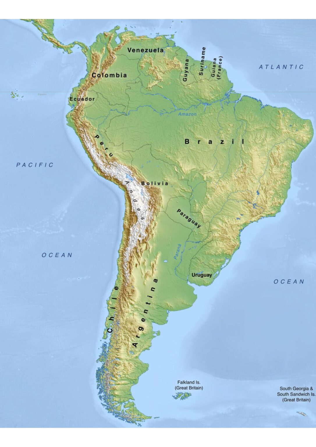
South America is a continent of staggering geographical contrasts, from the world's longest mountain range to the largest tropical rainforest and the driest desert on Earth. In this guide, you will explore the major physical features of South America as depicted on a detailed physical map. By understanding its towering peaks, vast river basins, expansive plains, and unique coastal landscapes, you will gain a deeper appreciation for how these natural elements shape the continent's climate, biodiversity, and human settlement.
The Andes Mountain Range: The Backbone of the Continent
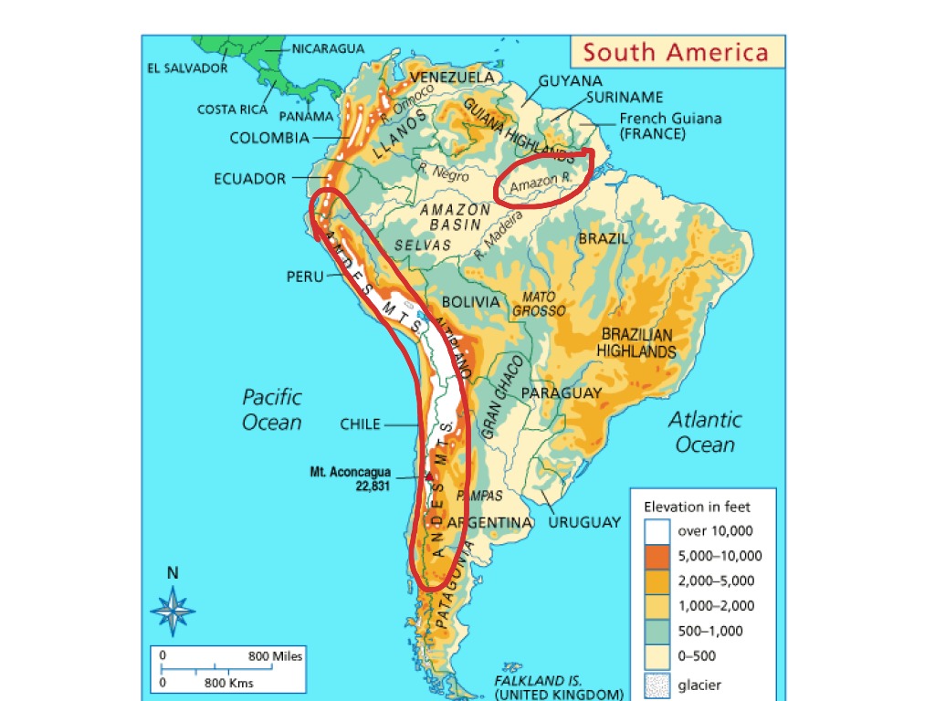
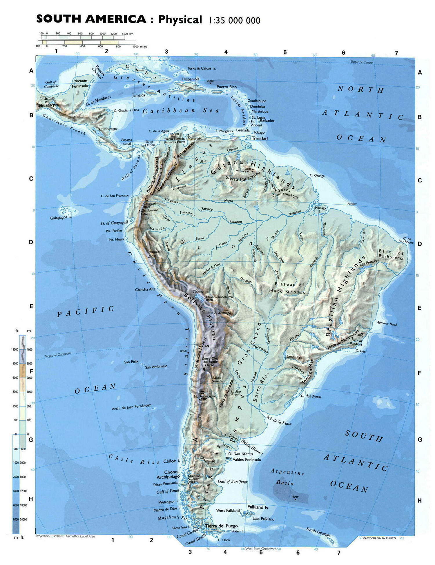
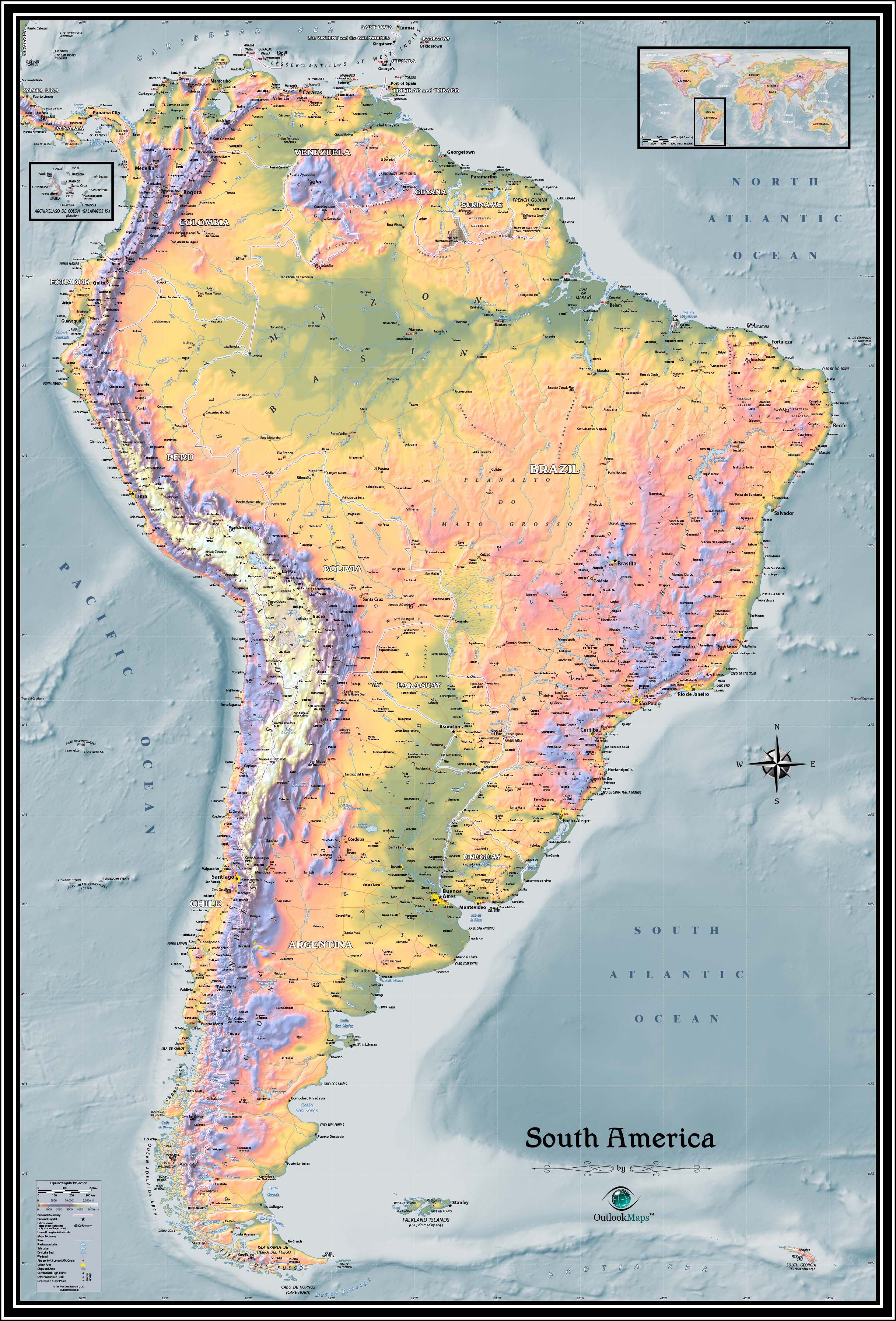
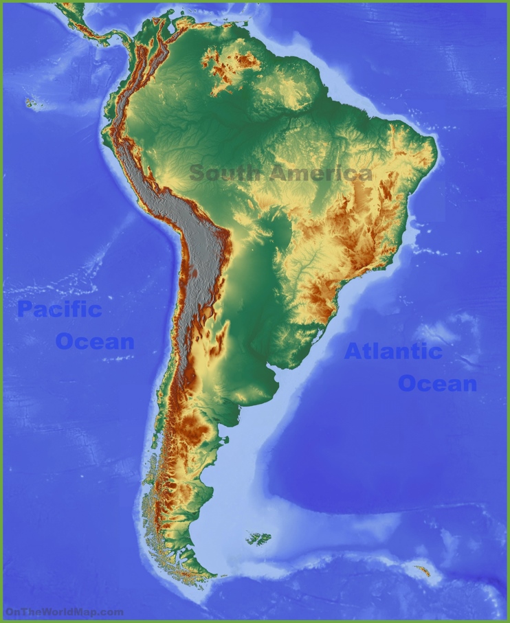
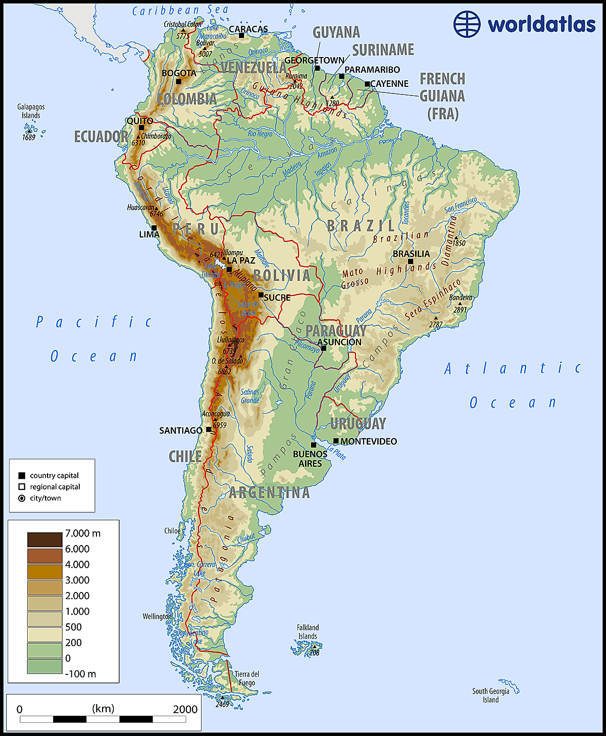
Stretching over 7,000 kilometers along the western edge of South America, the Andes form the longest continental mountain range in the world. This formidable barrier influences weather patterns, creates distinct ecological zones, and is home to the highest peaks in the Americas, including Mount Aconcagua in Argentina, which rises to nearly 7,000 meters. The Andes are a result of tectonic plate collisions, which also cause frequent volcanic and seismic activity. A physical map shows the Andes as a continuous, rugged spine with numerous snow-capped summits, deep valleys, and high plateaus such as the Altiplano in Bolivia. These highlands act as a natural divide, separating the narrow Pacific coastal strip from the vast interior lowlands.
The Amazon River Basin: The Lungs of the Earth
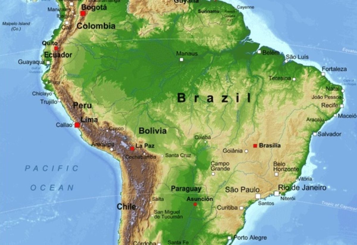
The Amazon River system dominates the northern half of the continent. Originating in the Peruvian Andes, the Amazon flows eastward across Brazil before emptying into the Atlantic Ocean. It is the largest river by discharge volume and the second-longest in the world. Its basin, covering about 40 percent of South America, is a vast expanse of lowland rainforest called the Amazon Rainforest. On a physical map, the basin appears as a broad, greenish lowland crisscrossed by a network of blue river tributaries like the Negro, Madeira, and Tapajós. This region experiences high rainfall year-round, creating a hot, humid climate that supports an incredible diversity of plant and animal life. The basin's flat topography makes it prone to seasonal flooding, which enriches the floodplain soils.
The Guiana Highlands and Brazilian Highlands: Ancient Plateaus
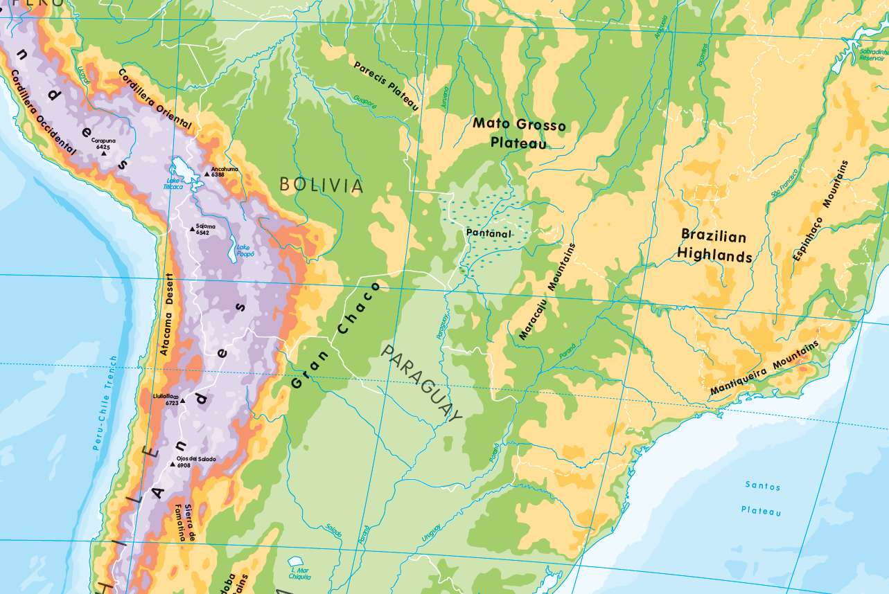
To the north of the Amazon Basin lie the Guiana Highlands, a weathered, ancient plateau that includes the famed tepuis—flat-topped mountains with sheer cliffs. These formations, such as Mount Roraima, are among the oldest on Earth and are separated by deep gorges. Similarly, the Brazilian Highlands occupy much of southeastern Brazil, rising as a series of low mountains, escarpments, and plateaus. A physical map shows these highlands as shaded, elevated regions that slowly descend toward the Atlantic coast. They were once part of a massive supercontinent and are rich in mineral resources like iron ore and gold. The combination of these highlands and the Andes creates a natural boundary that confines the Amazon drainage system.

The Llanos and Pampas: Vast Grasslands
Two major grassland regions define the interior of South America. The Llanos are expansive plains located in Colombia and Venezuela, north of the Amazon basin. They experience a distinct wet and dry season, supporting savanna vegetation and cattle ranching. To the south, the Pampas stretch across Argentina, Uruguay, and part of Brazil. These fertile plains are the continent's agricultural heartland, known for wheat, corn, and beef production. A physical map depicts the Llanos as a yellowish, flat region near the Orinoco River, while the Pampas appear as a smooth, grayish-green area extending from the Andes to the Atlantic. Both regions have very low relief, making them ideal for large-scale agriculture and transportation.
The Atacama Desert and Patagonia: Extreme Arid Southern Landscapes
South America also contains some of the most extreme arid environments. The Atacama Desert in northern Chile is the driest non-polar desert in the world, with some areas receiving no measurable rainfall for decades. A physical map shows it as a narrow strip between the Pacific Ocean and the Andes, characterized by salt flats, rocky valleys, and red sand dunes. Farther south lies Patagonia, a vast region spanning southern Argentina and Chile. Patagonia is a land of stark contrasts: icy fjords, glaciers, steppe-like plateaus, and strong winds. The Southern Patagonian Ice Field, one of the largest ice masses outside Antarctica, feeds numerous glaciers that calve into lakes and oceans. Physical maps indicate Patagonia with light brown or tan shading, broken by blue lines representing glacial rivers and lakes.
Coastal Features and Islands: From the Caribbean to Cape Horn
The continent's coastline is equally varied. The northern coast along the Caribbean Sea features tropical beaches, coral reefs, and the massive Orinoco Delta. The Atlantic coast of Brazil has numerous harbors and long stretches of sandy beaches backed by coastal mountains. On the Pacific side, the coastline is steep and narrow, with the Andes rising directly from the sea in many places. Notable islands include the Galápagos Islands west of Ecuador, known for their unique wildlife, and Tierra del Fuego at the southern tip, separated from the mainland by the Strait of Magellan. A comprehensive physical map marks these features clearly, showing how the continent tapers dramatically toward Cape Horn, the southernmost point of South America.
Major River Systems Beyond the Amazon
While the Amazon is the most famous, other major rivers shape the continent's geography. The Orinoco River flows in a great arc through Colombia and Venezuela, draining the Llanos and the Guiana Highlands. Its basin is home to the Casiquiare canal, a natural channel linking the Orinoco to the Amazon system. The Paraná-Paraguay River system flows southward through Brazil, Paraguay, and Argentina, forming the vast Pantanal wetland—the world's largest tropical wetland. This system eventually merges with the Uruguay River to form the Río de la Plata estuary near Buenos Aires. A physical map shows these rivers as thick blue lines carrying sediment from highlands to oceans, providing critical water routes for inland trade and agriculture.
Conclusion
South America's physical map reveals a continent shaped by powerful geological forces, from the towering Andes and ancient highlands to the immense river basins and arid deserts. Understanding these features—the jagged mountain chains, the lush Amazon lowlands, the fertile Pampas, and the harsh Patagonian steppe—provides essential context for the continent's ecology, climate, and human history. Whether you are a student, traveler, or geography enthusiast, a close study of South America's physical geography illuminates why this region is one of the most biologically and culturally rich on Earth. Each landform tells a story of tectonic movement, erosion, and climatic extremes that continue to shape the lives of millions.
Physical Map Of South America Physical South America Map | Premium
Physical Map Of South America Physical South America Map | Premium
Comprehensive Physical Map Of South America Detailed Topography And

Comprehensive Physical Map of South America Detailed Topography and ...
Physical Map Of South America - Cosmographics Ltd
Physical map of South America - Cosmographics Ltd
Geographical Features South America At William Gainey Blog
Geographical Features South America at William Gainey blog
Map Of South America Physical Features
Map of south america physical features
Map Of South America Physical Features

Map of south america physical features
Physical Map South America , Physical Map Of South America – TLWK
Physical Map South America , Physical Map of South America – TLWK
South America Physical Features Map

south america physical features map
South America Physical Features Map

south america physical features map
Geographical Features South America At William Gainey Blog
Geographical Features South America at William Gainey blog
Physical Map Of South America Printable - Printable Free Templates
Physical Map Of South America Printable - Printable Free Templates
Physical Map Of South America With Key
Physical map of south america with key
Physical Map Of South America Printable - Printable Free Templates
Physical Map Of South America Printable - Printable Free Templates
Physical Map Of South America Printable - Printable Free Templates

Physical Map Of South America Printable - Printable Free Templates
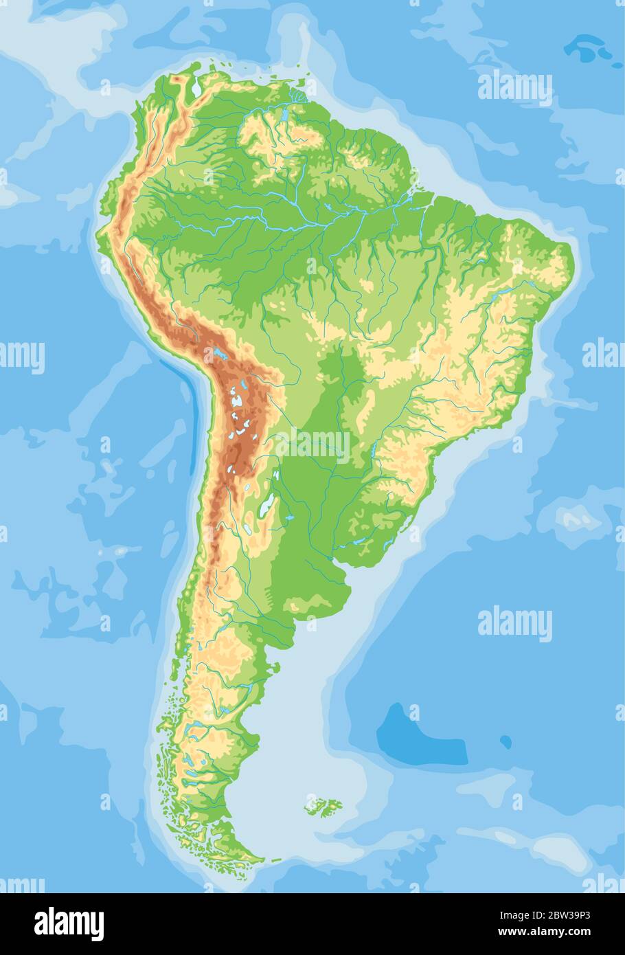
Premium Vector | Detailed Physical Map Of South America

Premium Vector | Detailed physical map of south america
PHYSICAL MAP SOUTH AMERICA Diagram | Quizlet

PHYSICAL MAP SOUTH AMERICA Diagram | Quizlet
Physical Map Of South America - Ontheworldmap.com
Physical map of South America - Ontheworldmap.com
South America Physical Features Map Physical Map Of South America,
South America Physical Features Map Physical Map Of South America,
Vibrant, Highly Detailed Physical Map Of South America Showcases
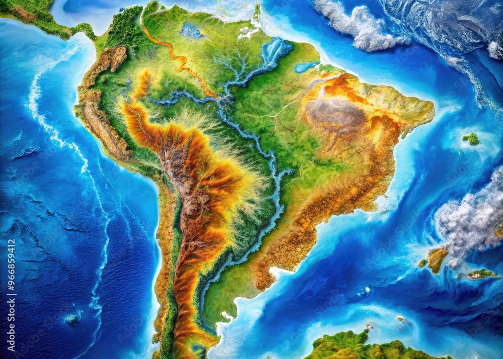
Vibrant, highly detailed physical map of South America showcases ...
South America Physical Wall Map By National Geographic - MapSales
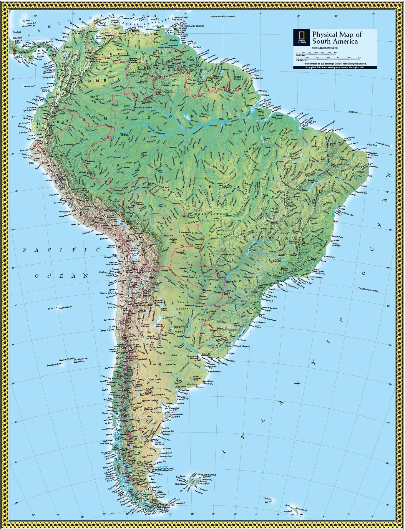
South America Physical Wall Map by National Geographic - MapSales
The Times Map Of South America (Physical Features) | Stanfords
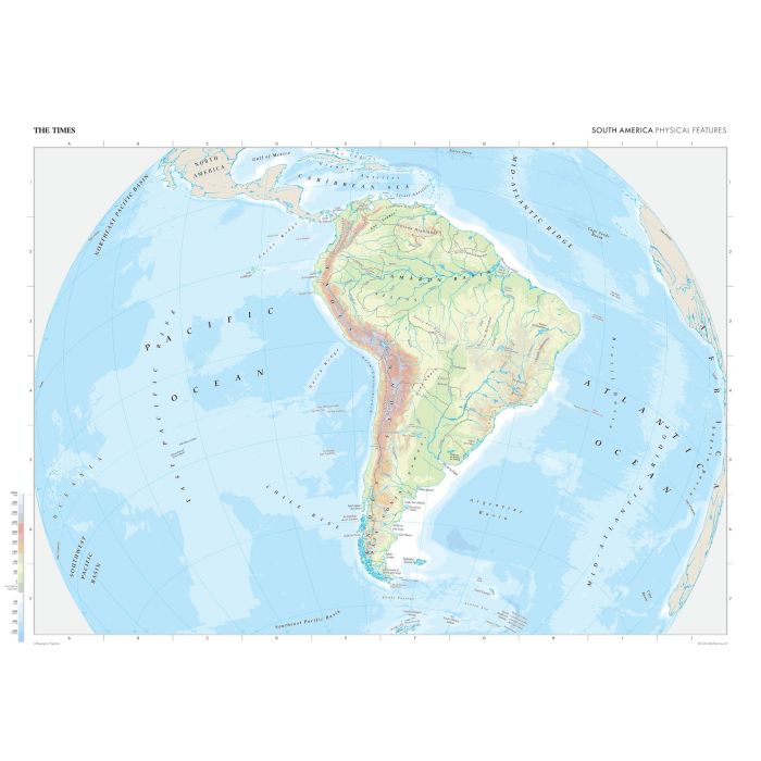
The Times Map of South America (Physical Features) | Stanfords
A Detailed High-resolution Physical Map Of South America Highlighting

A Detailed High-resolution Physical Map of South America Highlighting ...
Physical Map Of South America Physical 3D Map Of South America

Physical Map Of South America Physical 3D Map Of South America
Physical Feature Map Of South America
physical feature map of south america
Physical Map Of South America | Landform Features
Physical Map Of South America | Landform Features
Map Of South America Physical Features

Map of south america physical features
South America Physical Features Map

south america physical features map
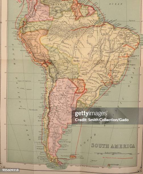
South America Physical Map Photos And Premium High Res Pictures - Getty

South America Physical Map Photos and Premium High Res Pictures - Getty ...
Physical Features Of South America | Teaching Resources

Physical Features of South America | Teaching Resources
South America Physical Map Quiz - Doquizzes
South America Physical Map Quiz - Doquizzes
South America Physical Map Mapa De America Mapa De America Del Sur

South America Physical Map Mapa De America Mapa De America Del Sur ...
South America Physical Features Map
south america physical features map
Physical Features Of South America

Physical features of south america