Exploring South America: A Complete Guide to Countries and Capitals
South America, a continent of breathtaking diversity, is home to twelve sovereign nations and three territories, each with a unique capital city that serves as its political, cultural, and economic heart. This guide will take you through the entire map of South America, helping you understand the location of each country and the significance of its capital. Whether you are a student, a traveler, or simply curious about geography, you will gain a clear and detailed picture of how this vibrant continent is organized, from the towering Andes to the Amazon basin and the Atlantic coast.
The Northern Tier: Caribbean Coast and the Guianas
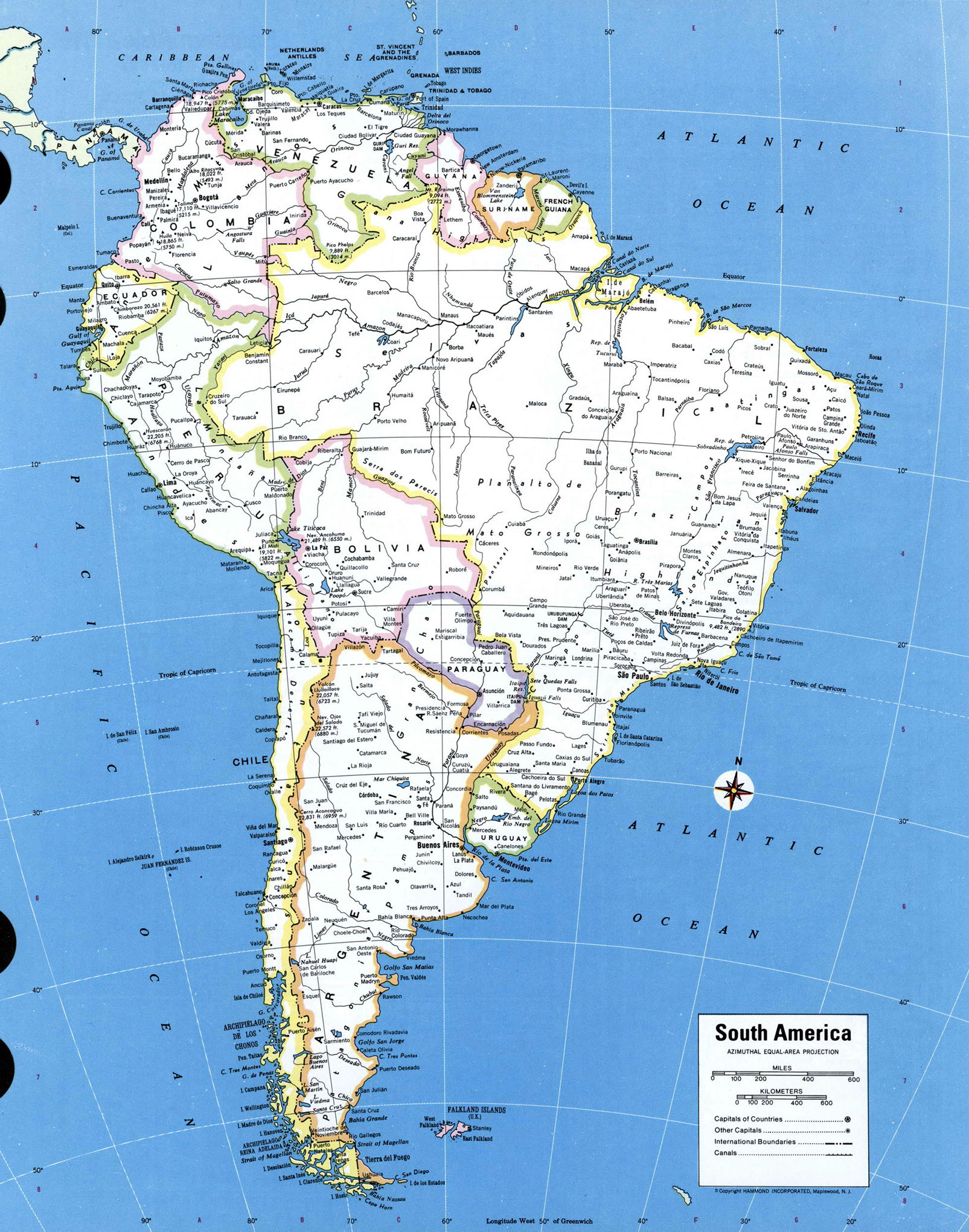
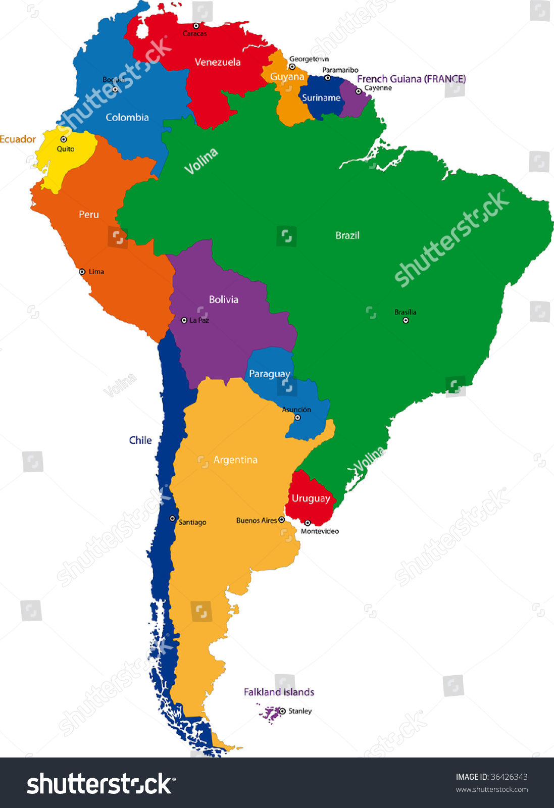
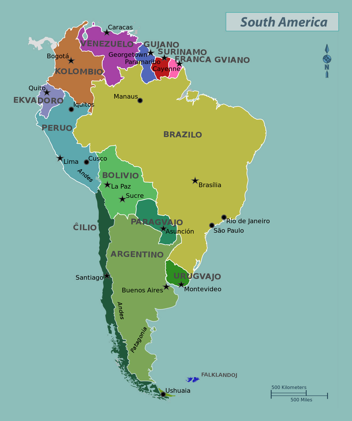
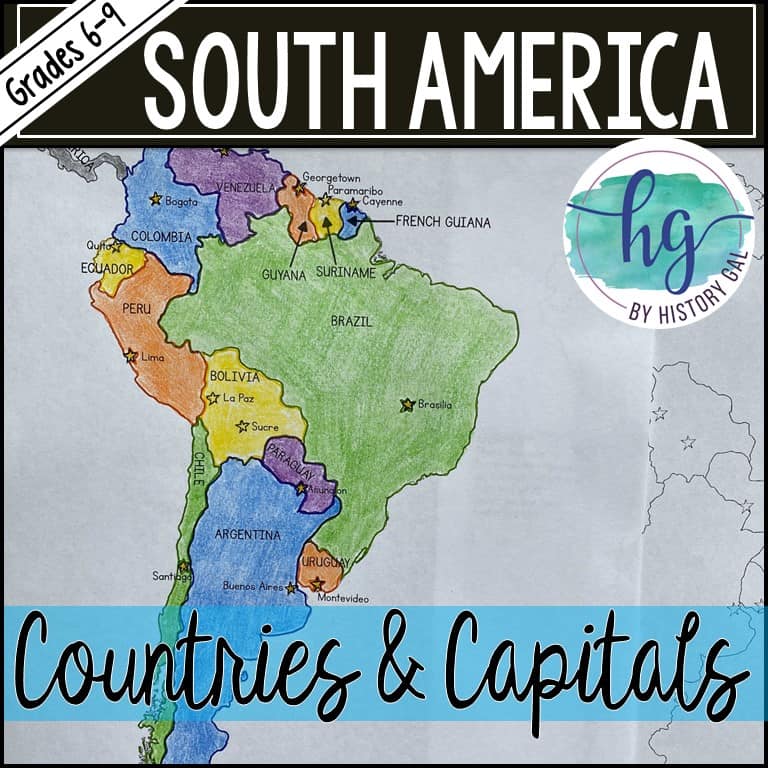
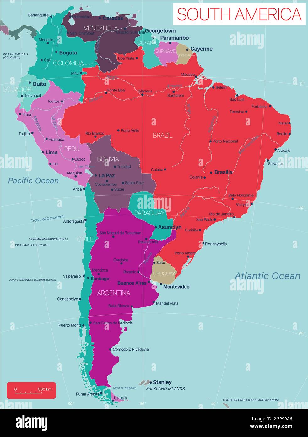
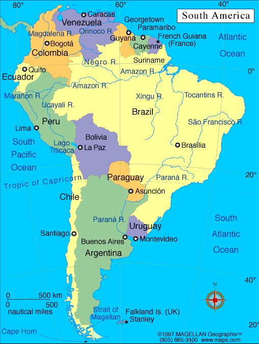
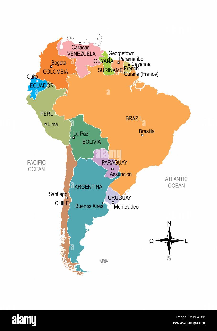
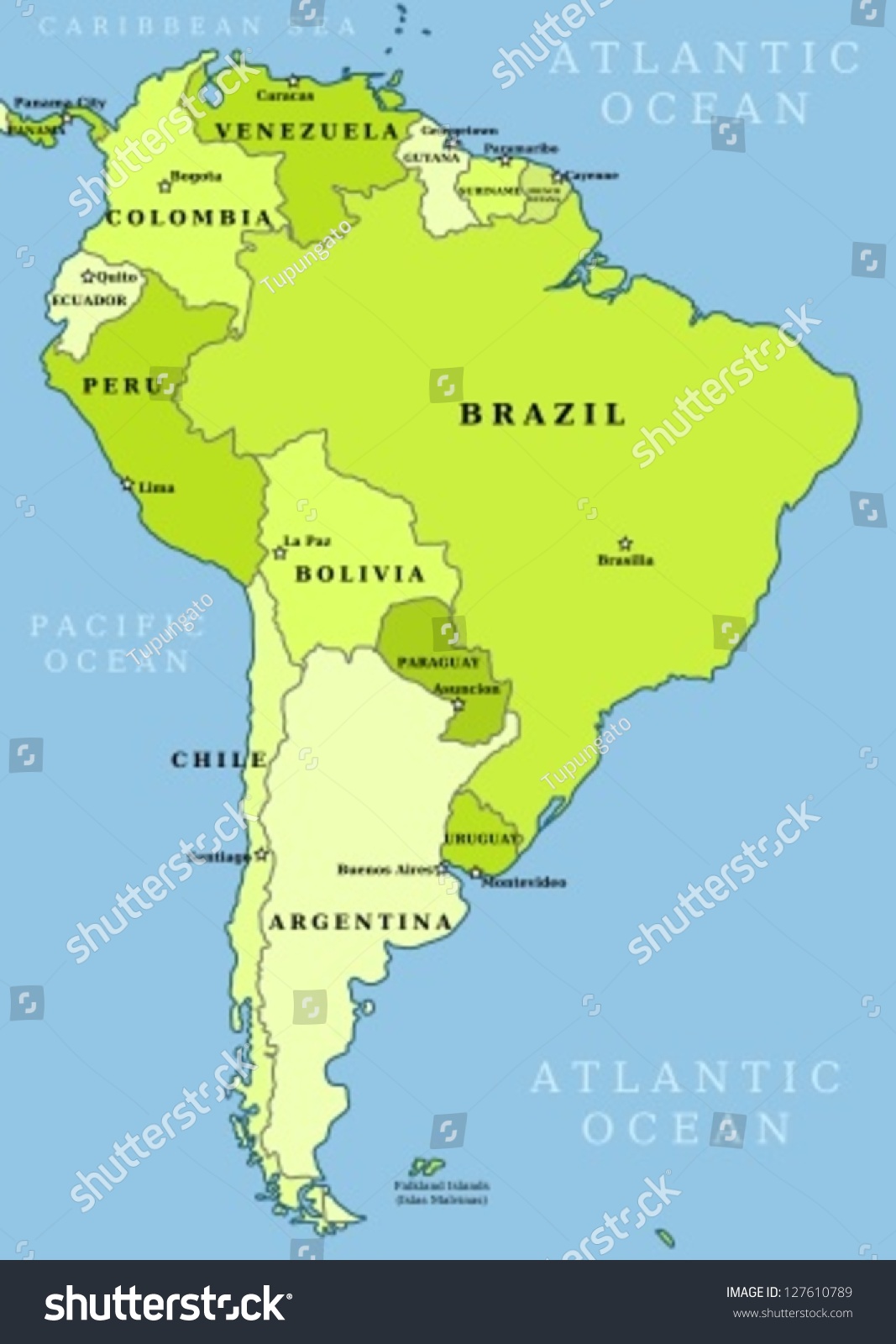
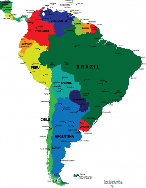
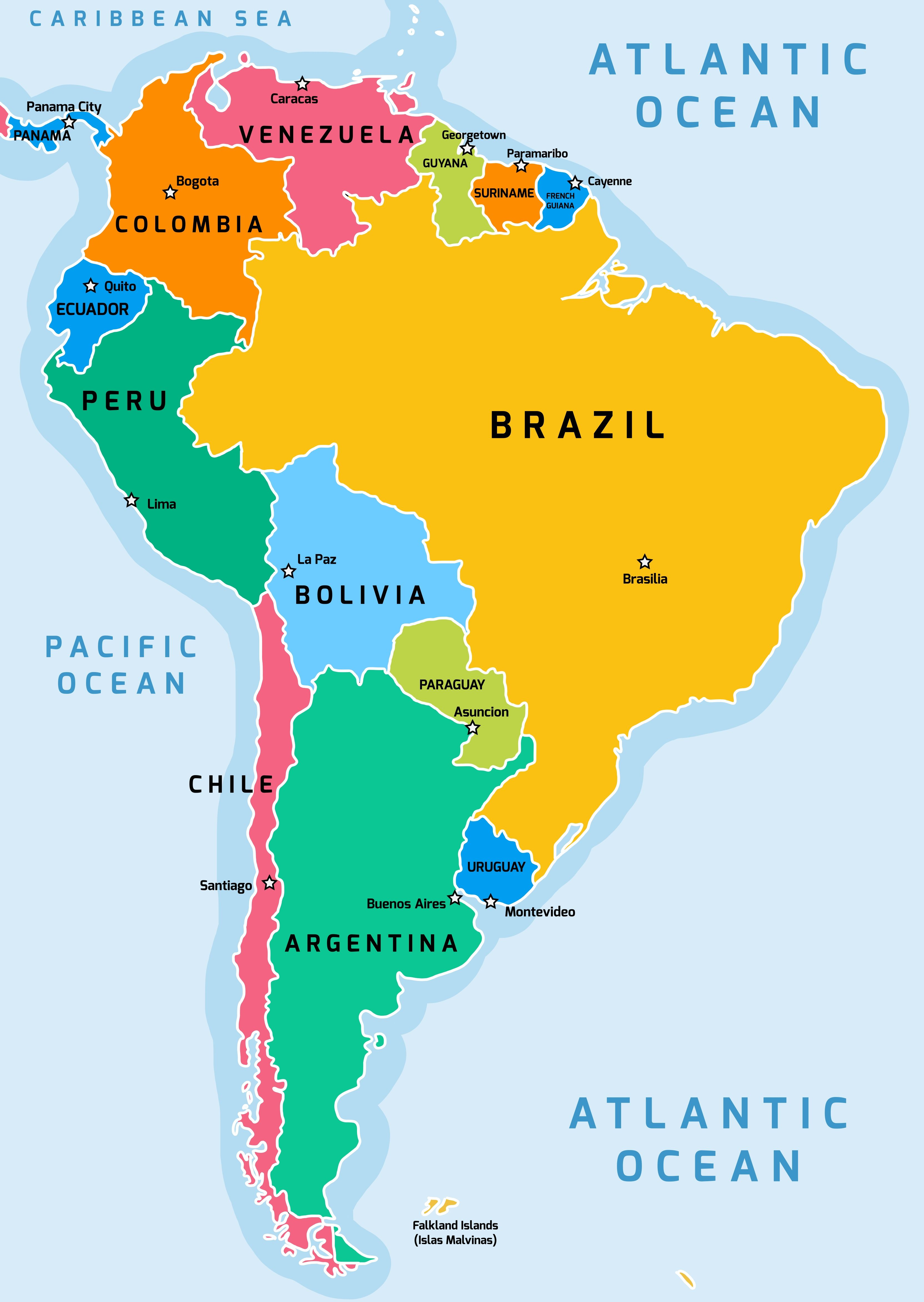
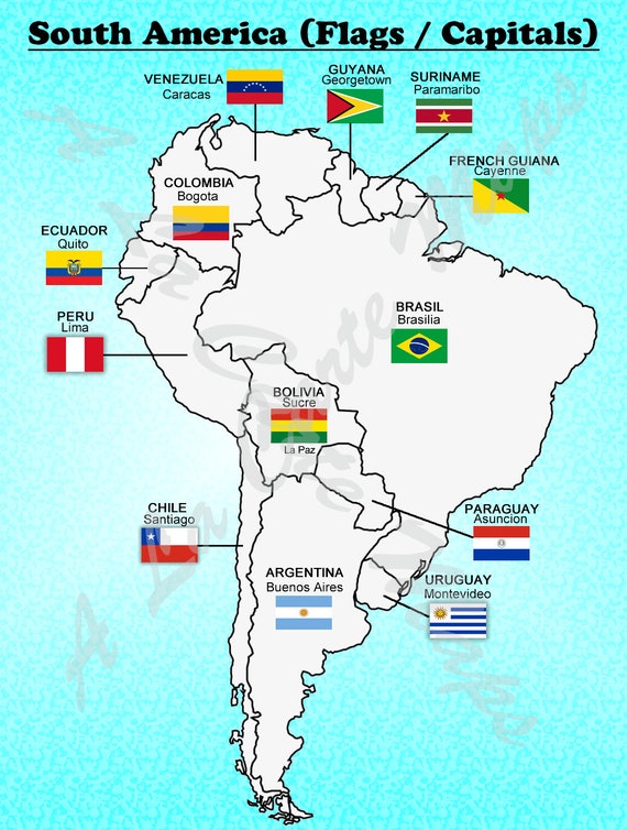
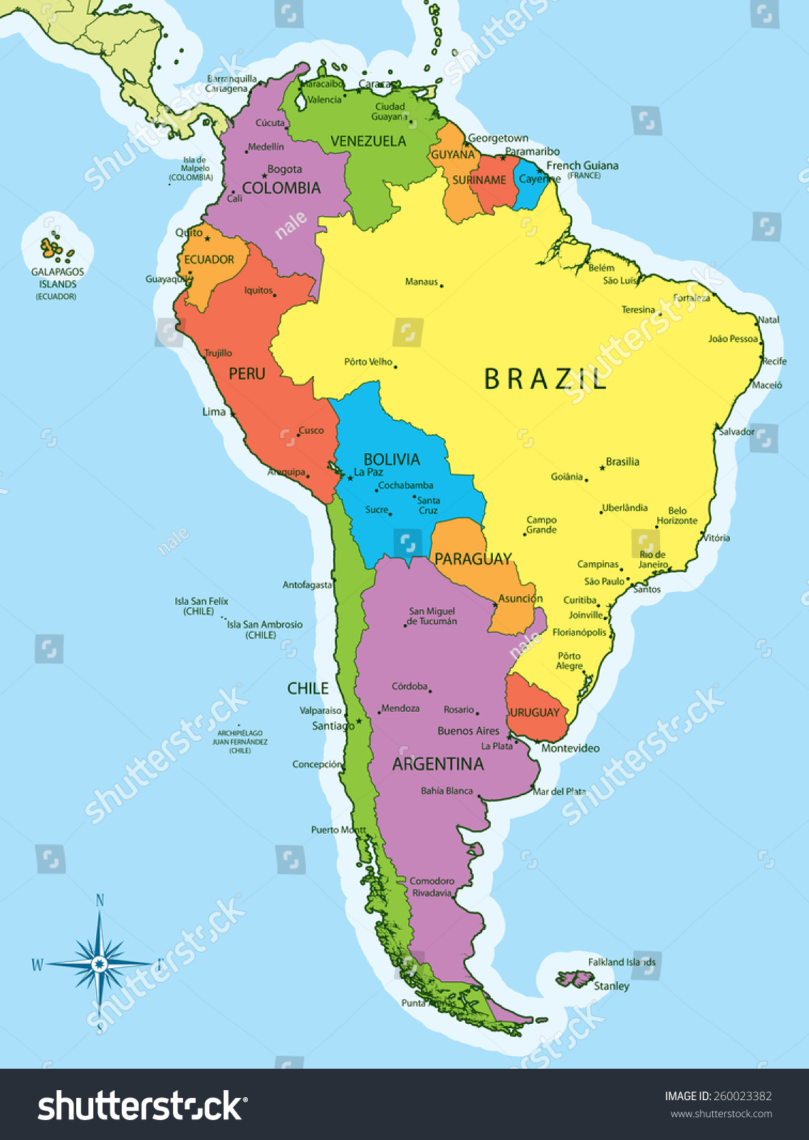
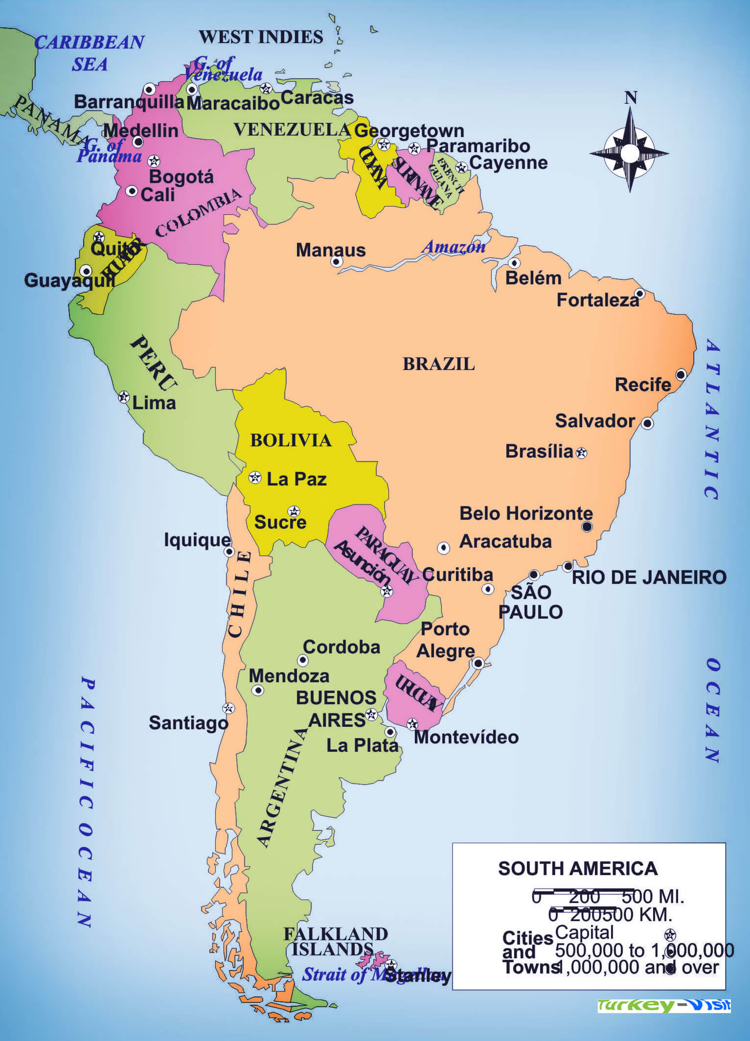
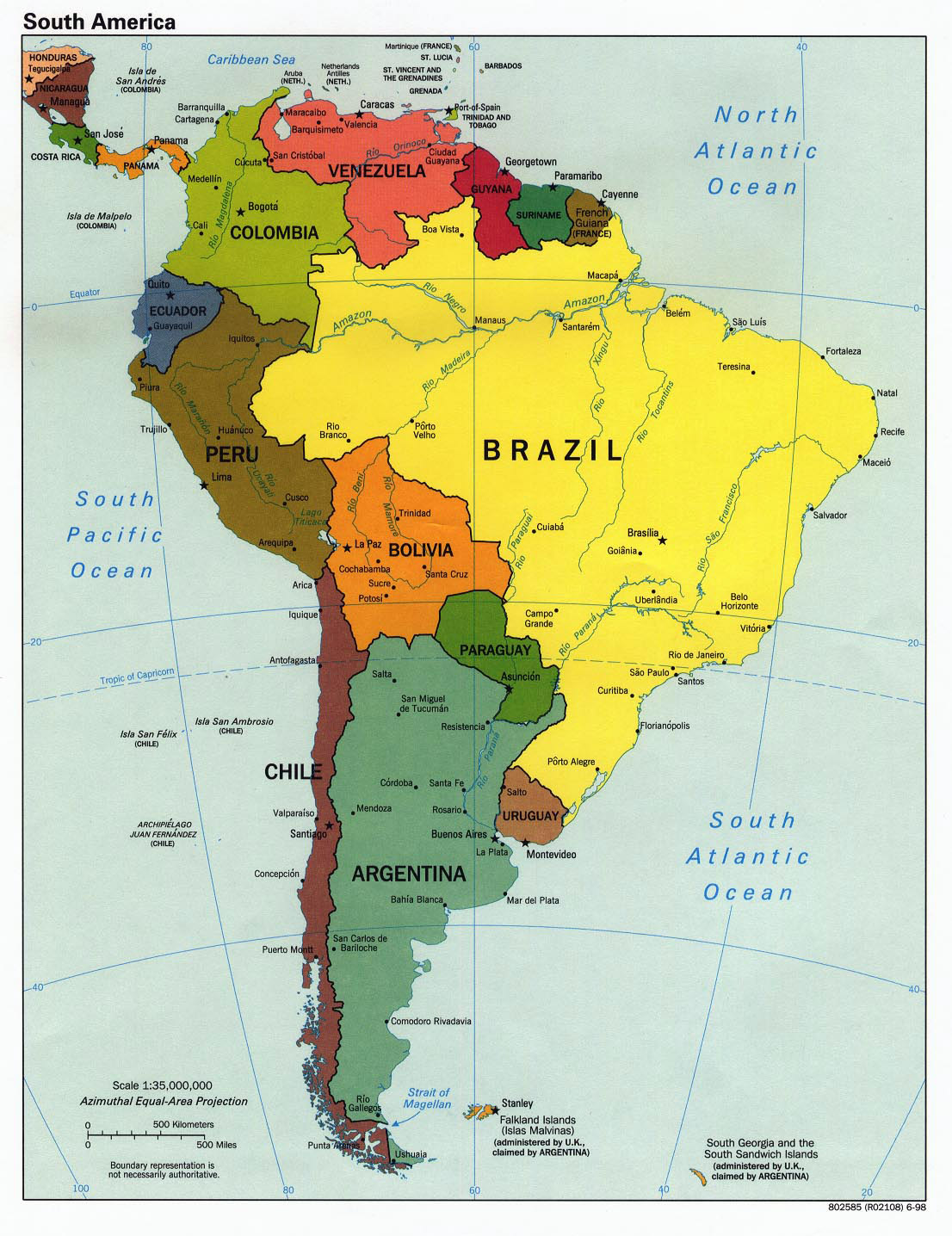
Starting from the north, the continent’s coastline along the Caribbean Sea is marked by three distinct countries. Colombia, with its capital Bogotá, sits at the northwestern corner. Bogotá is a high-altitude metropolis perched at 2,640 meters, known for its colonial architecture and vibrant arts scene. East of Colombia lies Venezuela, whose capital Caracas hugs the Caribbean coast in a valley of the Cordillera de la Costa. Caracas is a bustling hub of commerce and politics, despite its location in a seismically active region. Further east, the three Guianas offer a different flavor. Guyana’s capital is Georgetown, a low-lying city crisscrossed by canals, reflecting its Dutch colonial heritage. Suriname’s capital, Paramaribo, is famous for its UNESCO-listed wooden architecture along the Suriname River. Lastly, French Guiana, an overseas department of France, has its capital at Cayenne, a small yet lively port city known for its Creole culture and the nearby Guiana Space Centre.

The Andes Spine: Ecuador, Peru, Bolivia, and Chile
Running down the western edge of South America, the Andes Mountains define the geography of several nations. Ecuador, straddling the equator, has its capital Quito nestled high in the Andes at 2,850 meters. Quito boasts one of the best-preserved colonial centers in the Americas. South of Ecuador lies Peru, where the capital Lima sits on the Pacific coast, a sprawling desert city that blends ancient Incan history with modern vibrancy. Further inland, Bolivia presents a unique case: its constitutional capital is Sucre (the judicial seat), but the de facto capital and largest city is La Paz, the highest administrative capital in the world at over 3,600 meters. La Paz is dramatically set in a canyon, offering stunning views of the surrounding snow-capped peaks. To the south, Chile stretches like a long ribbon along the Pacific. Its capital Santiago lies in a valley flanked by the Andes and the Chilean Coast Range, a modern city with a strong wine culture and easy access to ski resorts.
The Southern Cone: Argentina, Uruguay, and Paraguay
At the southern end of the continent, the countries of the Southern Cone share temperate climates and strong European influences. Argentina, the second-largest country in South America, has its capital Buenos Aires, a cosmopolitan port city on the Río de la Plata. Known as the “Paris of South America,” Buenos Aires is famous for its tango, steak, and vibrant neighborhoods like La Boca and Palermo. Across the river lies Uruguay, a smaller nation with a tranquil reputation. Its capital, Montevideo, is a laid-back coastal city with a beautiful old town and a thriving cultural scene. Landlocked Paraguay sits in the heart of the continent. Its capital, Asunción, is one of the oldest cities in South America, founded in 1537. Asunción is a city of contrasts, with modern high-rises standing alongside colonial-era buildings, and it serves as the political and economic nucleus of the country.
The Giant of the East: Brazil and Its Capital
Brazil dominates the eastern half of South America, covering nearly half the continent’s land area and housing the world’s largest tropical rainforest, the Amazon. Its capital, Brasília, is a masterpiece of modernist urban planning, designed by architect Oscar Niemeyer and inaugurated in 1960. Unlike other major cities that grew organically, Brasília was purpose-built in the highlands of the Central-West region to shift development away from the coastal cities. Its layout resembles an airplane or a bird in flight, with government buildings, residential sectors, and monumental axes. While Rio de Janeiro and São Paulo are larger and more famous, Brasília remains the political heart of Brazil, housing the Palácio do Planalto (presidential office) and the National Congress.

Maritime Territories and Islands
Beyond the mainland, South America includes several offshore territories. To the east, the Falkland Islands (Islas Malvinas) are a British Overseas Territory, with the capital at Stanley, a small settlement on East Falkland. These islands are a subject of sovereignty dispute between the United Kingdom and Argentina. To the north of South America, the island nation of Trinidad and Tobago is often considered part of the Caribbean, but its capital Port of Spain is geographically close to the South American mainland. Additionally, the Galápagos Islands, though part of Ecuador, have no capital of their own but are governed from Quito; their unique wildlife makes them a global ecological treasure. These territories add to the geopolitical and cultural richness of the region, each with its own administrative center.
Key Geographic Features and Their Influence on Capitals
The location of many South American capitals is deeply tied to the continent’s dramatic geography. The Andes mountains run along the entire western edge, forcing capitals like Quito, Bogotá, and La Paz to occupy high-altitude valleys or plateaus. In contrast, the vast Amazon Basin in the north-central region has no major capitals within its dense rainforest; instead, cities like Manaus (Brazil) serve as regional hubs. The Atlantic coastline hosts the largest concentration of capitals, including Brasília (inland), Buenos Aires, Montevideo, and Paramaribo, all benefiting from port access and trade routes. The Atacama Desert in northern Chile is one of the driest places on Earth, yet Santiago lies in a fertile central valley that supports a large population. Understanding these geographic foundations helps explain why capitals developed where they did, balancing defense, resources, and connectivity.
Practical Tips for Learning and Memorizing
To master the map of South American countries and their capitals, start by dividing the continent into regions: the Caribbean north, the Andean west, the Southern Cone, Brazil, and the Guianas. Use mnemonic devices, such as “Bogotá in Colombia” (both start with C-O-L and B-O-G) or “Lima in Peru” (both end in ‘a’). Study the physical map alongside the political one to see how rivers, mountains, and coastlines define boundaries. Online quizzes and interactive maps are excellent tools for reinforcement. Visual learners can benefit from color-coding countries and their capitals on a printed map. Remember that capitals are not always the largest cities; for example, Brasília is not as populous as São Paulo, and La Paz outranks Sucre in size. Regular review, even just five minutes a day, will solidify your knowledge.
Conclusion
South America is a continent of remarkable contrasts, from the Amazon rainforest to the Patagonian steppe, and its capitals reflect this diversity. Each capital tells a story of history, culture, and human adaptation to the environment. From the high-altitude streets of La Paz and Quito to the coastal vibrancy of Buenos Aires and Montevideo, these cities are gateways to understanding the nations they lead. By familiarizing yourself with the map and the capitals, you not only learn geography but also gain insight into the political and social fabric of a region that continues to grow in global importance. Whether you plan to travel or simply expand your knowledge, this guide provides a solid foundation for exploring South America’s countries and their capitals.
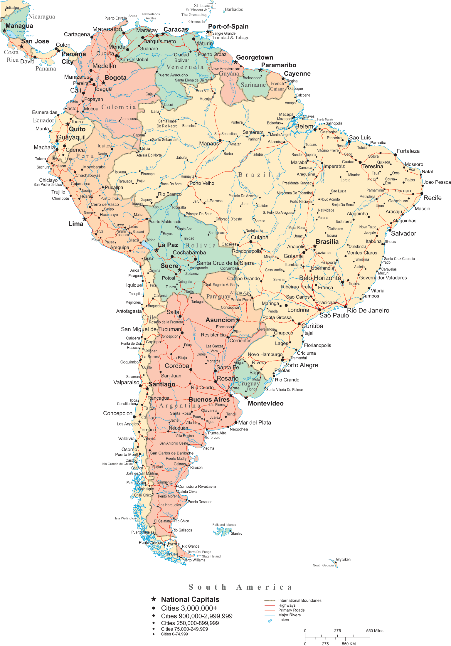
Detailed Political Map Of South America With Capitals And Major Cities

Detailed political map of South America with capitals and major cities ...
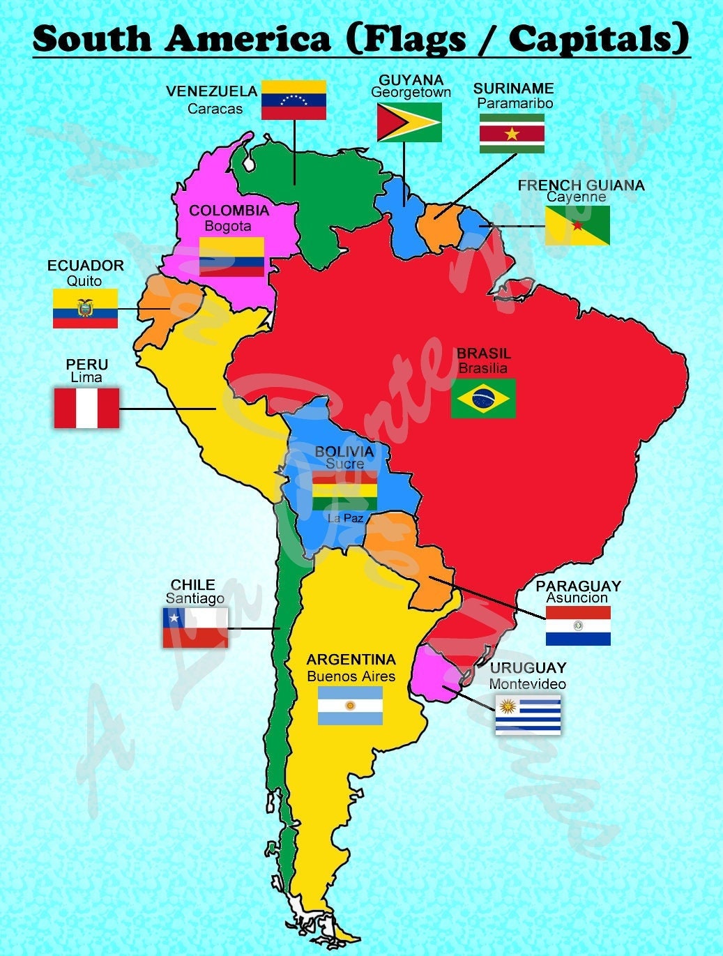
South American Countries And Capitals

South American Countries And Capitals
Maps Of South America And South American Countries | Political Maps
Maps of South America and South American countries | Political maps ...
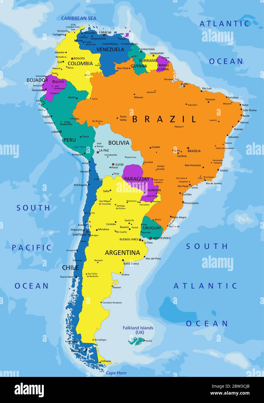
Colorful South America Map Countries Capital Stock Illustration
Colorful South America Map Countries Capital Stock Illustration ...
Maps Of South America And South American Countries | Political Maps
Maps of South America and South American countries | Political maps ...
South American Countries And Capitals Map Blank Map Of The Continent
South American Countries And Capitals Map Blank Map Of The Continent
South America Political Map Printable
South America Political Map Printable
South American Countries And Their Capitals In 2020 South America Map
South American Countries And Their Capitals In 2020 South America Map
South America

South America
South American Countries And Capitals List
South American Countries And Capitals List
South America Cities Map
South America Cities Map
South America Map Countries And Capitals - Uno

South America Map Countries And Capitals - Uno
South America Capitals
South America Capitals
South American Countries And Capitals List

South American Countries And Capitals List
South America Maps
South America Maps
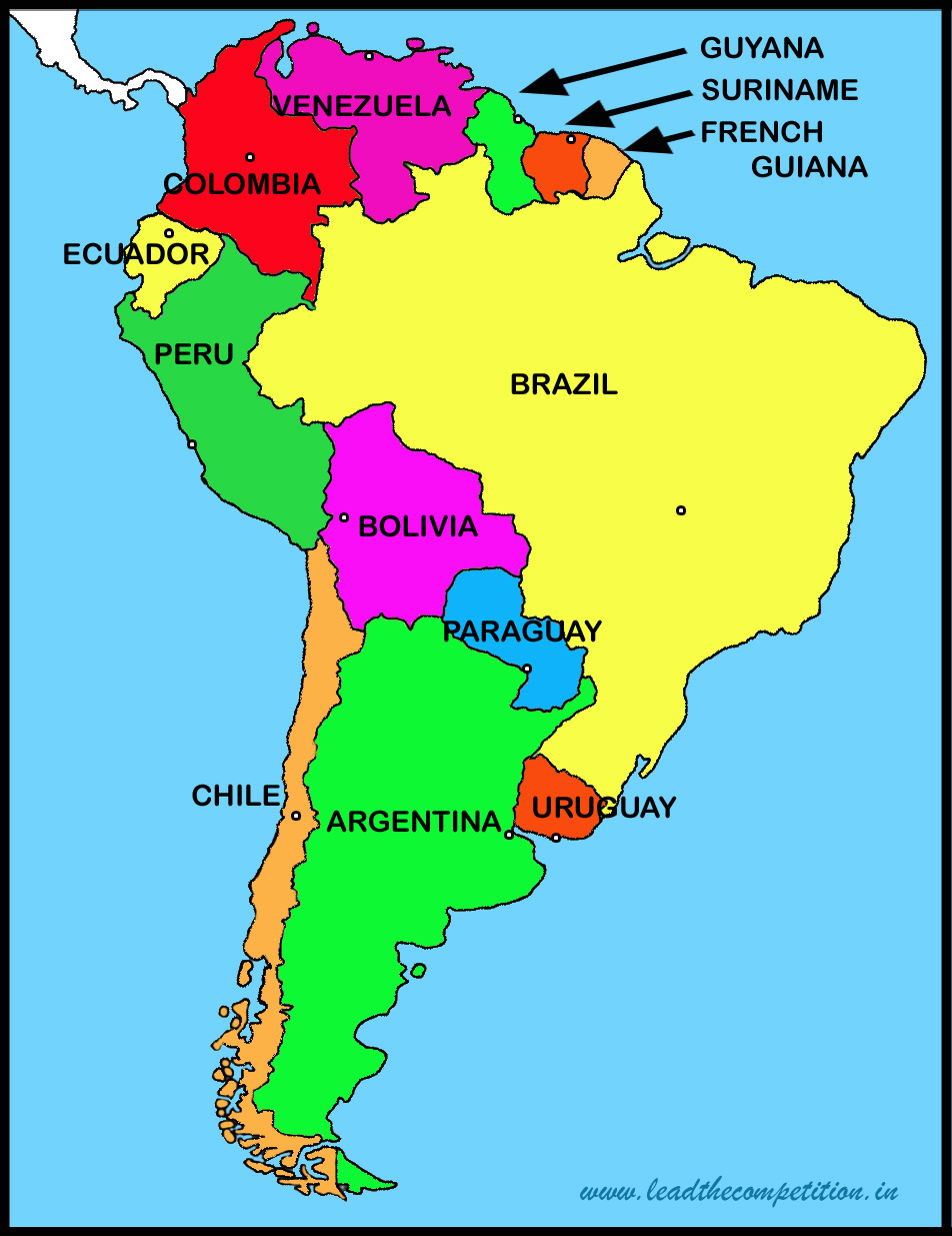
Colorful Map Of South America With Division Of Countries And Their
Colorful map of South America with division of countries and their ...
Digital Vector South American Countries Map In Illustrator And PDF Formats

Digital vector South American Countries map in Illustrator and PDF formats
South America Political Map With Capitals

South America Political Map With Capitals
Map Of South America. Political Division - Countries And Capital Ciites
Map Of South America. Political Division - Countries And Capital Ciites ...
South America Map Countries And Capitals - Uno
South America Map Countries And Capitals - Uno
Caples And South America Map Countries Labeled

Caples And South America Map Countries Labeled
South America Capitals Editable South America Countries, Provinces,
South America Capitals Editable South America Countries, Provinces,
South America Map And Satellite Image

South America Map and Satellite Image
All 28+ Background Images Political Map Of South America With Capitals

All 28+ Background Images political map of south america with capitals ...
South American Countries And Capitals List
South American Countries And Capitals List
Free PDF Maps Of South America

Free PDF maps of South America
South America Political Map

South America Political Map
Maps Of South America

Maps of South America
South American Countries And Capitals

South American Countries And Capitals
Map Of South America Countries And Capitals
Map Of South America Countries And Capitals
South America Countries Map
South America Countries Map
Map Of South America With Countries And Capitals

Map of South America with countries and capitals
Maps Of South America And South American Countries | Political Maps
Maps of South America and South American countries | Political maps ...