Complete Guide to South America Capitals Map and Country List 2024
Welcome to your definitive guide on South America's capitals, countries, and geographic layout. In this article, you will learn every capital city of the 12 sovereign nations and 3 dependent territories of South America, how to read a map of the continent, and key facts about each capital. Whether you are a student preparing for a geography exam, a traveler planning a trip, or a curious learner, this guide provides a clear, comprehensive overview with visual references and practical details.
Overview of South America and Its Nations
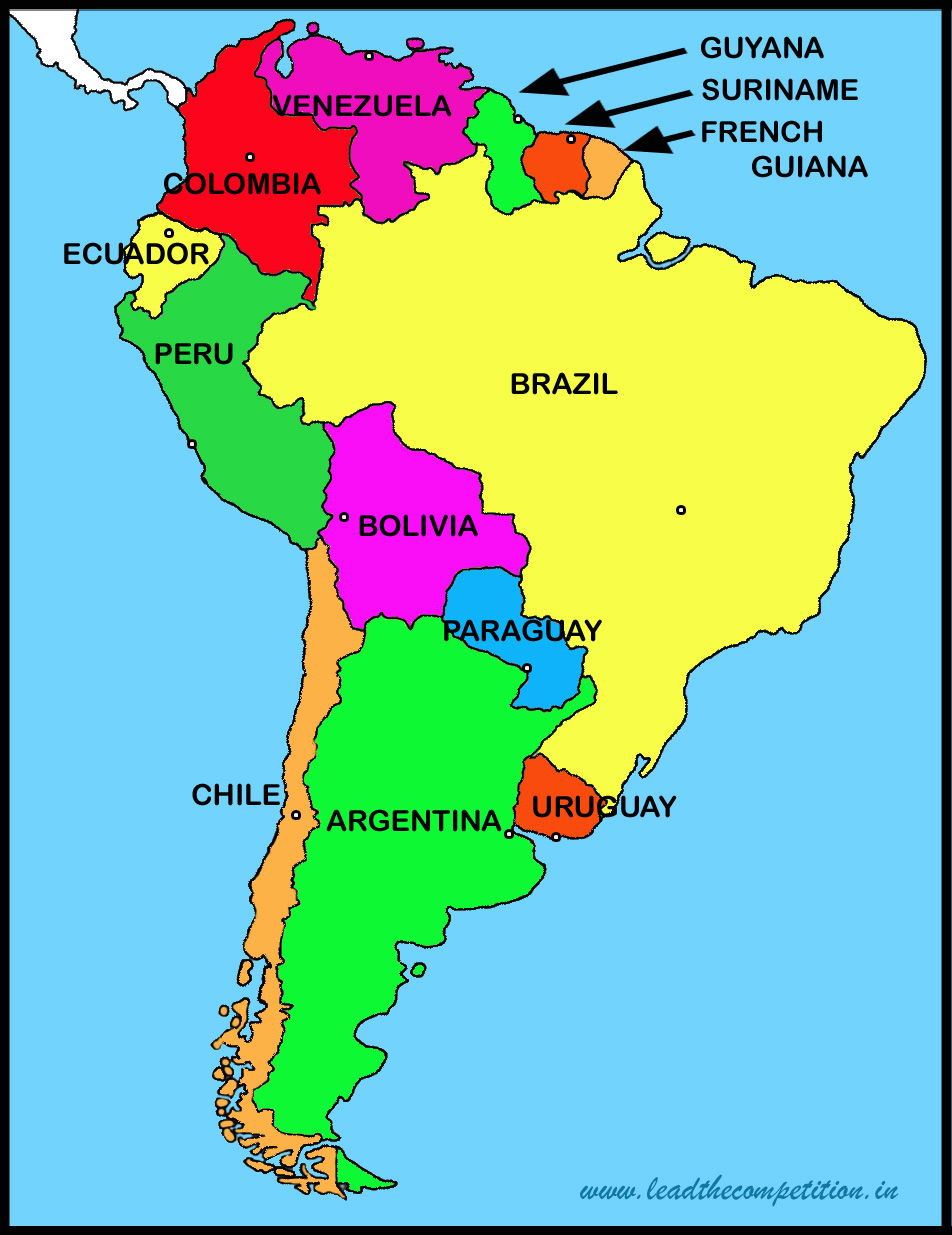
South America is the fourth largest continent, home to diverse landscapes from the Amazon rainforest to the Andes mountains. It comprises 12 independent countries: Argentina, Bolivia, Brazil, Chile, Colombia, Ecuador, Guyana, Paraguay, Peru, Suriname, Uruguay, and Venezuela. Additionally, there are three dependent territories: French Guiana (France), the Falkland Islands (UK), and South Georgia and the South Sandwich Islands (UK). Each country has a capital that serves as its political, economic, and cultural heart. Understanding these capitals is essential for grasping regional politics, trade routes, and historical development. Below is a detailed table of all sovereign nations and their capitals.
| Country | Capital | Population (approx.) | Interesting Fact |
|---|---|---|---|
| Argentina | Buenos Aires | 15 million (metro) | Known as "Paris of South America" for its European architecture. |
| Bolivia | Sucre (constitutional) / La Paz (administrative) | Sucre: 300,000 / La Paz: 800,000 | La Paz is the highest capital city in the world at 3,640 meters. |
| Brazil | Brasília | 3 million | Modernist city built in the 1960s, a UNESCO World Heritage site. |
| Chile | Santiago | 6.8 million | Home to the largest public outdoor pool in the world (San Alfonso del Mar). |
| Colombia | Bogotá | 8 million | Third-highest capital in South America, at 2,640 meters. |
| Ecuador | Quito | 2 million | Second-highest official capital in the world, at 2,850 meters. |
| Guyana | Georgetown | 250,000 | Only English-speaking country in mainland South America. |
| Paraguay | Asunción | 520,000 | One of the oldest cities in South America, founded in 1537. |
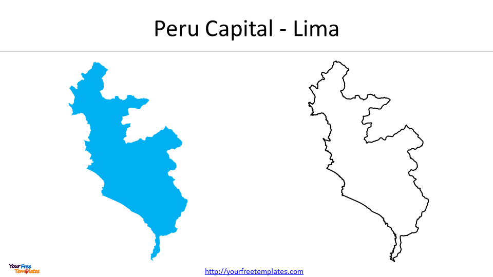
| Peru | Lima | 10 million (metro) | Coastal capital with a rich colonial history and world-class cuisine. |
| Suriname | Paramaribo | 250,000 | Capital of the smallest country in South America (by area). |
| Uruguay | Montevideo | 1.3 million | Known for its relaxed lifestyle and beautiful beaches. |
| Venezuela | Caracas | 3 million | Nestled in a valley near the Caribbean coast. |
Note: Bolivia has two capitals; Sucre is the constitutional capital, while La Paz houses the government and is de facto administrative. Dependent territories like French Guiana (capital Cayenne) are not independent nations but are often included in regional studies.
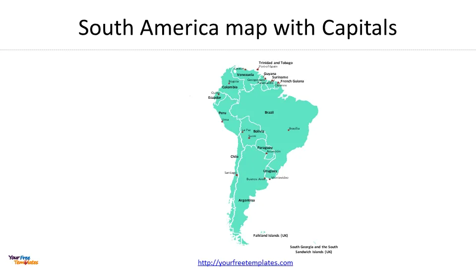
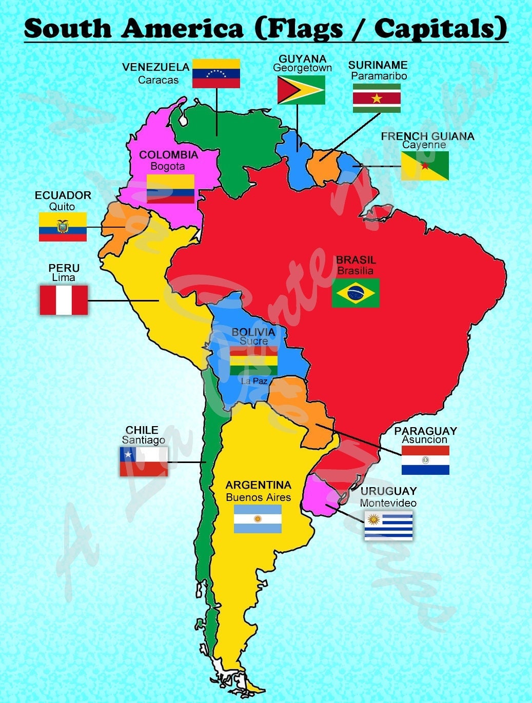
South America Capitals Map: Visual Navigation
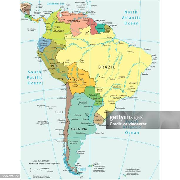
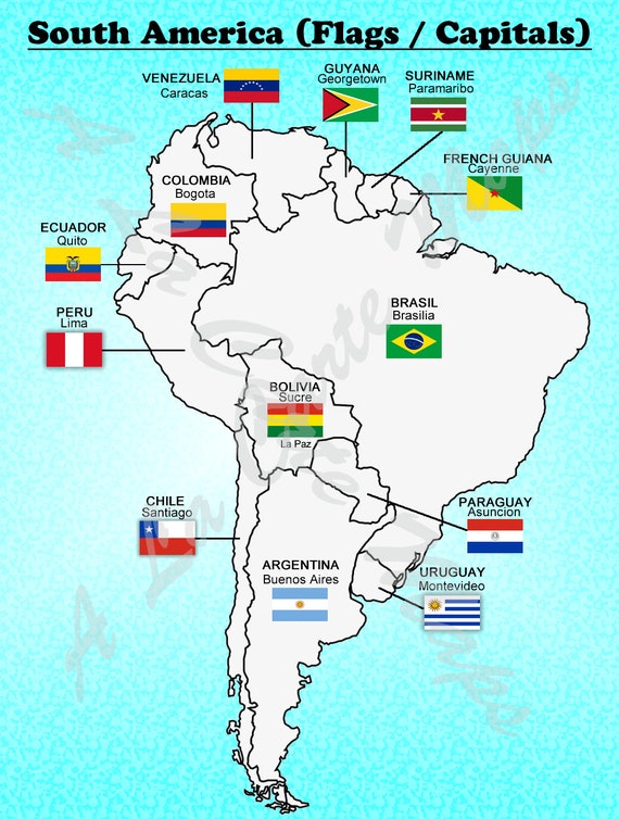
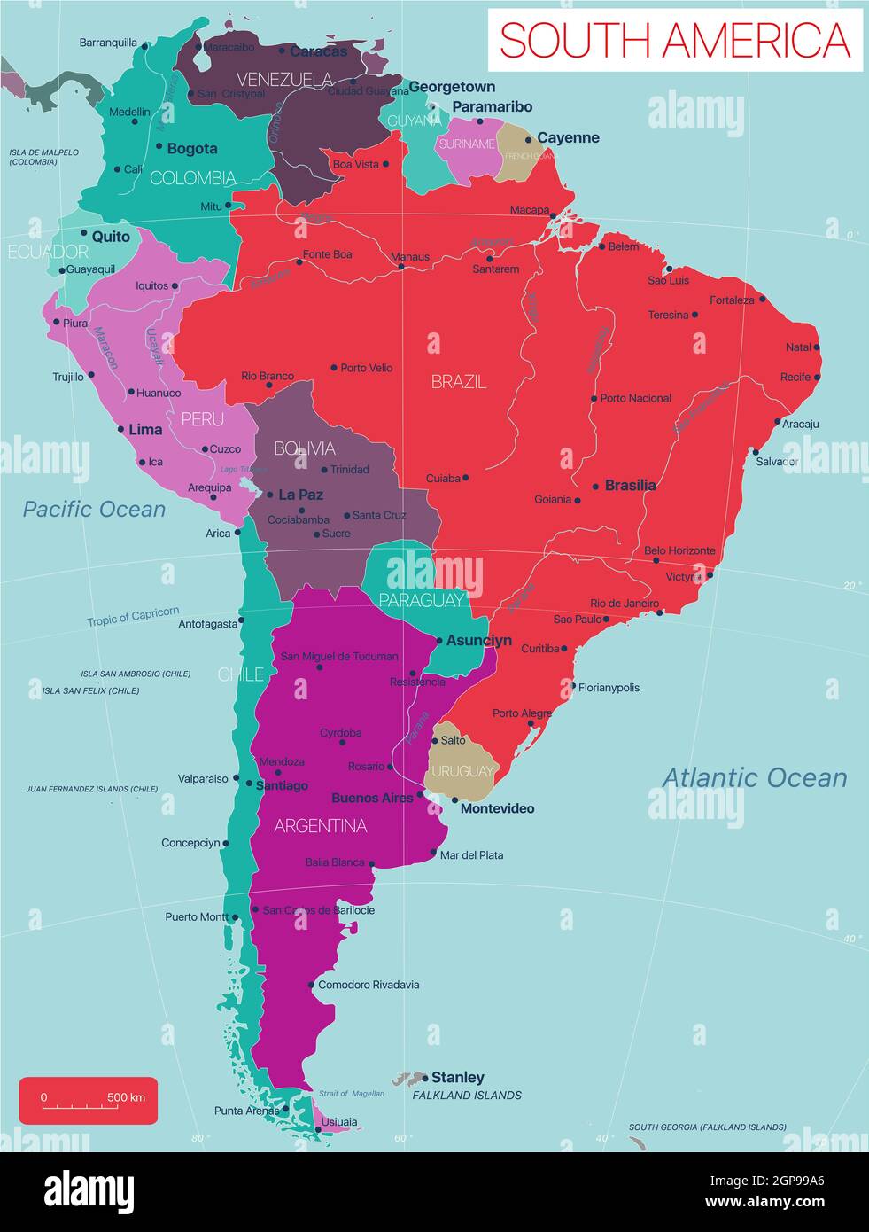
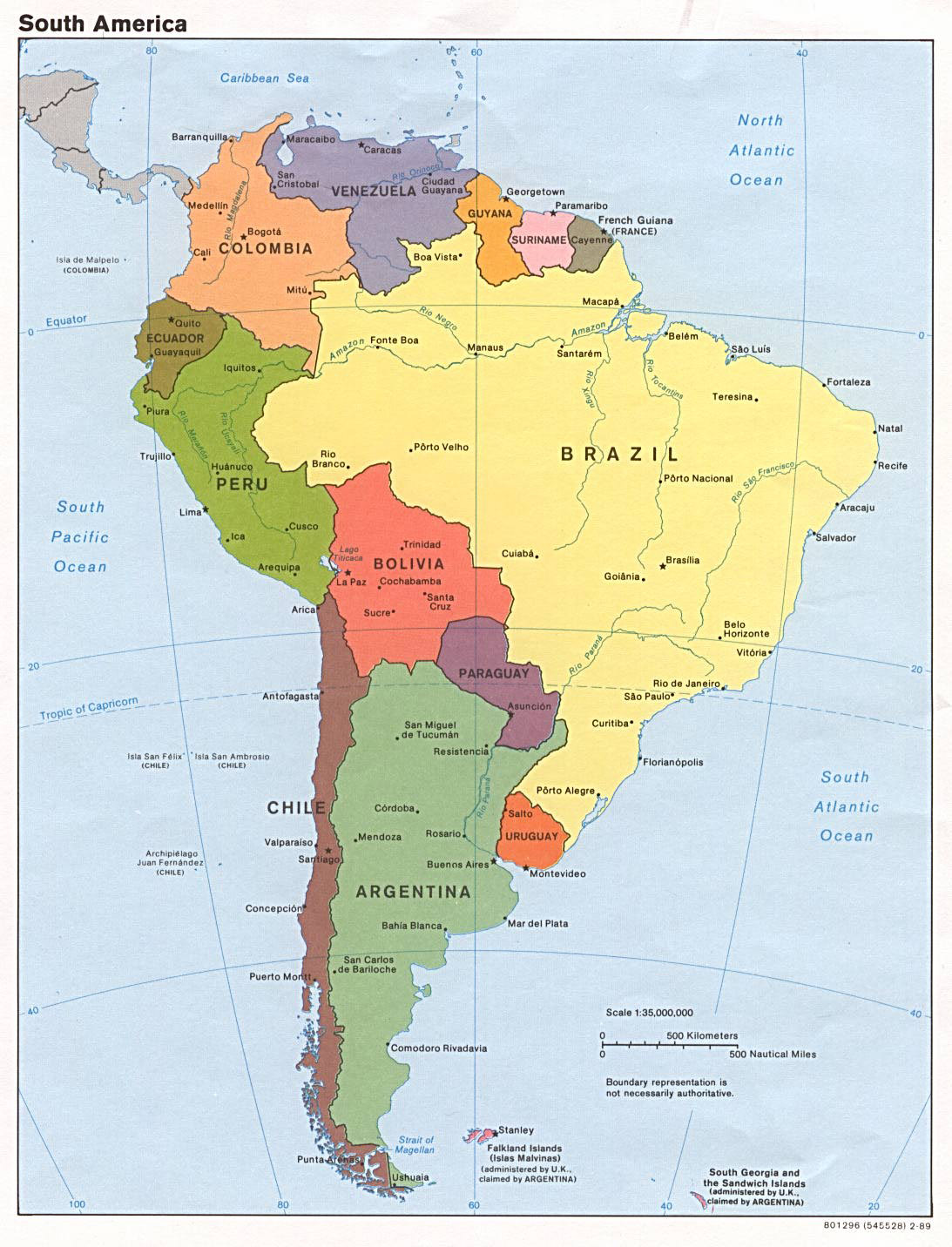
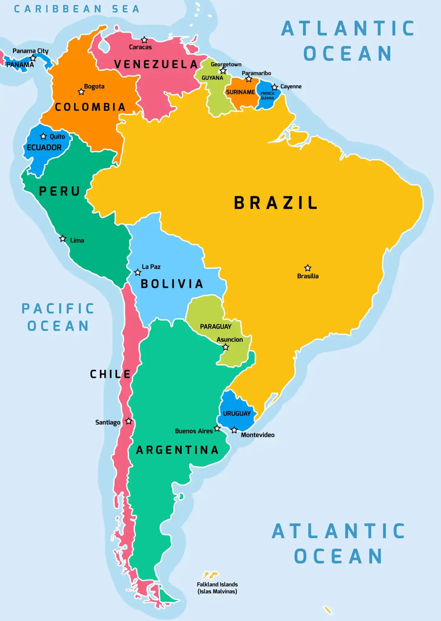
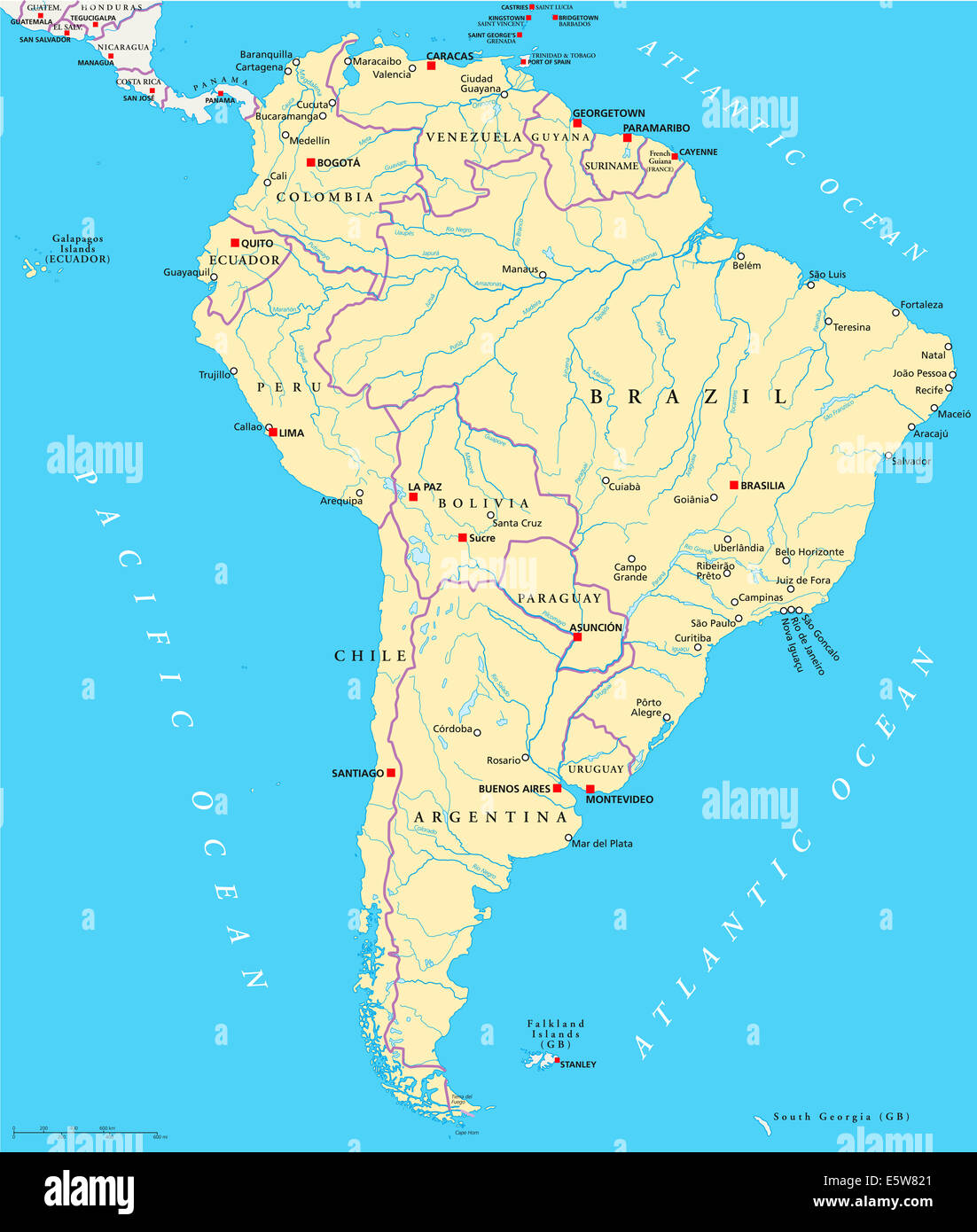
A visual map is indispensable for understanding the spatial relationships between capitals. The continent stretches from the Caribbean in the north to the southern tip of Tierra del Fuego. Most capitals are located along the western coast (e.g., Lima, Santiago, Quito) or in the eastern part (e.g., Brasília, Buenos Aires, Montevideo). Below is a labeled map highlighting all major capitals. Pay attention to the clustering of capitals near the coast—this reflects historical colonization patterns where ports were essential for trade.

The map above (credit: Scribd) shows South America with clear borders and capital markers. Use it to trace routes: for example, note how Buenos Aires, Montevideo, and Santiago form a southern economic triangle, while Caracas, Bogotá, and Quito connect the northern Andes region. The Amazon basin's capital centers (Brasília, Belém, Manaus) are interior hubs. For a more detailed view, the pin map below color-codes each capital by country—a useful tool for classroom or self-study.

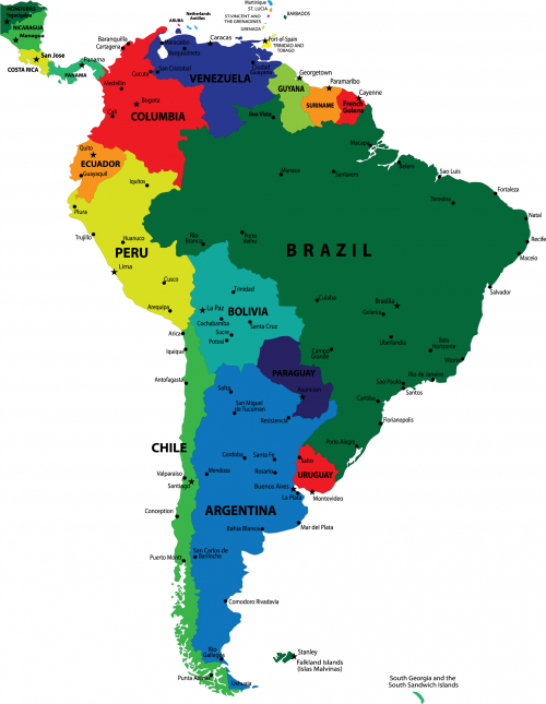
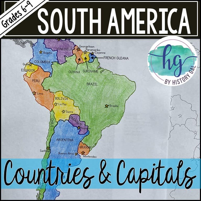
This second image (by Made By Teachers) provides a printable pin map style, ideal for hands-on learning. Each capital is represented by a flag-like pin, making it easy to quiz yourself or students. Notice the geographic diversity: while many capitals are political centers, some, like Quito and La Paz, are also major Indigenous cultural hubs, while others like Brasília were purpose-built for governance.
Detailed Guide to Each Capital City
Here we expand on the most notable capitals, going beyond the table to provide context on history, culture, and modern significance.
Buenos Aires, Argentina
Buenos Aires is a vibrant, sprawling metropolis of 15 million people in its metropolitan area. Known for its tango music, steak houses, and colorful neighborhoods like La Boca and Palermo, it is the cultural gateway to Argentina. The capital sits on the Río de la Plata estuary and serves as the country's political and economic heart. Its European-style boulevards and cafes give it a distinctly Old World feel, contrasting with its modern skyscrapers.
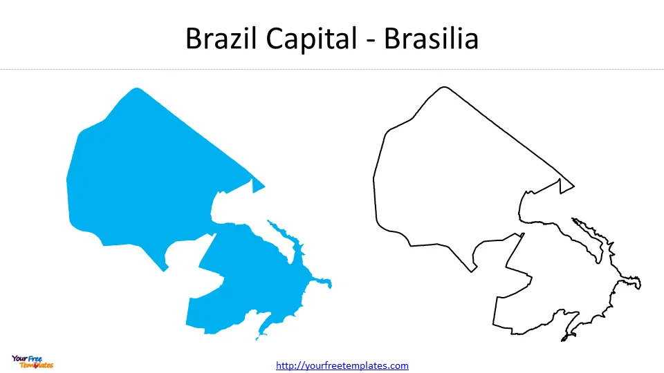
Brasília, Brazil
Brasília is a planned city inaugurated in 1960, designed by architect Oscar Niemeyer and urban planner Lúcio Costa. Its airplane-shaped layout is iconic, and the city is famous for its futuristic government buildings, including the National Congress and the Cathedral of Brasília. As the seat of Brazil's federal government, it is home to all three branches. Its location in the interior was chosen to promote development away from the coastal population centers.
Santiago, Chile
Santiago is a modern capital surrounded by the Andes mountains, offering stunning views and easy access to ski resorts. Its population of 6.8 million makes it the largest city in Chile. The capital boasts a strong economy, excellent museums (like the Museo Nacional de Bellas Artes), and a thriving culinary scene. The historic Plaza de Armas anchors the old city center, while districts like Providencia and Las Condes represent the financial hub.
Lima, Peru
Lima is a coastal capital that blends ancient pre-Columbian ruins with colonial architecture and a world-renowned gastronomic scene. The city’s historic center is a UNESCO World Heritage site, featuring the Plaza Mayor and the Cathedral of Lima. With a metro population of 10 million, it is the fourth-largest city in South America. The nearby Huaca Pucllana pyramid is a remarkable archaeological site within the urban area.
How to Use the Capitals List and Map Together
To master South American geography, combine the list and map. Start by memorizing the 12 sovereign countries and their capitals using the table above. Then, on the map, locate each capital and trace its relative position: for instance, note that Quito is directly on the equator, while Buenos Aires is far south. Use the color-coded pin map to create flashcards: cover the city names and guess based on the pin color and location. This dual approach—visual and textual—significantly improves retention. For advanced study, learn the dependent territories: Cayenne (French Guiana), Stanley (Falkland Islands), and the uninhabited South Georgia.
Practical Tips for Travelers and Students
If you plan to visit these capitals, consider seasonal weather patterns. For example, Quito and La Paz have mild climates year-round due to altitude, while Buenos Aires and Montevideo experience hot summers (December–February) and mild winters. Check visa requirements, as some capitals (like Cayenne) are overseas departments of France and require a Schengen visa. For students, creating a mental map by grouping capitals geographically helps: the Western Andes capitals (Quito, Lima, Santiago), the Eastern coastal capitals (Caracas, Georgetown, Paramaribo, Cayenne), the Southern Cone (Buenos Aires, Montevideo), and the interior (Brasília, Asunción, La Paz).
Conclusion
Understanding South America’s capitals and their locations on a map is crucial for anyone interested in the continent's geography, history, or current affairs. From the high-altitude administrative cities of Bolivia to the coastal metropolises of Argentina and Brazil, each capital tells a unique story of colonization, independence, and modern development. By using the provided table, detailed explanations, and two visual maps, you now have a complete toolkit to learn and teach this topic. Whether you are preparing for a test, planning a backpacking adventure, or simply expanding your knowledge, these resources will serve as reliable references. Keep the map handy, and revisit the list regularly to deepen your familiarity with South America’s vibrant capital cities.
Capitals In South America Stock Photography | CartoonDealer.com #93427772

Capitals In South America Stock Photography | CartoonDealer.com #93427772
162,921 South America With Capitals Stock Photos, High-Res Pictures
162,921 South America With Capitals Stock Photos, High-Res Pictures ...
South America Political Map With Capitals
South America Political Map With Capitals
Map Of Countries In South America With Capitals

Map of Countries in South America with Capitals
South America Map Labels - Capitals By Moments For Montessori | TPT

South America Map Labels - Capitals by Moments for Montessori | TPT
South-America-Capitals-11 - Free PowerPoint Template
South-America-Capitals-11 - Free PowerPoint Template
Capitals In South America Stock Photography | CartoonDealer.com #93427772

Capitals In South America Stock Photography | CartoonDealer.com #93427772
South America Political Map

South America Political Map
Map Of South American Countries With Capitals A Comprehensive Guide To

Map Of South American Countries With Capitals A Comprehensive Guide To
South-America-Capitals-2 - Free PowerPoint Template
South-America-Capitals-2 - Free PowerPoint Template
South American Countries And Capitals List
South American Countries And Capitals List
South America Capitals

South america capitals
Capitals Of South American Countries - Match The Memory
Capitals of South American Countries - Match The Memory
South American Countries And Capitals List

South American Countries And Capitals List
South America Map With Capitals | Mary W Tinsley

South America Map With Capitals | Mary W Tinsley
South America Map With Capitals Printable - Printable Free Templates

South America Map With Capitals Printable - Printable Free Templates
South America Map Countries And Capitals - Uno
South America Map Countries And Capitals - Uno
South America Capitals

South america capitals
Map Of South America Countries And Capitals
Map Of South America Countries And Capitals
South America Capitals
South America Capitals
South American Capitals List List Of Countries And Capitals With

South American Capitals List List Of Countries And Capitals With
Map Of South America With Capitals
Map Of South America With Capitals
South America Map With States And Capitals United States Map
South America Map With States And Capitals United States Map
South America Political Map With Capitals
South America Political Map With Capitals
Central And South America Map With Capitals
Central And South America Map With Capitals
List Of Capitals In South America (With Map) - The Facts Institute
List of Capitals in South America (With Map) - The Facts Institute
Map Of South America With Countries And Capitals - Ontheworldmap.com

Map of South America with countries and capitals - Ontheworldmap.com
Premium Vector | Vector Map Of South America With Countries Capitals

Premium Vector | Vector map of south america with countries capitals ...
South American Capitals

South american capitals
Detailed Political Map Of South America With Capitals And Major Cities
Detailed Political Map Of South America With Capitals And Major Cities
South-America-Capitals-5 - Free PowerPoint Template
South-America-Capitals-5 - Free PowerPoint Template
South America Political Map With Capitals
South America Political Map With Capitals
South America Map With Capitals Printable - Printable Free Templates

South America Map With Capitals Printable - Printable Free Templates