Exploring Australia’s States and Territories: A Comprehensive Map Guide
Australia is a vast and diverse continent-nation, composed of six states and two major territories, each with its own unique geography, culture, and capital city. This guide will walk you through the complete map of Australia’s states, highlighting the location of each capital, key physical features, and regional distinctiveness. Whether you are a traveler planning a journey, a student studying world geography, or simply curious about the Land Down Under, this article will help you understand how the country is organized from coast to desert.
Overview of Australia’s Political Divisions
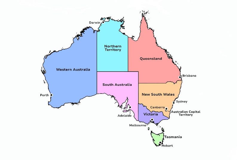
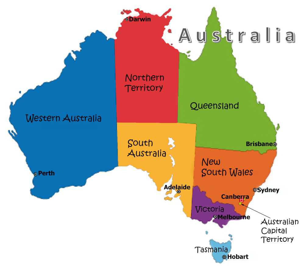
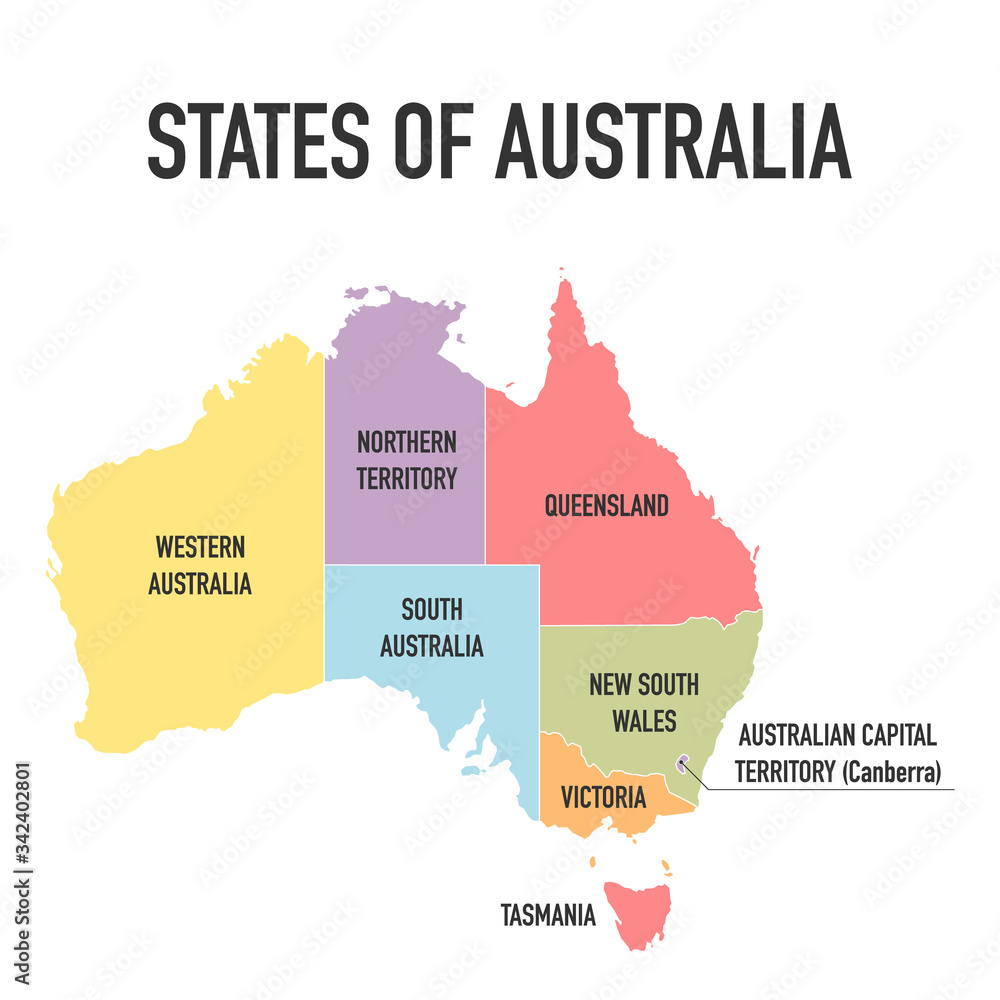
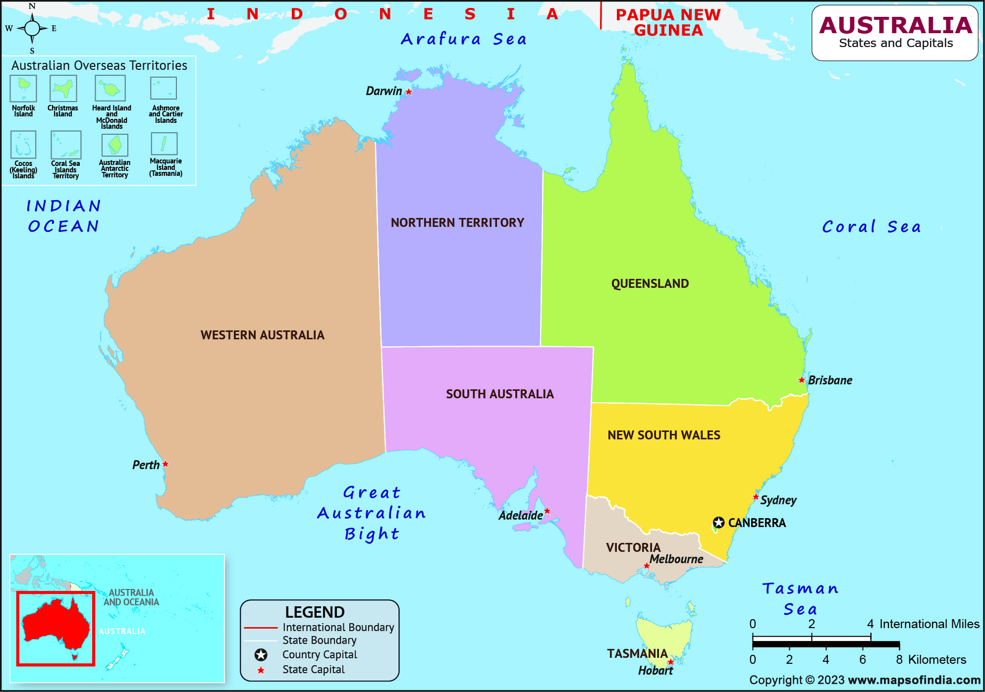
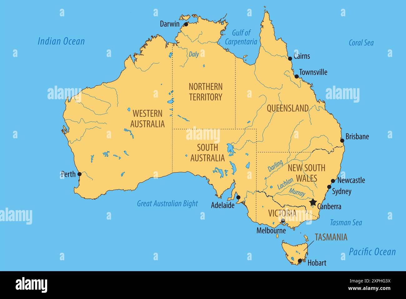
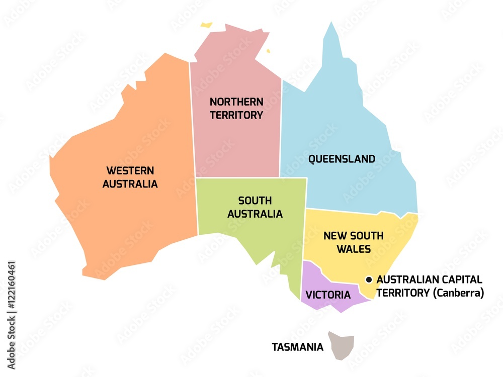
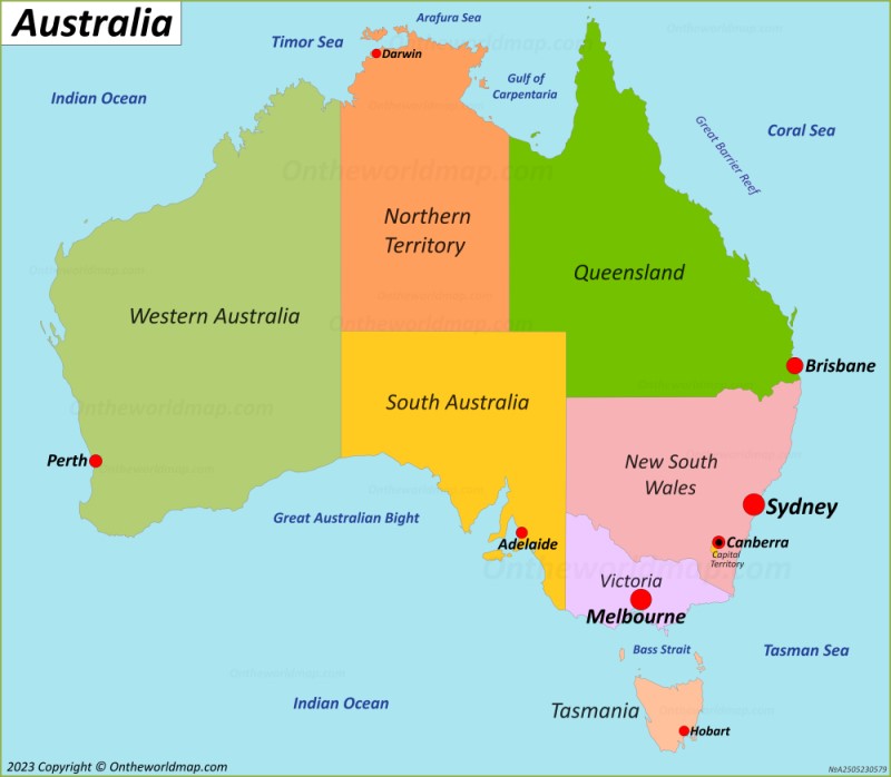
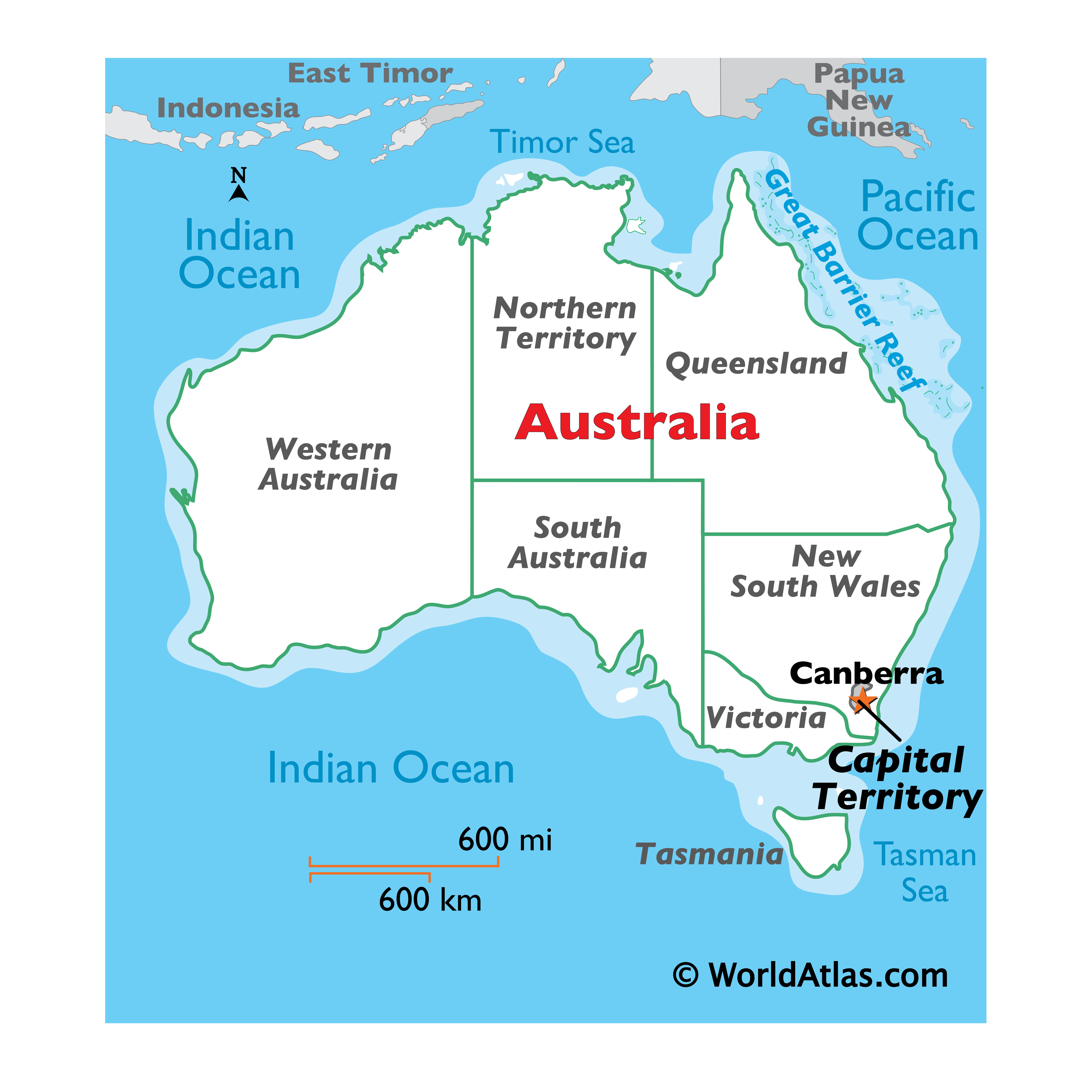
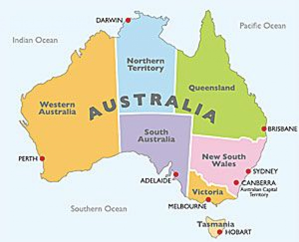
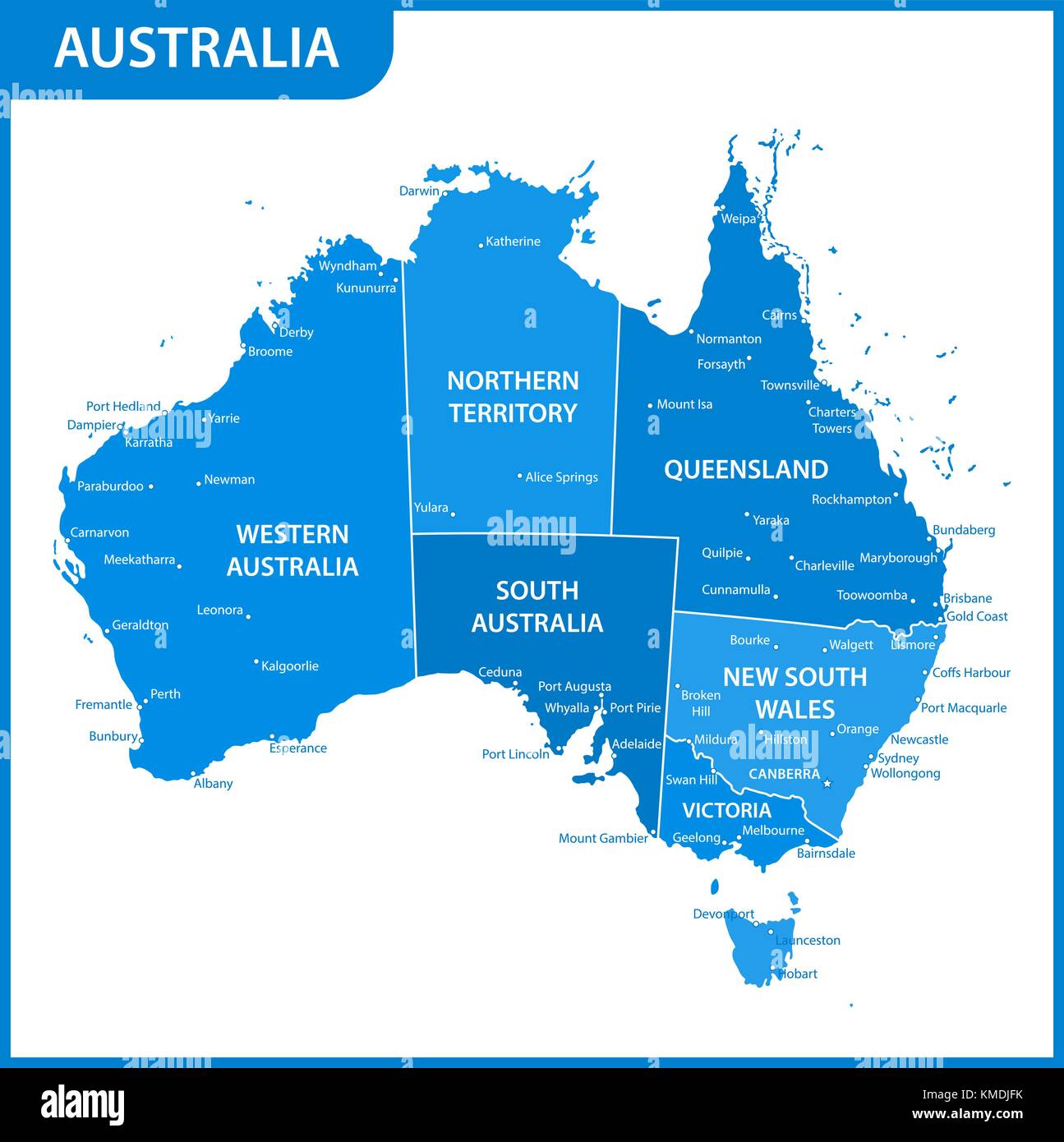
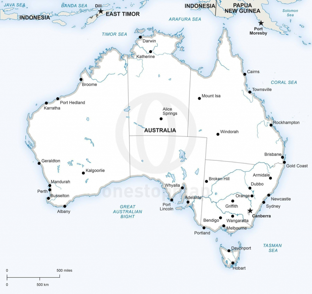
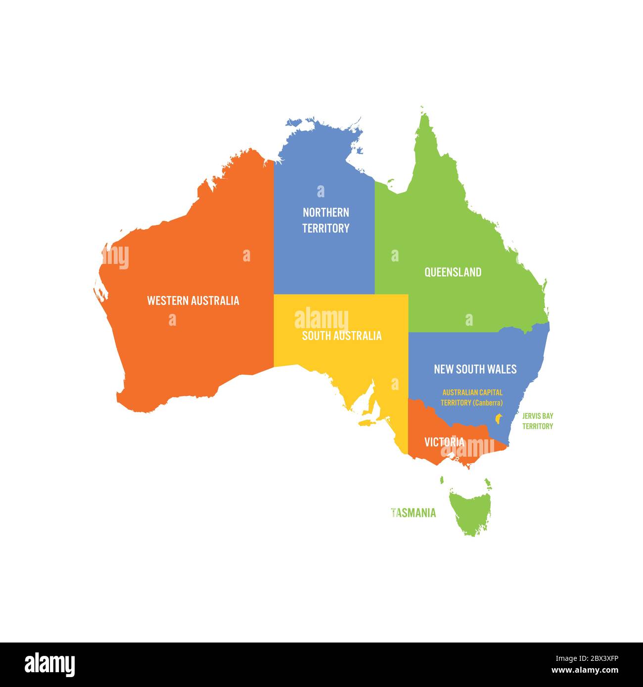
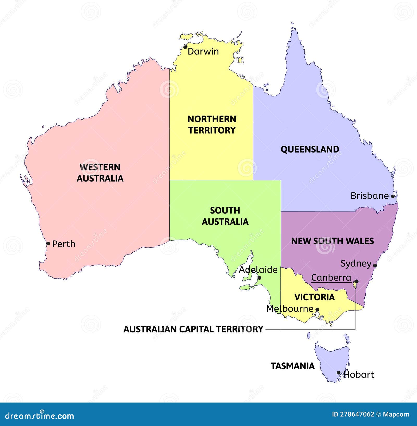
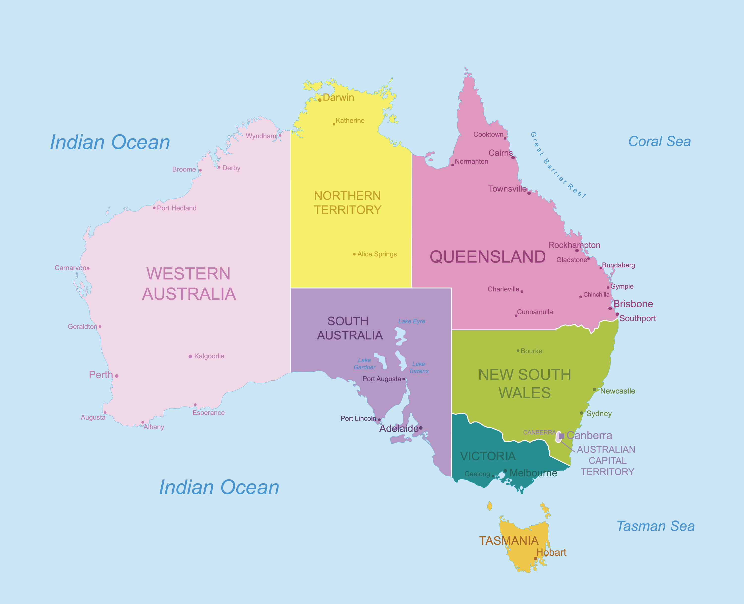
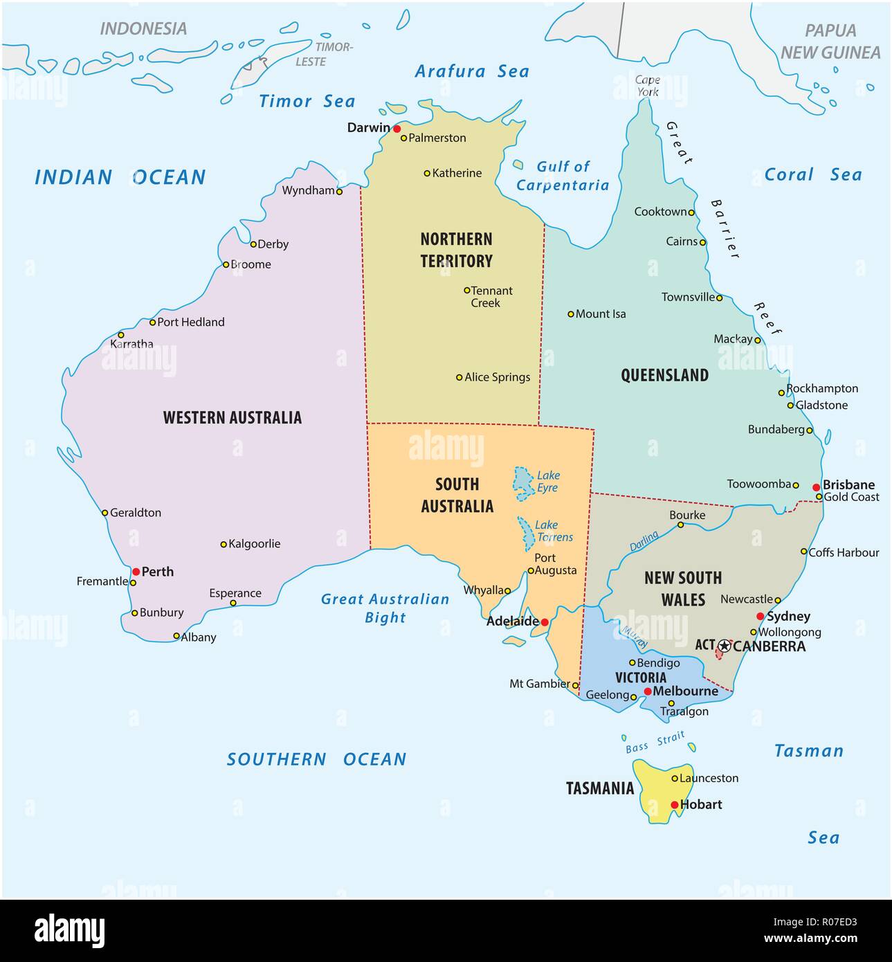
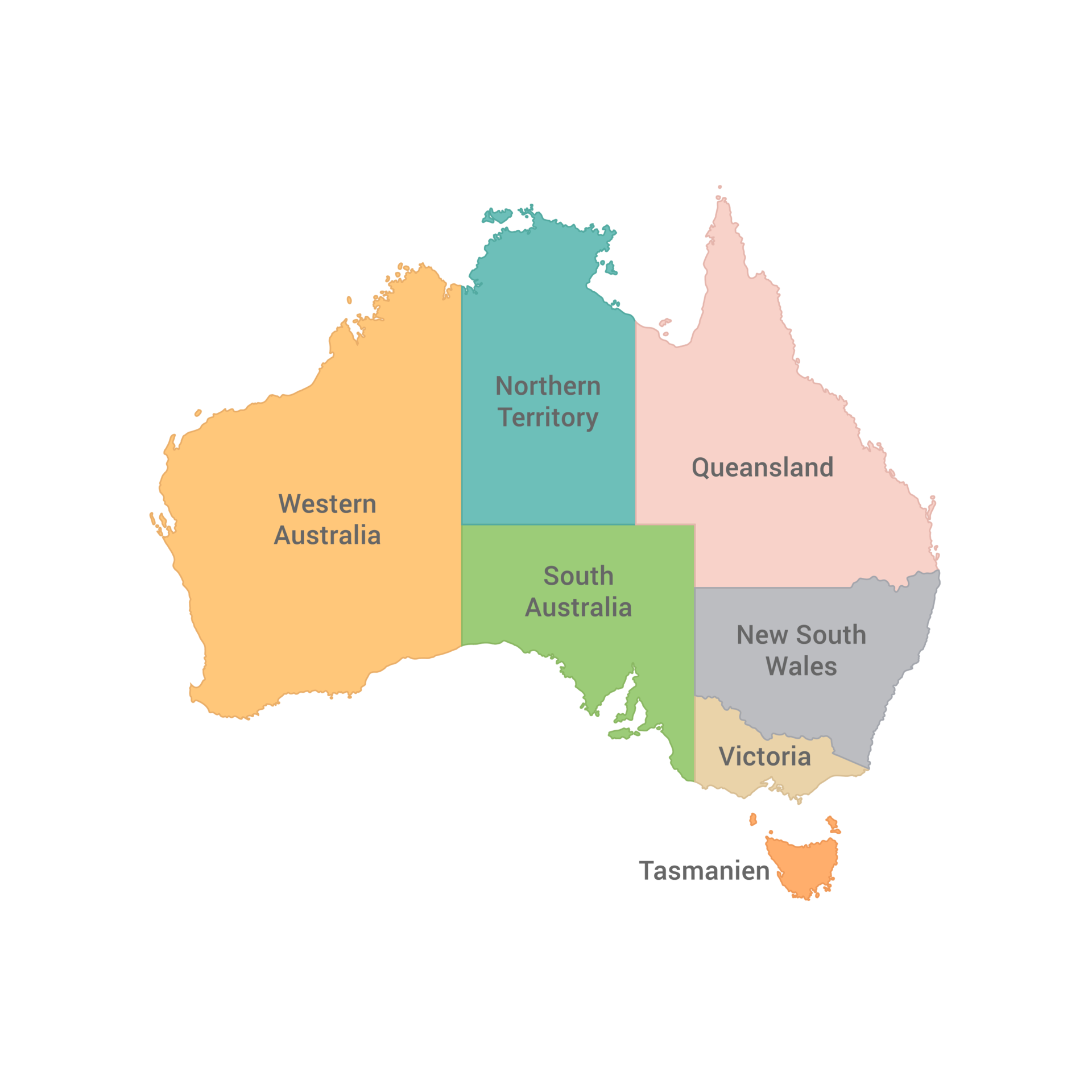
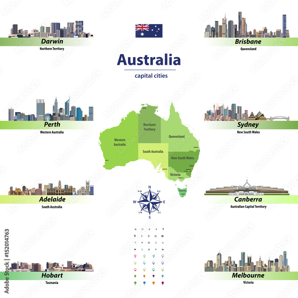
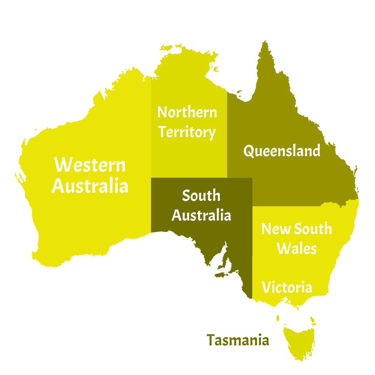
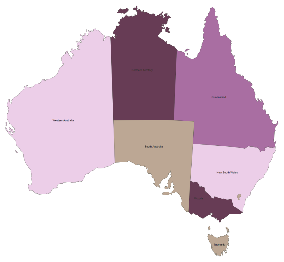
Australia is divided into six states: New South Wales, Victoria, Queensland, South Australia, Western Australia, and Tasmania. There are also two internal territories—the Australian Capital Territory (ACT) and the Northern Territory—which function similarly to states in many administrative respects. Each state and territory has its own capital city, government, and legislative powers. The map of Australia shows a clear pattern: the eastern states are smaller and more densely populated, while the western and central regions are vast and arid.

New South Wales and Sydney
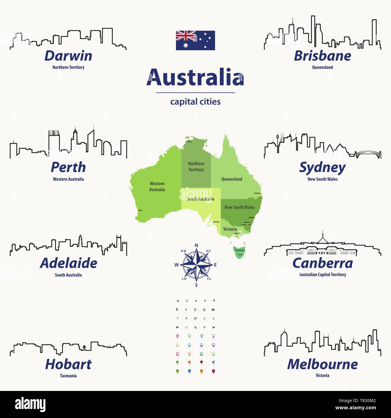
New South Wales (NSW) is located on the southeastern coast of Australia. Its capital, Sydney, is the country’s largest and most iconic city, famous for its harbour, Opera House, and Harbour Bridge. On a map, NSW stretches from the Pacific Ocean in the east to the inland plains and the Great Dividing Range. The state includes world-renowned beach destinations like Bondi and Byron Bay, as well as the rugged Blue Mountains. NSW also hosts the capital of Australia, Canberra, which is a separate territory within its borders—the Australian Capital Territory.
Victoria and Melbourne
Victoria is the smallest mainland state, lying south of New South Wales. Its capital, Melbourne, is often regarded as Australia’s cultural and sporting capital. The map of Victoria shows a compact shape, bordered by the Murray River to the north and Bass Strait to the south. The state features the iconic Great Ocean Road, gold rush heritage towns like Ballarat, and the alpine region of the Victorian Alps. Melbourne itself is a hub of art, cuisine, and major events such as the Australian Open tennis tournament.
Queensland and Brisbane
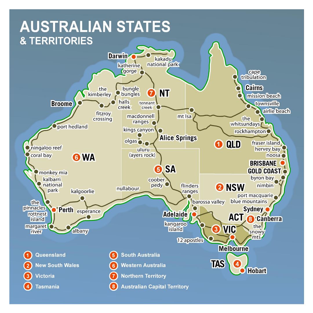
Queensland occupies the northeastern quadrant of Australia. Its capital is Brisbane, a vibrant city located on the Brisbane River. On a map, Queensland extends from the tropical north (including Cairns and the Great Barrier Reef) to the subtropical south (Gold Coast and Sunshine Coast). The state is renowned for its warm climate, stunning beaches, and natural wonders like the Daintree Rainforest and the Whitsunday Islands. The interior, known as the Outback, includes national parks and cattle stations that stretch across vast, dry landscapes.
South Australia and Adelaide
South Australia sits in the southern central part of the country, bordered by Western Australia, the Northern Territory, Queensland, New South Wales, and Victoria. Its capital, Adelaide, is known for its orderly grid layout, beautiful parklands, and thriving food and wine culture. The map of South Australia reveals a coastline along the Great Australian Bight, with the famous Barossa Valley wine region just north of Adelaide. Further inland, the state includes the vast, red desert landscapes of the Flinders Ranges and Lake Eyre, the largest salt lake in Australia.
Western Australia and Perth
Western Australia (WA) is by far the largest state, covering nearly a third of the continent’s landmass. Its capital, Perth, is one of the most isolated major cities in the world, located on the southwestern coast. The map of WA shows a dramatic diversity: from the lush forests of the Margaret River region in the southwest to the ancient rock formations of the Kimberley in the north. The state is rich in mineral resources, including iron ore and gold, and its coastline features turquoise waters and white sand beaches like those at Coral Bay and Broome.
Tasmania and Hobart
Tasmania is an island state separated from the mainland by Bass Strait. Its capital, Hobart, is nestled at the foot of Mount Wellington on the south coast. On a map, Tasmania appears as a heart-shaped island with rugged coastlines, temperate rainforests, and World Heritage-listed wilderness areas. The state is known for its pristine natural environment, including Cradle Mountain, Freycinet National Park, and the historic Port Arthur penal settlement. Tasmania also has a strong arts scene and produces world-class cool-climate wines.
The Northern Territory and Darwin
The Northern Territory (NT) is a federal territory in north-central Australia. Its capital, Darwin, is a tropical city that withstood cyclones and World War II bombing. The map of the NT features two iconic regions: the Red Centre, home to Uluru (Ayers Rock) and Alice Springs, and the Top End, with Kakadu National Park and the floodplains of the Mary River. The territory is sparsely populated but famous for its Aboriginal heritage, dramatic monoliths, and wildlife such as saltwater crocodiles.
The Australian Capital Territory and Canberra
The Australian Capital Territory (ACT) is a small enclave within New South Wales, designed specifically to house the national capital, Canberra. On a map, the ACT appears as a roughly oval area surrounding Lake Burley Griffin. Canberra was purpose-built as a political and administrative centre, home to Parliament House, the High Court, and numerous national institutions like the Australian War Memorial and the National Gallery. Unlike state capitals, Canberra is not a coastal city, but it is surrounded by bushland and mountains.
Physical Geography and Key Features on the Map
When studying a map of Australia, several prominent physical features stand out. The Great Dividing Range runs along the eastern coast, from Queensland through New South Wales and into Victoria. The vast interior, known as the Outback, consists of desert plains, salt lakes, and red sand dunes. The Murray-Darling Basin in the southeast is Australia’s most important river system, supporting agriculture. Along the northern coast, monsoon forests and mangroves line the Timor and Arafura Seas. Recognizing these features helps you understand why population density is highest along the eastern and southwestern coasts.
Conclusion
Mastering the map of Australia’s states and territories is essential for appreciating the country’s enormous scale and regional diversity. From the bustling harbours of Sydney and Melbourne to the wild red deserts of the Northern Territory and the pristine beaches of Queensland, each state and territory offers a distinct character and natural beauty. Whether you use a printable map or a digital SVG version, keeping these divisions in mind will enrich your travel plans, studies, or general knowledge of one of the world’s most fascinating countries. Remember that Australia’s geography is not just lines on a map—it is the story of its people, wildlife, and landscapes, waiting to be explored.
Printable Map Of Australia With States And Capital Cities - Printable

Printable Map Of Australia With States And Capital Cities - Printable ...
Albums 95+ Pictures Map Of Australia With States And Territories Full
Albums 95+ Pictures Map Of Australia With States And Territories Full ...
Australia Map, New Political Detailed Map, Separate Individual States
Australia map, new political detailed map, separate individual states ...
Australia States And Capitals List And Map | List Of States And
Australia States and Capitals List and Map | List of States and ...
Printable Map Of Australia With States And Capital Cities - Printable

Printable Map Of Australia With States And Capital Cities - Printable ...
Australia States Map

Australia States Map
States And Cities In Australia
States And Cities In Australia
Australian Map With States
Australian Map With States
Australia Map With States And Territories Stock Vector | Adobe Stock
Australia map with states and territories Stock Vector | Adobe Stock
Map Of Australia With Capitals - Free Printable Templates Hub
Map Of Australia With Capitals - Free Printable Templates Hub
The Detailed Map Of The Australia With Regions Or States And Cities

The Detailed Map Of The Australia With Regions Or States And Cities ...
Australia States And Capitals Map | List Of Australia States
Australia States And Capitals Map | List of Australia States ...
List Of Australia States And Capitals Map Of Australian, 42% OFF

List Of Australia States And Capitals Map Of Australian, 42% OFF
Australian Map With States And Capital Cities
Australian Map With States And Capital Cities
Map With States And Capital Cities And Territories Of Australia

Map With States And Capital Cities And Territories Of Australia
Printable Map Of Australia With States And Capital Cities | Adams
Printable Map Of Australia With States And Capital Cities | Adams ...
Australia Administrative Map States Capitals Colored Stock Vector

Australia Administrative Map States Capitals Colored Stock Vector ...
Australia States And Territories Map

Australia states and territories map
Large Detailed Australia States And Territories Map | Australia
Large detailed Australia states and territories map | Australia ...
Australia Map States Hi-res Stock Photography And Images - Alamy
Australia map states hi-res stock photography and images - Alamy
Australia States Map Kmdjfk Hi-res Stock Photography And Images - Alamy
Australia states map kmdjfk hi-res stock photography and images - Alamy
27,300 Australia Map States Images, Stock Photos & Vectors | Shutterstock

27,300 Australia Map States Images, Stock Photos & Vectors | Shutterstock
Printable Australia Political Map

Printable Australia Political Map
Printable Map Of Australia With States And Capital Cities - Free Math
Printable Map Of Australia With States And Capital Cities - Free Math ...
Australian States And Cities
Australian States And Cities
Australia Administrative Map With States And Capitals Of The States
Australia Administrative Map With States And Capitals Of The States ...
Labeled Map Of Australia With States, Cities, Capitals
Labeled Map of Australia with States, Cities, Capitals
Australian Map With States And Capital Cities
Australian Map With States And Capital Cities
Australia Map Vector With States In Illustrator, SVG, JPG,, 47% OFF
Australia Map Vector With States In Illustrator, SVG, JPG,, 47% OFF
Australia States Map With Capital Cities Skylines Vector Illustration
Australia states map with capital cities skylines vector illustration ...
Printable Map Of Australia With States And Capital Cities - Printable

Printable Map Of Australia With States And Capital Cities - Printable ...
Free Australia Map Clipart With States Template To Edit Online
Free Australia Map Clipart With States Template to Edit Online
Australia States
Australia States