South America Map Guide: Rivers and Mountains Uncovered
Embarking on a journey through South America is like stepping into a world of extremes—from the world's longest mountain range to its mightiest river system. This guide will help you navigate the continent's physical geography by breaking down its major rivers and mountain ranges, showing you how they shape the landscape, climate, and life of this vibrant region. Whether you're a student, traveler, or geography enthusiast, you'll come away with a clear mental map of South America's most dramatic features.
Understanding the Backbone: The Andes Mountains
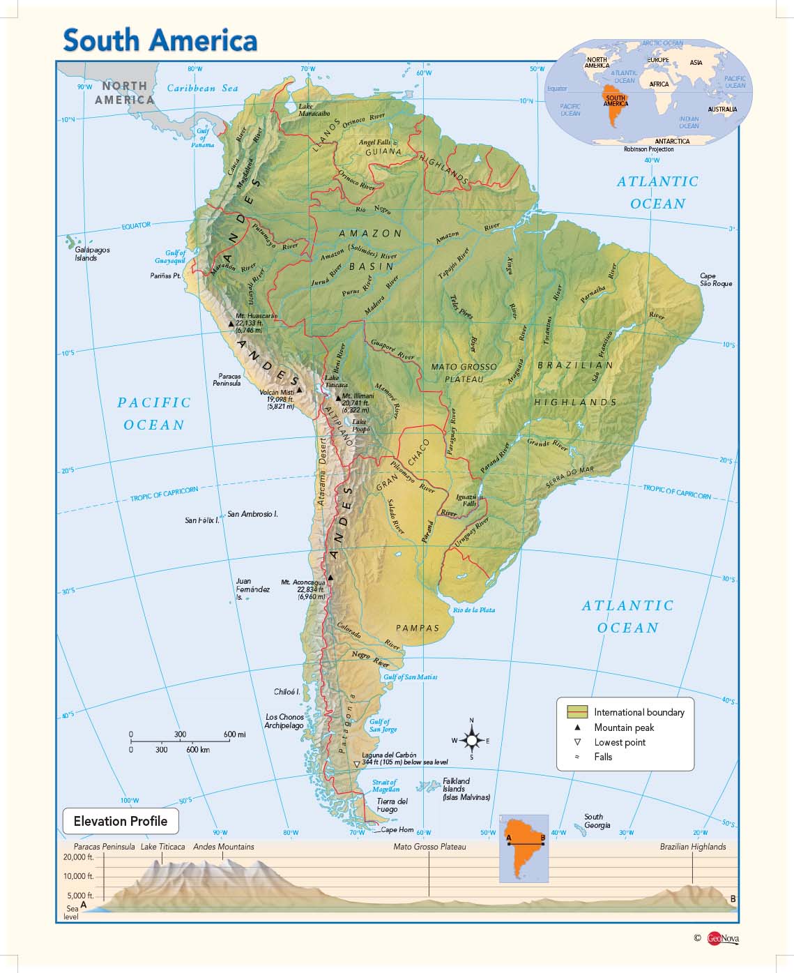
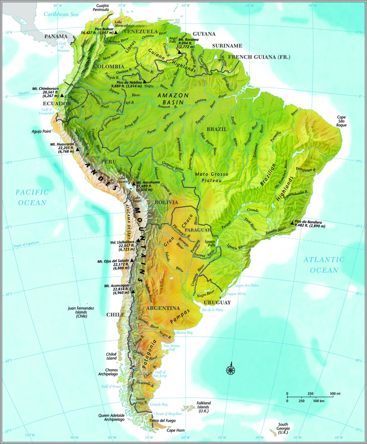
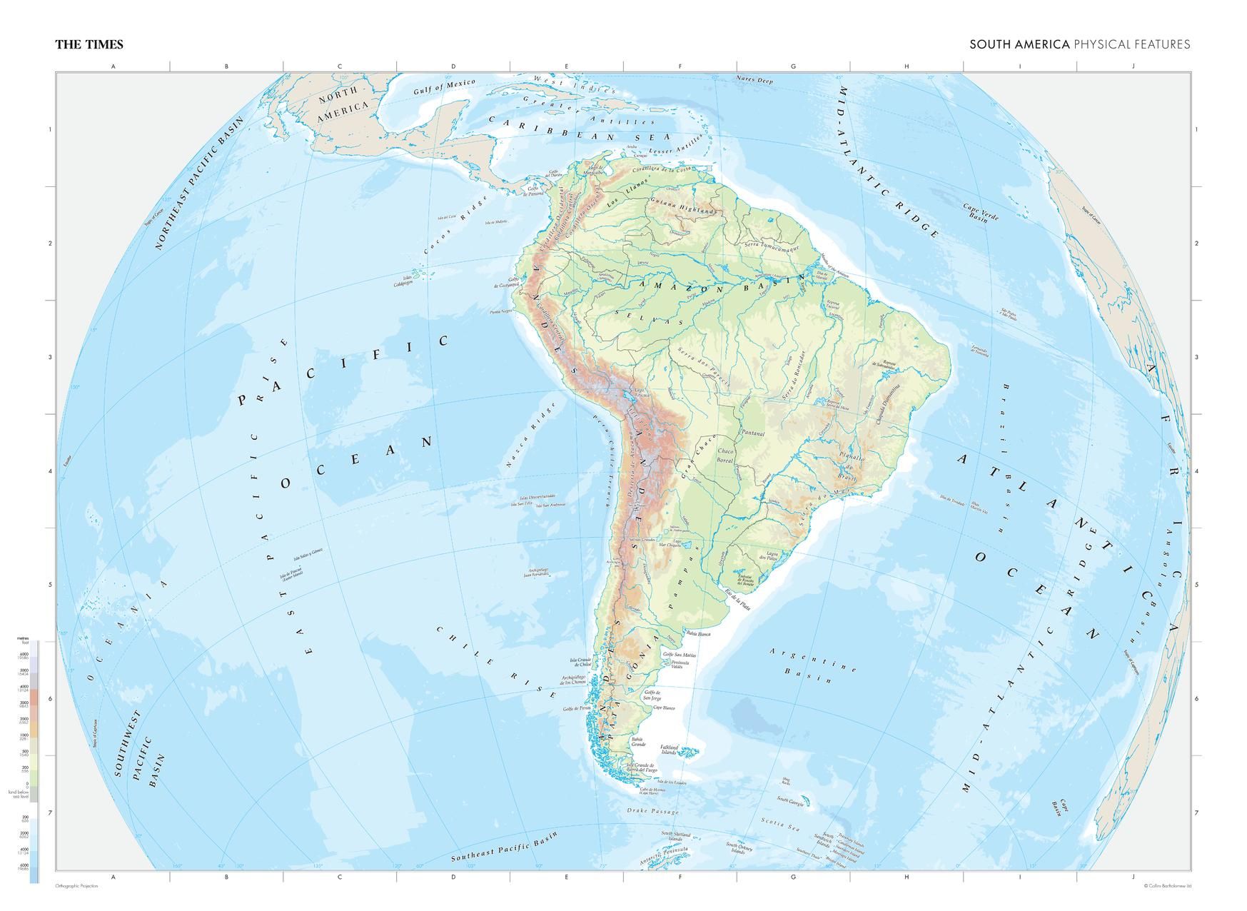
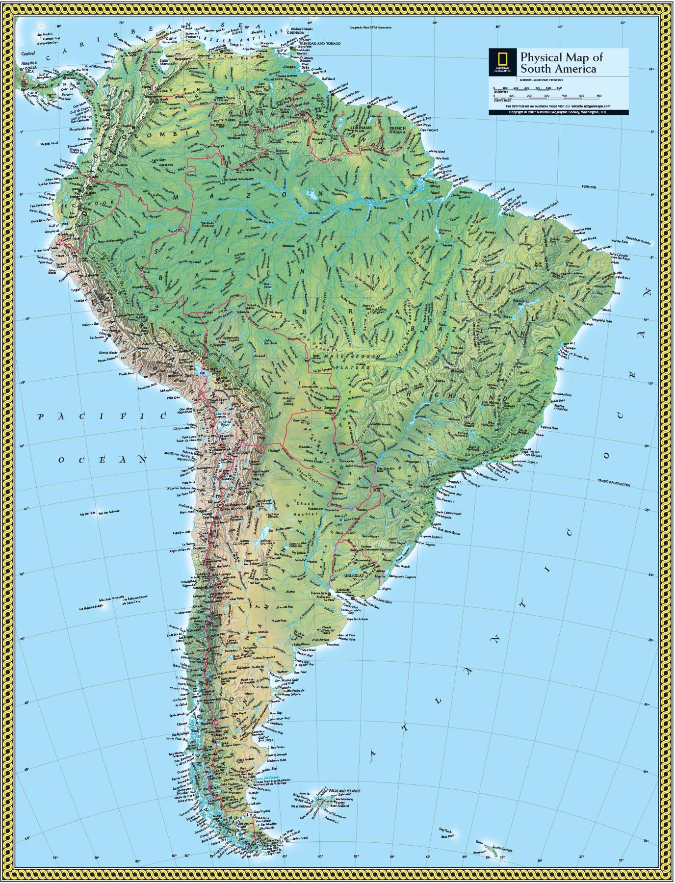
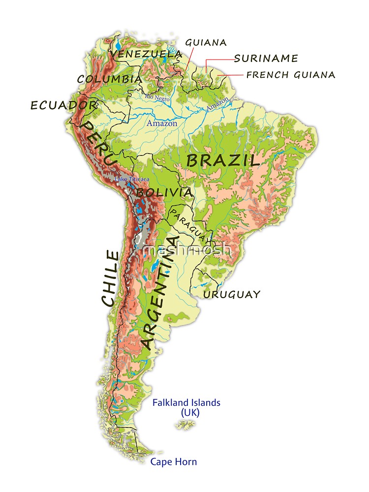
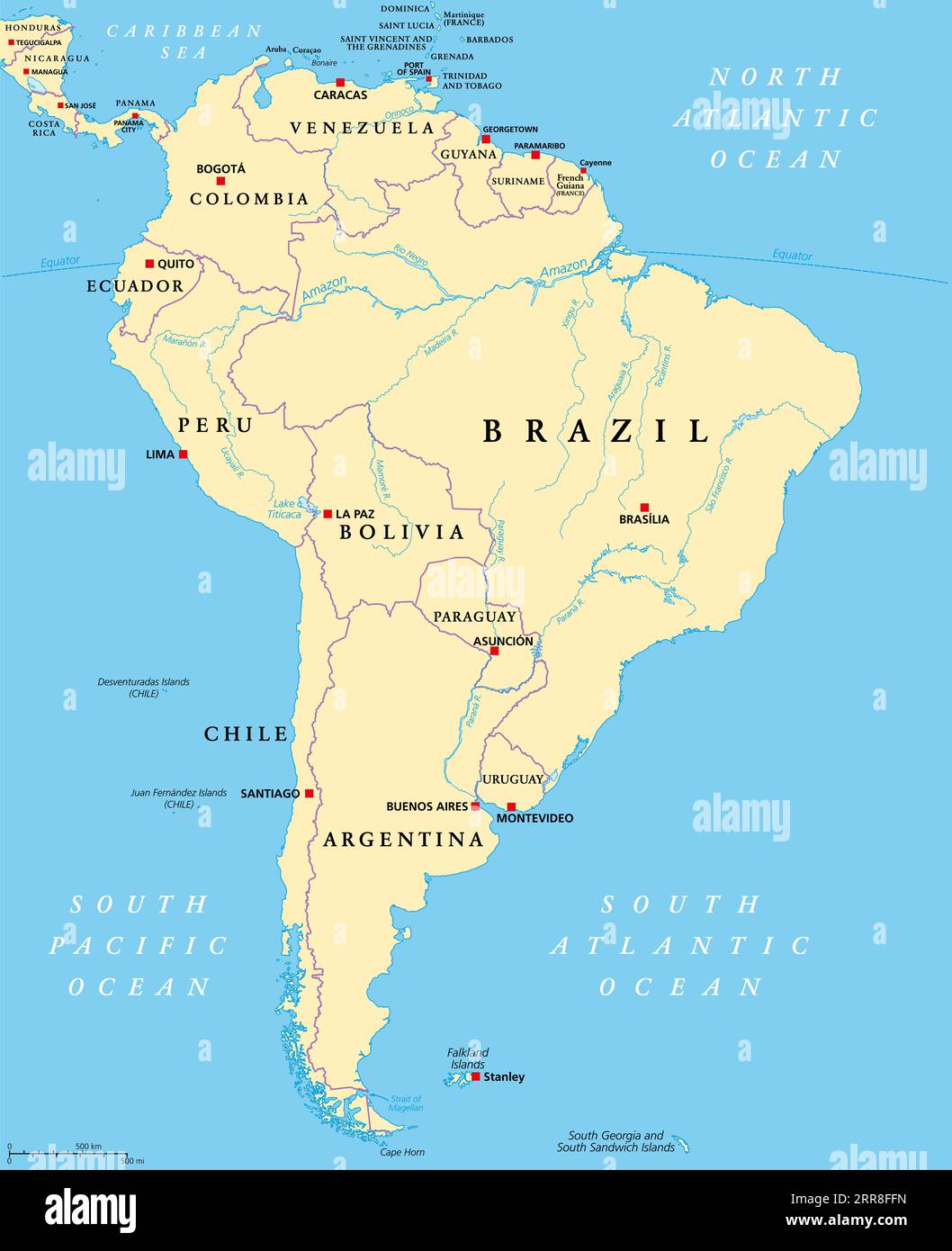
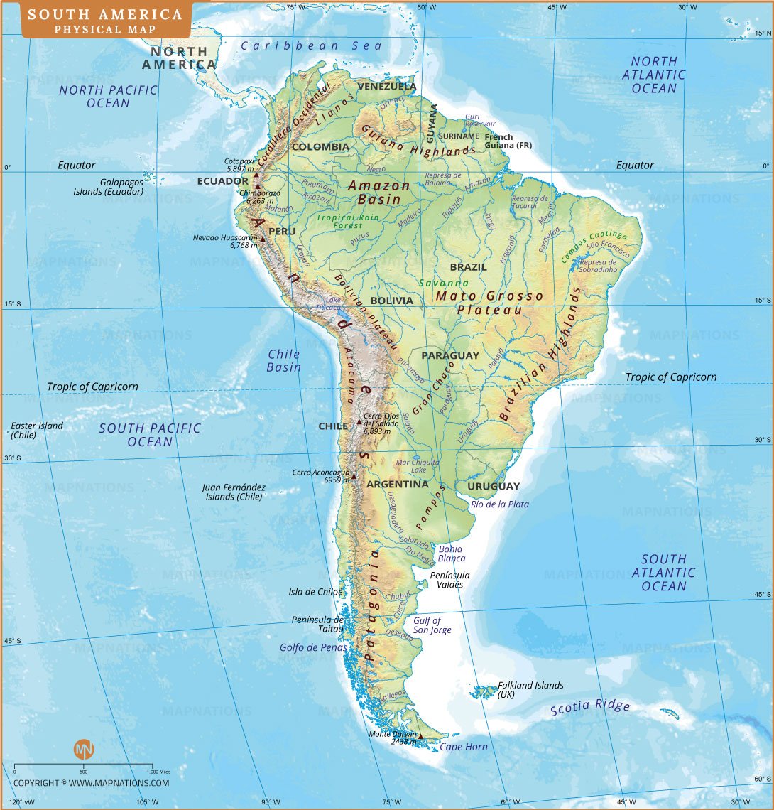
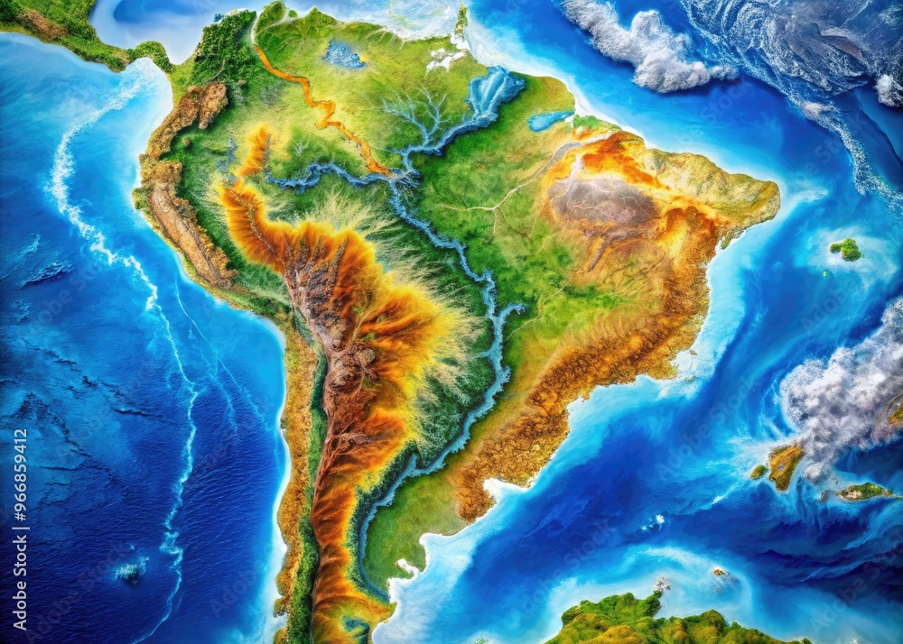
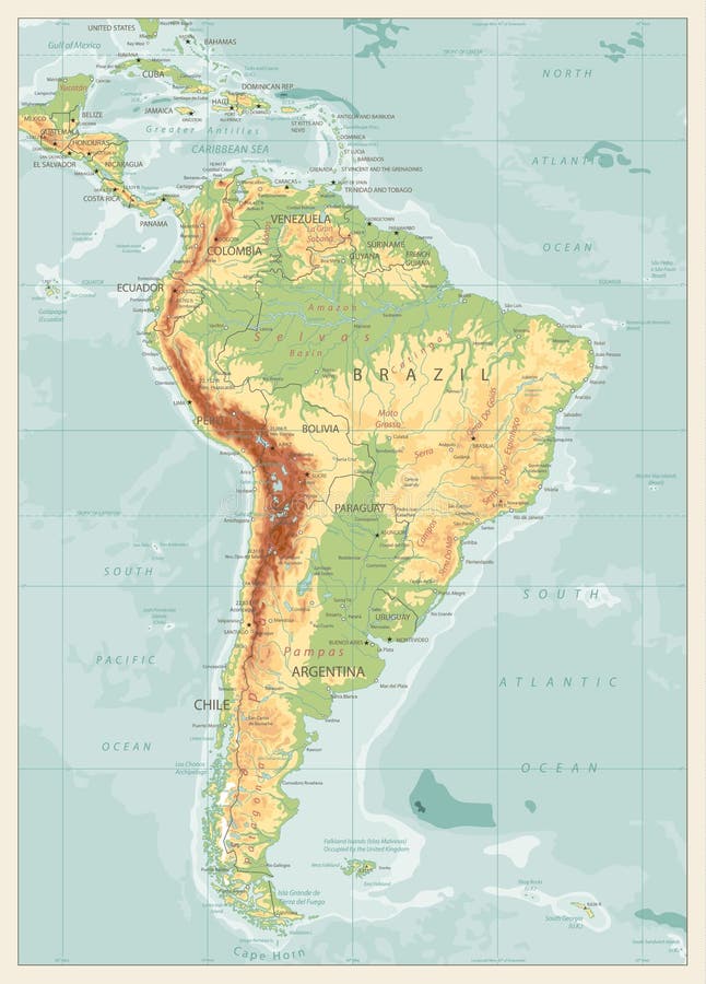
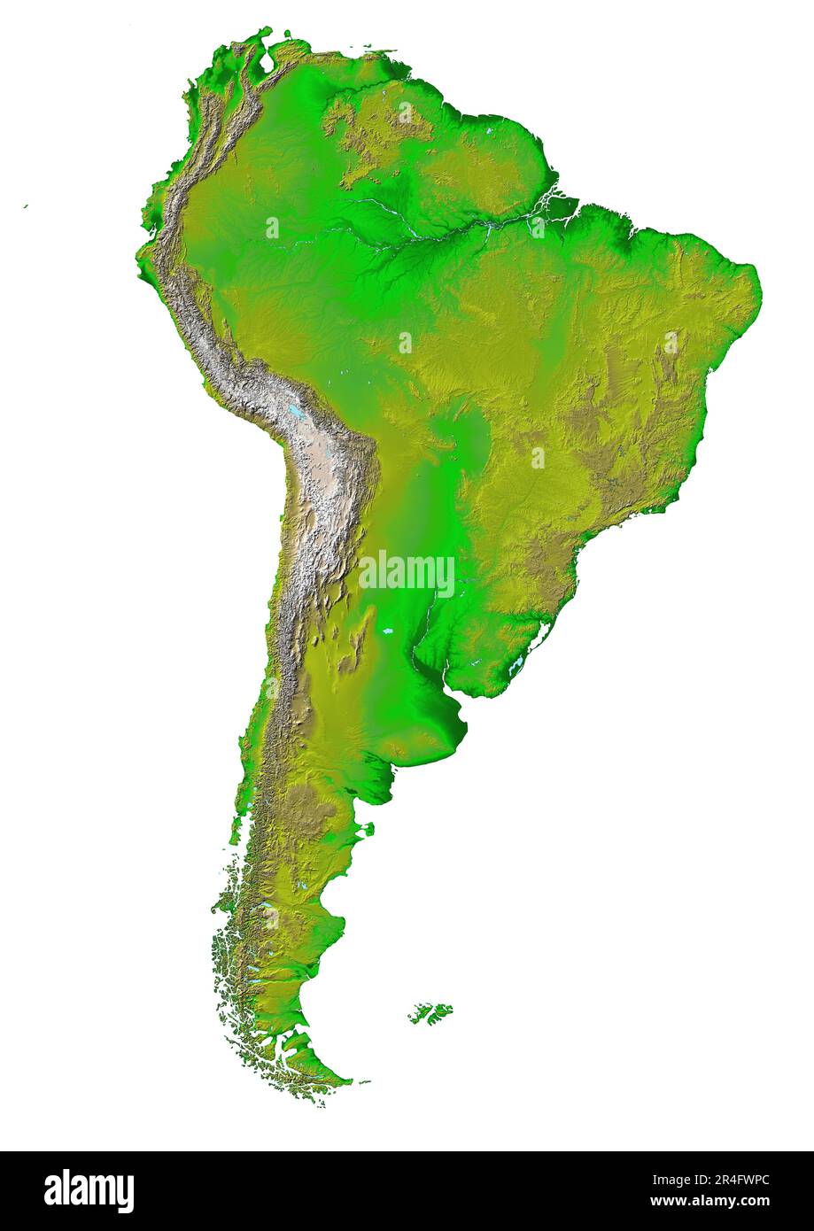
The Andes are not just a mountain range; they are the continental backbone of South America, stretching over 7,000 kilometers (4,350 miles) from Venezuela in the north to Chile and Argentina in the south. This makes them the longest continental mountain range on Earth. As you trace them on a map, you'll notice they hug the Pacific coast, creating a dramatic wall that separates the narrow coastal plains from the vast interior. The Andes are home to the highest peak in the Americas, Mount Aconcagua, which soars to nearly 7,000 meters (22,837 feet) in Argentina. This range is also the source of countless rivers that drain into the Atlantic, including the headwaters of the Amazon. The altitude zones here create distinct ecosystems, from tropical forests at the base to snow-capped peaks and glaciers above 5,000 meters.
The Amazon River: Lifeline of the Continent
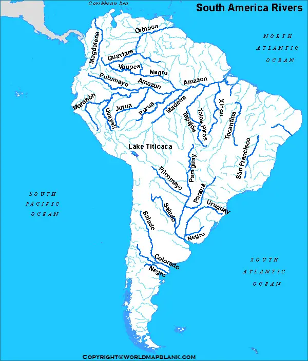
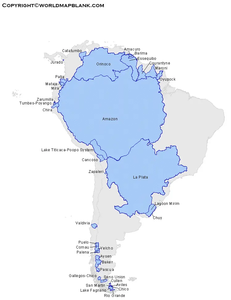
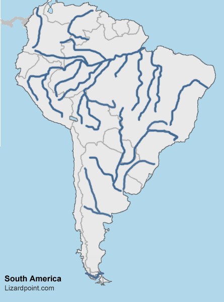
No discussion of South American rivers is complete without the Amazon. It is the largest river by discharge volume of water in the world, and by some measures, the longest. Originating from the Andes in Peru, the Amazon flows eastward across the continent, eventually emptying into the Atlantic Ocean on the coast of Brazil. On a map, its network of tributaries looks like a vast tree of blue veins, covering more than 7 million square kilometers. The Amazon River is so wide that in certain stretches, you cannot see the opposite bank. Its flow is so powerful that it pushes freshwater far into the Atlantic, altering the ocean's salinity hundreds of miles offshore. For anyone mapping South America, the Amazon basin is the dominant feature of the northern half of the continent, and its floodplains create some of the most fertile—and most threatened—land on Earth.
The Orinoco River and the Llanos
North of the Amazon, the Orinoco River carves a massive arc through Venezuela and Colombia. This river system is smaller than the Amazon but still ranks among the world's great rivers. The Orinoco's basin is dominated by the Llanos, a vast tropical grassland plain. On a map, you'll see this region as a flat expanse between the Andes and the Guiana Highlands. The Orinoco is famous for its annual flooding cycle, which transforms the Llanos into a giant seasonal wetland, rich in birdlife and cattle ranching. At its delta, the river splits into dozens of channels before reaching the Atlantic, creating a maze of swamps and islands. Understanding the Orinoco helps explain why northern South America has such a distinct wet and dry season climate.
The Paraná-Paraguay River System and the Pantanal
Flowing southward, the Paraná and Paraguay Rivers form a massive basin that drains much of southern Brazil, Paraguay, and northern Argentina. This system is critical for agriculture and hydroelectric power—the Itaipu Dam on the Paraná is one of the largest hydroelectric plants in the world. On a map, these rivers look like a gentle giant, meandering through lowlands. The Paraguay River feeds the Pantanal, the world's largest tropical wetland, which sprawls across Brazil, Bolivia, and Paraguay. The Pantanal is a paradise for wildlife, with jaguars, capybaras, and caimans thriving in its seasonal floodplains. The Río de la Plata, a massive estuary where the Paraná and Uruguay Rivers meet the Atlantic, is another key feature, acting as the gateway for the continent's southern trade.
Other Notable Rivers and River Basins
Beyond the big three—Amazon, Orinoco, Paraná-Paraguay—there are other rivers worth knowing. The São Francisco River flows north and then east through Brazil, providing water to the dry northeastern region. It's often called the "river of national unity" because it connects the interior to the coast. In the far south, the Colorado and Negro Rivers run through Argentina's Patagonia, originating from the Andes and carving deep valleys through arid plateaus. Each of these rivers, when traced on a comprehensive map, reveals the intimate connection between mountain snowmelt, rainfall patterns, and human settlement. The rivers are not just lines on a page—they are the arteries of the continent.

Mountain Systems Beyond the Andes
While the Andes dominate, they are not South America's only mountains. The Guiana Highlands in the north, spanning Venezuela, Guyana, and Brazil, are ancient, heavily eroded plateaus that rise sharply from the surrounding lowlands. The famous table-top mountains called *tepuis* here inspired Arthur Conan Doyle's "The Lost World." The Brazilian Highlands, on the other hand, cover a huge area of eastern and southern Brazil, with rounded hills, escarpments, and valleys. These highlands are not as tall as the Andes—most peaks are under 2,000 meters—but they create a dramatic drop-off along the Atlantic coast. Lastly, the Patagonian Andes in the far south are a spectacular mix of glaciers, fjords, and jagged peaks, including Mount Fitz Roy and Torres del Paine. These ranges are younger and more glacially carved than the northern Andes.
How Rivers and Mountains Shape Climate and Life
The interplay between rivers and mountains creates South America's diverse climates. The Andes block moisture from the Pacific, creating the Atacama Desert on the western side—one of the driest places on Earth—while forcing moist Atlantic air to rise on the eastern slopes, producing the Amazon rainforest. Rivers, in turn, moderate local climates by providing moisture and cooling breezes. On a map, you can see how river valleys become corridors for species migration and human transport. The mountains also act as barriers, isolating species and giving rise to unique ecosystems like the Páramo (high-altitude grasslands) in the northern Andes. Understanding this relationship is key to reading any South American physical map: where mountains rise, rivers begin, and where rivers flow, life flourishes.
Conclusion
South America's map is a masterpiece of natural contrasts, where towering mountains give birth to rivers of unimaginable scale. By familiarizing yourself with the Andes, the Amazon, the Orinoco, and the Paraná systems, as well as the highlands and plateaus, you gain a deeper appreciation for how geography dictates the continent's ecology, economy, and culture. Whether you're planning a trip, studying for a test, or simply feeding your curiosity, these physical features form the backbone of the continent's identity. Next time you look at a map, trace a river from its mountain source to the sea—you'll be following the pulse of South America itself.
Physical Map Of South America | Landform Features
Physical Map Of South America | Landform Features
South America Rivers Lakes Mountains PDF | PDF

South America Rivers Lakes Mountains PDF | PDF
South America Detailed Physical Map Global Stock Vector (Royalty Free

South America Detailed Physical Map Global Stock Vector (Royalty Free ...
Physical Maps Of South America | Mapswire
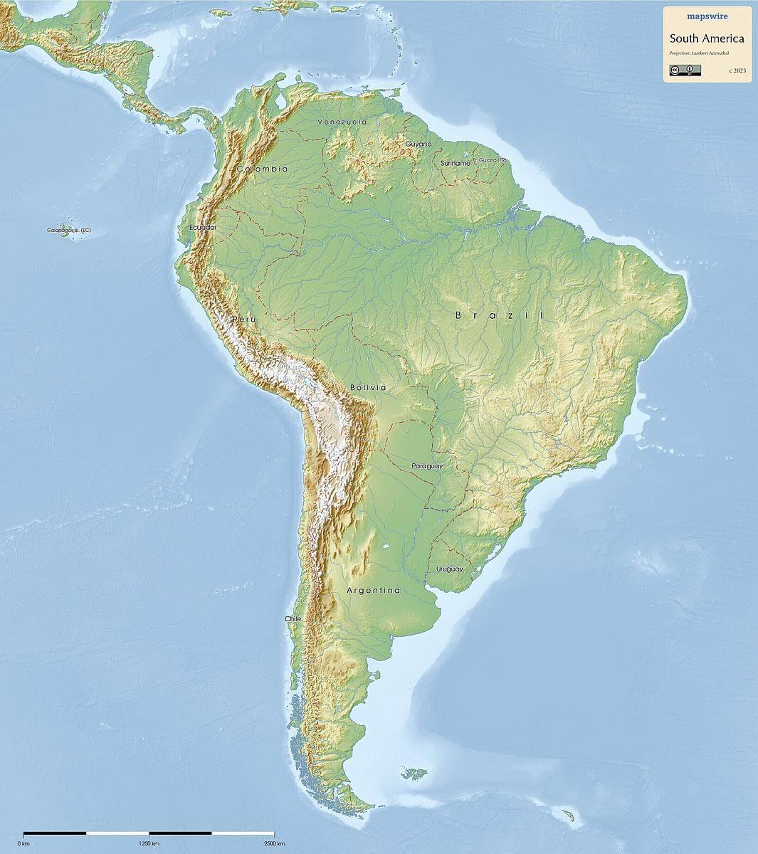
Physical Maps of South America | Mapswire
Physical Map Of South America Printable - Printable Free Templates
Physical Map Of South America Printable - Printable Free Templates
South America Physical Map - Landscapes And Geographic Features

South America Physical Map - Landscapes and Geographic Features
How Many Rivers Are Labeled On The Map Of South America - Free

How Many Rivers Are Labeled On The Map Of South America - Free ...
South America Map Rivers And Lakes - Free Printable Templates

South America Map Rivers And Lakes - Free Printable Templates
Labeled Map Of South America Rivers In PDF

Labeled Map of South America Rivers in PDF
South America Physical Wall Map By GeoNova - MapSales
South America Physical Wall Map by GeoNova - MapSales
Map Of South America Mountains Printable Labeled PDF
Map of South America Mountains Printable Labeled PDF
Physical Map Of South America Printable - Printable Free Templates

Physical Map Of South America Printable - Printable Free Templates
Physical Map Of South America Physical South America Map | Premium
Physical Map Of South America Physical South America Map | Premium
South America Rivers Map Latin America: Rivers & Bodies Of Water Quiz

South America Rivers Map Latin America: Rivers & Bodies Of Water Quiz
Map South America

Map South America
South America Physical Map Printable
South America Physical Map Printable
South America Detailed Physical Map Global Stock Vector (Royalty Free

South America Detailed Physical Map Global Stock Vector (Royalty Free ...
Blank Physical Map Of South America

Blank Physical Map Of South America
Map Of Major Rivers In South America AMERICAS.North & South America

Map Of Major Rivers In South America AMERICAS.North & South America
Download Rivers In South America Map

Download Rivers in South America Map
Printable South America Map Major Rivers – Free Download And Print For You.

Printable South America Map Major Rivers – Free download and print for you.
South America Map With Main Rivers | Stable Diffusion Online
South America Map with Main Rivers | Stable Diffusion Online
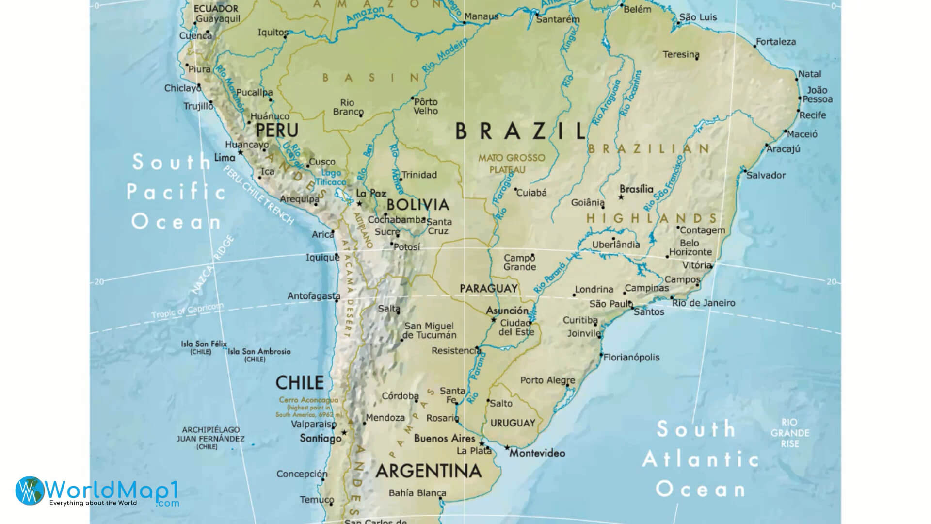
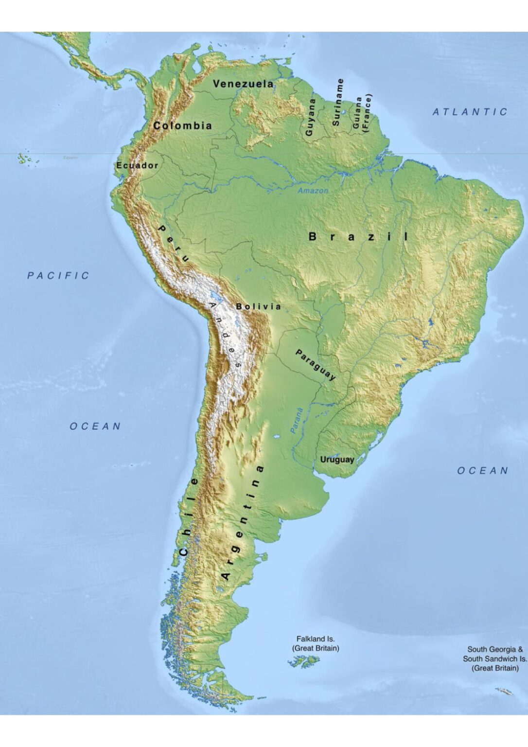
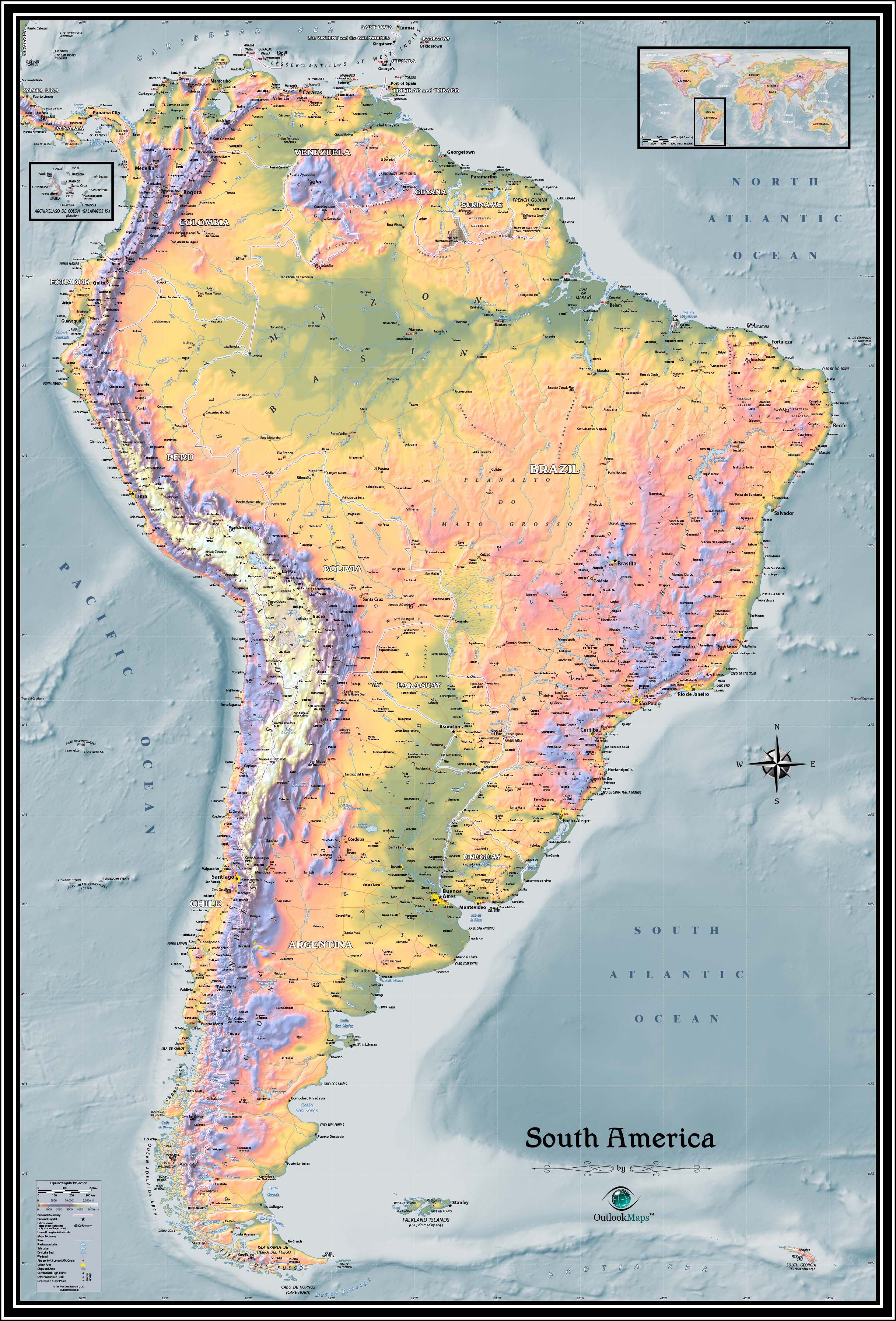
Physical Map Of South America
Physical Map Of South America
Rivers In South America Map
rivers in south america map
South America Physical Map – Mountains, Rivers & Terrain Features
South America Physical Map – Mountains, Rivers & Terrain Features
Vibrant, Highly Detailed Physical Map Of South America Showcases
Vibrant, highly detailed physical map of South America showcases ...
Blank Map Of South America With Rivers And Mountains
Blank Map Of South America With Rivers And Mountains
South America Rivers Map | Map Of South America Rivers – World Map Blank
South America Rivers Map | Map of South America Rivers – World Map Blank
Physical Map Of South America

Physical Map Of South America
Blue Green Atlas - The Geography Of South America

Blue Green Atlas - The Geography of South America
Physical Map Of South America With Rivers, Mountains, And Lakes

Physical Map of South America with Rivers, Mountains, and Lakes
South America Rivers And Lakes
South America Rivers And Lakes
The Physical Map Of South America Reveals Varied Relief, Including
The physical map of South America reveals varied relief, including ...
Blank Map Of South America With Rivers And Mountains
Blank Map Of South America With Rivers And Mountains