Exploring the Physical Geography of South America: A Detailed Map Guide
If you’re looking to truly understand the landscape of South America—from the soaring Andes to the vast Amazon basin—you’ve come to the right place. This guide will walk you through the continent’s major geographical features as shown on a physical map. You’ll learn about the mountain ranges, river systems, plains, and plateaus that define this diverse land, complete with visual references to help you picture it all.
The Dominant Andes Mountain Range
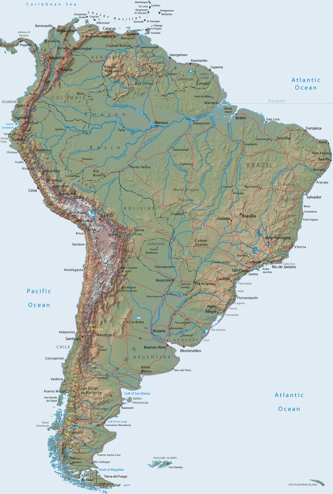
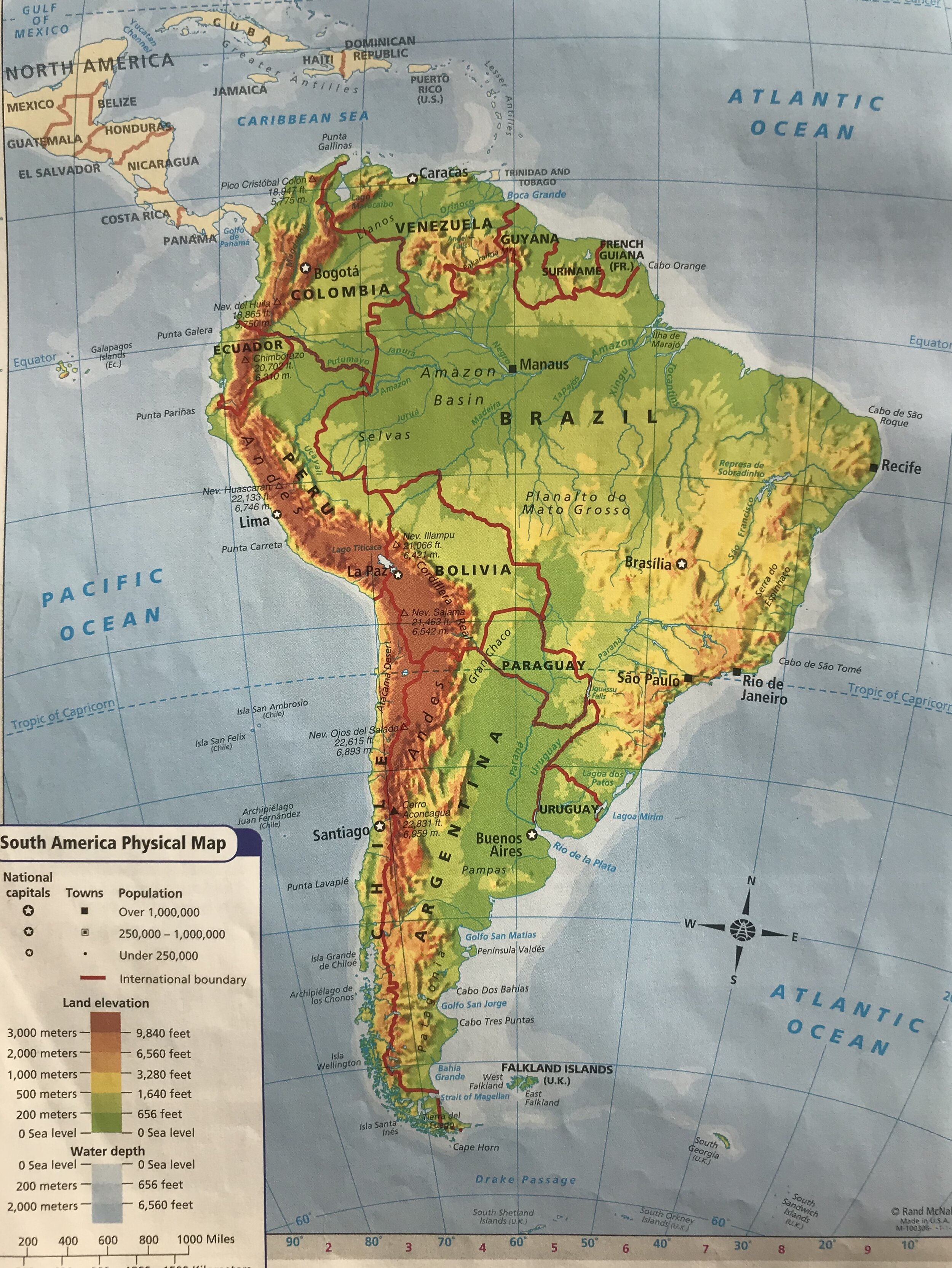
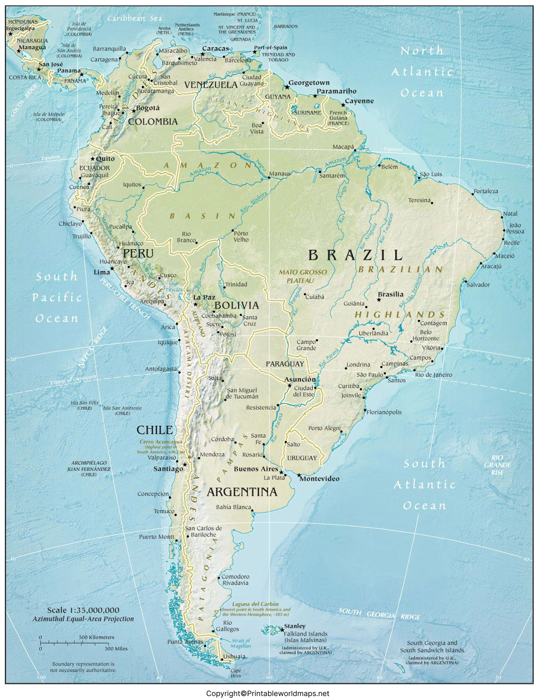
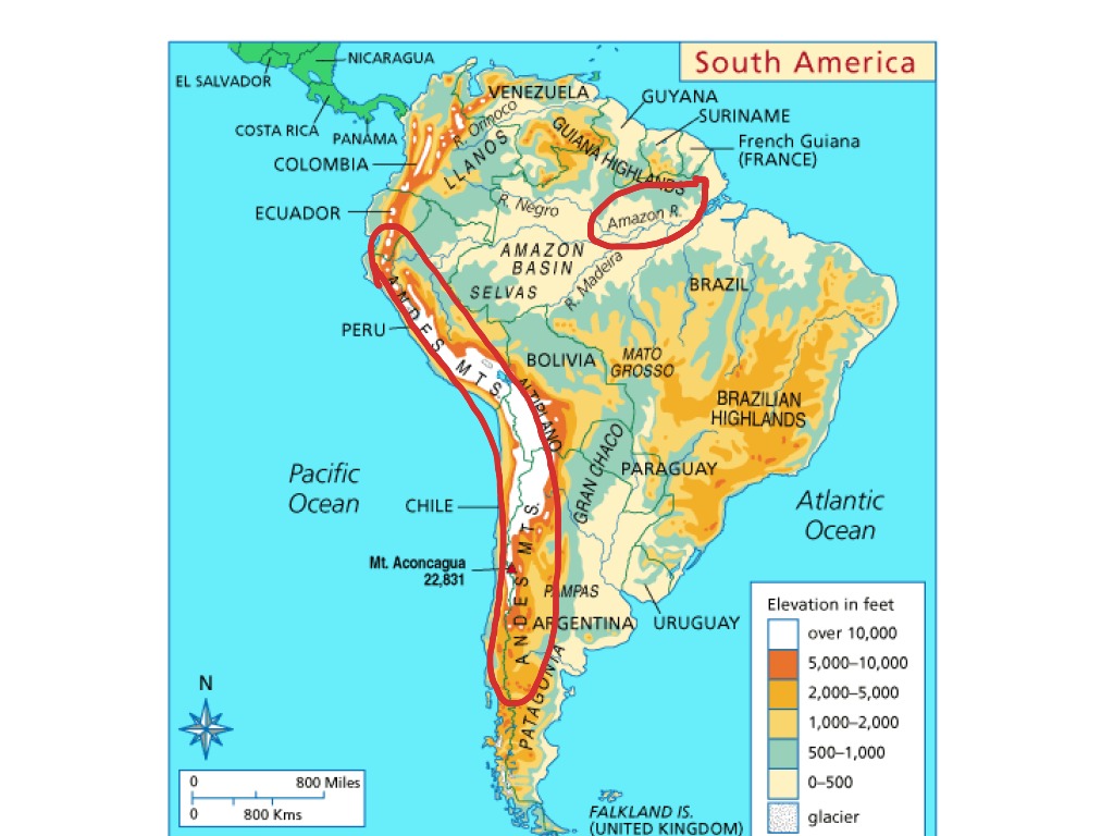
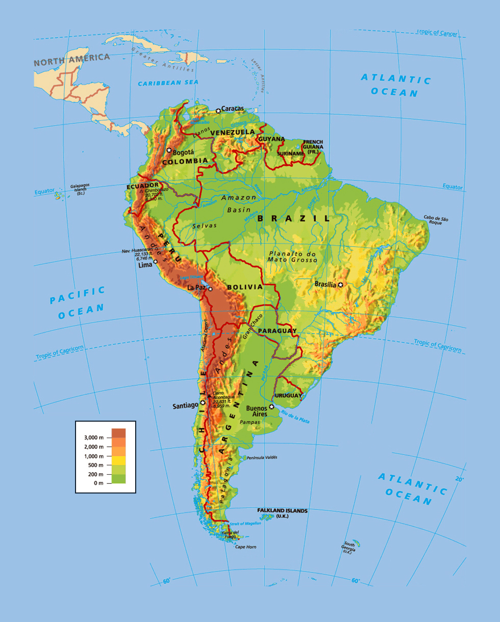
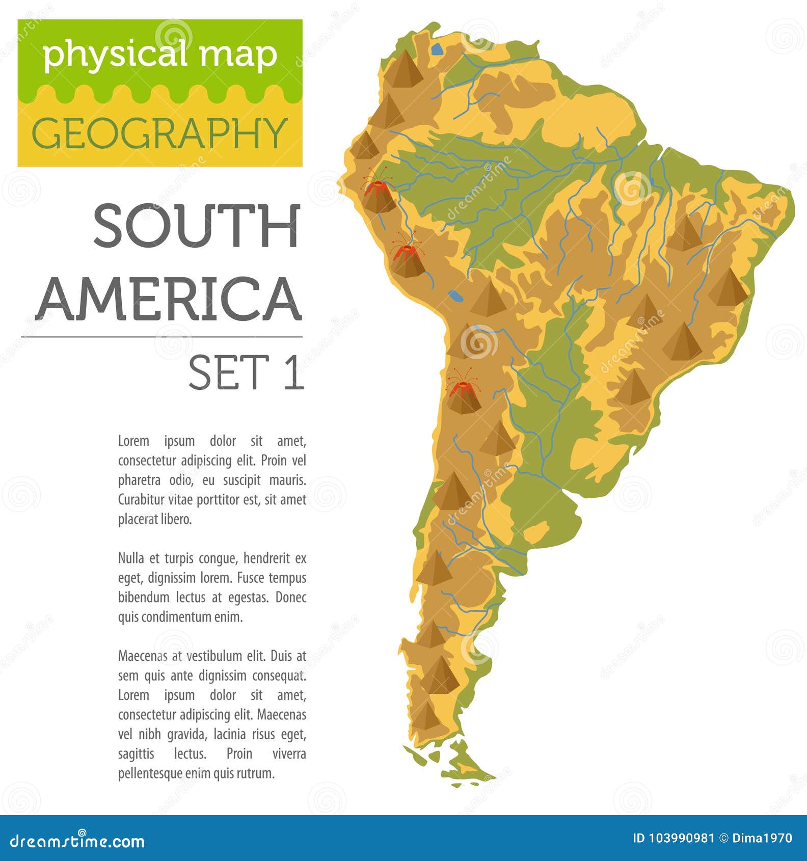
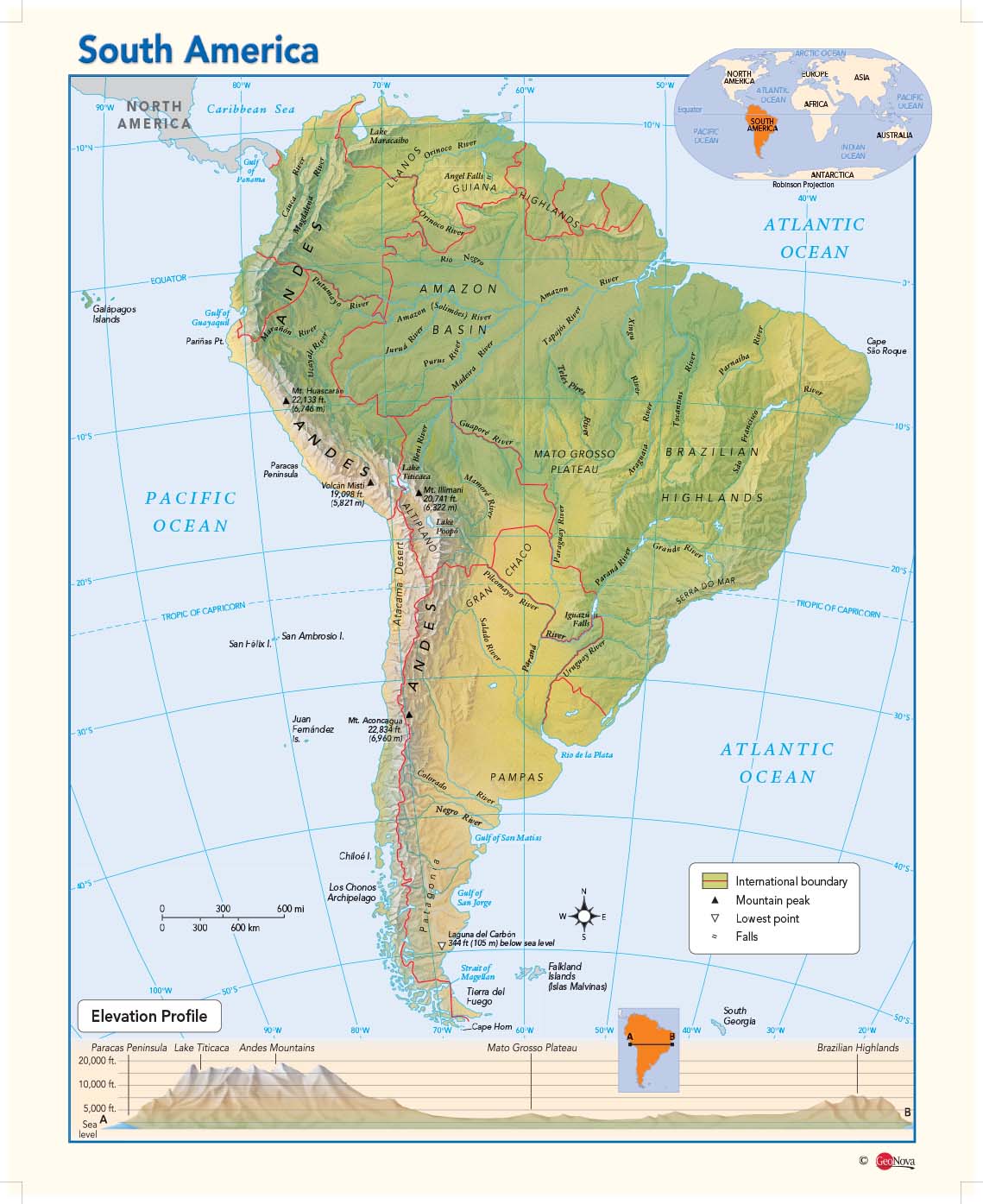
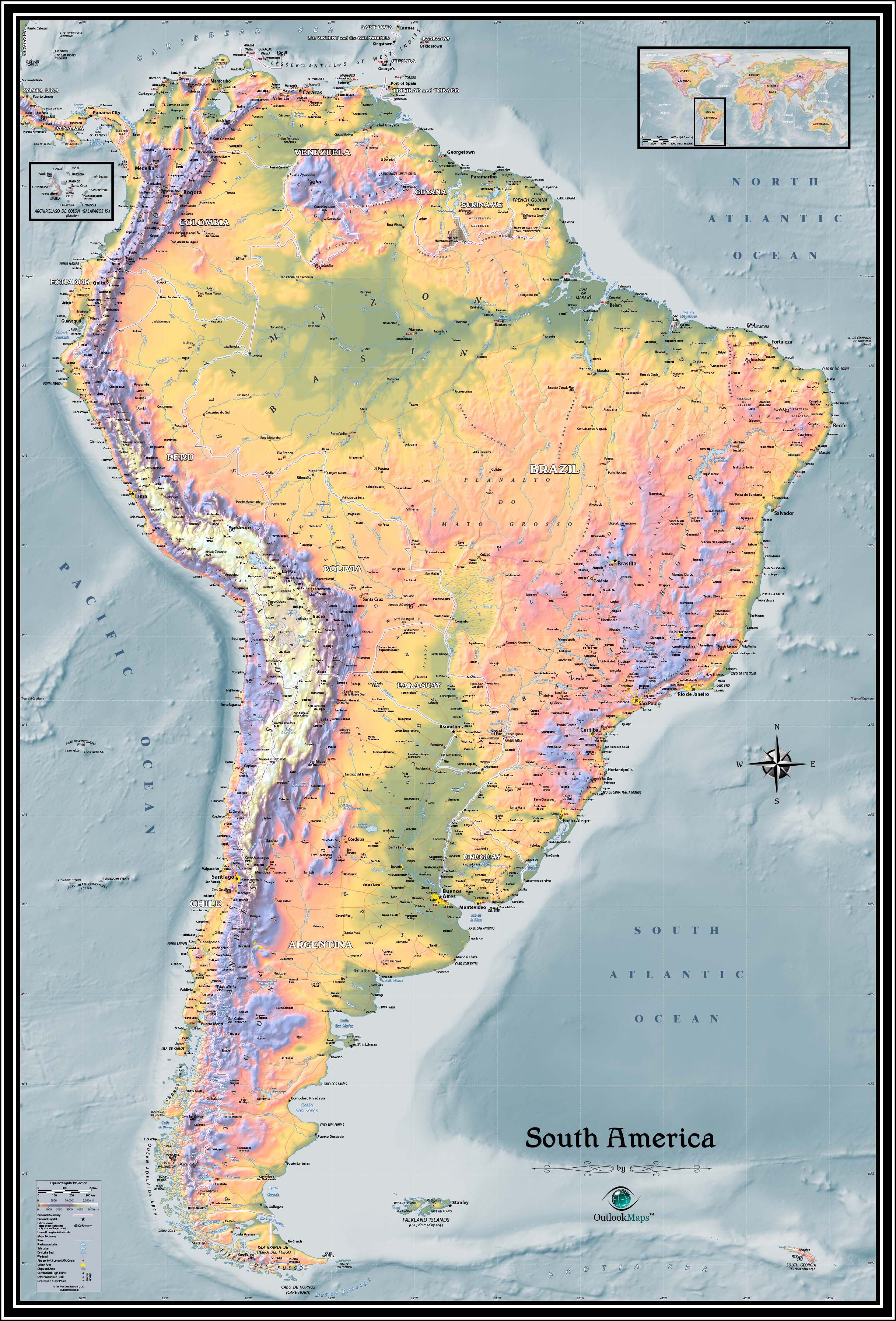
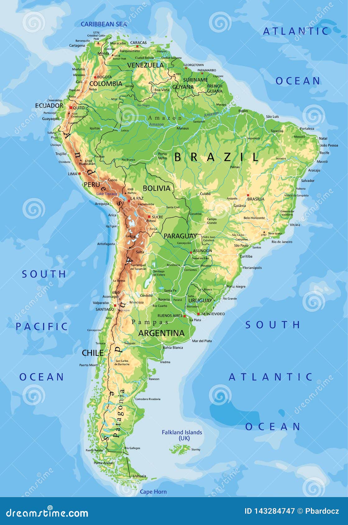
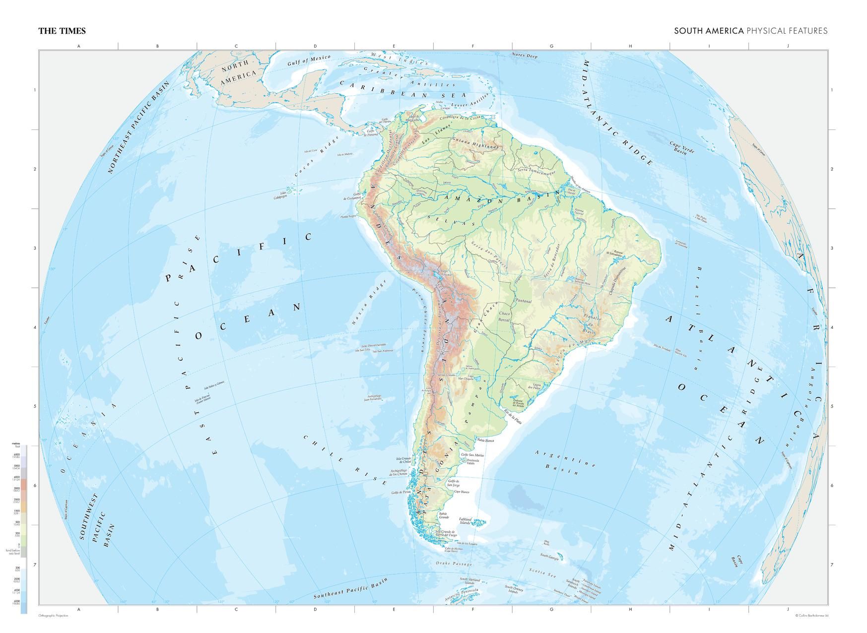
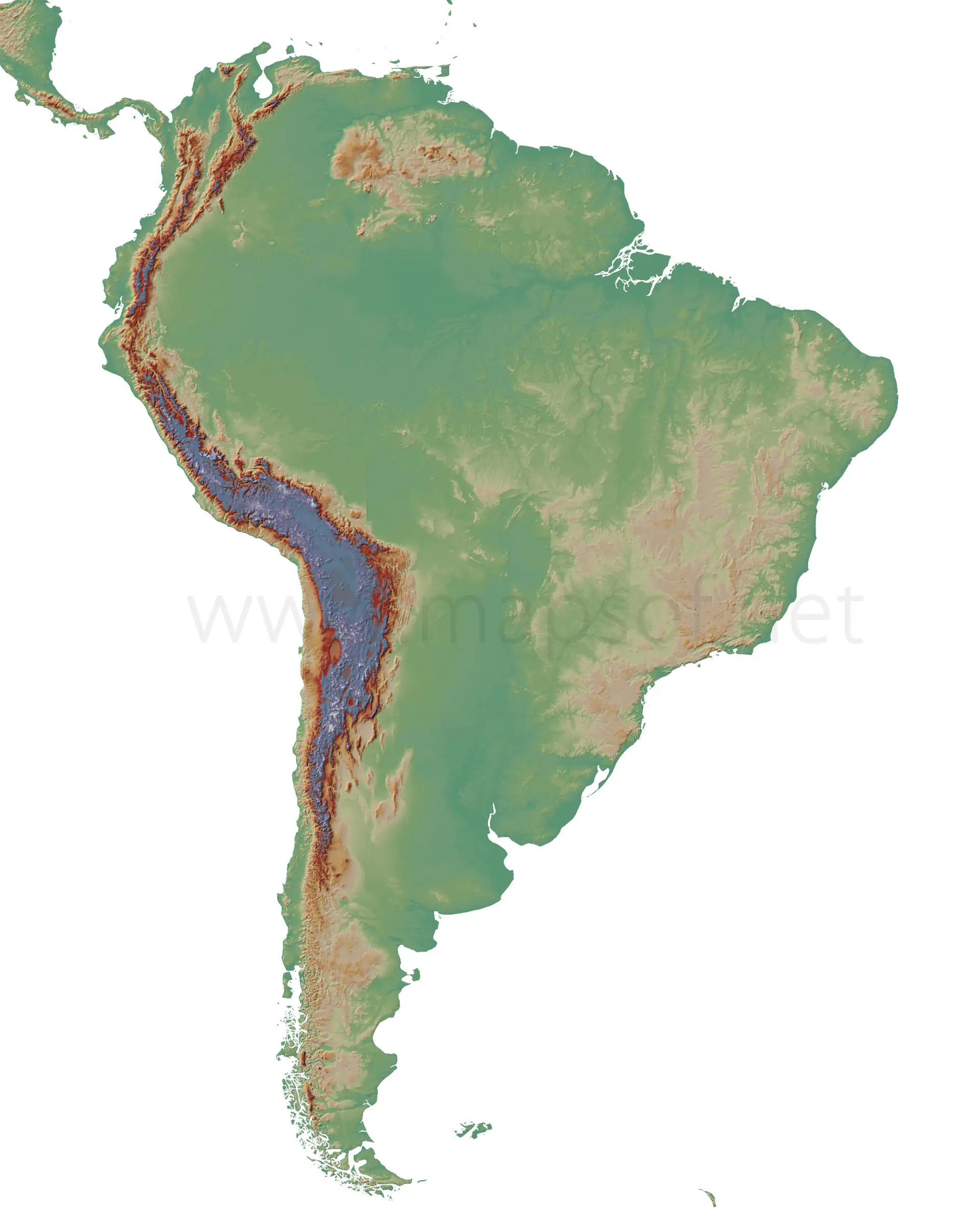
Stretching over 7,000 kilometers along the entire western edge of South America, the Andes is the world’s longest continental mountain range. On a geographical map, you’ll see this rugged spine running from Venezuela in the north all the way down to Tierra del Fuego at the southern tip. The Andes are not a single chain but a series of parallel ranges and high plateaus. This region is home to the highest peaks in the Americas, including Mount Aconcagua in Argentina, which rises to nearly 7,000 meters. The range creates a dramatic rain shadow effect: the western slopes are generally dry, while the eastern sides receive ample moisture, feeding the continent’s great rivers. If you look at a physical map, the Andes appear as a dark, textured band of browns and grays, indicating steep elevation changes.
The Amazon Basin and River System
East of the Andes lies the Amazon Basin, the largest river basin on Earth. On a geographical map, this region is typically shown in deep green, representing dense tropical rainforest. The Amazon River itself flows from the Peruvian Andes across Brazil to the Atlantic Ocean, carrying more water than any other river in the world. Its network of tributaries—like the Rio Negro, Madeira, and Tapajós— spreads like veins across the map. This basin is a flat, low-lying area, with elevations rarely exceeding 200 meters. The sheer scale is staggering: the Amazon River discharges about 209,000 cubic meters of water per second. Understanding this system on a map helps you see how the entire central and northern part of the continent is interconnected by water, creating a unique ecosystem that is vital for global climate and biodiversity.
The Brazilian Highlands and the Guiana Shield
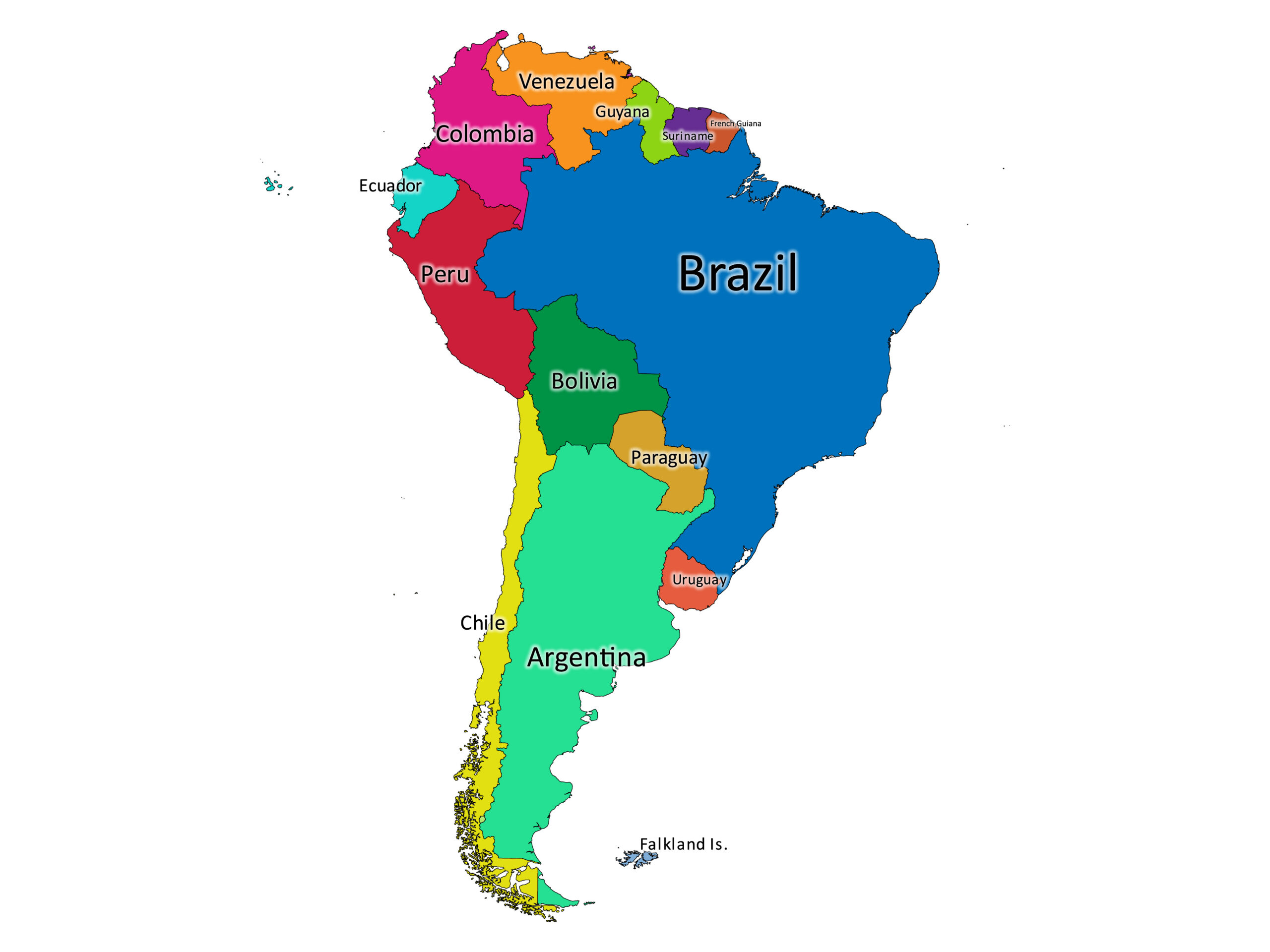
Moving away from the lowlands, you’ll encounter two major ancient geological formations: the Brazilian Highlands and the Guiana Shield. The Brazilian Highlands cover a huge portion of eastern and southern Brazil, appearing on maps as a broad, elevated plateau with rolling hills and deep valleys. This region is not as tall as the Andes, but its average elevation is between 300 and 1,500 meters. The Guiana Shield, located north of the Amazon Basin, covers parts of Venezuela, Guyana, Suriname, and French Guiana. It features dramatic flat-topped mountains called *tepuis*, such as Mount Roraima. On a physical map, these highlands are often colored in shades of ochre and light brown, contrasting with the green lowlands. They are rich in minerals and have unique ecosystems, isolated from the surrounding rainforest.
The Great Plains: Llanos, Pampas, and Patagonia
South America’s plains are as diverse as its highlands. In the north, the *Llanos* of Venezuela and Colombia are vast tropical grasslands, shown on maps as light green expanses between the Andes and the Orinoco River. Moving south, you enter the *Pampas* of Argentina and Uruguay—a flat, fertile plain that is the agricultural heartland of the continent. On a map, this area appears as a smooth, light beige or pale green region. Further south lies Patagonia, a cold, windy plateau that stretches to the southern tip. Patagonia is not a single plain but a mix of steppes, deserts, and glacial valleys. Maps show it as a brownish, arid expanse punctuated by lakes and ice fields. Each of these plains has a distinct climate and vegetation, shaped by latitude and proximity to the Andes.
Major Coastal and Island Features
The coastline of South America is surprisingly varied. On the west, you have the long, narrow strip of Chile, where the Andes plunge directly into the Pacific Ocean, creating a coastline of fjords and islands in the south. In the north, the Caribbean coast offers warm waters, coral reefs, and the mouths of the Orinoco and Amazon rivers. The eastern coast of Brazil is marked by a series of mountain ranges that come close to the shore, such as the Serra do Mar, creating stunning coastal escarpments. Important islands include the Galápagos Islands (west of Ecuador), Tierra del Fuego (an archipelago at the southern tip shared by Chile and Argentina), and the Falkland Islands (east of Patagonia). These islands are clearly marked on physical maps and often indicate unique volcanic or glacial origins, adding to the continent’s geographical richness.
Climate Zones and Their Map Representation
A geographical map of South America is also a climate map in disguise. The equator runs through the northern part of the continent, so you see tropical climates in the Amazon, the Llanos, and the Caribbean coast. As you move south, you encounter subtropical and temperate zones in the Pampas. The Andes create their own microclimates: high-altitude tundra near the peaks, and arid conditions in the rain shadow—like the Atacama Desert in northern Chile, one of the driest places on Earth, shown as a pale yellow strip on the map. Patagonia is another dry, cool zone. The map’s color coding—deep greens for rainforest, light browns for deserts, and whites for ice caps in southern Chile—visually tells the story of how the continent’s geography directly influences its weather patterns.
Conclusion
From the towering Andes to the sprawling Amazon and the windswept Patagonian steppes, South America’s geography is a story of extremes and contrasts. A physical map is not just a collection of lines and colors—it is a window into how the continent was shaped by tectonic forces, water, and time. Whether you’re a student, traveler, or geography enthusiast, understanding these key features—mountain ranges, river basins, highlands, and plains—gives you a deeper appreciation for the natural world of South America. Use this guide as a reference the next time you look at a map, and you’ll see the continent in a whole new light.
Map Quotes, Galapagos Ecuador, Tropic Of Capricorn, Asia Continent

Map Quotes, Galapagos Ecuador, Tropic Of Capricorn, Asia Continent ...
Geographical Features South America At William Gainey Blog
Geographical Features South America at William Gainey blog
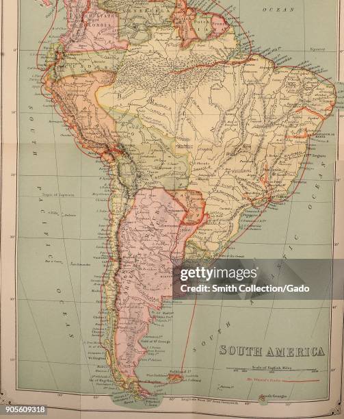
Free Printable Labeled Map Of South America Physical PDF

Free Printable Labeled Map of South America Physical PDF
South America - Other Maps

South America - Other Maps
South America Geographical Features Map

South america geographical features map
Political Map Of South America (1200 Px) - Nations Online Project

Political Map of South America (1200 px) - Nations Online Project
South America Physical Features - Labelled Diagram
South America Physical Features - Labelled diagram
Bot Verification
Bot Verification
Physical Maps Of South America | Mapswire
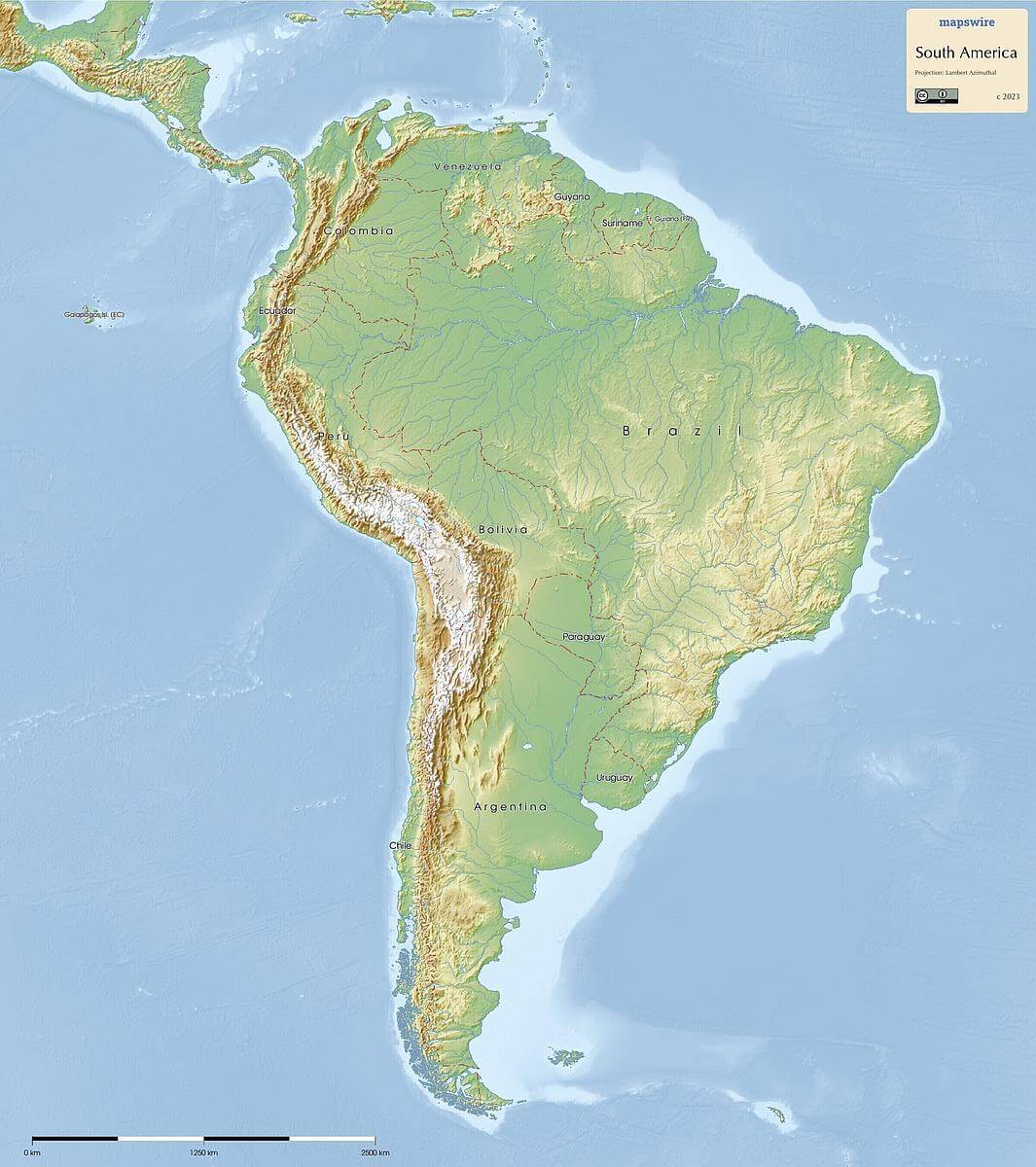
Physical Maps of South America | Mapswire
Geographical Features South America At William Gainey Blog
Geographical Features South America at William Gainey blog
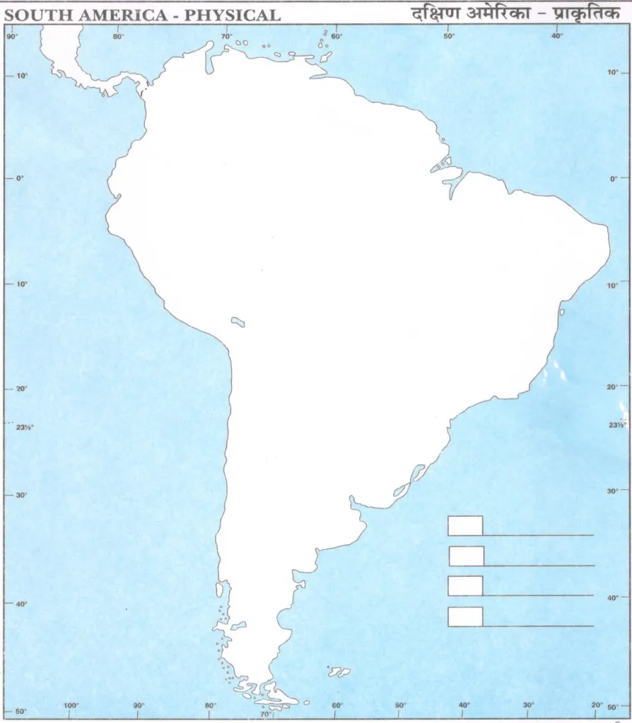
Free Printable Blank Map Of South America Worksheet
Free Printable Blank Map of South America Worksheet
Geographical Features South America At William Gainey Blog
Geographical Features South America at William Gainey blog
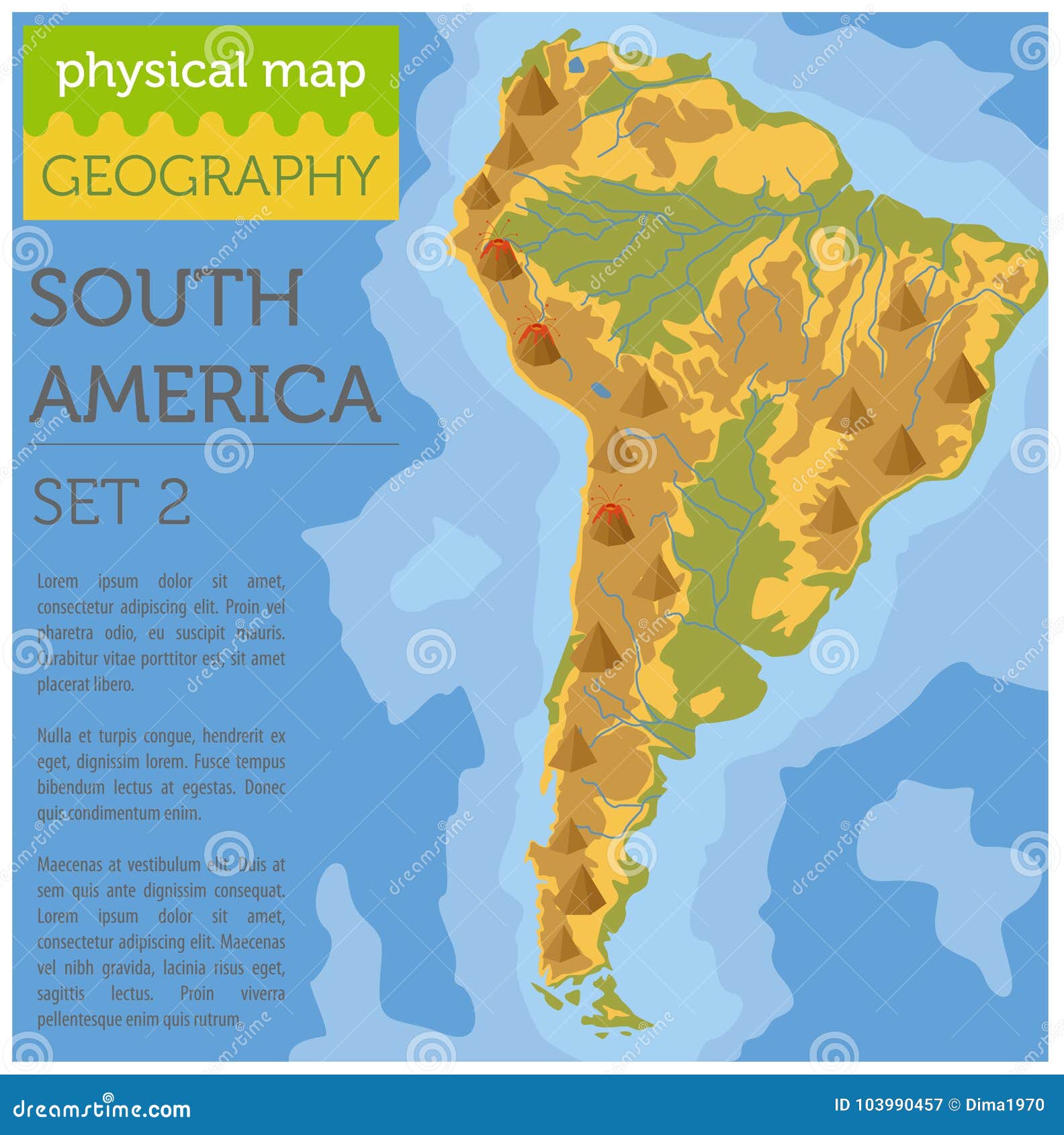
South America Physical Map Elements. Build Your Own Geography In Stock
South America Physical Map Elements. Build Your Own Geography in Stock ...
Physical Map South America , Physical Map Of South America – TLWK
Physical Map South America , Physical Map of South America – TLWK
Physical Map Of South America Printable - Printable Free Templates
Physical Map Of South America Printable - Printable Free Templates
Physical Map Of South America Printable - Printable Free Templates
Physical Map Of South America Printable - Printable Free Templates
35 South America Physical Map Stock Photos, High-Res Pictures, And
35 South America Physical Map Stock Photos, High-Res Pictures, and ...
Physical Map Of South America For Students - PDF Download - AglaSem
Physical Map of South America for Students - PDF Download - AglaSem
Physical Map Of South America Physical South America Map | Premium
Physical Map Of South America Physical South America Map | Premium
South America Physical Map – Freeworldmaps.net

South America Physical Map – Freeworldmaps.net
Geographical Features South America At William Gainey Blog
Geographical Features South America at William Gainey blog
South America Geographical Regions, Multi Colored Political Map
South America geographical regions, multi colored political map ...
Geographical Features South America At William Gainey Blog

Geographical Features South America at William Gainey blog
Physical Map Of South America
Physical Map Of South America
South America Map With Major Cities And National Parks

South America Map with Major Cities and National Parks
Geographical Features South America At William Gainey Blog
Geographical Features South America at William Gainey blog
South America Physical Map Printable
South America Physical Map Printable
Physical Map Of South America | EDUCATION - THiNKNET Design Studio

Physical Map of South America | EDUCATION - THiNKNET Design Studio
Physical Map Of South America Diagram | Quizlet

Physical Map of South America Diagram | Quizlet
Physical Map Of South America Physical South America Map | Premium

Physical Map Of South America Physical South America Map | Premium
Physical Map Of South America Printable - Printable Free Templates
Physical Map Of South America Printable - Printable Free Templates
PHYSICAL MAP SOUTH AMERICA Diagram | Quizlet

PHYSICAL MAP SOUTH AMERICA Diagram | Quizlet
South America Map Quiz - Doquizzes
South America Map Quiz - Doquizzes