Your Guide to the Current Map of South America: Countries, Capitals, and Geography
South America is a continent of staggering diversity, from the soaring Andes mountains to the vast Amazon rainforest and the sun-drenched beaches of its eastern coast. Understanding the current political and physical map of this region can seem complex, but it is truly fascinating. In this guide, you will learn about every independent country, its capital city, the major physical features that define the landscape, and the unique territories that make up the modern map of South America. By the end, you will have a clear mental picture of the continent and the stories its borders tell.
The Sovereign Nations and Their Capitals
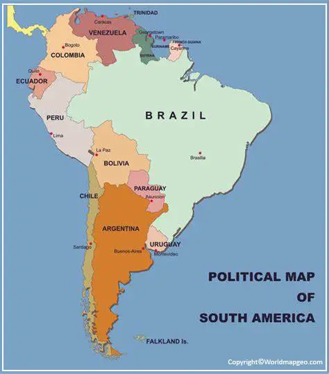
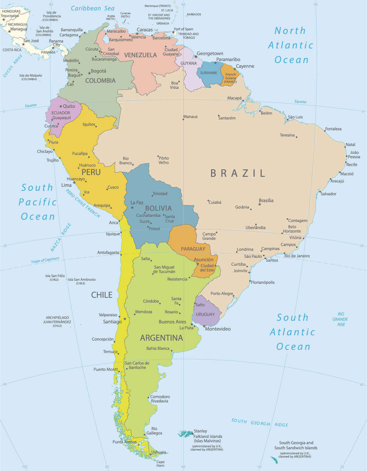
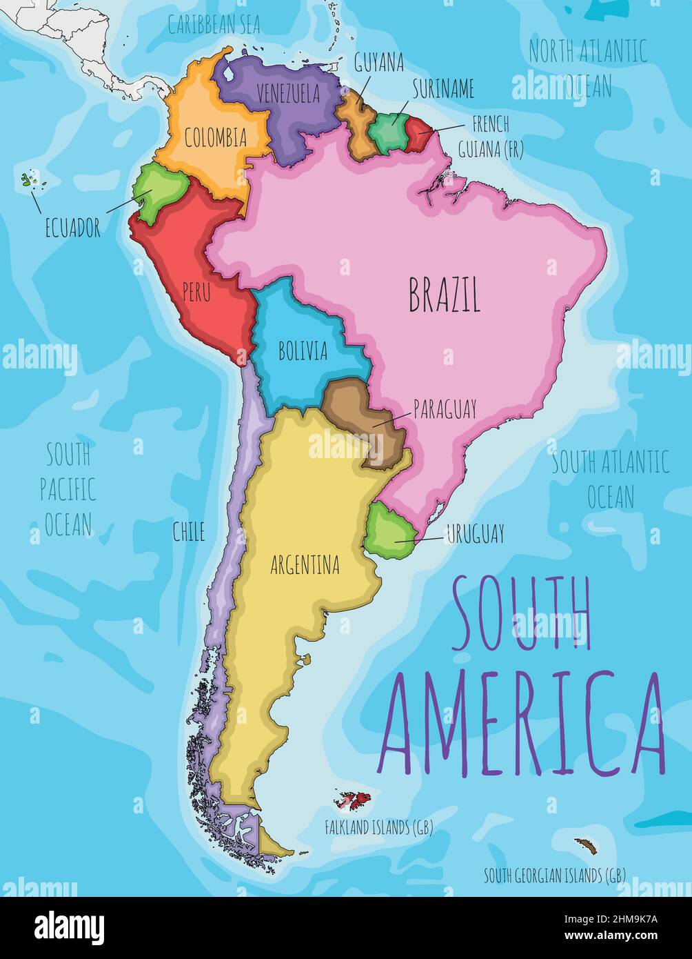
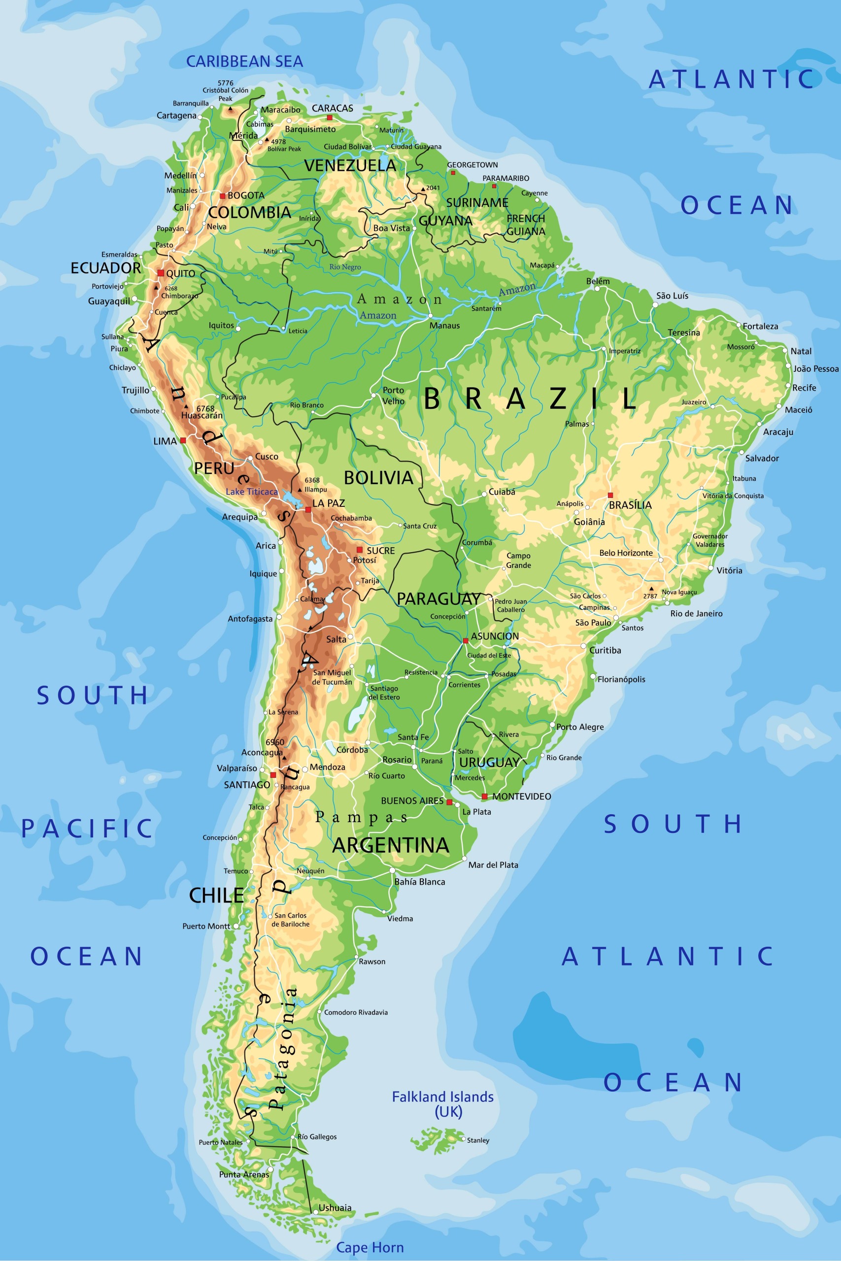
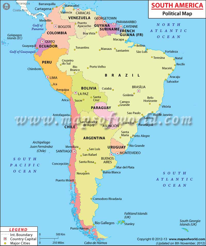
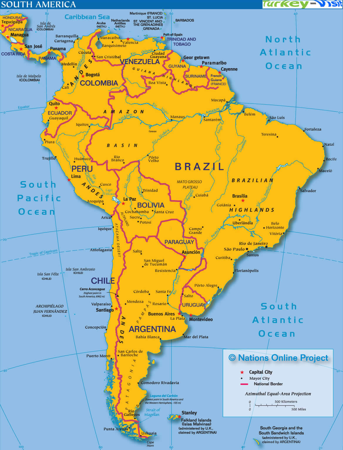
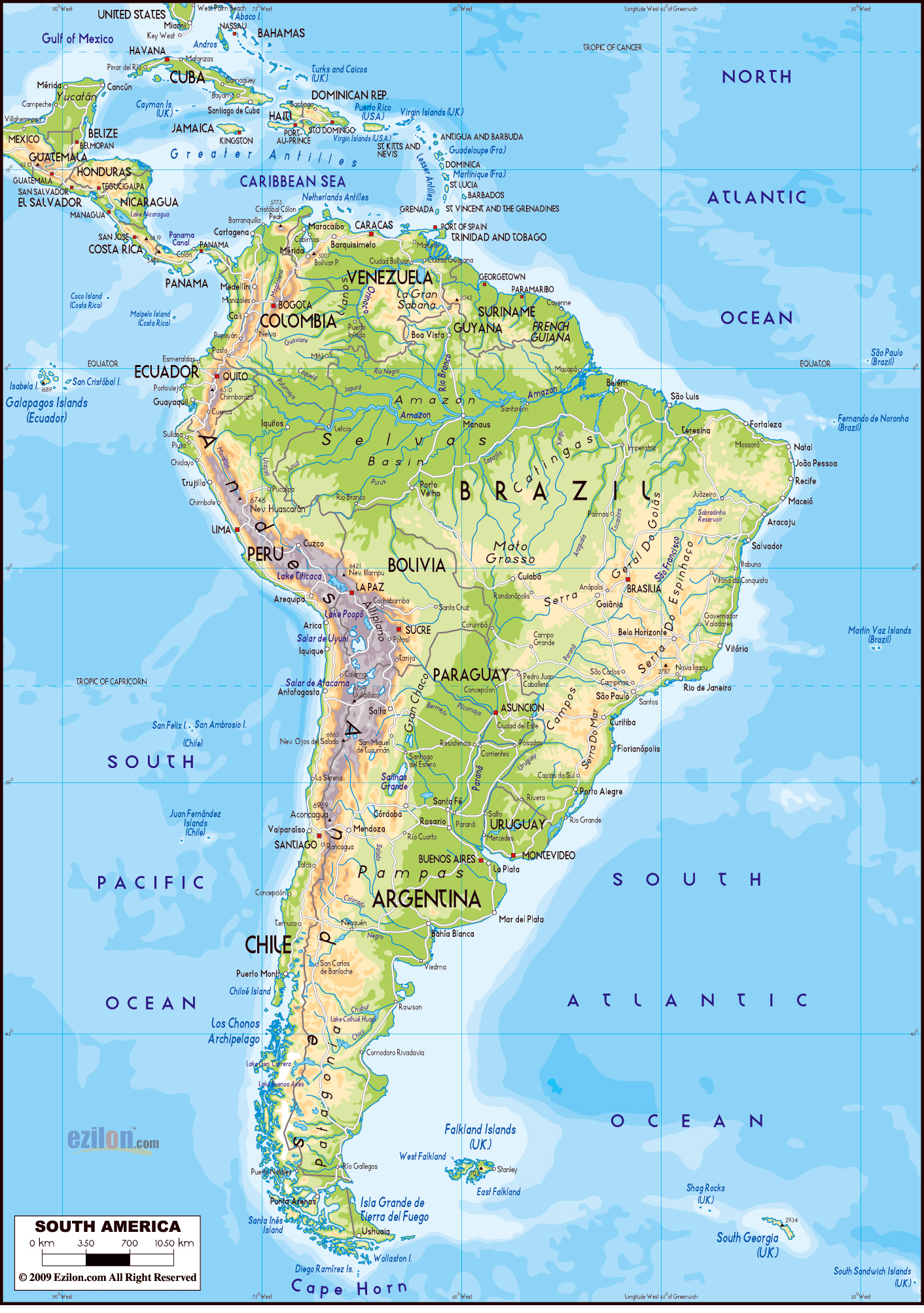
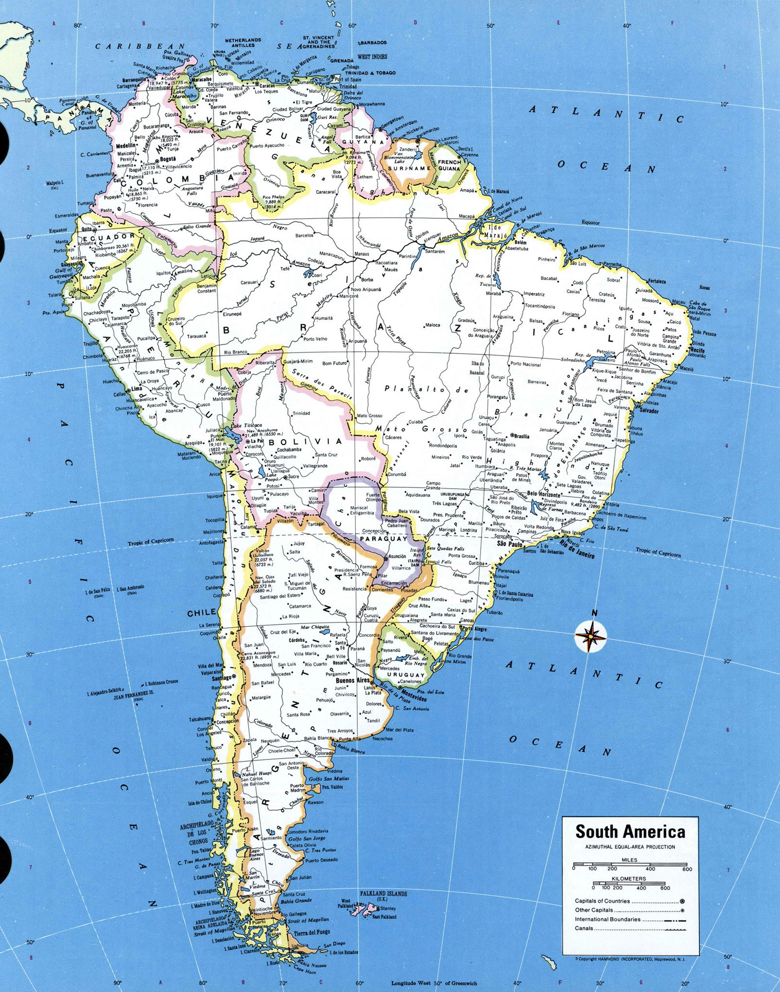
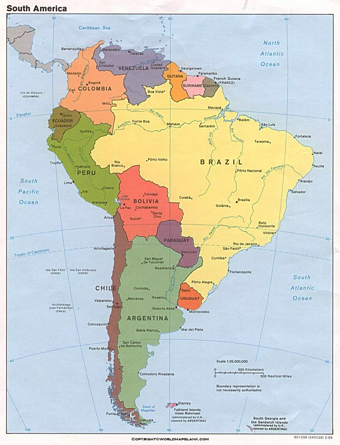
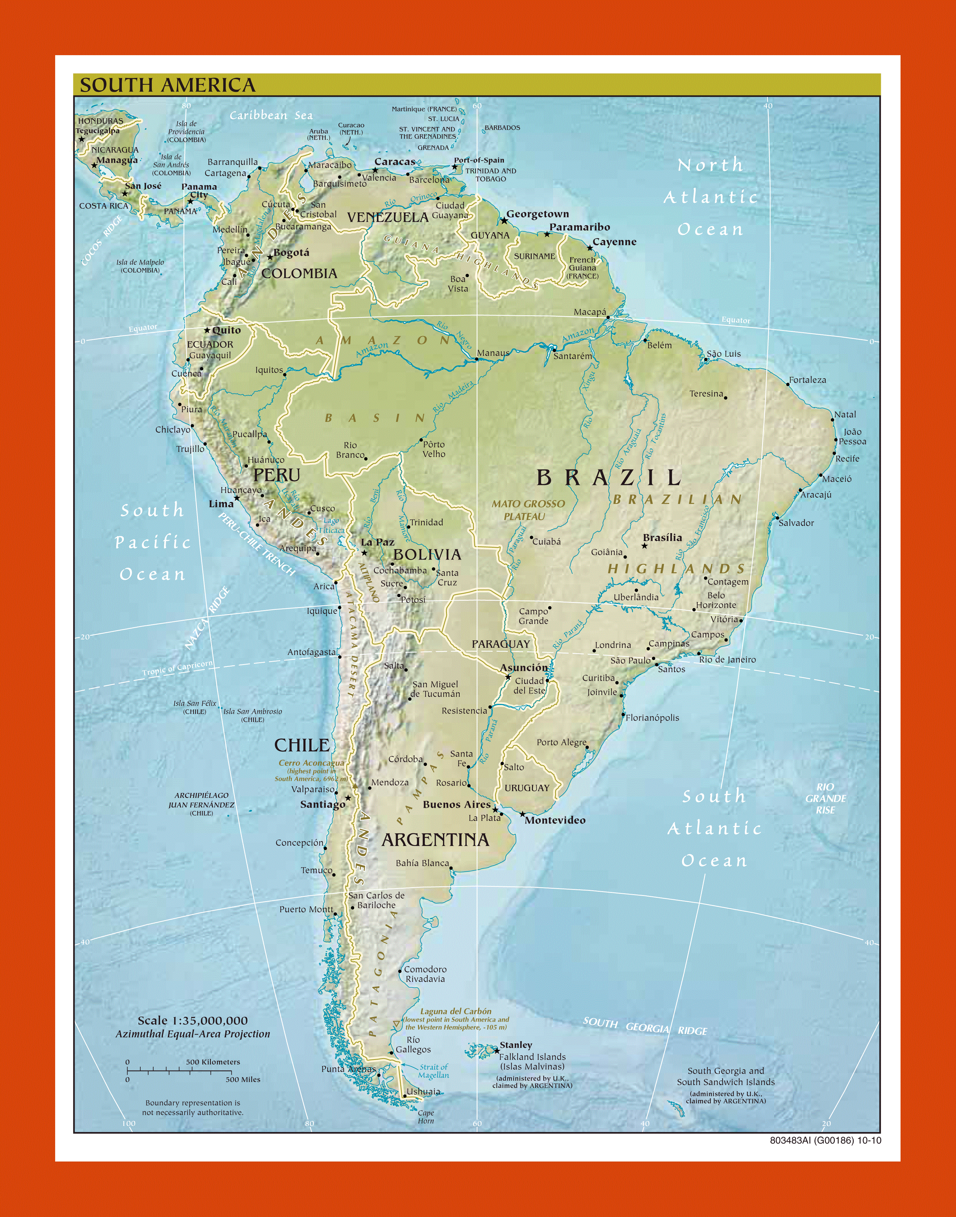
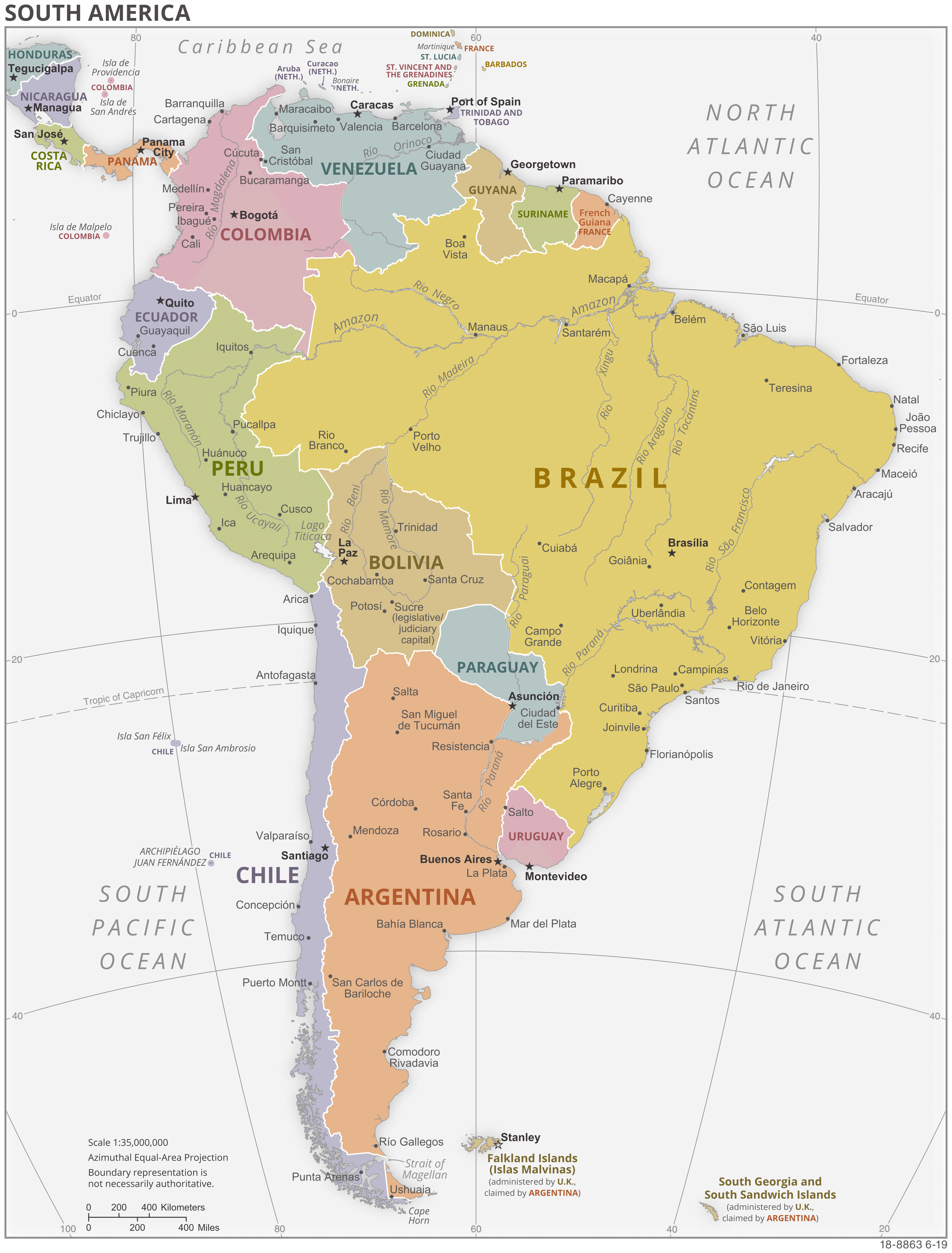
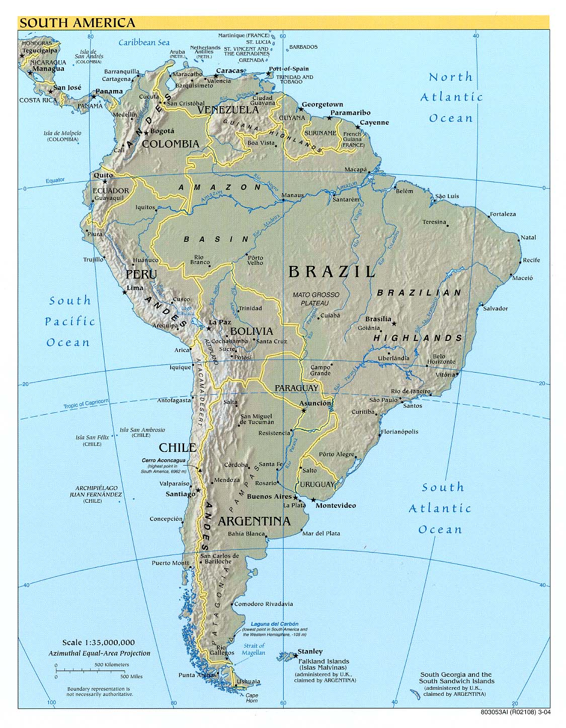
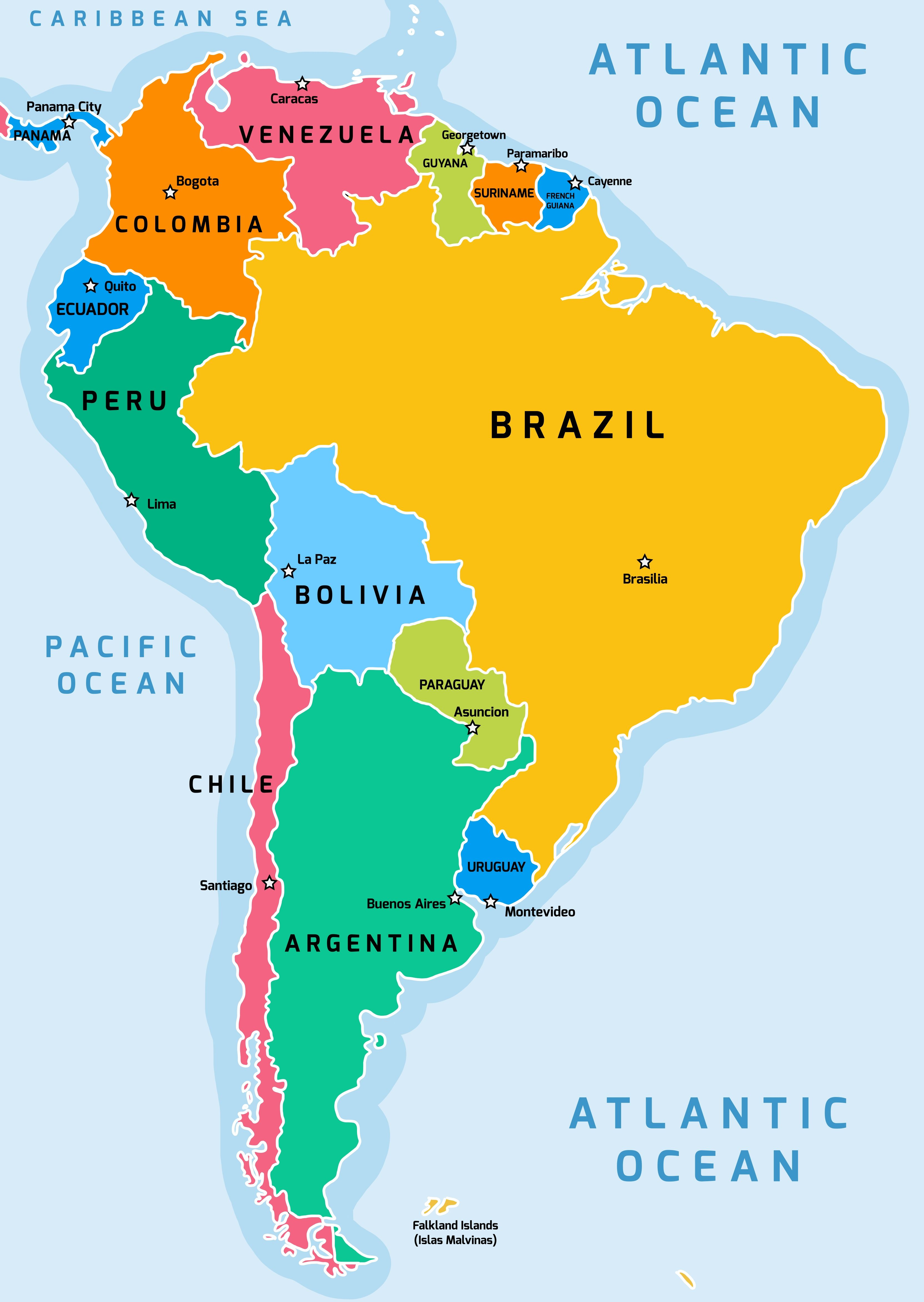
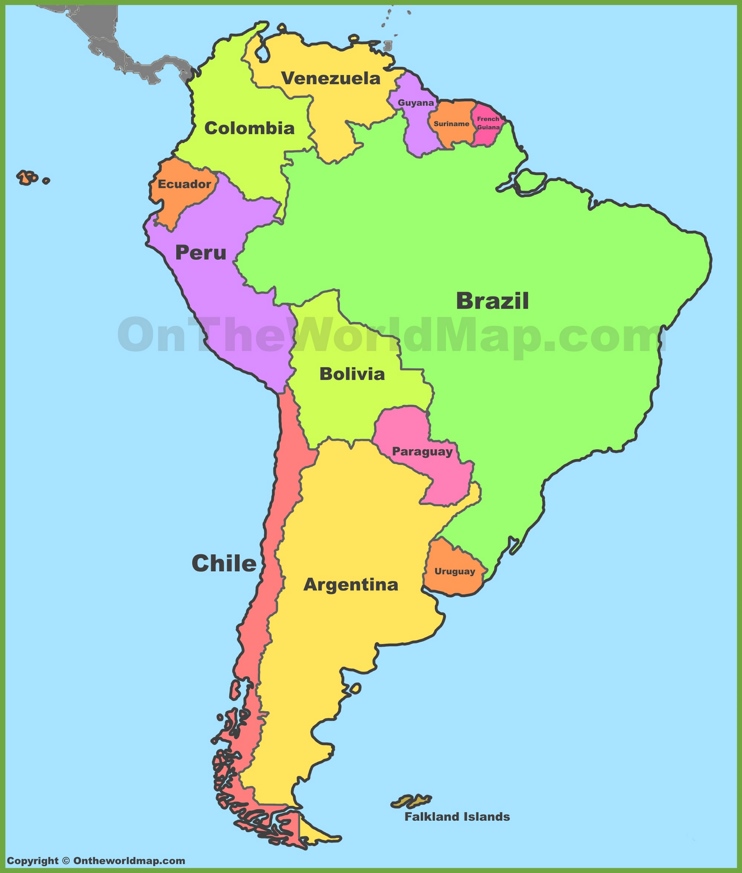
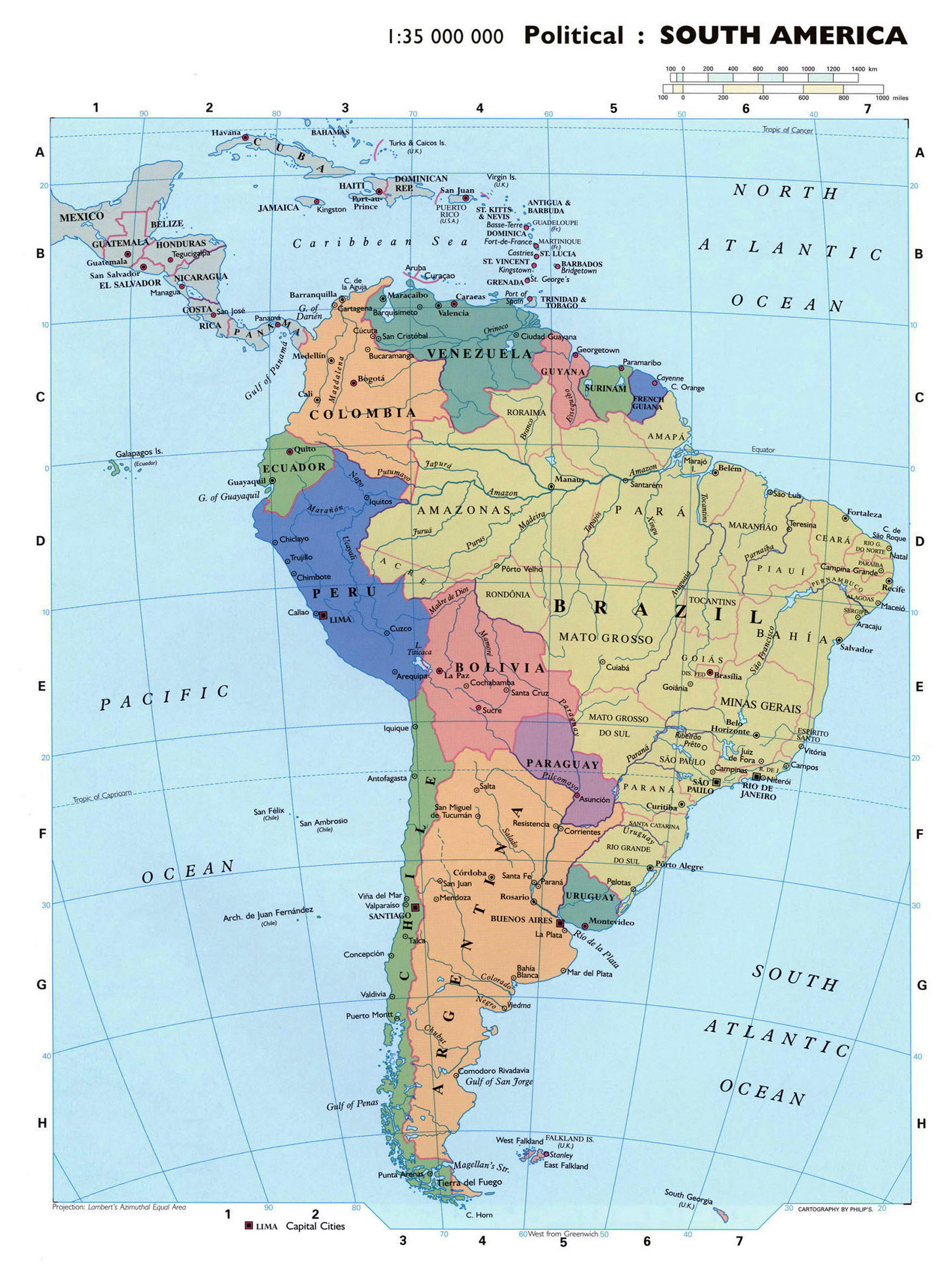
South America is home to 12 independent countries. The continent is dominated by Brazil, which occupies nearly half of the landmass and shares a border with every other South American nation except Chile and Ecuador. Its capital is Brasília, a planned city built in the 20th century. Argentina, the second-largest country, boasts Buenos Aires as its capital, a vibrant port city. The other nations and their capitals are: Colombia (Bogotá), Venezuela (Caracas), Peru (Lima), Chile (Santiago), Ecuador (Quito), Bolivia (two capitals: Sucre, the constitutional capital, and La Paz, the seat of government), Uruguay (Montevideo), Paraguay (Asunción), Guyana (Georgetown), and Suriname (Paramaribo). Each capital sits at a unique geographic crossroads, from the high-altitude Andes to the humid coastal plains.
Major Physical Features on the Map
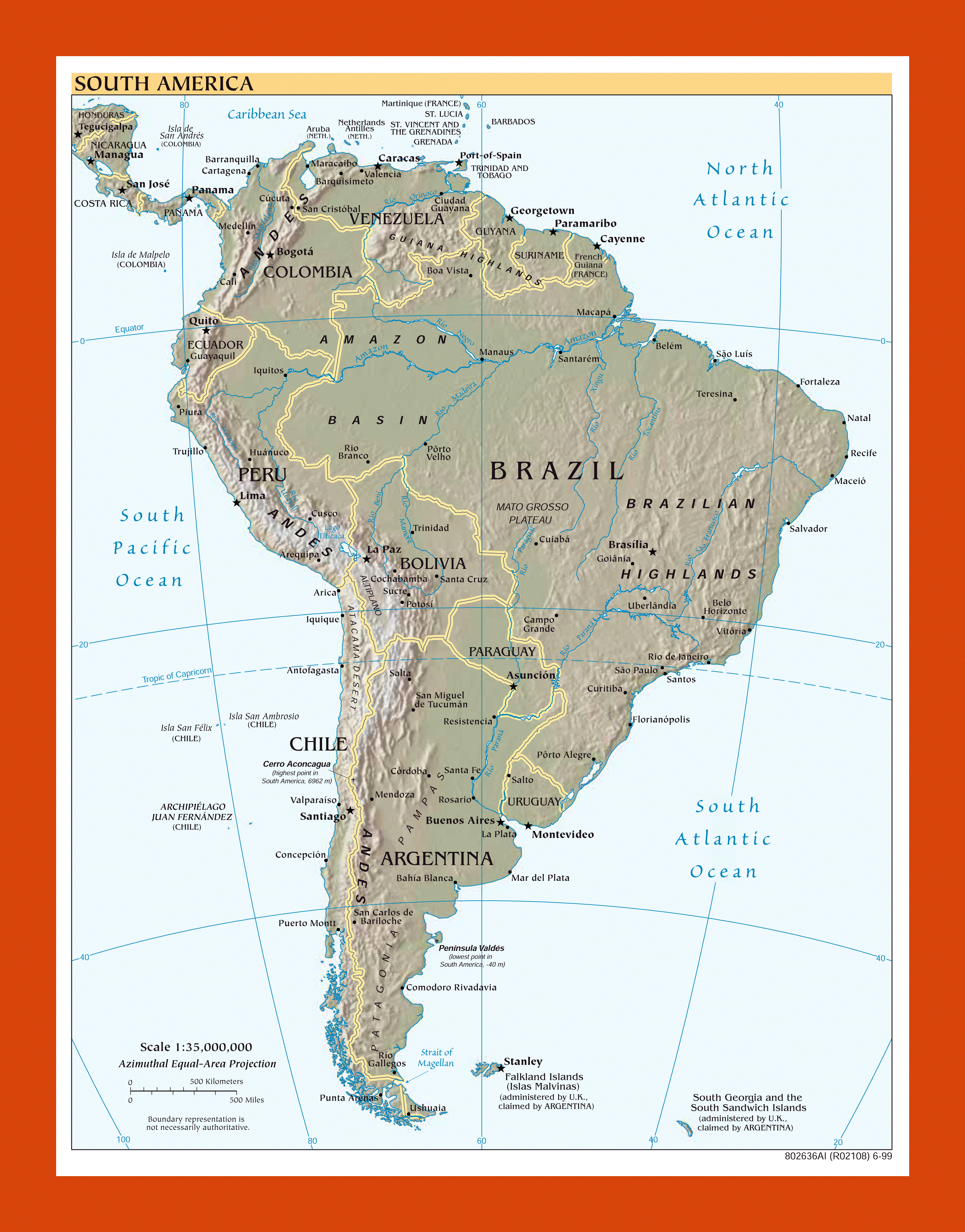
When you look at a physical map of South America, three features immediately stand out. First, the Andes Mountain range runs like a spine along the entire western edge, creating a natural border for countries like Chile, Argentina, Peru, and Ecuador. This is the world’s longest continental mountain range. Second, the Amazon River basin covers a massive swath of the northern and central continent, primarily flowing through Brazil, Peru, and Colombia. This basin is home to the Amazon rainforest and the largest river system by volume on Earth. Third, the Brazilian Highlands and the Guiana Shield form elevated plateaus in the east and north, which are rich in minerals and dramatic waterfalls. The vast lowlands, such as the Pampas of Argentina and Uruguay, and the Pantanal (the world’s largest tropical wetland) in Brazil and Bolivia, round out the geographical diversity you’ll see on any modern map.
Disputed Territories and Special Regions
While the political map appears settled, a few key areas remain notable. The Falkland Islands (Islas Malvinas) are a British Overseas Territory claimed by Argentina, and you will see it labeled on most maps with a note of this dispute. French Guiana is an overseas department of France, making it an integral part of the European Union—this means its currency is the Euro and its people are citizens of the EU. Additionally, the border between Guyana and Venezuela has a long-standing dispute over the Essequibo region, a large, forested area. Similarly, the border between Chile and Argentina in the Southern Patagonian Ice Field has areas still being precisely demarcated. These zones remind us that maps are not static; they represent ongoing political and historical negotiations.
Understanding Map Symbols and Scale
To read a modern South American map effectively, you need to decipher its symbols. Capital cities are typically marked with a star inside a circle, while other major cities use a simple dot. Mountain peaks are often indicated by a triangular symbol, and rivers are shown as blue lines that grow thicker as they approach the ocean. The scale bar is crucial—South America is enormous. For perspective, the distance from the northernmost point of Colombia to the southern tip of Chile (Tierra del Fuego) is roughly 4,500 miles (7,200 kilometers). A map with a scale of 1:10,000,000 will show you the shape of the countries and major cities, but you’ll need a larger scale, like 1:500,000, to navigate provincial roads or hiking trails. Pay attention to the legend; it is your key to all the information embedded in the map.
How the Map Has Changed Recently
The borders of South America have been relatively stable for over a century, but that doesn’t mean the map is outdated. Recent changes have been administrative and symbolic. For instance, in 2018, the city of La Paz in Bolivia officially became the only capital after a constitutional change, though Sucre remains the judicial capital. Furthermore, road infrastructure and new town developments are constantly updated on the most current maps. The growth of cities like Manaus in Brazil and Ciudad del Este in Paraguay has shifted population centers. When you look at the most recent satellite-based maps, you will see the effects of deforestation in the Amazon and the expansion of agricultural land in the Cerrado savanna. A current map is a snapshot of both human activity and natural change.
Using Digital and Interactive Maps
Today, most people rely on digital tools like Google Maps, OpenStreetMap, or dedicated GIS applications to explore South America. These allow you to toggle between satellite imagery, political boundaries, terrain, and even real-time traffic in cities like São Paulo or Lima. A key advantage is the ability to zoom in on remote areas, such as the Atacama Desert in Chile or the Lençóis Maranhenses in Brazil, to see detailed dune patterns and river channels. Interactive maps also let you layer data—for example, showing elevation, rainfall, or population density. For travelers, these maps provide route planning through the Pan-American Highway, which runs through most South American countries, with the notable break in the Darién Gap between Panama and Colombia. Always ensure your digital map is downloaded offline if you plan to journey into regions with poor internet connectivity.
Conclusion
From the 12 independent nations to the contested frontiers and breathtaking physical landmarks, the current map of South America is a living document of geography, history, and culture. Whether you are planning an expedition to the Andes, studying the political divisions for a class, or simply curious about the world, understanding how to read this map—its symbols, its scale, and its recent changes—gives you a powerful tool. The continent is not just a collection of lines and colors; it is a sprawling, dynamic landscape where ancient mountains meet modern cities, and every river and road tells a story. Keep a current digital or printed map handy, and you’ll always have a guide to this incredible part of the world.
Map Of South America Political Map ǀ Maps Of All Cities, 44% OFF

Map Of South America Political Map ǀ Maps Of All Cities, 44% OFF
South America Countries Labelled Diagram - Form Example Download
South America Countries Labelled Diagram - Form example download
Map Of South America With Countries, Cities, Borders And Roads - Ezilon

Map of South America with Countries, Cities, Borders and Roads - Ezilon ...
South American Countries Flags

South American Countries Flags
South America Political Map

South America Political Map
Large Scale Political Map Of South America With Major Cities 1997
Large Scale Political Map Of South America With Major Cities 1997
South America Political Map

South America Political Map
South America Map | Mappr
South America Map | Mappr
Map Of South American Countries - Map Worksheets

Map Of South American Countries - Map Worksheets
List Of Countries In South America By Size - Uno

List Of Countries In South America By Size - Uno
South American Countries, Countries In South America
South American Countries, Countries in South America
South America Countries Map
South America Countries Map
South America - Other Maps

South America - Other Maps
Map Of South America Printable
Map Of South America Printable
Maps Of South America And South American Countries | Political Maps
Maps of South America and South American countries | Political maps ...
South America Political Map – Map Of South America Political
South America Political Map – Map of South America Political ...
Political Map Of South America Printable

Political Map Of South America Printable
South America Map | South America Map, America Map, South America

South America Map | South america map, America map, South america
Political Map Of South America The World With A 70 Meters Sea Level
Political Map Of South America The World With A 70 Meters Sea Level
Large Map Of South America With Countries
Large map of South America with countries
File:Map Of South America.jpg - Wikipedia
File:Map of South America.jpg - Wikipedia
South America Capitals Editable South America Countries, Provinces,
South America Capitals Editable South America Countries, Provinces,
South America Time Zones Map

South America Time Zones Map
South America Political Wall Map | Shop Mapworld

South America Political Wall Map | Shop Mapworld
South America Political Wall Map | Maps.com.com

South America Political Wall Map | Maps.com.com
Map Of South America Printable

Map Of South America Printable
South America Maps | Maps Of South America - OnTheWorldMap.com
South America Maps | Maps of South America - OnTheWorldMap.com
Political Map Of South America (1200 Px) - Nations Online Project

Political Map of South America (1200 px) - Nations Online Project
Free PDF Maps Of South America

Free PDF maps of South America
South America Maps | Maps Of South America

South America Maps | Maps of South America
Political Map Of South America - South America Map South America Map

Political Map of South America - South America Map south america map
Large Detailed Political Map Of South America | South America
Large detailed political map of South America | South America ...
South America Map Printable

South America Map Printable