Vintage Australia Map States: A Nostalgic Journey Through the Land Down Under
Embark on a visual and historical exploration of the Australian continent through the lens of vintage cartography. This guide will take you through the unique charm of old maps depicting Australia's states and territories, revealing how their borders, names, and artistic styles have evolved over time. You will learn about the distinct characteristics of each state as shown in antique prints, understand the allure of aged paper and sepia tones, and discover how these maps serve as both decorative art and historical documents. Whether you are a collector, a history enthusiast, or simply someone drawn to the aesthetic of old maps, this journey will deepen your appreciation for the profound beauty of Australia's cartographic past.
The Allure of Vintage Australian Cartography
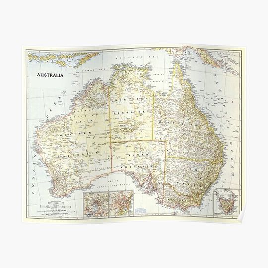
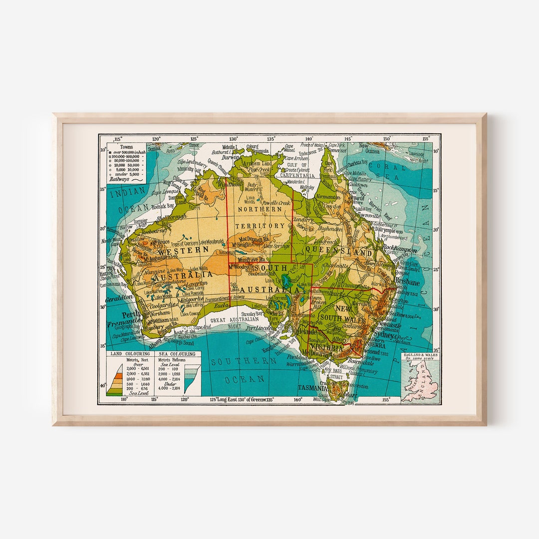
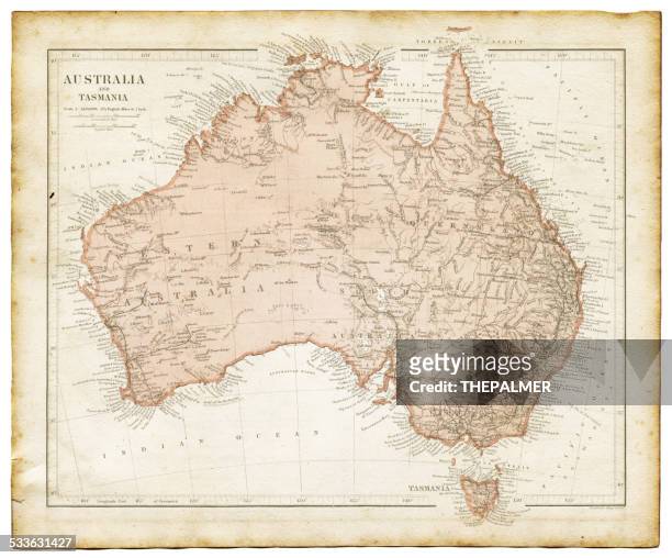
Vintage maps of Australia capture a moment when the continent was still being fully explored and understood by European settlers. The soft, muted colors—often shades of ochre, sage green, dusty rose, and faded blue—lend an air of romance and nostalgia. Unlike modern digital maps, these older prints often feature ornate borders, elaborate compass roses, and handwritten calligraphy. The paper itself may show foxing (age spots) or a gentle yellowing that adds depth and character. For many, owning a vintage or reproduction map of Australia is not just about geography; it is about connecting with a time when mapmaking was as much an art as a science. The imperfections and stylized depictions of mountains, rivers, and coastlines invite the viewer to imagine the journeys of early explorers.

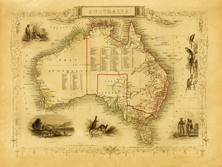
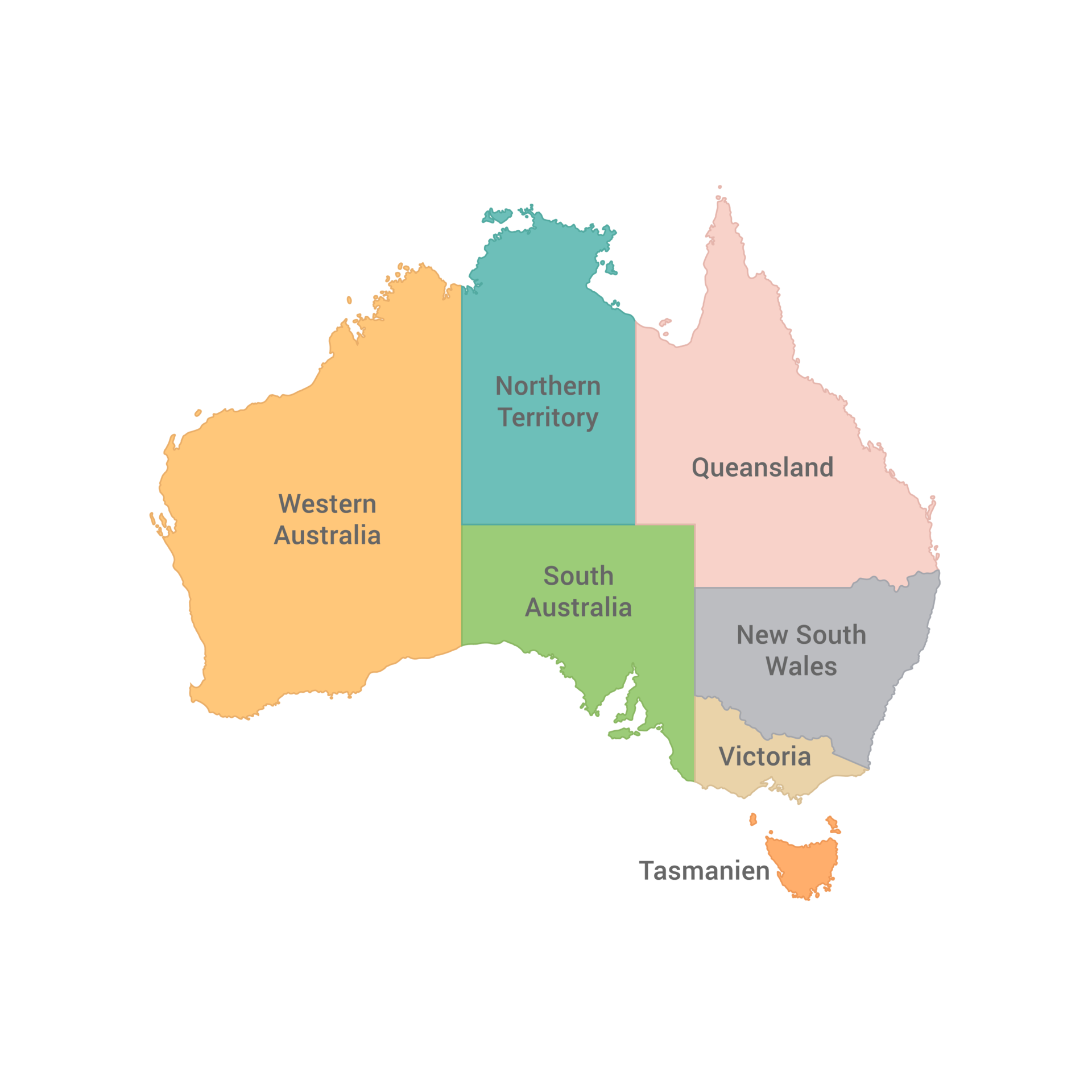
New South Wales: The Mother Colony
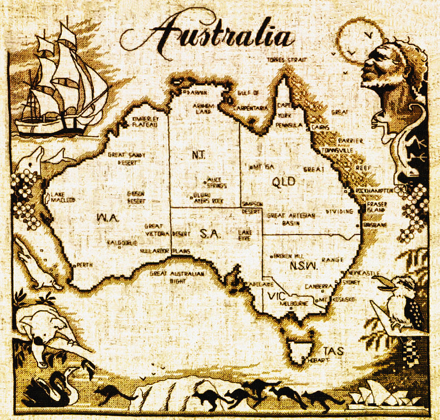
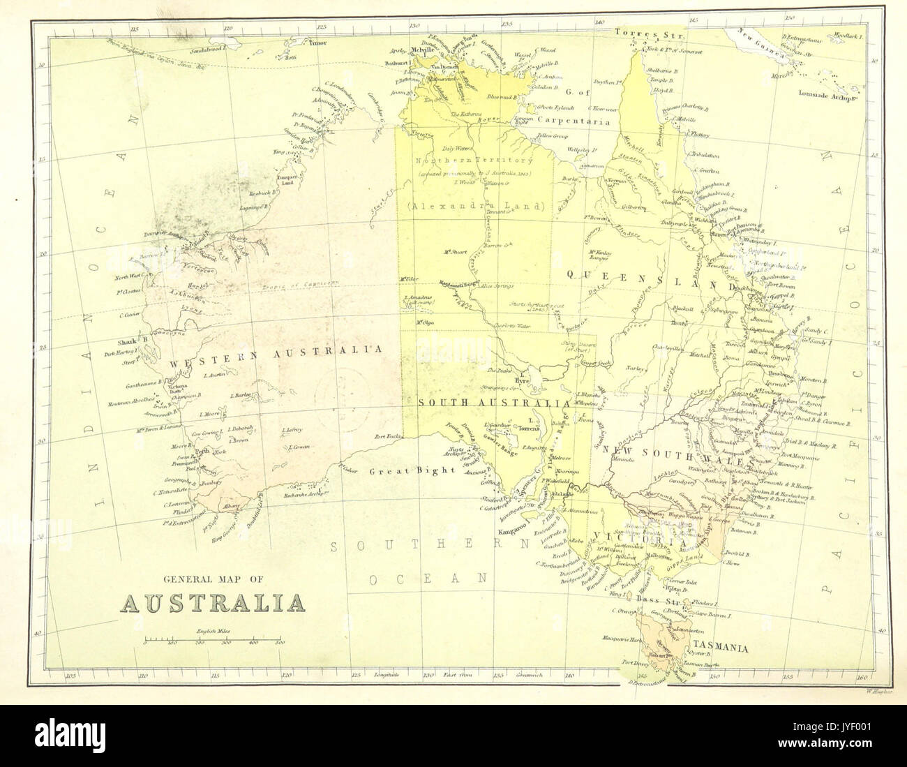
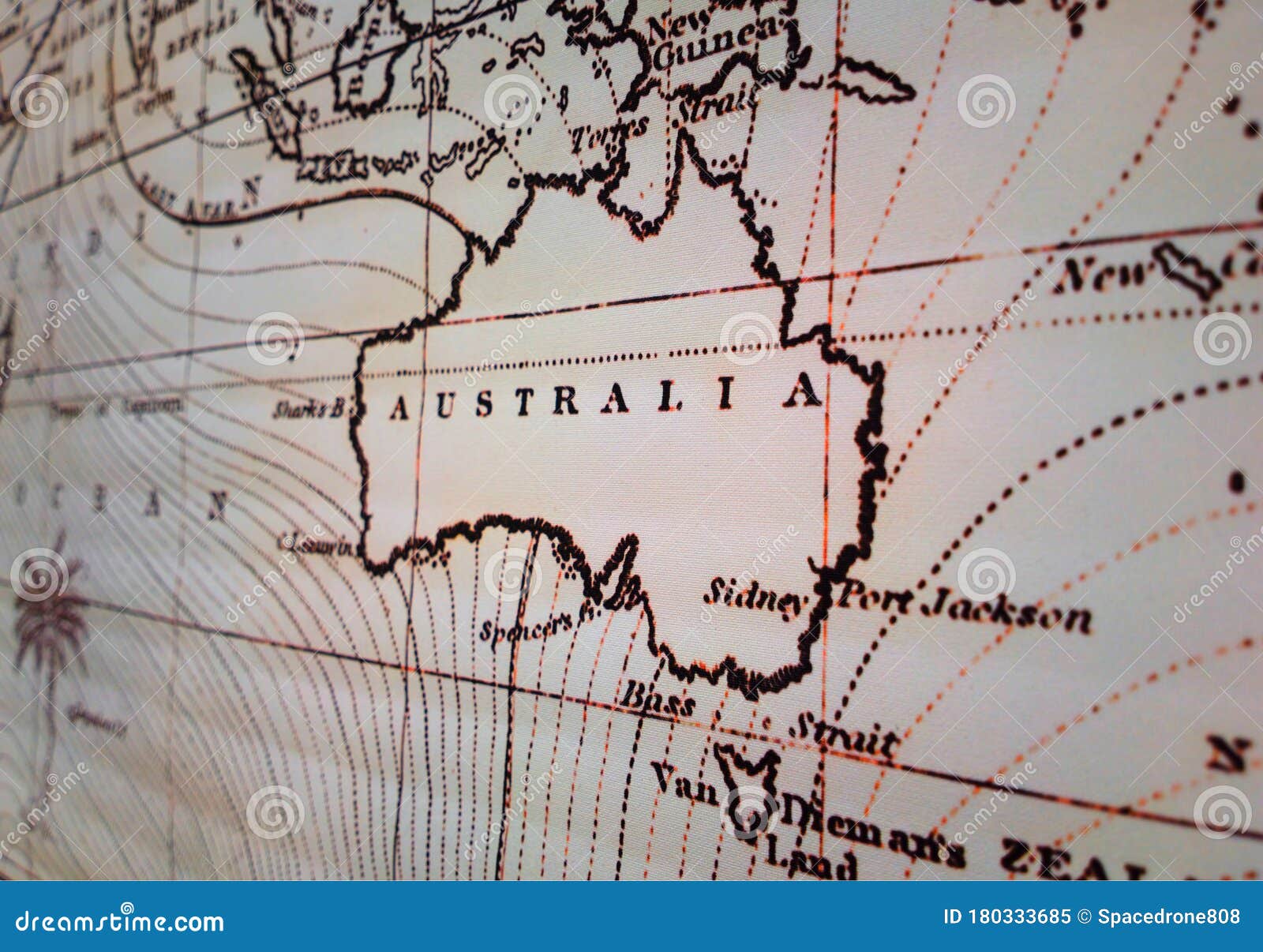
On vintage maps, New South Wales (NSW) often appears as the largest and most prominent state, reflecting its status as the first British colony established in 1788. Early maps show its sprawling boundaries extending far westward, sometimes covering what is now Queensland and Victoria. In antique prints, you will typically see the city of Sydney marked with a bold star or a small illustration of Sydney Harbour. The coastal regions are detailed with fjord-like inlets and the Great Dividing Range is depicted as a series of jagged mountain peaks. Later vintage maps, from the late 19th and early 20th centuries, begin to show NSW in its modern shape, with the Murray River forming a clear southern border. The coloring is often a warm, sunbaked yellow or light green, emphasizing the agricultural lands of the Riverina and the pastoral runs of the western slopes.
Victoria: The Gold Rush Land
Victoria separated from New South Wales in 1851, and vintage maps from the mid-19th century reveal its rapid development during the gold rush era. These maps often highlight goldfields with small symbols or text in a delicate serif font. The capital, Melbourne, is frequently shown as a large, detailed urban grid, reflecting its boomtown growth. On older maps, the coastline around Port Phillip Bay is drawn with great care, and the Great Ocean Road area is marked with dramatic cliffs. The state's shape on vintage prints is already recognizable, though the boundaries drawn through the Murray River are sometimes depicted more stylistically, with the river appearing as a thick blue ribbon. Colors for Victoria tend toward richer greens and browns, representing its lush forests and temperate farmland. Collectors prize maps that show the "golden triangle" near Ballarat and Bendigo.
Queensland: The Tropical Frontier
Vintage maps of Queensland evoke a sense of vast, untamed wilderness. Initially part of New South Wales, Queensland was proclaimed a separate colony in 1859. Old maps often illustrate its immense size, stretching from the subtropical south to the tropical north. The Great Barrier Reef is a common feature, rendered as a dotted line or a series of tiny coral formations along the coast. The interior, known as the Outback, is frequently left largely blank or filled with subtle notations like "pastoral runs" or "unexplored territory." The city of Brisbane, marked near the southern coast, is shown as a modest settlement compared to Sydney or Melbourne. On many vintage maps, Queensland's color is a pale apricot or light tan, suggesting its warm climate and dry interior. The shipwreck-prone coastline is often annotated with warnings or the names of dangerous reefs.
South Australia: The Colony of Freedom
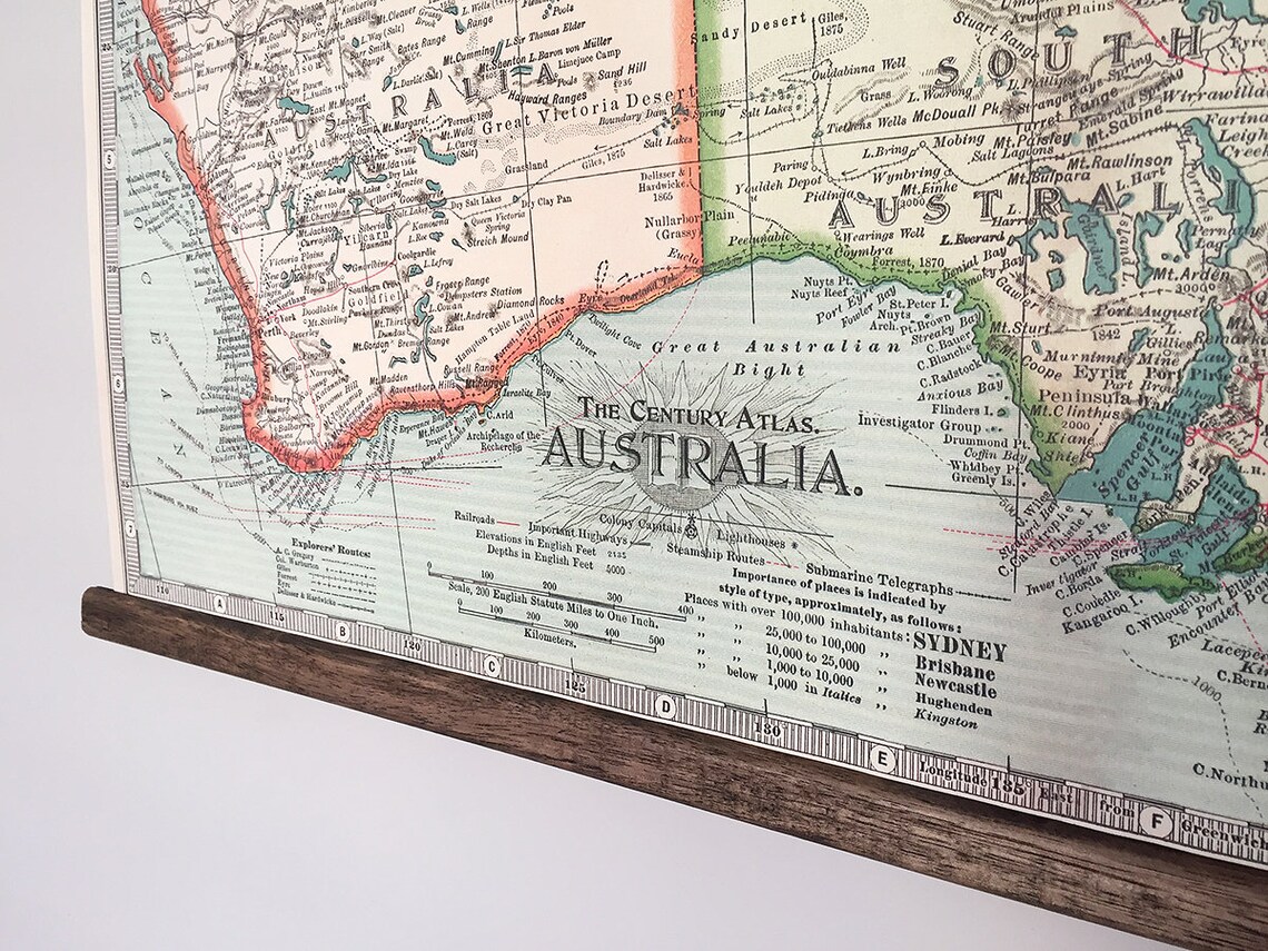
South Australia was unique among Australian colonies as it was founded by free settlers, not convicts. Vintage maps of this state emphasize its orderly survey system, with many early prints showing a grid of "hundreds" (land divisions) radiating from Adelaide. The city of Adelaide itself is frequently drawn as a perfect grid of streets, surrounded by parklands. On older maps, the vast Lake Eyre basin and the Flinders Ranges are depicted with dramatic shading and hachure marks. The coastline of the Great Australian Bight is shown as a smooth, sweeping curve, often with tiny anchor symbols near ports like Port Augusta. The coloring for South Australia on vintage maps is usually a pale pink or lavender, a distinctive choice that makes the state stand out against the greens and yellows of its neighbors. The Murray River's lower reaches form the border with Victoria, and riverboats are sometimes illustrated along its course.
Western Australia: The Massive Unknown
Western Australia occupies nearly one-third of the continent, and vintage maps capture its immense scale and the mystery of its interior. Early maps show a stark, largely empty interior, with only a few coastal settlements like Perth, Fremantle, and Albany marked. The Nullarbor Plain is often noted across the southern coast, while the Kimberley region in the north is drawn with rugged, unclear boundaries. The Swan River Colony (the early name for Perth) is frequently highlighted with a small illustration of the Swan River winding through the landscape. On vintage maps from the 1880s onward, gold rush locations like Coolgardie and Kalgoorlie appear, denoted by small circles or stars. The color used for Western Australia is often a deep, sun-bleached yellow or orange, reflecting its arid environment. The long, isolated coastline is drawn with careful attention to the many bays and capes.
Tasmania: The Island State
Tasmania, originally called Van Diemen's Land, is always a striking feature on vintage maps of Australia due to its island form and distinctive shape. Early maps frequently showed the island with a more rugged, jagged coastline than modern cartography, and its mountainous interior is often depicted with dense clusters of hachure lines or small, detailed peaks. The capital, Hobart, is marked at the foot of Mount Wellington, which is often drawn as a prominent natural landmark. On vintage maps, Tasmania's separate identity is emphasized, and it is common to see the island illustrated in a darker green or forest brown, contrasting with the lighter colors of the mainland. The Bass Strait, separating Tasmania from Victoria, is usually drawn with navigational lines and small islands like King Island and Flinders Island clearly marked. These maps remind us of Tasmania's rich convict history and its role as a whaling and timber hub.
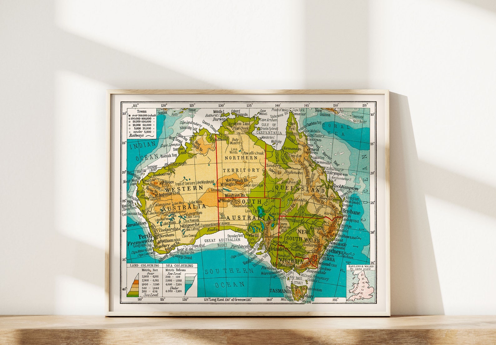
Northern Territory and the Australian Capital Territory
The Northern Territory did not become a self-governing territory until the 20th century, but it appears on many vintage maps from the late 19th century as part of South Australia (until 1911). On these older maps, the vast, sparsely populated region is often simply labeled "Northern Territory" in a modest font. The town of Darwin (formerly Palmerston) is shown as a small circle on the north coast, while Alice Springs is often absent or represented as a tiny outpost. The Australian Capital Territory (ACT) is a much later addition, only appearing on maps after 1908 when Canberra was selected as the site for the national capital. On early 20th-century vintage maps, the ACT is delineated as a small, irregularly shaped enclave within New South Wales. The planned city of Canberra is sometimes shown as a starburst pattern of roads and concentric circles.
Decorative Elements and Artistic Style
What truly sets vintage maps apart is their decorative artistry. Many antique Australian maps are framed by intricate borders featuring flora like eucalyptus leaves and wattle, or fauna such as kangaroos and emus. A detailed compass rose, often pointing north with a fleur-de-lis or an ornate arrow, adds to the aesthetic. In the margins, you might find small vignettes of indigenous Australians in traditional attire, or scenes of explorers with horses and camels. The title cartouche is often elaborate, enclosed in scrollwork or framed by symbols of commerce, such as ships and wool bales. The lettering is typically elegant and varied, using different scripts for country names, state names, and geographical features. These elements combine to create a visual object that is both informative and deeply pleasing to the eye, far removed from the sterile uniformity of modern digital maps.
Conclusion
Vintage maps of Australia offer a serene and enriching window into the past, where each state tells its own story through color, line, and artistry. From the sprawling promise of New South Wales to the tropical mystery of Queensland, the orderly grids of South Australia, and the immense unknown of Western Australia, these maps capture the spirit of a land being defined. They are more than just geographic guides—they are historical artifacts that preserve the hopes, explorations, and aesthetics of bygone eras. Whether displayed as a fine art print or studied for their cartographic detail, these vintage representations of Australia invite us to appreciate the evolving identity of the nation and the enduring beauty of handcrafted maps. By understanding the unique features of each state on these old charts, we gain a profound connection to the land and the generations who mapped it.
AUSTRALIA. Showing States And Railways. BARTHOLOMEW 1947 Old Vintage

AUSTRALIA. Showing states and railways. BARTHOLOMEW 1947 old vintage ...
Vintage Map Australia Hi-res Stock Photography And Images - Alamy

Vintage map australia hi-res stock photography and images - Alamy
Vintage Australia Map - Aged Map With Australia Shape

Vintage Australia Map - Aged Map with Australia Shape
Vintage Australia Map Free Stock Photo - Public Domain Pictures

Vintage Australia Map Free Stock Photo - Public Domain Pictures
Vintage Maps Of Australia

Vintage Maps of Australia
Vintage Australia Map Stock Image. Image Of Grunge, Country - 21985269
Vintage Australia map stock image. Image of grunge, country - 21985269
Vintage Map Of Australia | Vintage Map, Australia Map, Vintage Pictures

Vintage Map of Australia | Vintage map, Australia map, Vintage pictures
Australia Retro Vintage Looking Map Stock Photo - Alamy
Australia retro vintage looking map Stock Photo - Alamy
Vintage Map Australia Textbook Hi-res Stock Photography And Images - Alamy
Vintage map australia textbook hi-res stock photography and images - Alamy
Vintage MAP Of AUSTRALIA- Instant Download Digital Printable- Old
Vintage MAP of AUSTRALIA- Instant Download Digital Printable- Old ...
1939 Antique Map Of Australia Vintage Australia Map Gallery Etsy – Artofit

1939 antique map of australia vintage australia map gallery etsy – Artofit
Vintage Paper Map Of Australia Stock Photo - Alamy
Vintage paper map of Australia Stock Photo - Alamy
Vintage Map Of Australia

Vintage Map of Australia
Vintage Map Of Australia Stock Videos & Footage - HD And 4K Video Clips
Vintage map of australia Stock Videos & Footage - HD and 4K Video Clips ...
VINTAGE AUSTRALIA MAP Vintage Map Of Australia Australia - Etsy
VINTAGE AUSTRALIA MAP Vintage Map of Australia Australia - Etsy
Vintage Map Of Australia 1937 Poster By Design Turnpike - Pixels

Vintage Map of Australia 1937 Poster by Design Turnpike - Pixels
Australian States Map Pages. Vintage Encyclopaedia Pages For Junk
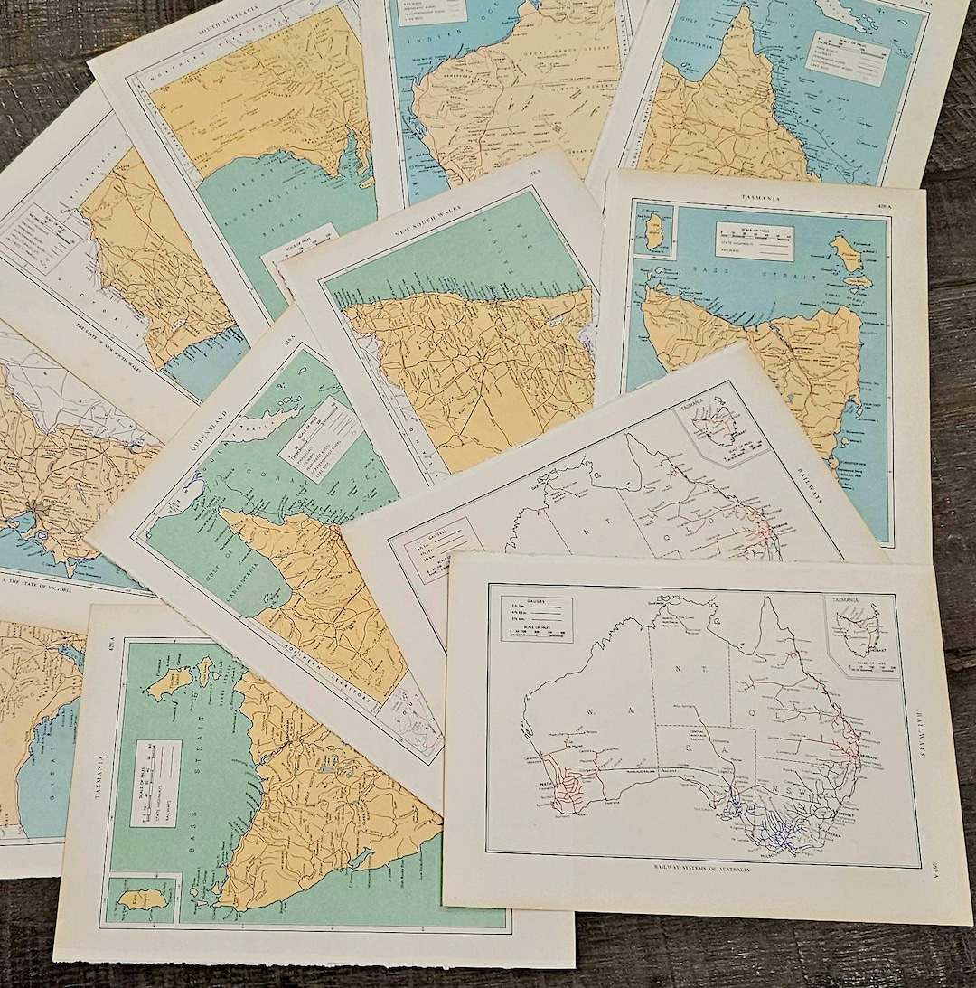
Australian States Map Pages. Vintage Encyclopaedia Pages for Junk ...
Vintage Australia Map 1948 Antique Map Of Map Painting By Roxanne Owen

Vintage Australia Map 1948 Antique Map Of Map Painting by Roxanne Owen ...
Vintage Australia Map Stock Photo. Image Of Geography - 96767552

Vintage Australia map stock photo. Image of geography - 96767552
Australia Map Vintage Stock Photos, Pictures & Royalty-Free Images - IStock

Australia Map Vintage Stock Photos, Pictures & Royalty-Free Images - iStock
Vintage Australia Map 1948 | Antique Map Of Australia | Australia
Vintage Australia Map 1948 | Antique Map Of Australia | Australia ...
Vintage Australia Map Reproduction - Etsy
Vintage Australia Map Reproduction - Etsy
Vintage Map Of Australia | Royalty-Free Vector Stock | FreeImages

Vintage Map Of Australia | Royalty-Free Vector Stock | FreeImages
VINTAGE AUSTRALIA MAP, Vintage Map Of Australia, Australia Map Print
VINTAGE AUSTRALIA MAP, Vintage Map of Australia, Australia Map Print ...
A Vintage Map Of Australia. Stock Photo - Image Of Gazeteer, Globe

A Vintage Map of Australia. Stock Photo - Image of gazeteer, globe ...
Old Map Australia 1851 Vintage Map On Luulla
Old Map Australia 1851 Vintage Map on Luulla
Vintage Decorative Map Of Australia By Nicoolay
Vintage Decorative Map Of Australia by Nicoolay
Item Details

Item Details
Vintage Australia Map 1948 | Antique Map Of Australia | Australia

Vintage Australia Map 1948 | Antique Map Of Australia | Australia ...
1,813 Vintage Australia Map Stock Photos, High-Res Pictures, And Images
1,813 Vintage Australia Map Stock Photos, High-Res Pictures, and Images ...
Map, Australia Map, Vintage Maps

Map, Australia map, Vintage maps
Vintage Australia Map Stock Photography | CartoonDealer.com #96767552
Vintage Australia Map Stock Photography | CartoonDealer.com #96767552
Australia Map Vector With States In Illustrator, SVG, JPG,, 47% OFF
Australia Map Vector With States In Illustrator, SVG, JPG,, 47% OFF