Explore South America: A Fun Guide to Countries and Capitals for Kids
Welcome, young explorer! Have you ever looked at a map of South America and wondered about all the amazing countries and their capital cities? This guide is just for you. We’re going to take a journey across this incredible continent, learning about each country and the special city that serves as its capital. By the end, you’ll be able to point out Brazil, remember the capital of Peru, and impress your friends with fun facts about this land of rainforests, mountains, and vibrant cultures. Let’s get started!
Why Learn the Map of South America?
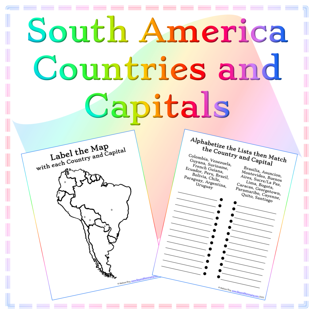
South America is a continent full of wonders. It has the world’s largest rainforest, the mighty Amazon River, and the towering Andes Mountains. Knowing where each country is and what its capital is called helps you understand how people live, what languages they speak, and why each place is special. Think of it like learning the address of a huge, exciting neighborhood. Once you know the capitals, you can picture where cities like Buenos Aires or Lima are located, and it makes reading about the world much more fun.

The Northern Countries and Their Capitals
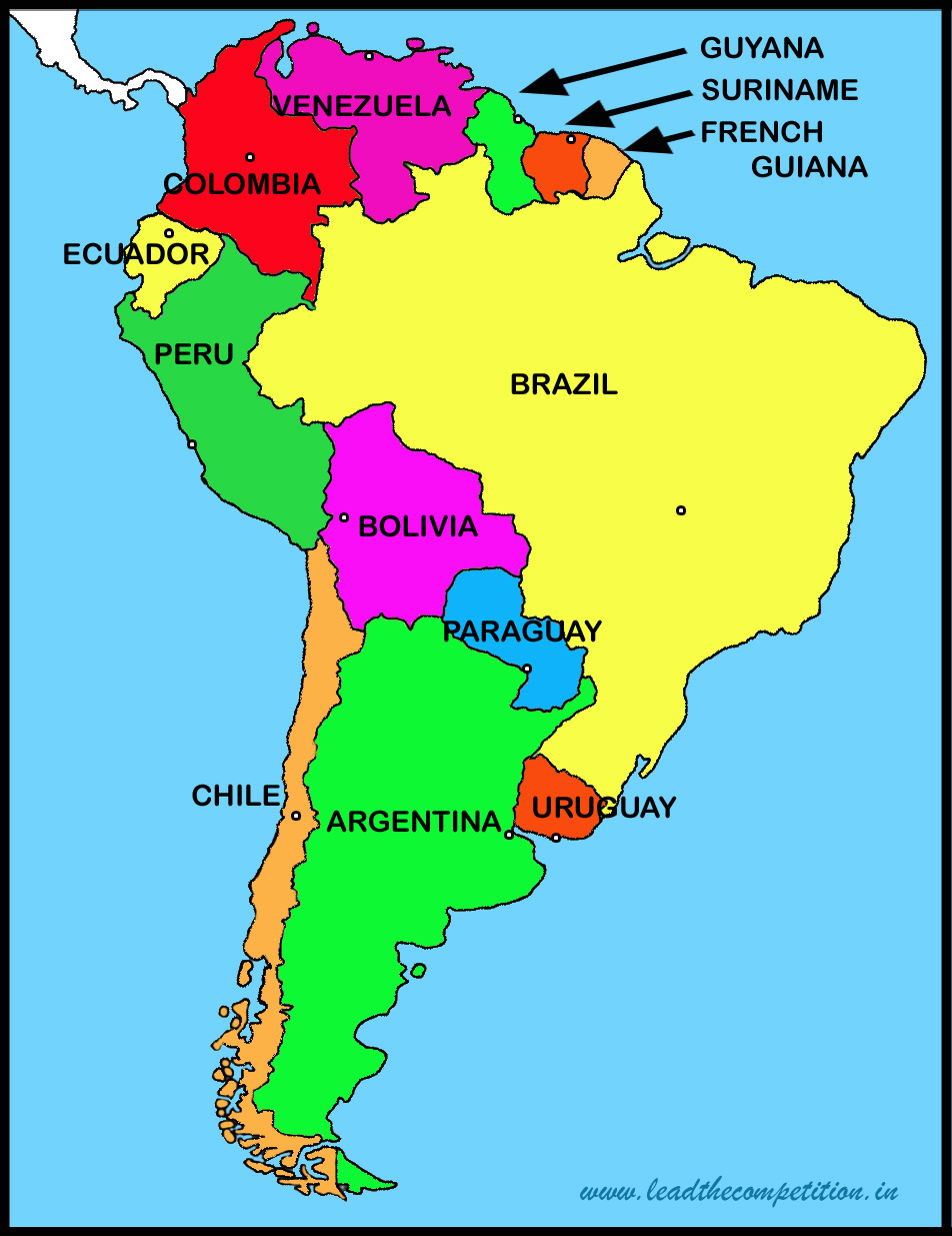
Let’s start at the top of South America. The northern part of the continent is warm, tropical, and close to the Caribbean Sea. Here, you’ll find countries that are full of beaches, rainforests, and friendly people.
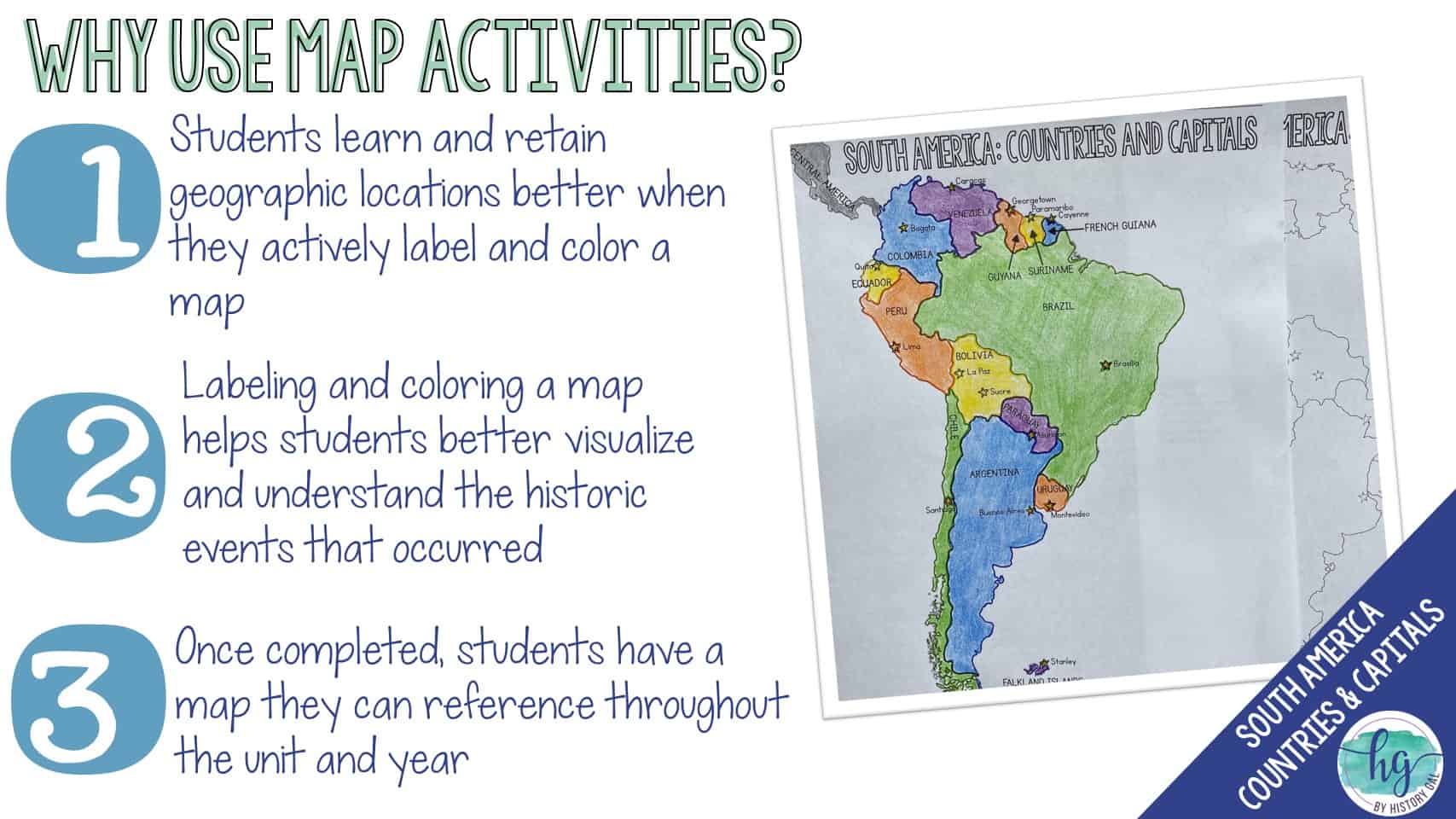
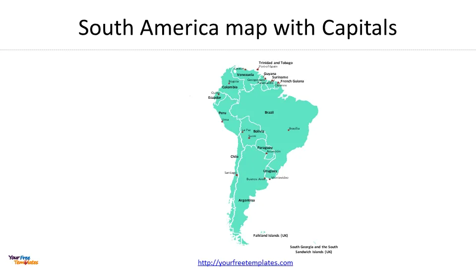
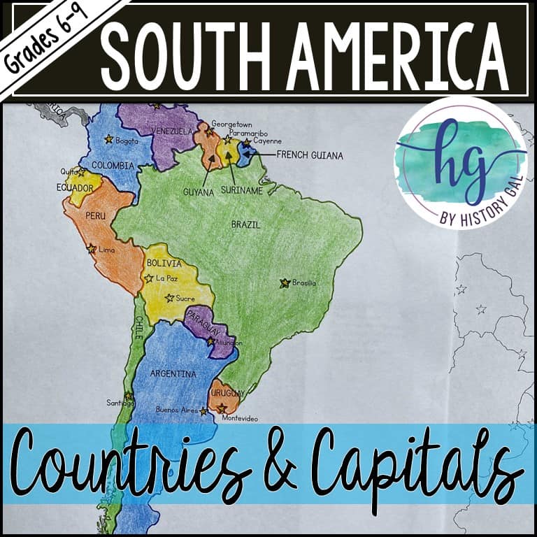
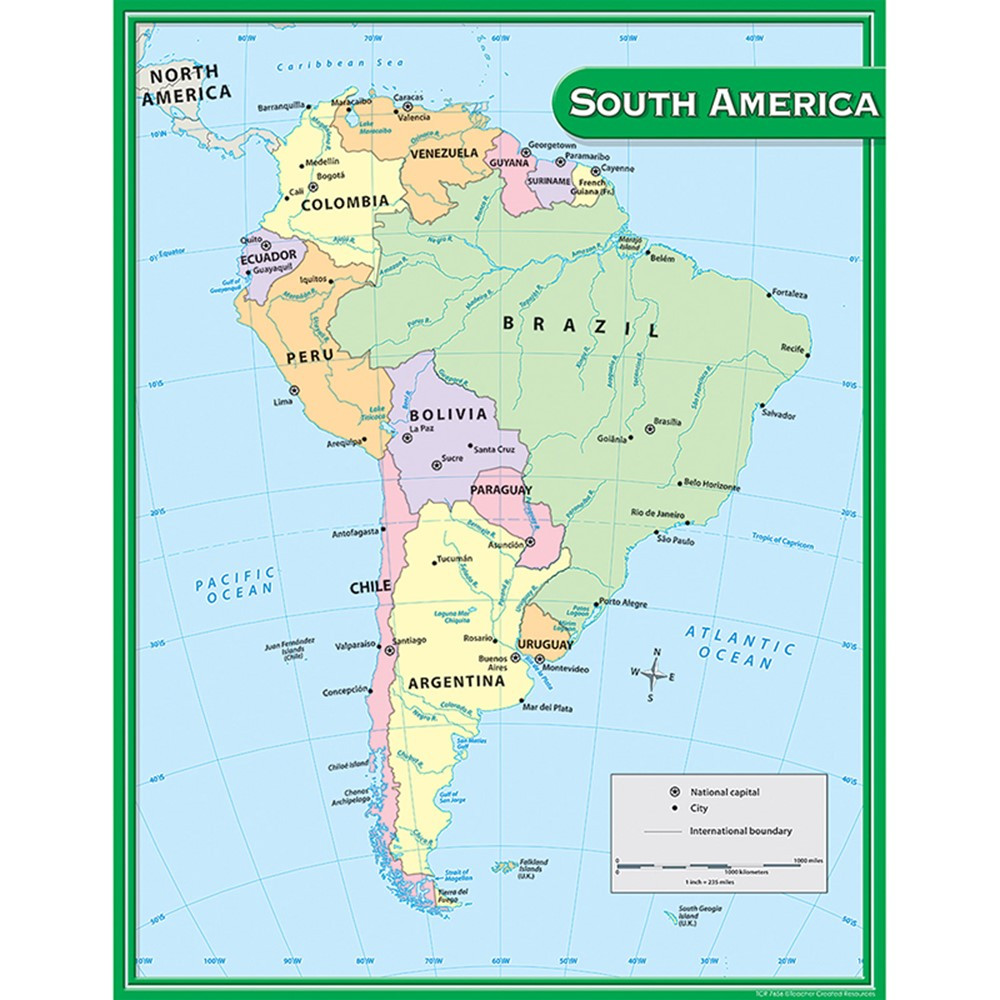
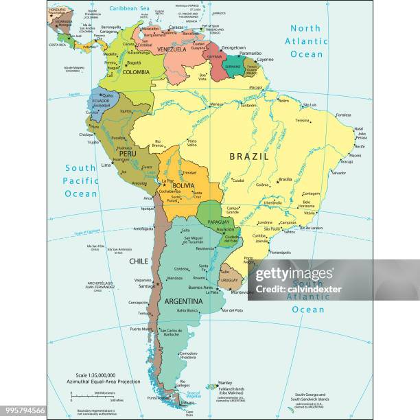
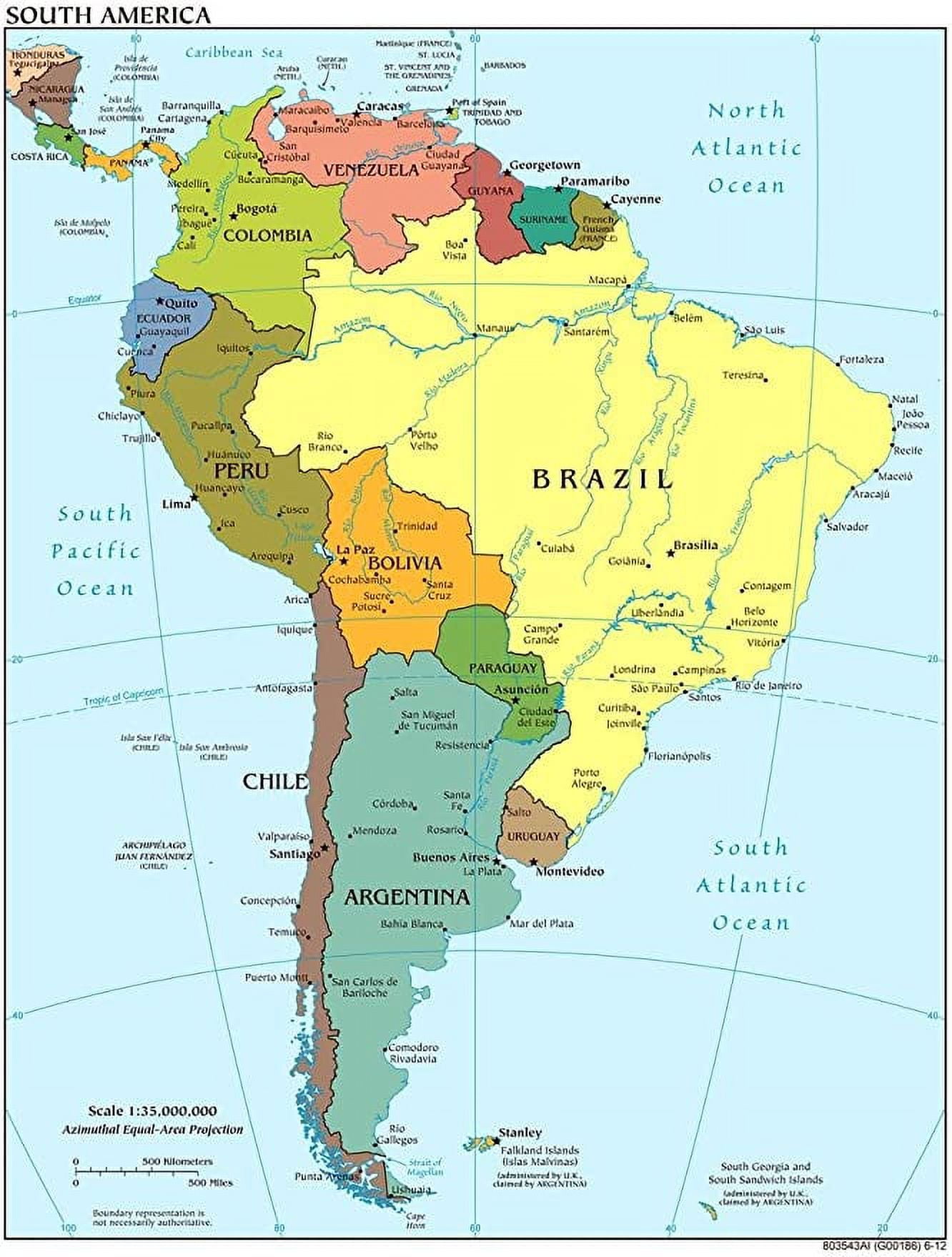
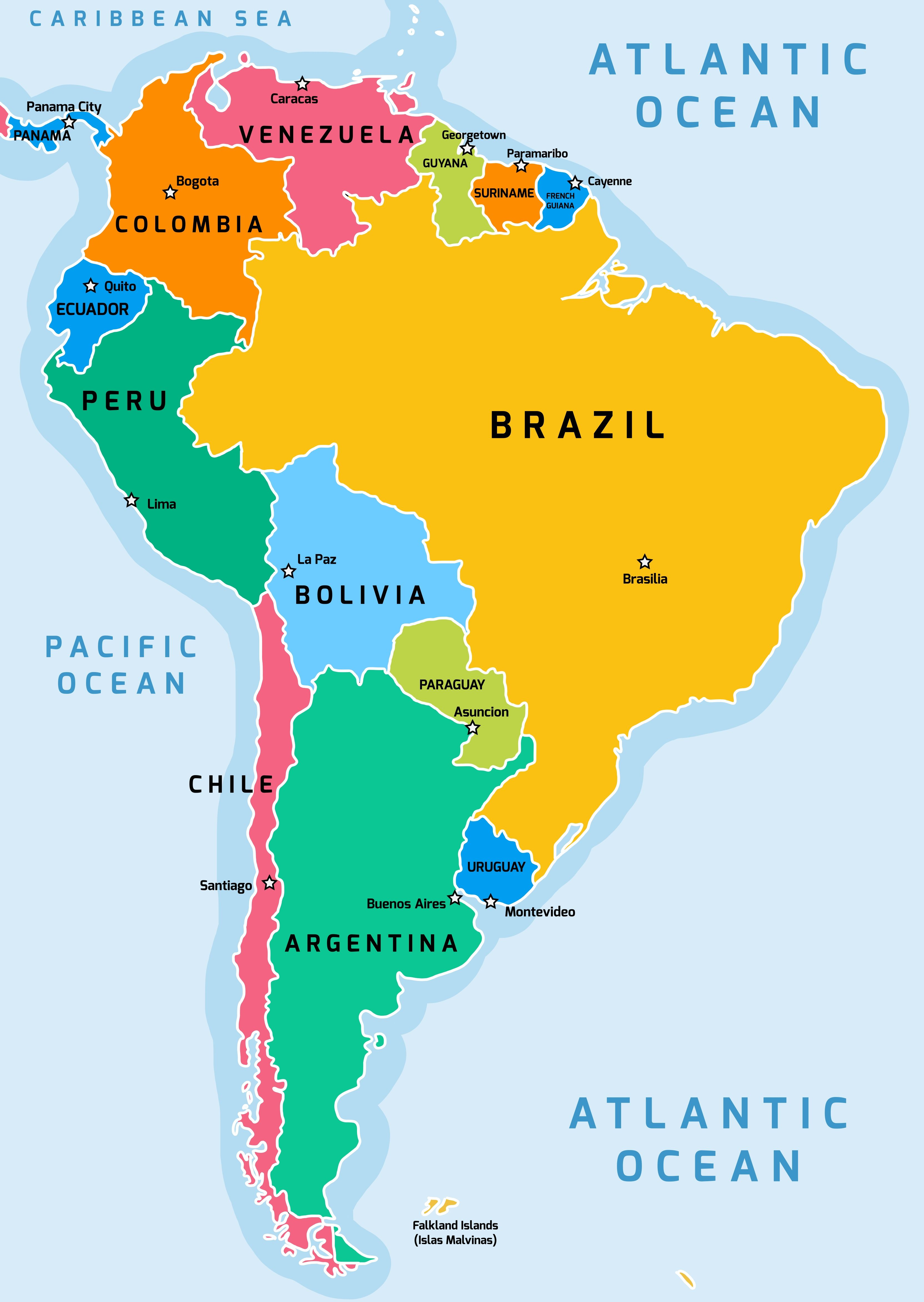
Colombia is the only South American country with coastlines on both the Pacific Ocean and the Caribbean Sea. Its capital is Bogotá, a huge city high up in the mountains. Next, Venezuela has the world’s tallest waterfall, Angel Falls, and its capital is Caracas. Don’t forget the small but fascinating countries: Guyana (capital: Georgetown), Suriname (capital: Paramaribo), and French Guiana (which is actually a part of France, with its capital at Cayenne). These countries have rich languages and cultures, and their capitals are gateways to incredible nature.
The Mighty Amazon Basin and Its Capitals
Covering much of the northern and central part of the continent, the Amazon rainforest is a gigantic green space. It stretches across several countries. The biggest share belongs to Brazil, the largest country in South America. Brazil’s capital is Brasília, a city shaped like an airplane when viewed from above! Not far from the Amazon, you’ll find Ecuador, which sits right on the Equator. Its capital is Quito, one of the highest capital cities in the world. Peru is famous for the ancient Incan ruins of Machu Picchu, and its capital is Lima, a bustling city right on the Pacific coast. Also in this region is Bolivia, which has two capitals: Sucre is the constitutional capital, and La Paz is the administrative capital, sitting high in the Andes.
The Andes Mountains and the West Coast
Running like a spine down the entire western side of South America are the Andes Mountains. This is where you’ll find extremely high peaks, active volcanoes, and unique wildlife like llamas and alpacas. The countries here have capitals that are often nestled in valleys or high plateaus.
Starting from the north, Ecuador (as we mentioned) has Quito. Heading south, Peru has Lima on the coast. Further down is Chile, a very long, narrow country that stretches all the way to the tip of the continent. Its capital is Santiago, surrounded by mountains. On the other side of the Andes from Chile lies Argentina, a huge country known for tango dancing and delicious steak. Its capital is Buenos Aires, a lively city that feels like a mix of Europe and Latin America. Between Peru and Chile is Bolivia with its high-altitude capitals.
The Southern Cone and its Capitals
The very bottom of South America is called the Southern Cone. It’s cooler here, with vast grasslands called the Pampas, glaciers, and the famous Patagonia region. Argentina dominates much of this area, and we already know its capital is Buenos Aires. Next to Argentina is Uruguay, a small, peaceful country on the Atlantic coast. Its capital is Montevideo, a charming city with beautiful beaches. Finally, Paraguay is a landlocked country (without a coastline) in the heart of the continent. Its capital is Asunción, one of the oldest cities in South America. Together, these three countries form a region with a rich history of gauchos (cowboys) and mate tea.
Fun Facts About South American Capitals
Learning capitals can be tricky, but here are some cool tricks to remember them: Did you know that Lima, Peru, is one of the driest capital cities in the world, getting almost no rain? Or that Brasília, Brazil, was built in just 41 months during the 1950s? Quito in Ecuador is so high that some people get dizzy when they first arrive. And Buenos Aires in Argentina has more bookshops per person than almost any other city in the world. Thinking about these special details makes each capital easy to remember when you look at a map.
Conclusion
You’ve now taken a fantastic trip across South America, learning its countries and capitals from the top to the bottom. From the Amazon rainforest to the snowy Andes, from the sunny beaches of the Caribbean to the windswept plains of Patagonia, each capital city tells a story about its country. Whether you are studying for a geography test or just curious about the world, you now have a great foundation. Next time you see a map of South America, you can confidently point to Brasília, Lima, Quito, Buenos Aires, and the rest. Keep exploring, and remember that every capital city is someone’s home, full of life and adventure!
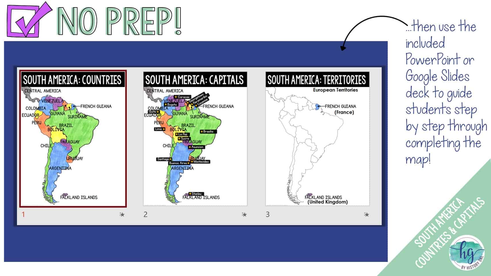
South America Countries And Capitals Map (Print And Digital) - By

South America Countries and Capitals Map (Print and Digital) - By ...
South America Countries And Capitals Map (Print And Digital) - By

South America Countries and Capitals Map (Print and Digital) - By ...
South-America-Capitals-2 - Free PowerPoint Template
South-America-Capitals-2 - Free PowerPoint Template
South America Map With States And Capitals United States Map
South America Map With States And Capitals United States Map
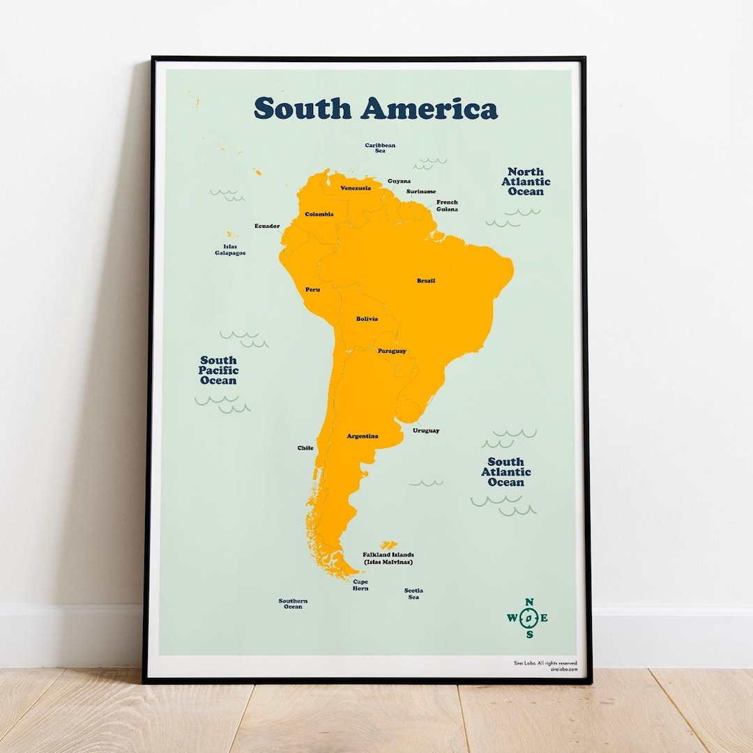
South America Countries And Capitals
South America Countries and Capitals
South America Map Chart - TCR7656 | Teacher Created Resources | Maps
South America Map Chart - TCR7656 | Teacher Created Resources | Maps ...
Latin America Political Map With Capitals
Latin America Political Map With Capitals
South America Countries And Capitals Map (Print And Digital) - By
South America Countries and Capitals Map (Print and Digital) - By ...
South America Countries And Capitals Map (Print And Digital) - By
South America Countries and Capitals Map (Print and Digital) - By ...
1,020 South America Map With Capitals Stock Photos, High-Res Pictures
1,020 South America Map With Capitals Stock Photos, High-Res Pictures ...
South America Countries And Capitals Map (Print And Digital) - By
South America Countries and Capitals Map (Print and Digital) - By ...
South America Countries And Capitals Map (Print And Digital) - By
South America Countries and Capitals Map (Print and Digital) - By ...
Premium Photo | Discover The Wonders Of South America A Fun And

Premium Photo | Discover the Wonders of South America A Fun and ...
South America Countries And Capitals Map (Print And Digital) - By
South America Countries and Capitals Map (Print and Digital) - By ...
South America Countries And Capitals Map (Print And Digital) - By
South America Countries and Capitals Map (Print and Digital) - By ...
Printable South America Map For Kids Homeschool Learning Latin America
Printable South America Map for Kids Homeschool Learning Latin America ...
South America Countries And Capitals Map (Print And Digital) - By

South America Countries and Capitals Map (Print and Digital) - By ...
South America Countries And Capitals Map (Print And Digital) - By

South America Countries and Capitals Map (Print and Digital) - By ...
South America Map Labels - Capitals By Moments For Montessori | TPT

South America Map Labels - Capitals by Moments for Montessori | TPT
Printable South America Map With Capitals - Printable Free Templates
Printable South America Map With Capitals - Printable Free Templates
Central And South America Map With Capitals
Central And South America Map With Capitals
United States Of America Map With Capitals Printable Map

United States Of America Map With Capitals Printable Map
South America Countries And Capitals Map (Print And Digital) - By

South America Countries and Capitals Map (Print and Digital) - By ...
South America Countries And Capitals Map (Print And Digital) - By
South America Countries and Capitals Map (Print and Digital) - By ...
South America Countries And Capitals Map (Print And Digital) - By
South America Countries and Capitals Map (Print and Digital) - By ...
Map Of South America Printable

Map Of South America Printable
Identifying The Countries And Capitals Of South America - KS2

Identifying the countries and capitals of South America - KS2 ...
South America Map With Capitals Printable - Printable Free Templates

South America Map With Capitals Printable - Printable Free Templates
The 13 Capital Cities Of South America (Map Included) - The Facts Institute
The 13 Capital Cities of South America (Map Included) - The Facts Institute
South America Maps With Capitals

South America Maps With Capitals
South America Capitals Quiz - Quiz.now
South America Capitals Quiz - Quiz.now
Free Printable Map Of South America (Labeled) - The Facts Institute

Free Printable Map of South America (Labeled) - The Facts Institute
South America Political Map With Capitals
South America Political Map With Capitals