World Map of Ocean Currents: A Comprehensive Guide to Global Circulation Patterns
Have you ever wondered what invisible forces shape the climate of entire continents, guide the migrations of marine life, and connect distant shores? The answer lies in the vast, dynamic network of ocean currents that flow across our planet. In this guide, you will explore the world map of ocean currents, learning what drives these massive water movements, how to identify major currents by name and location, and why they are essential to understanding global weather, ecosystems, and even human history. Whether you are a student, a curious traveler, or a climate enthusiast, this deep dive will transform the way you see the blue expanse of the world's oceans.
What Are Ocean Currents and Why Do They Matter?
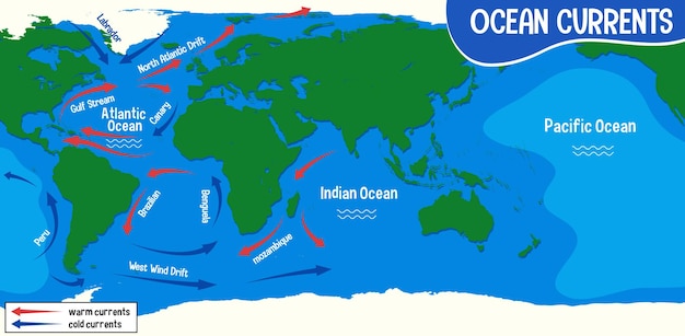
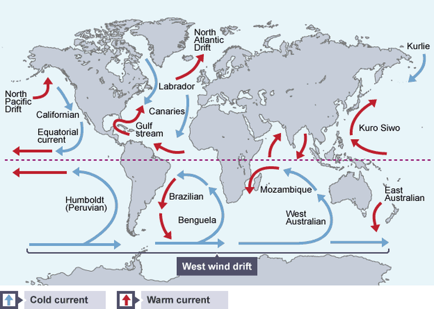
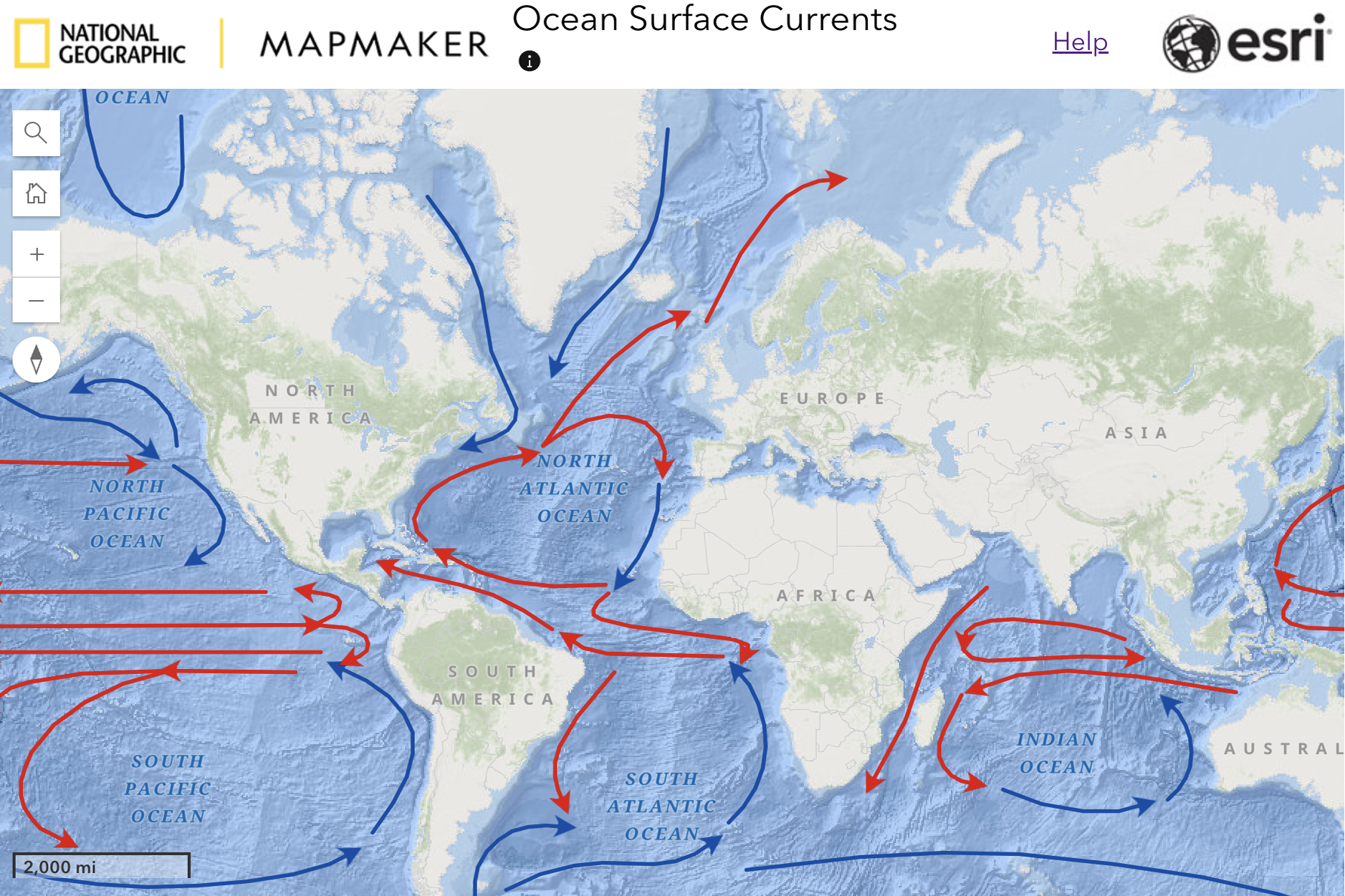
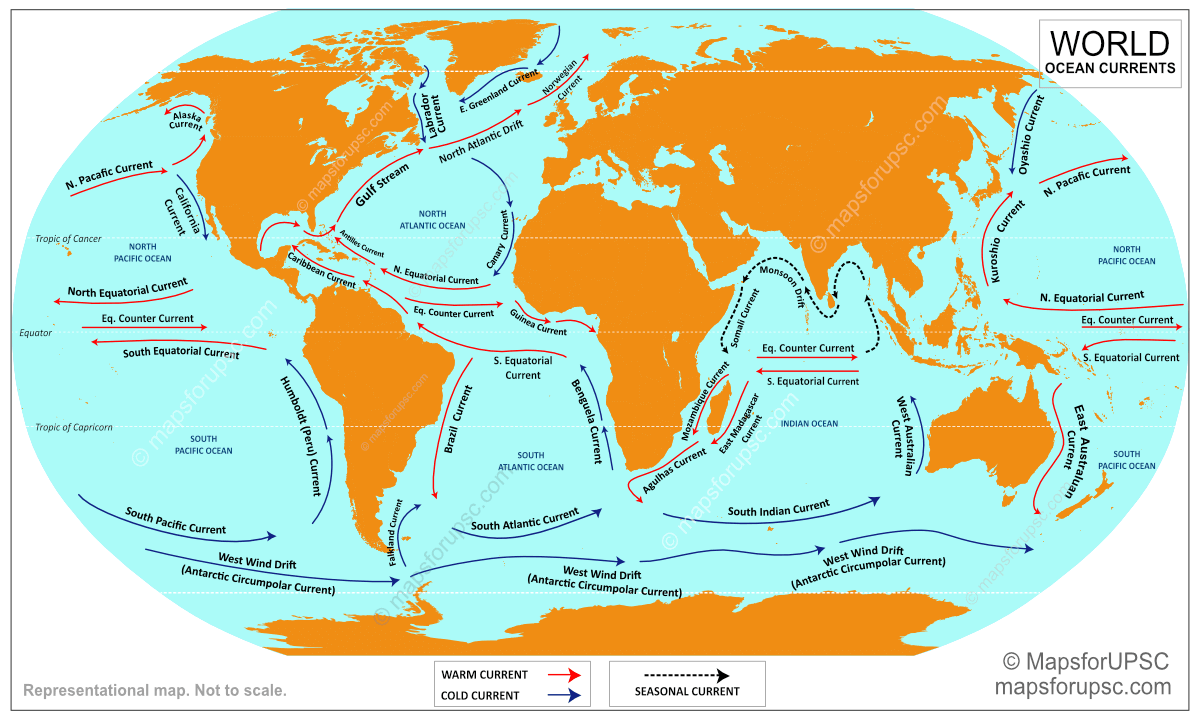
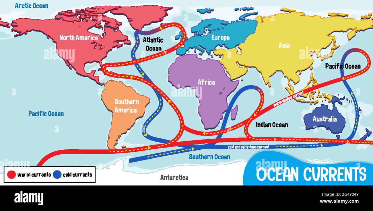
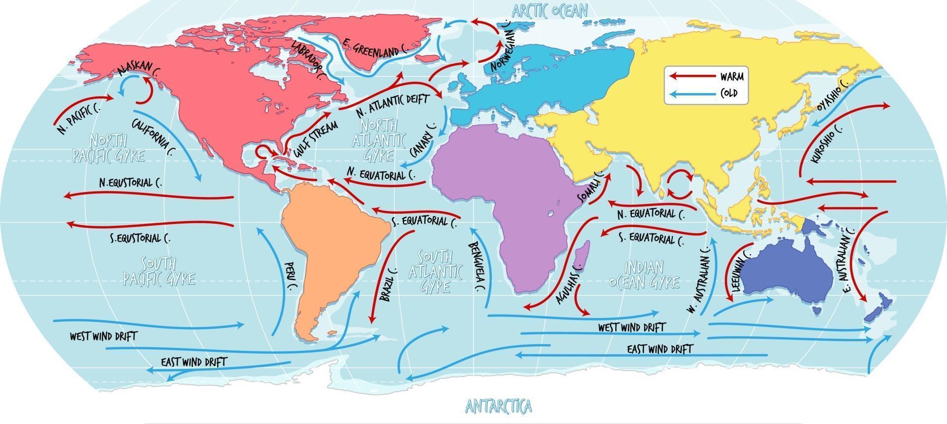
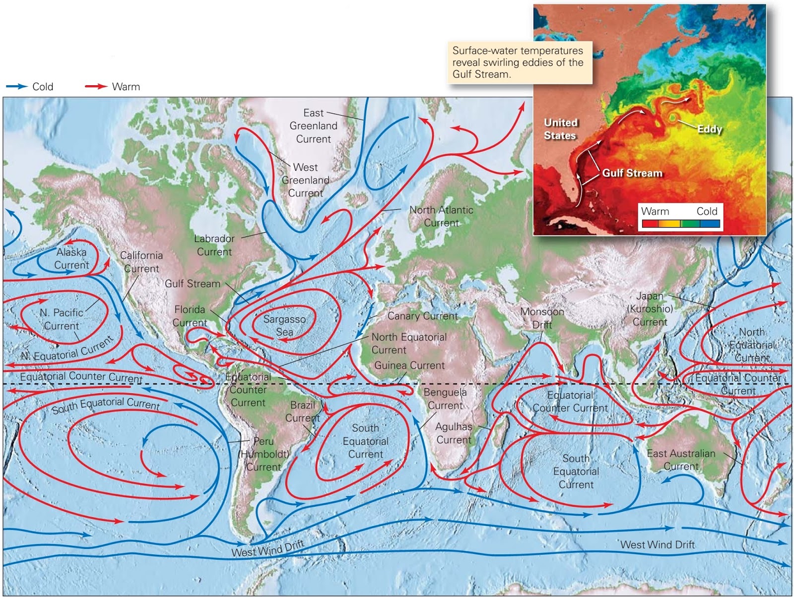
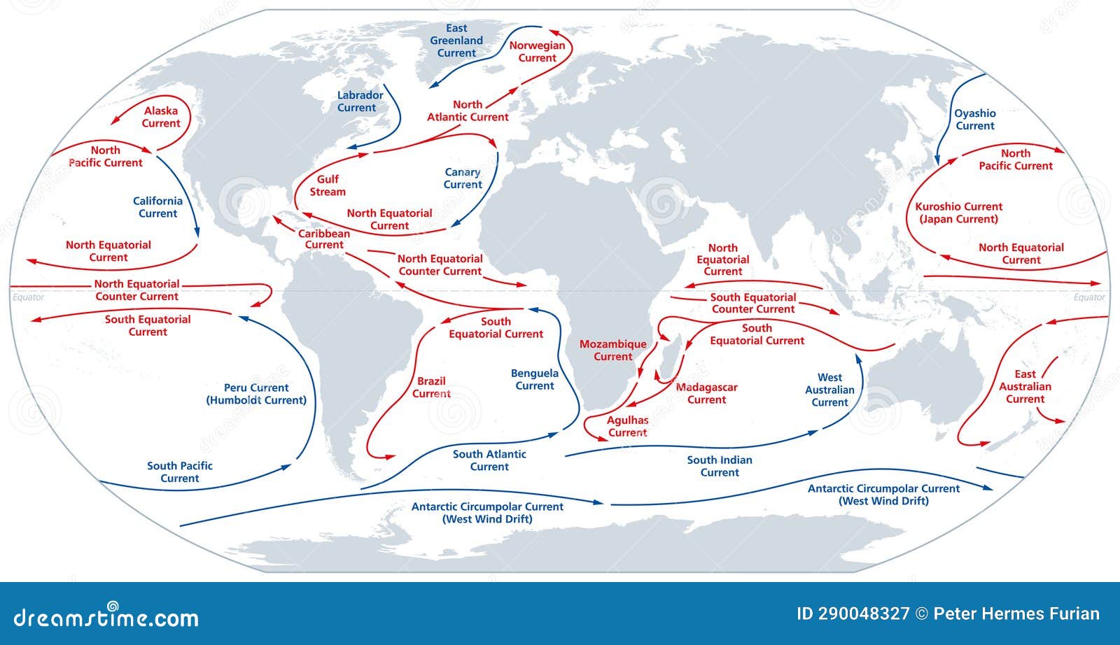
Ocean currents are continuous, directed movements of seawater generated by a combination of forces including wind, the Earth's rotation (the Coriolis effect), temperature differences, and salinity gradients. Think of them as the planet's circulatory system—transporting heat from the equator toward the poles and redistributing nutrients that sustain marine food webs. A world map of ocean currents reveals a complex choreography of warm and cold flows that directly influence coastal climates. For instance, the warm Gulf Stream keeps Western Europe milder than comparable latitudes in North America, while the cold California Current brings fog and rich fisheries to the U.S. West Coast. Without these currents, regional temperatures would be far more extreme, and ocean life would be far less abundant.

Major Surface Currents: The Five Great Ocean Gyres
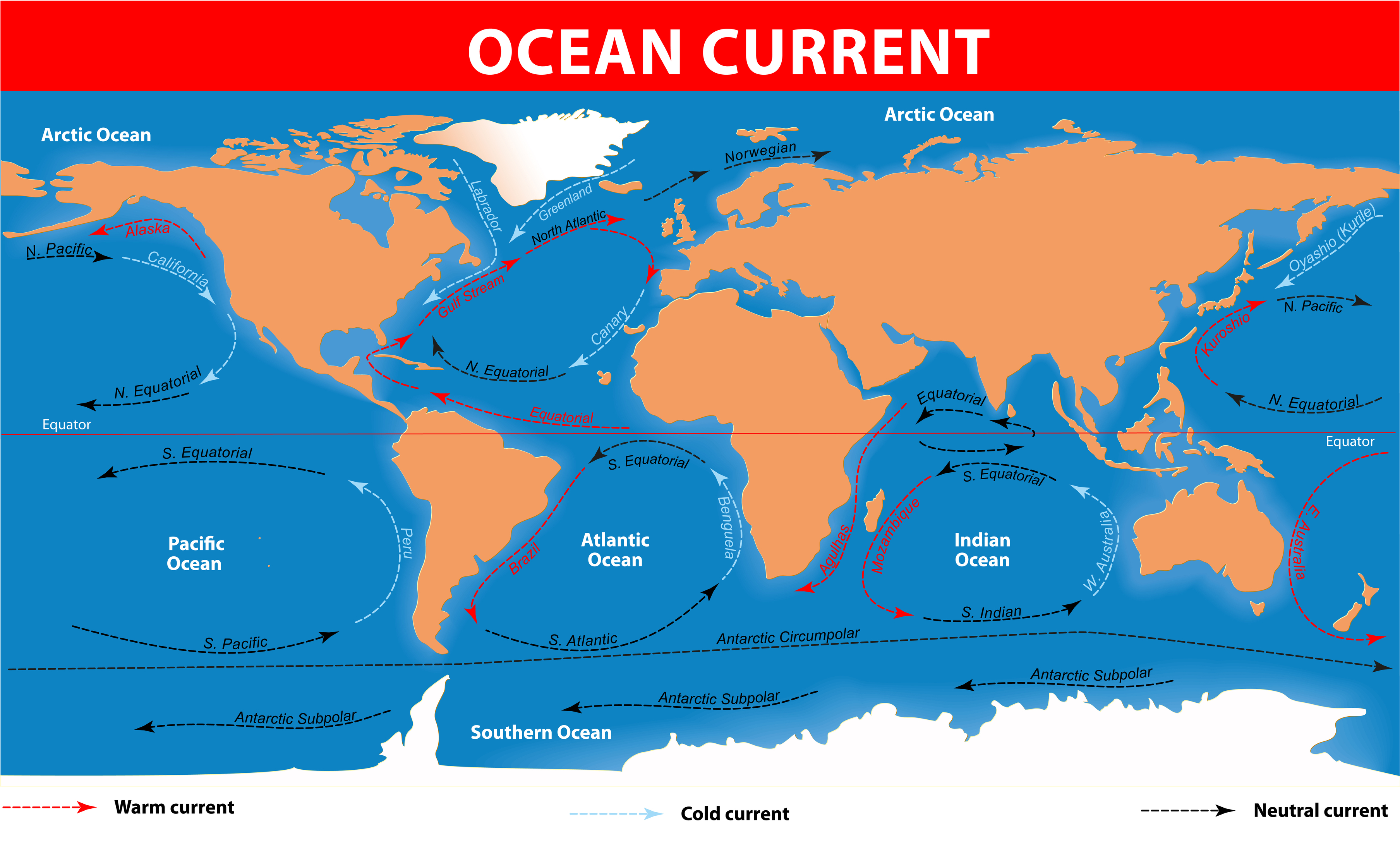
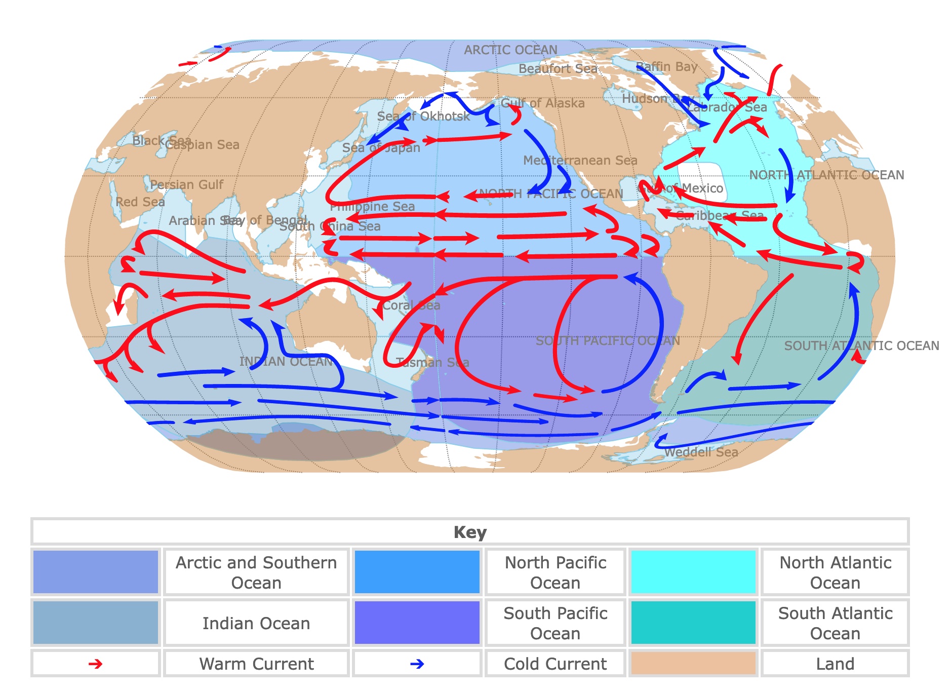
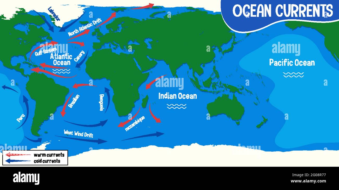
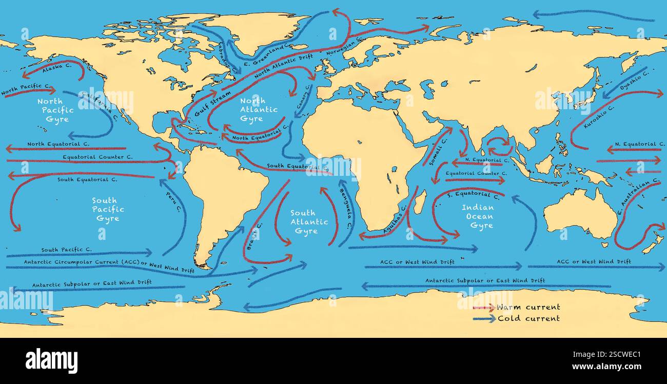
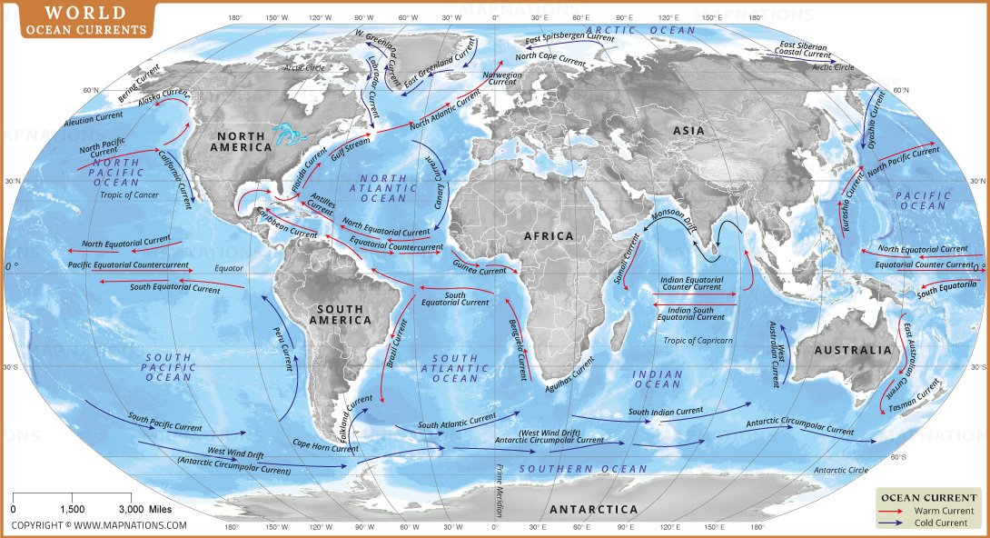
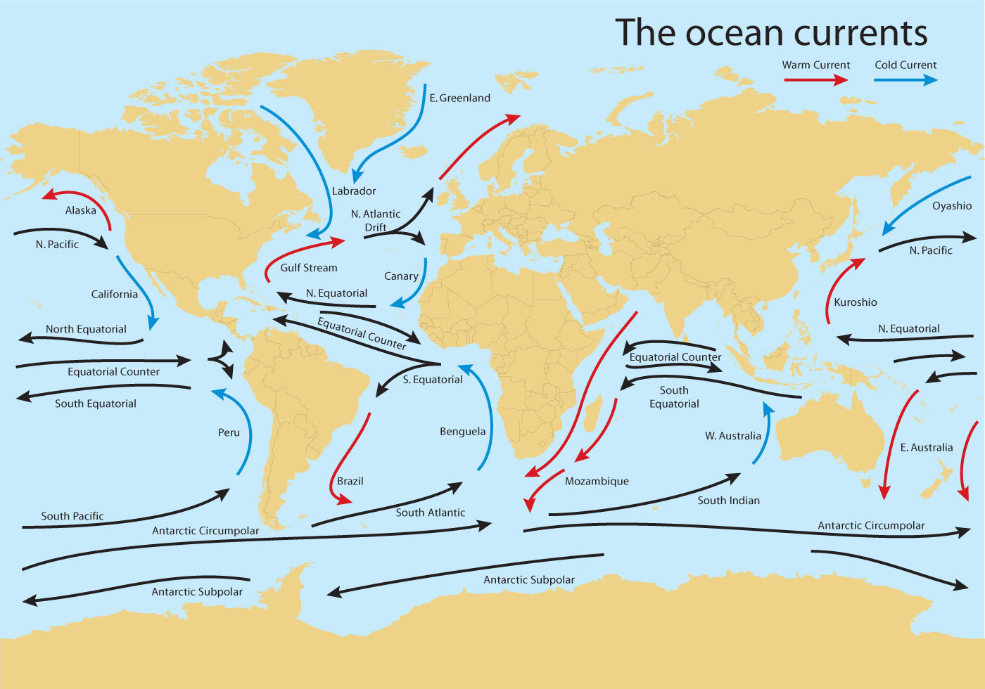
When you look at a world map of ocean currents, the most prominent features are the five major gyres—large, circular systems of currents created by global wind patterns and the Coriolis effect. These gyres rotate clockwise in the Northern Hemisphere and counterclockwise in the Southern Hemisphere. The North Atlantic Gyre includes the Gulf Stream (warm) and the Canary Current (cool). The South Atlantic Gyre features the Brazil Current (warm) and the Benguela Current (cool). In the Pacific, the North Pacific Gyre hosts the Kuroshio Current (warm) and California Current (cool), while the South Pacific Gyre contains the East Australian Current (warm) and the Humboldt/Peru Current (cool). The Indian Ocean Gyre is unique, driven partly by seasonal monsoon winds, and includes the Agulhas Current—one of the strongest western boundary currents on Earth. These gyres act as giant conveyor belts, transferring immense amounts of heat and energy around the globe.
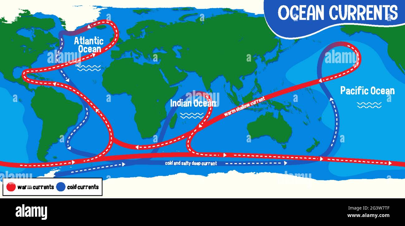
Warm vs. Cold Currents: Reading the Map
To truly understand a world map of ocean currents, you must distinguish between warm and cold flows. Warm currents typically originate near the equator and carry tropical heat poleward along the eastern edges of continents. Examples include the Gulf Stream, Kuroshio, and Brazil Current. Cold currents flow from high latitudes toward the equator along the western coasts of continents, such as the California, Humboldt, and Canary currents. On a color-coded map, warm currents are often shown in red or orange, while cold currents appear in blue or purple. This thermal contrast is critical: warm currents increase evaporation and rainfall, often fueling tropical storms, while cold currents stabilize coastal climates and create fog, as seen in San Francisco. Cold currents also upwell deep, nutrient-rich waters, making them hotspots for biodiversity, including major fishing grounds off Peru and Namibia.
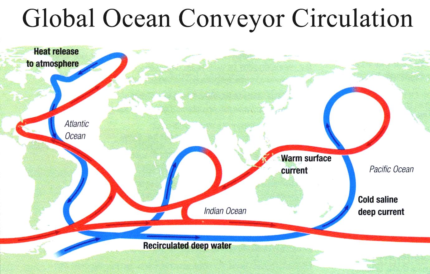
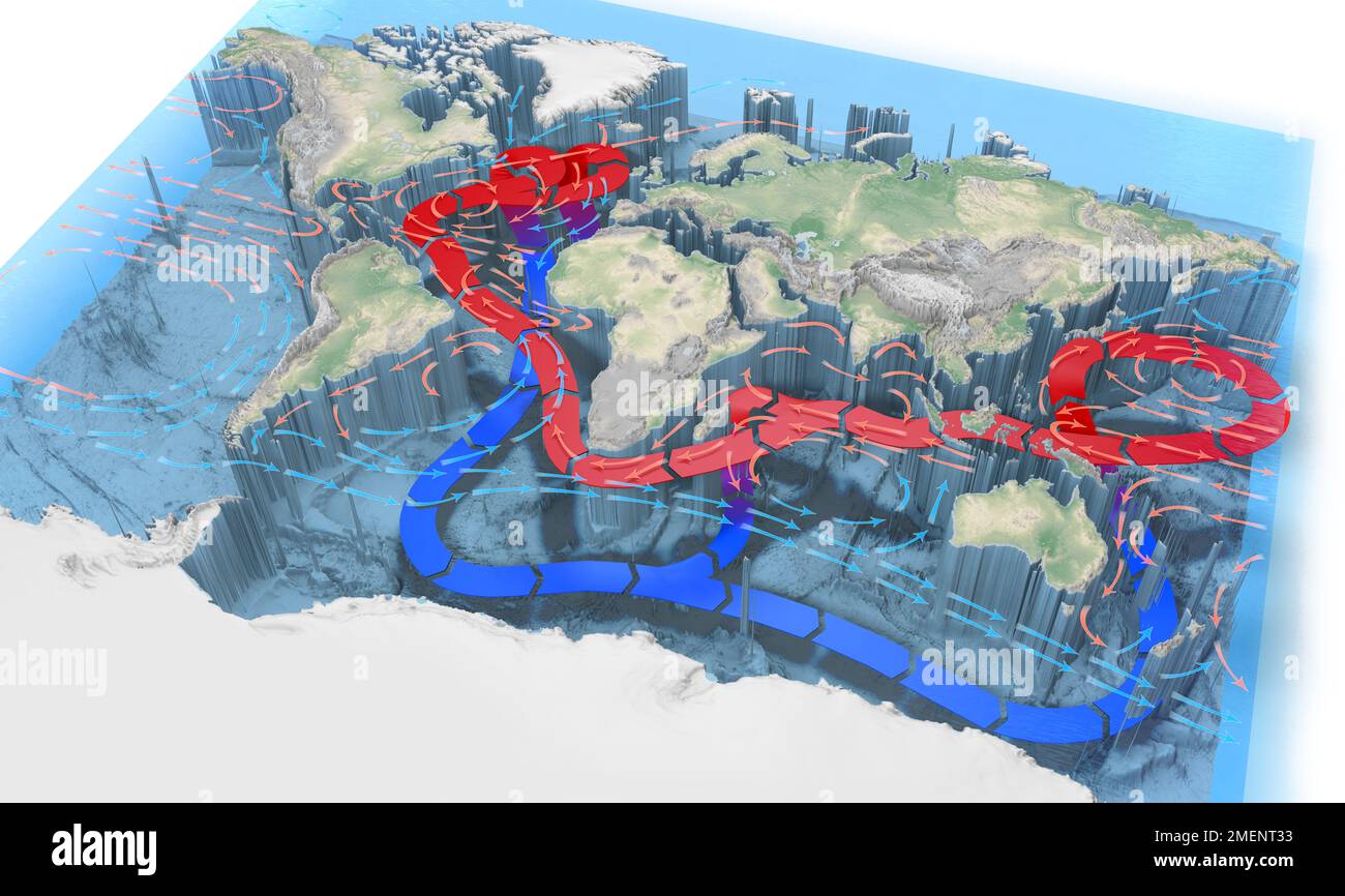
Deep Ocean Currents: The Global Conveyor Belt
While surface currents are driven by wind, deep ocean currents are powered by differences in water density—a process called thermohaline circulation. This "global conveyor belt" connects all the world's oceans in a slow, deep loop. Cold, salty water in the North Atlantic sinks near Greenland and Iceland, flowing southward along the ocean floor, through the Southern Ocean, and into the Indian and Pacific Oceans, where it gradually warms, rises, and returns as surface currents. A complete cycle takes about 1,000 years. This deep circulation is vital for storing carbon dioxide and regulating Earth's long-term climate. When you view a comprehensive world map of ocean currents, deep flows are often represented with dashed or dotted arrows showing movement at depths below 1,000 meters. Understanding this system is essential for grasping how climate change could disrupt global heat distribution.
How Ocean Currents Affect Climate and Weather
The influence of ocean currents on climate cannot be overstated. Warm currents raise air temperatures and humidity, leading to lush coastal rainforests (e.g., along the coast of Brazil). Conversely, cold currents produce arid conditions—think of the Namib Desert in Africa, kept dry by the cold Benguela Current. On a global scale, the El Niño-Southern Oscillation (ENSO) temporarily disrupts normal current patterns in the Pacific, causing floods in some regions and droughts in others. Similarly, the Atlantic Meridional Overturning Circulation (AMOC), part of the deep conveyor belt, helps keep Northern Europe temperate. Studying a world map of ocean currents allows climatologists to predict monsoons, hurricane paths, and marine heatwaves. For travelers and sailors, these currents also dictate navigation routes, with ancient mariners relying on the trade winds and currents for centuries of exploration.
Navigating the Map: Key Currents to Know
Here is a quick reference to the most significant currents you will see on a world map of ocean currents: Gulf Stream (North Atlantic, warm, from Florida to Norway), Kuroshio Current (North Pacific, warm, east of Japan), Humboldt Current (South Pacific, cold, along Chile and Peru), Agulhas Current (Indian Ocean, warm, along southeast Africa), Antarctic Circumpolar Current (Southern Ocean, cold, circling Antarctica—the largest current by volume), and Labrador Current (North Atlantic, cold, along eastern Canada). Each of these currents has a distinct role in local and global systems. For example, the Antarctic Circumpolar Current isolates Antarctica's cold waters, affecting global sea ice extent. The Labrador Current brings icebergs into shipping lanes, famously contributing to the Titanic disaster.
Conclusion
Exploring a world map of ocean currents reveals a hidden engine driving our planet's climate, ecology, and human endeavors. From the surging Gulf Stream that warms Europe to the deep, silent flow of the global conveyor belt, these currents connect every corner of the ocean. Whether you use the map to understand why your favorite coastal city has foggy summers or to trace the migration of tuna across the Pacific, the patterns are both beautiful and profound. As the climate changes, monitoring shifts in these currents becomes ever more critical. Next time you see a vivid ocean currents map, remember—you're looking at the lifeblood of Earth, moving relentlessly beneath the waves.
Ocean Currents Map Printable

Ocean Currents Map Printable
Ocean Current - Geostrophic, Gyres, Circulation | Britannica

Ocean current - Geostrophic, Gyres, Circulation | Britannica
Ocean Currents Names 1903 Ocean Currents Cold And Warm With Their

Ocean Currents Names 1903 Ocean Currents Cold And Warm With Their
World Map With Ocean Currents And Geographical Details Depicted In An

World Map with Ocean Currents and Geographical Details Depicted in an ...
Global Currents Map
Global Currents Map
Ocean Currents - KidsPressMagazine.com
Ocean Currents - KidsPressMagazine.com
Ocean Currents Map Blank
Ocean Currents Map Blank
Create A World Map Depicting The Routes Of Major Ocean Currents And

Create a world map depicting the routes of major ocean currents and ...
Free Vector | Ocean Currents On World Map
Free Vector | Ocean currents on world map
Ocean Currents - Get Into Geography
Ocean Currents - Get Into Geography
Ocean Currents Map Worksheet How Many Oceans And Seas | Oceans Are
Ocean Currents Map Worksheet How Many Oceans And Seas | ... Oceans Are
Ocean Currents: Map, Types, Causes & Key Facts – UPSC
Ocean Currents: Map, Types, Causes & Key Facts – UPSC
Ocean Currents On World Map Background Illustration Stock Vector Image
Ocean currents on world map background illustration Stock Vector Image ...
Ocean Currents Map • Ocean Cleanup Organizations The Ocean Cleanup

Ocean Currents Map • Ocean Cleanup Organizations The Ocean Cleanup ...
Ocean Currents World Map | Story.Earth

Ocean Currents World Map | Story.Earth
World's Major Ocean Currents, Color + Label Map With Assignment | TPT

World's Major Ocean Currents, Color + Label Map with assignment | TPT
Ocean Currents On World Map Background Illustration Stock Vector Image
Ocean currents on world map background illustration Stock Vector Image ...
World Map Of Oceans And Currents
World Map of Oceans and Currents
Ocean Currents On World Map Background Illustration Stock Vector Image
Ocean currents on world map background illustration Stock Vector Image ...
Ocean Currents Animation

Ocean Currents Animation
Atlantic Ocean Currents Map Hi-res Stock Photography And Images - Alamy
Atlantic ocean currents map hi-res stock photography and images - Alamy
Ocean Currents On World Map Background 2988393 Vector Art At Vecteezy

Ocean currents on world map background 2988393 Vector Art at Vecteezy
Map Of Warm And Cold Ocean Currents Stock Photo - Alamy
Map of warm and cold ocean currents Stock Photo - Alamy
Pacific Ocean Currents Map

Pacific Ocean Currents Map
World Ocean Currents Map – Major Warm And Cold Currents Explained
World Ocean Currents Map – Major Warm and Cold Currents Explained
Ocean Current Worldmap Vector 104987 Vector Art At Vecteezy
Ocean Current Worldmap Vector 104987 Vector Art at Vecteezy
Ocean Currents On World Map Background 2701680 Vector Art At Vecteezy

Ocean currents on world map background 2701680 Vector Art at Vecteezy
World Ocean Currents Diagram | Quizlet

World Ocean Currents Diagram | Quizlet
Ocean Currents On World Map Background Stock Vector (Royalty Free

Ocean Currents On World Map Background Stock Vector (Royalty Free ...
World Maps - Ocean Currents

World Maps - Ocean Currents
Ocean Currents Names 1903 Ocean Currents Cold And Warm With Their
Ocean Currents Names 1903 Ocean Currents Cold And Warm With Their
Ocean Waters And Currents ~ Learning Geology
Ocean waters and currents ~ Learning Geology
World Map Of Major Ocean Currents, Warm Currents In Red, Cold Currents
World Map of Major Ocean Currents, Warm Currents in Red, Cold Currents ...