Exploring the Political Landscape of South America: A Detailed World Map Guide
This comprehensive guide will take you on a journey through the political geography of South America, providing a clear understanding of its sovereign nations, territories, and key geographical features. By examining detailed political maps—both labeled and blank—you will learn to identify each country, its capital cities, and the physical borders that define this vibrant continent. Whether you are a student, traveler, or geography enthusiast, this article will equip you with the knowledge to read and interpret South American maps with confidence, appreciating the cultural and political diversity that shapes the region.
The Sovereign Nations of South America
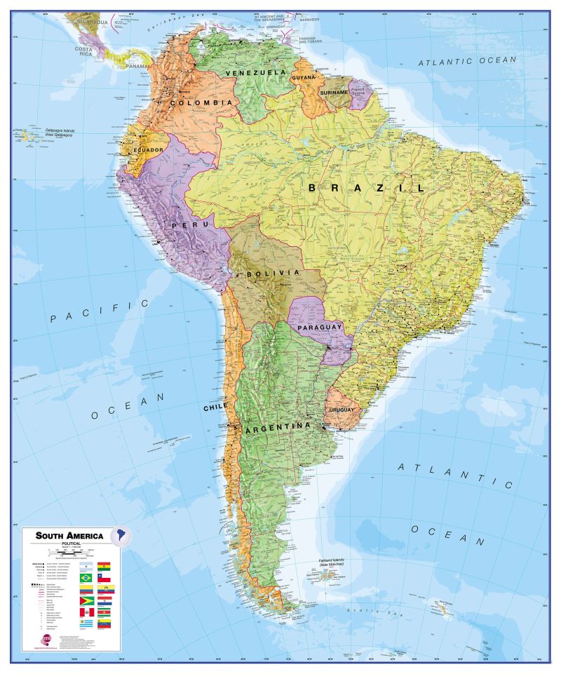
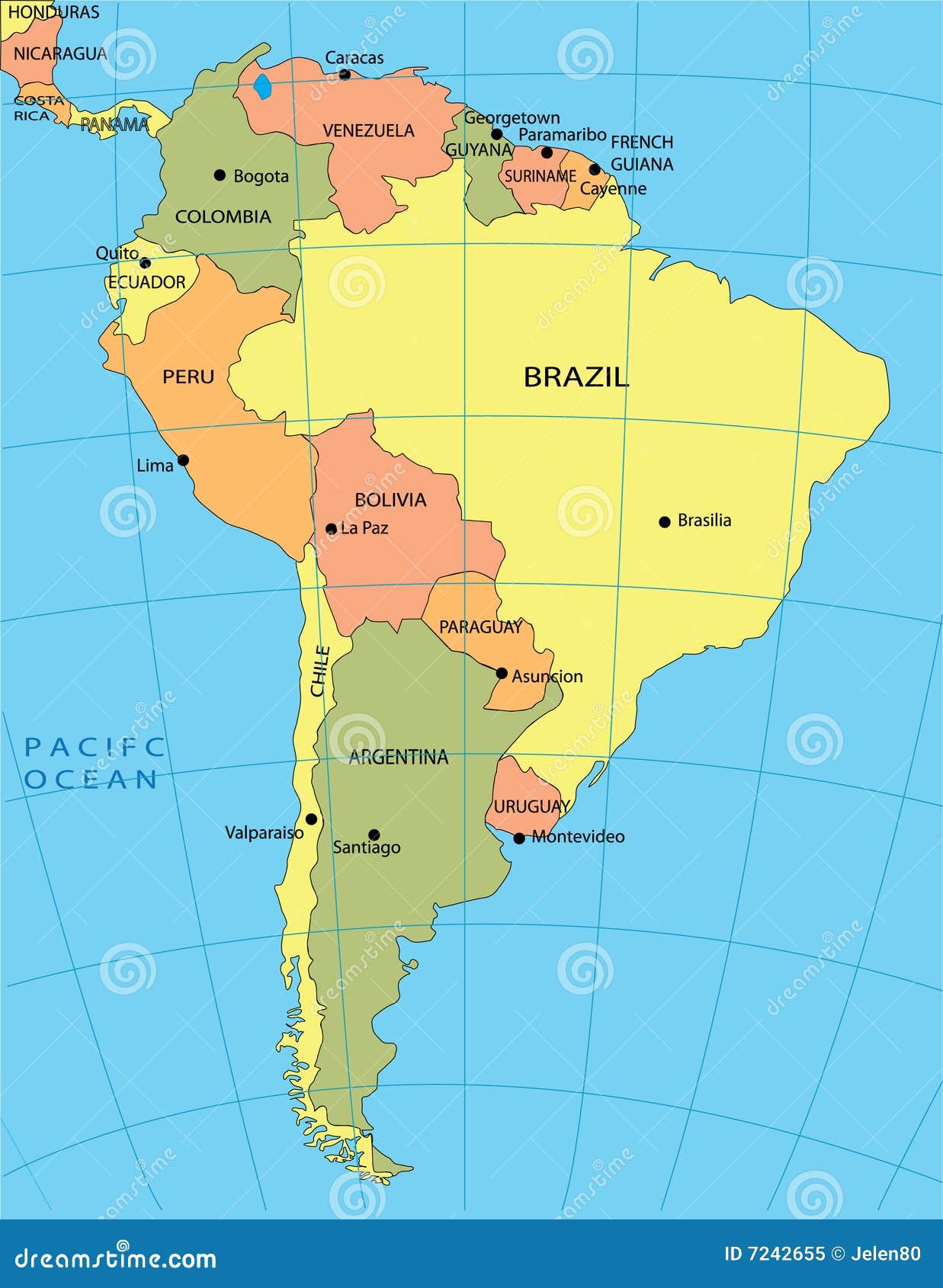
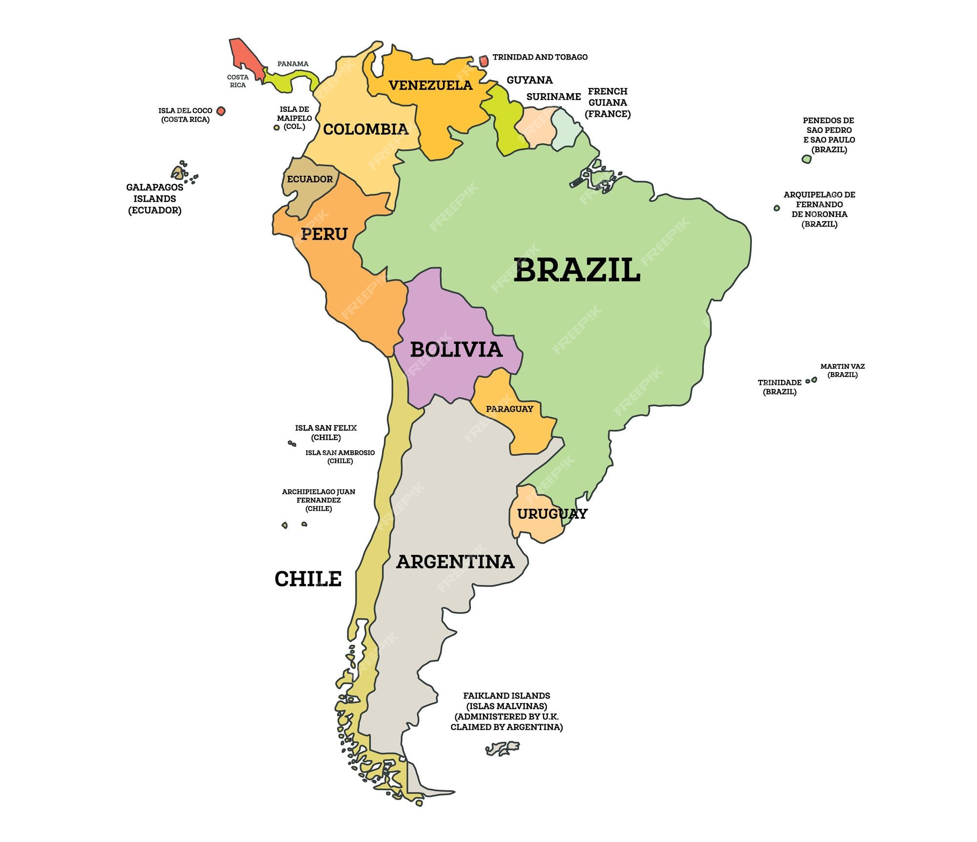
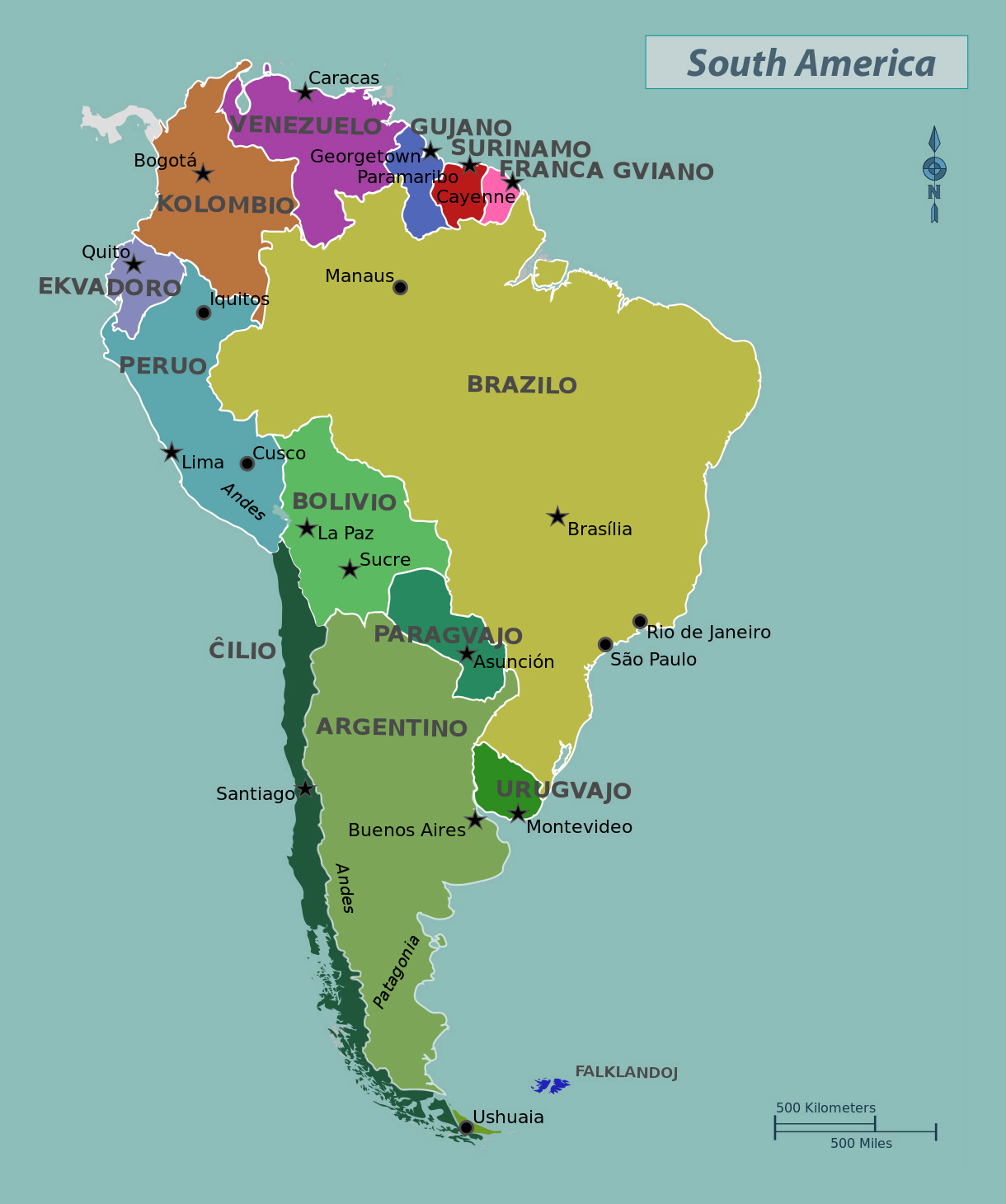
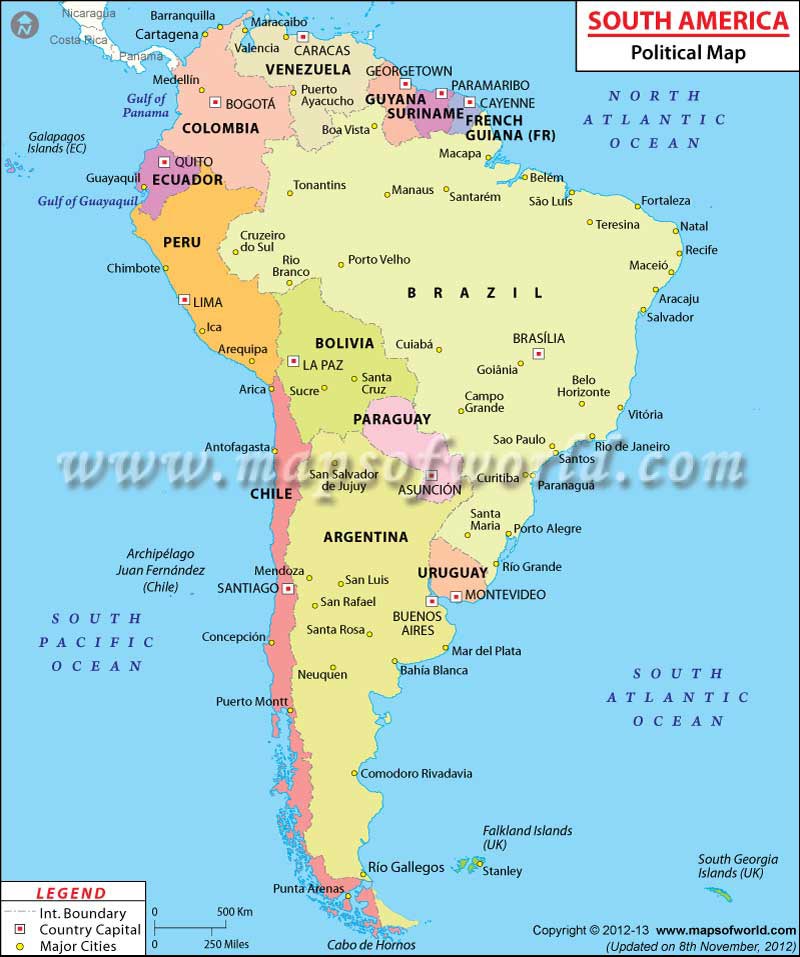
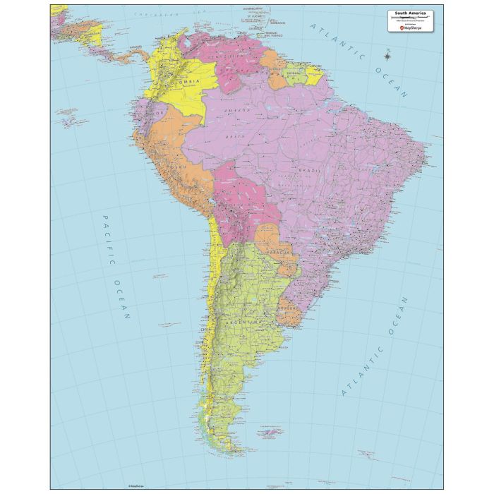
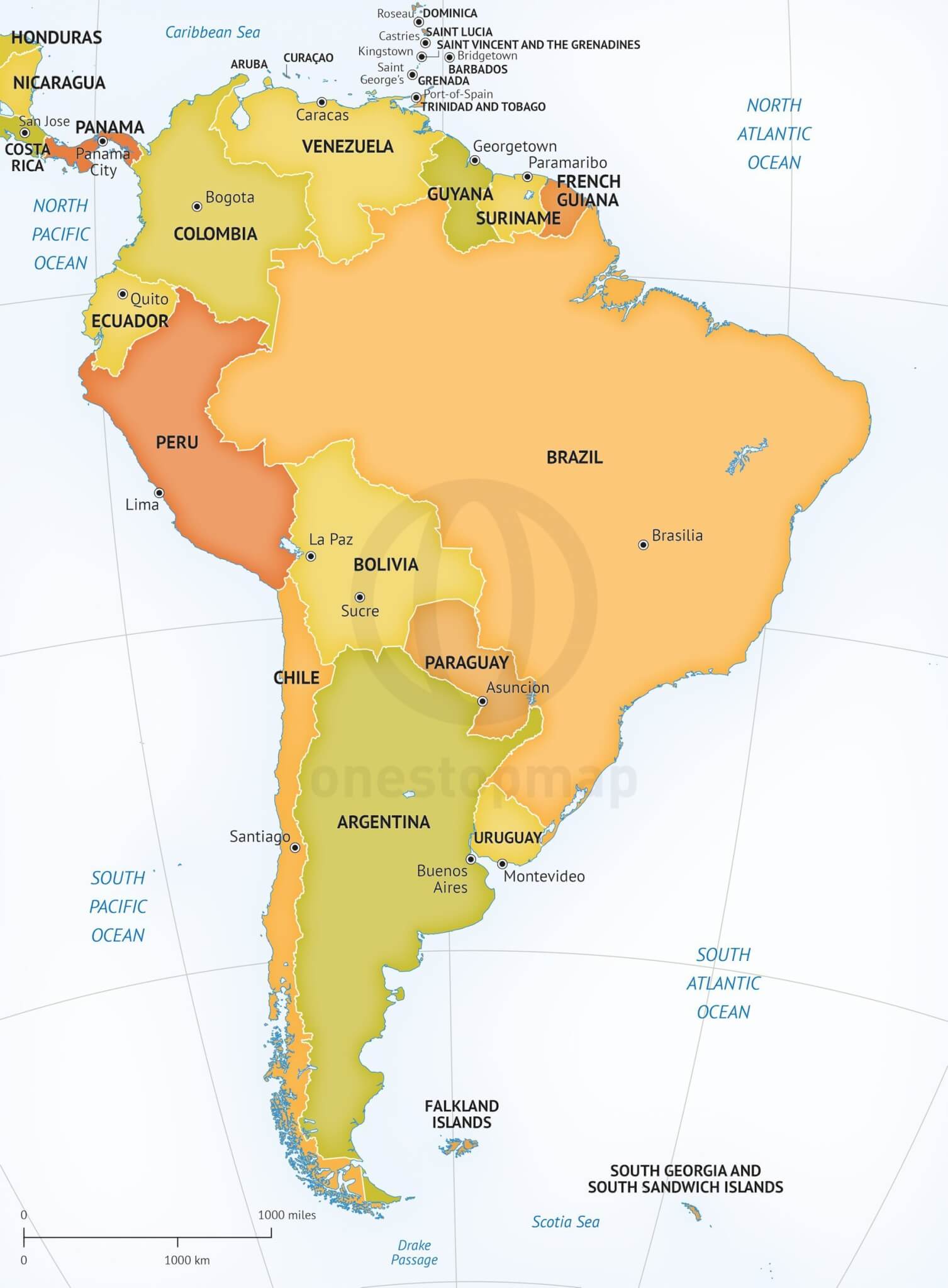
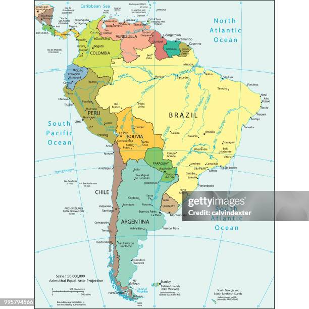
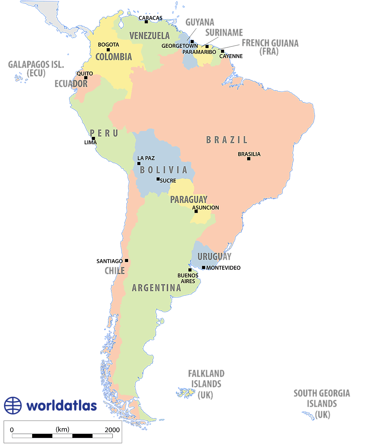
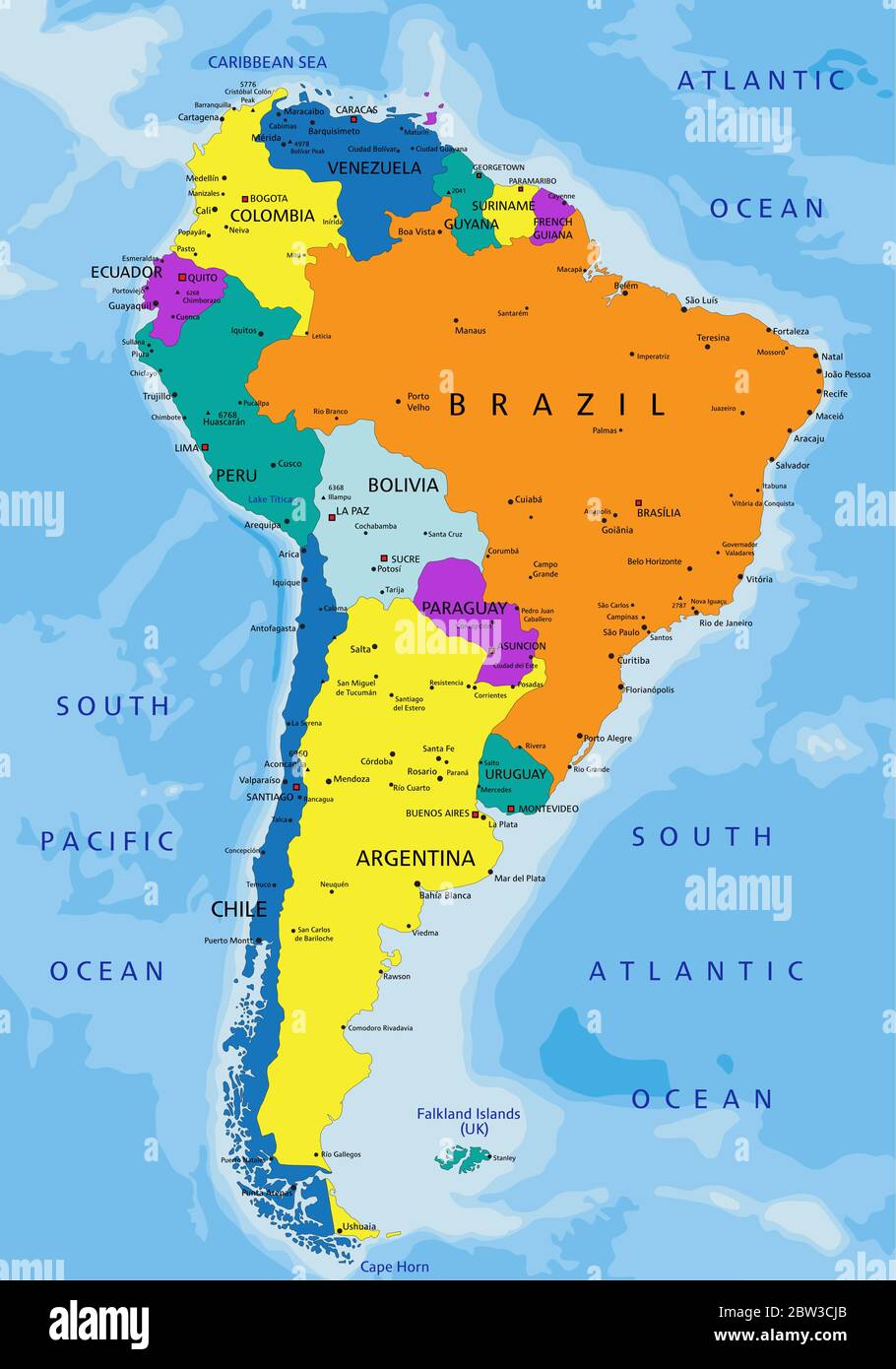
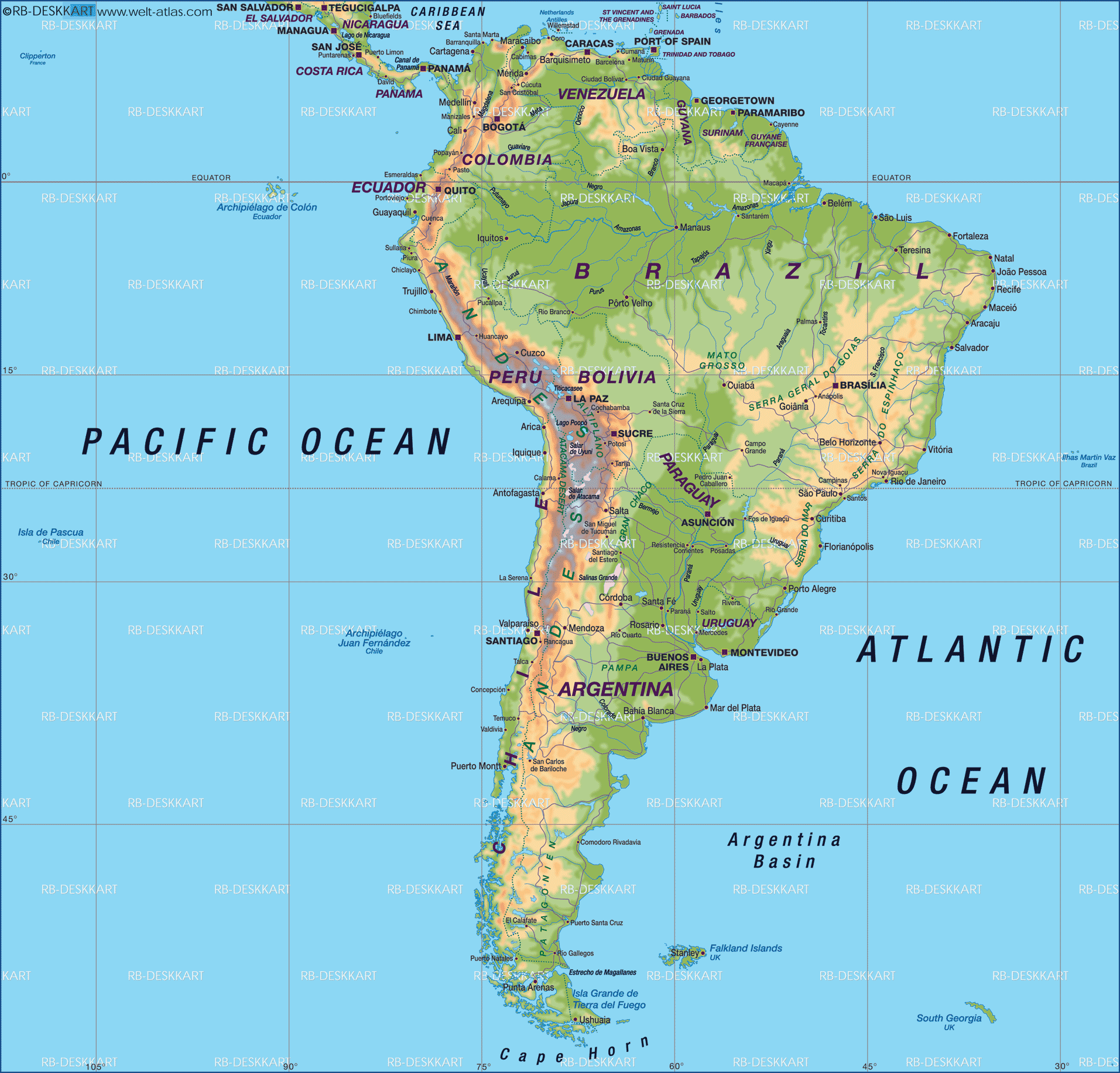
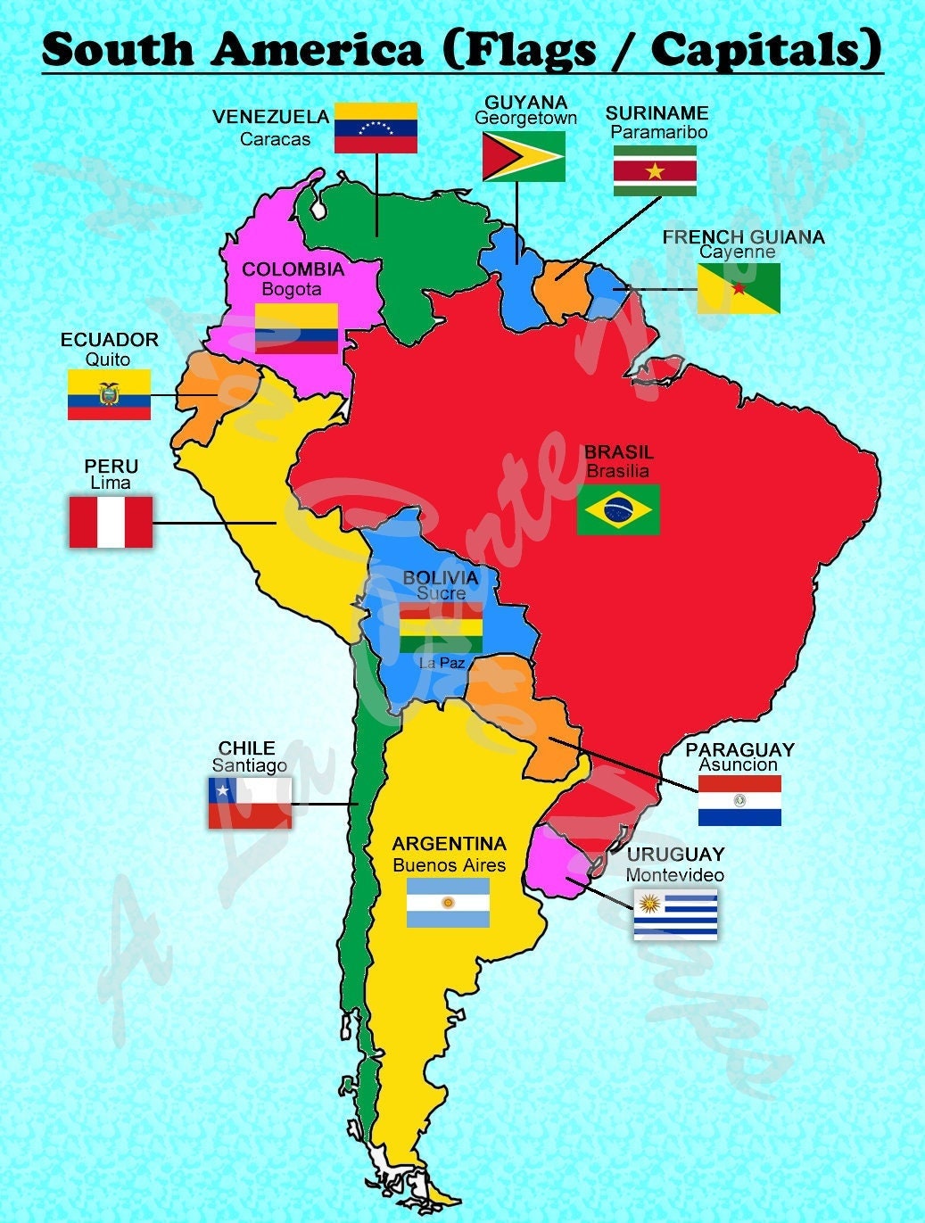
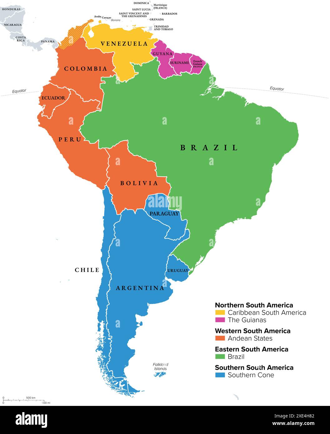
South America is home to 12 independent countries, each with its own unique history, culture, and political system. From the vast Amazon rainforest to the towering Andes mountains, these nations occupy a landmass of approximately 17.84 million square kilometers. The largest country by area is Brazil, which dominates the eastern half of the continent, while the smallest is Suriname, located on the northeastern coast. Other key nations include Argentina, known for its expansive pampas and tango culture; Chile, a long, narrow strip along the Pacific coast; and Peru, the heart of the ancient Inca Empire. Understanding where these countries lie on a political map is crucial for grasping trade routes, geopolitical alliances, and regional conflicts. For instance, the map often highlights the shared borders between Colombia, Venezuela, and Brazil, which are critical for Amazonian conservation efforts and economic integration through organizations like Mercosur.

Capital Cities and Administrative Hubs
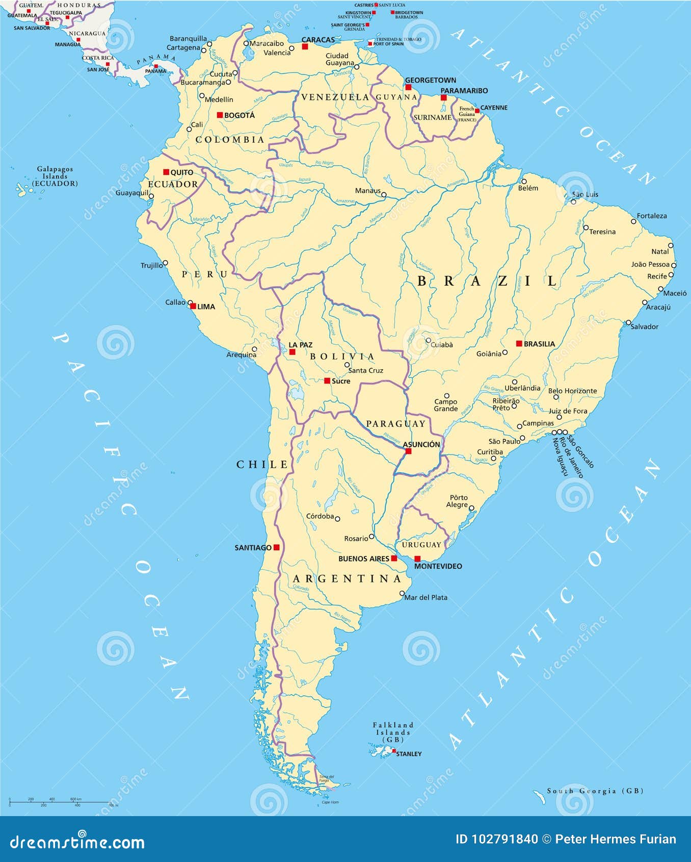
A political map of South America is incomplete without its capital cities, which serve as seats of government and economic powerhouses. Brasília, the futuristic planned capital of Brazil, is a UNESCO World Heritage site known for its modernist architecture. Buenos Aires, the capital of Argentina, is a bustling port city with European influences, while Lima, Peru’s capital, sits on the Pacific coast and preserves colonial-era treasures. Other notable capitals include Bogotá (Colombia), Santiago (Chile), and Quito (Ecuador), the latter being the second-highest capital city in the world at 2,850 meters above sea level. On a political map, these cities are often marked with stars or distinctive dots, providing a visual guide to the administrative hierarchy of the continent. Learning these capitals helps in understanding the distribution of political power and the historical colonial patterns of settlement, as many capitals are located near coasts or rivers that facilitated trade during the Spanish and Portuguese empires.
Geographical Features That Define Borders
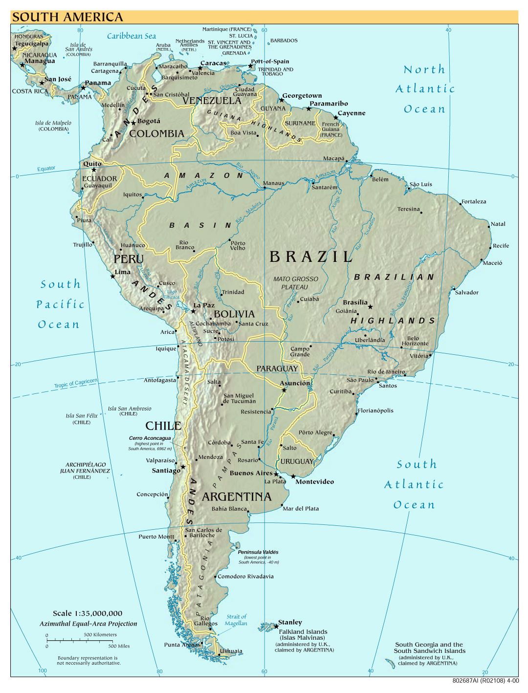
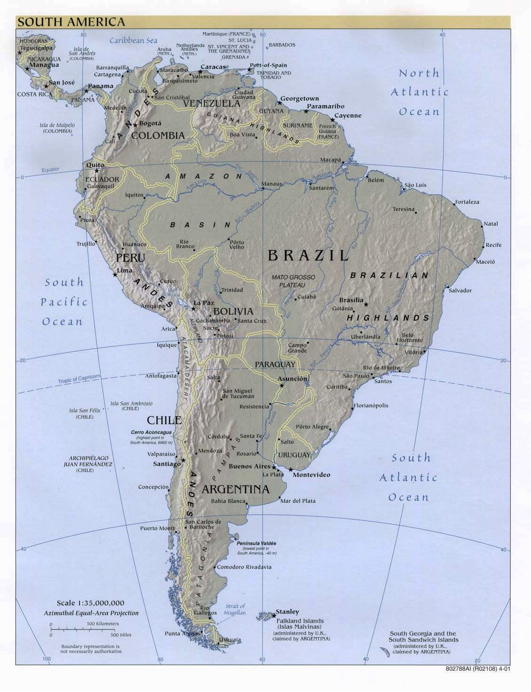
South America’s political boundaries are deeply intertwined with its physical geography. The Andes Mountains, the longest continental mountain range in the world, form a natural border between Chile and Argentina, as well as between Peru and Bolivia. The Amazon River basin, covering over 7 million square kilometers, creates a vast lowland that separates countries like Colombia, Peru, and Brazil. The Guiana Highlands in the northeast and the Patagonian steppe in the south also influence where political lines are drawn. A comprehensive world map of South America will show how rivers like the Paraná, Orinoco, and Amazon act as both connectors and dividers. For example, the Río de la Plata estuary separates Uruguay from Argentina, while the Amazon River’s tributaries often define the boundaries of remote states in Brazil. Understanding these features is essential for grasping why some countries, such as Bolivia and Paraguay, remain landlocked, while others have extensive coastlines and strategic ports.
The Role of Blank Political Maps in Education
Blank political maps of South America are invaluable tools for learning and assessment. They provide a clean, unlabeled canvas where students can practice identifying countries, capitals, and major rivers without visual cues. For instance, a blank map might show the outline of Chile’s long, narrow shape, forcing the learner to recall its name and neighboring countries like Argentina and Peru. The image titled "Map of South America Political - Blank World Map" is a perfect example, offering a high-contrast view of borders without labels. Educators often use such maps for quizzes, while travelers use them to plan itineraries. By repeatedly filling in a blank map, one retains spatial information more effectively than through passive viewing. Additionally, blank maps help highlight the relative sizes of nations—for instance, how Brazil dwarfs Uruguay or how the small size of French Guiana (an overseas department of France) contrasts with the vastness of the continent.

Territories and Non-Sovereign Entities
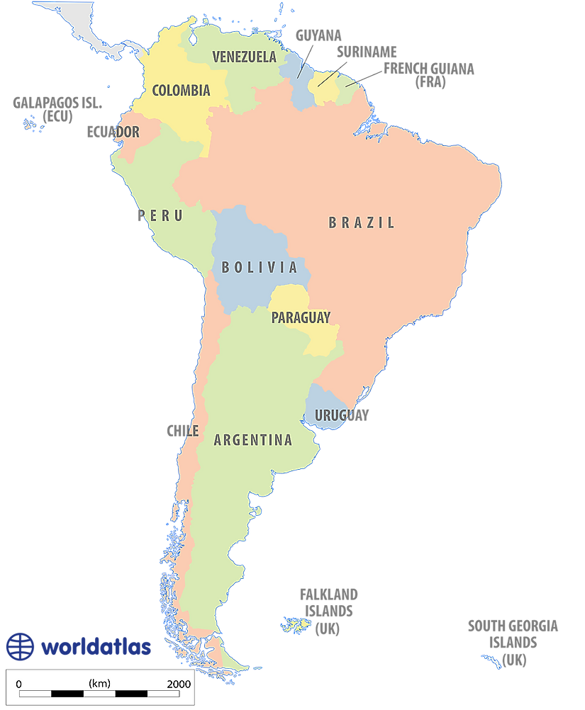
Beyond the 12 independent countries, South America includes several territories that are not fully sovereign. The Falkland Islands (administered by the United Kingdom but claimed by Argentina) are a disputed archipelago off the southern coast. French Guiana is an overseas department of France, making it part of the European Union despite being in South America. The Galápagos Islands, belonging to Ecuador, are internationally famous for their unique wildlife but are often depicted on political maps as a small dot off the Pacific coast. These territories add layers of complexity to the political landscape, often reflecting colonial legacies. For example, Suriname and Guyana—both former colonies—have English and Dutch influences, while French Guiana uses the euro and French as its official language. A complete political map will also show the boundary between Colombia and Panama, which forms the Darien Gap—a dense jungle region that is the only missing link in the Pan-American Highway.
Regional Organizations and Their Map Implications
Political maps of South America also reveal the influence of regional blocs. The Union of South American Nations (UNASUR) and the Southern Common Market (Mercosur) aim to promote economic integration and political cooperation among member states. On a map, these alliances are not just lines but represent shared economic zones and visa-free travel agreements. For instance, citizens of Argentina, Brazil, Paraguay, and Uruguay can move more freely across borders due to Mercosur. Similarly, the Amazon Cooperation Treaty Organization (ACTO) highlights the shared responsibility of eight countries for the Amazon rainforest. By studying a political map, one can see how these countries collaborate across the Amazon River basin, a region that transcends national boundaries. This cooperation is crucial for addressing deforestation, climate change, and indigenous rights, making the map a living document of both national sovereignty and regional unity.
Practical Uses of Political Maps for Travel and Research
For travelers, a political map of South America is indispensable for navigation and planning. It shows major highways, railways, and ports that connect cities like São Paulo (Brazil) and Buenos Aires (Argentina). Researchers use these maps to analyze demographic patterns, such as the concentration of population in coastal cities like Rio de Janeiro and Lima, versus the sparsely populated Amazon interior. Political maps also indicate time zones and administrative divisions, such as Brazil’s 26 states and Chile’s 16 regions. By examining both the labeled and blank versions, one can better understand the distribution of resources—like oil in Venezuela and copper in Chile—and their geopolitical influence. Furthermore, these maps are often updated to reflect changes in disputed areas, such as the maritime boundary between Chile and Peru settled by the International Court of Justice in 2014.
Conclusion
Mastering the political map of South America is a gateway to understanding the continent’s rich tapestry of nations, cultures, and histories. From the sweeping Amazon basin to the icy peaks of Patagonia, every border and capital city tells a story of conquest, independence, and modern collaboration. Whether you use a filled-in political map for reference or a blank one for practice, the knowledge gained empowers you to navigate the complex political realities of South America. As global trade and environmental challenges continue to shape the region, a solid grasp of its geography will remain an essential tool for students, policymakers, and curious minds alike.
South America Map With Countries | Political Map Of South America

South America Map With Countries | Political Map of South America
Political Map Of South America | EDUCATION - THiNKNET Design Studio

Political Map of South America | EDUCATION - THiNKNET Design Studio
South America Map Printable

South America Map Printable
Political South America Wall Map
Political South America Wall Map
South America Political Map Photos, Download The BEST Free South
South America Political Map Photos, Download The BEST Free South ...
Political Map Of South America Royalty Free Stock Photo - Image: 7242655
Political Map Of South America Royalty Free Stock Photo - Image: 7242655
Premium Vector | South America Political Map Map With Name Of Countries
Premium Vector | South America Political Map Map with Name of Countries ...
Large Political Map Of South America With Capitals | South America
Large political map of South America with capitals | South America ...
Map Of South America, Highlighted On The World Map, South America On
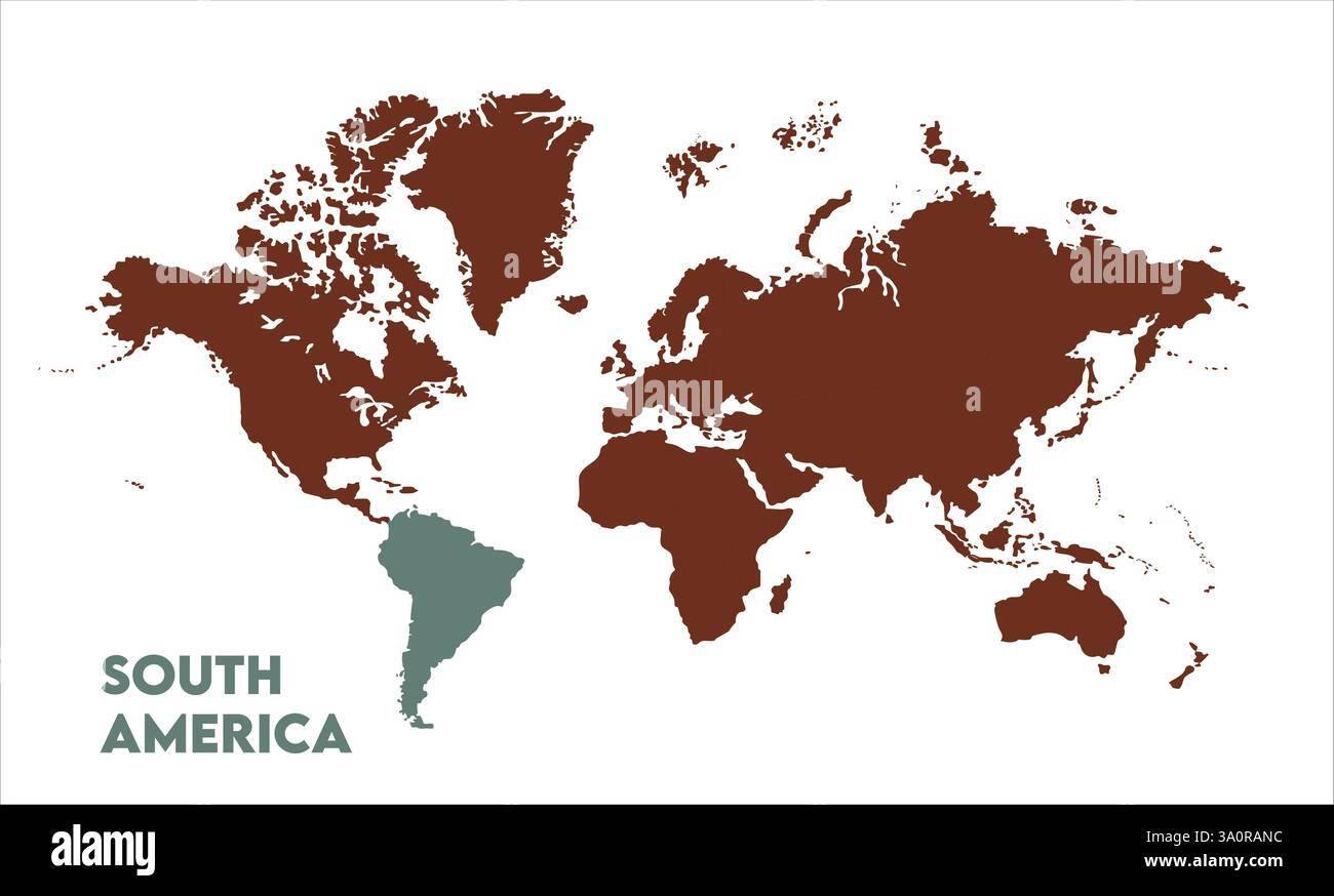
Map of South America, highlighted on the world map, South America on ...
Large Scale Political Map Of South America With Relief And Capitals
Large scale political map of South America with relief and capitals ...
World Map Of South America
World map of south america
South American Countries, Countries In South America
South American Countries, Countries in South America
South America Political Map With Capitals
South America Political Map With Capitals
South America Political Map | Stanfords
South America Political Map | Stanfords
Large Detailed Political Map Of South America With Relief, Major Cities
Large detailed political map of South America with relief, major cities ...
South America Map World

South America Map World
Vector Map Of South America Political | One Stop Map
Vector Map of South America Political | One Stop Map
1,020 South America Map With Capitals Stock Photos, High-Res Pictures
1,020 South America Map With Capitals Stock Photos, High-Res Pictures ...
Maps Of South America - World Atlas
Maps of South America - World Atlas
South America Political Map Printable
South America Political Map Printable
Political Maps Of South America | Mapswire

Political Maps of South America | Mapswire
Large Political Map Of South America With Roads, Major Cities And

Large political map of South America with roads, major cities and ...
Map Of South America (General Map / Region Of The World) | Welt-Atlas.de
Map of South America (General Map / Region of the World) | Welt-Atlas.de
Blank Political Map Of South America

Blank Political Map Of South America
South America Political Map
South America Political Map
Maps Of South America
Maps of South America
Political Map Of South America

Political map of South America
South America Map Political World Map Blank And Printable

South America Map Political World Map Blank And Printable
Political Map Of South America The World With A 70 Meters Sea Level
Political Map Of South America The World With A 70 Meters Sea Level
Map Of South America, Highlighted On The World Map, South America On
Map of South America, highlighted on the world map, South America on ...
World Map Of South America

World Map Of South America
South America Political Map World Countries Stock Illustration

South America Political Map World Countries Stock Illustration ...
Executive South America Wall Map Political

Executive South America Wall Map Political