Colonial Latin America Map Quiz: A Hilarious Guide to Who Stole What and When
Ever looked at a colonial map of Latin America and thought, “Wow, that looks like a giant game of Risk where Spain won, Portugal got a consolation prize, and nobody invited the indigenous folks to the table”? You’re not far off. This guide will walk you through the chaotic, comical, and frankly confusing history of how a bunch of European powers carved up an entire continent. By the end, you’ll not only ace your map quiz but also understand why Brazil speaks Portuguese and why there are random bits of France in South America. Buckle up, we’re going colonial.
The Big Two: Spain and Portugal’s Terribly Drawn Line
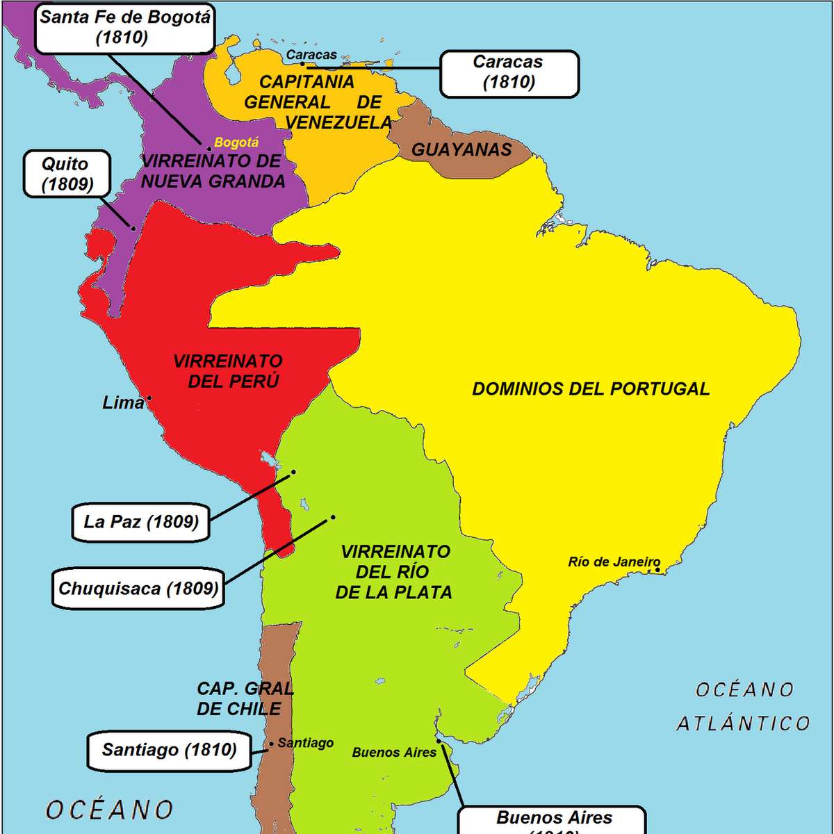
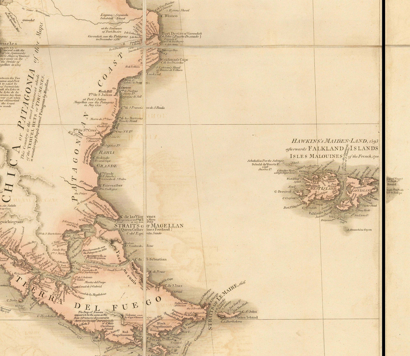
Imagine you and your roommate are splitting a pizza, but you only have a crayon and a globe with no scale. That’s basically how Spain and Portugal divided South America. In 1494, the Pope—basically the ultimate referee of the 15th century—drew the Treaty of Tordesillas. This imaginary line, 370 leagues west of the Cape Verde islands, gave Spain everything to the west and Portugal everything east. The result? Portugal got a tiny chunk of land that eventually became Brazil—a massive country that laughs in the face of that initial line. Spain, meanwhile, got the rest: from Mexico down to Tierra del Fuego, which they promptly tried to manage with the organizational skills of a caffeinated squirrel. Look at any 1810 map (like the one above showing “Colonial Possessions in 1810”) and you’ll see a massive Spanish blob that looks like it swallowed a continent, while Brazil just hangs out on the right, smugly speaking Portuguese.

Spain’s Hot Mess: Viceroyalties That Made No Sense
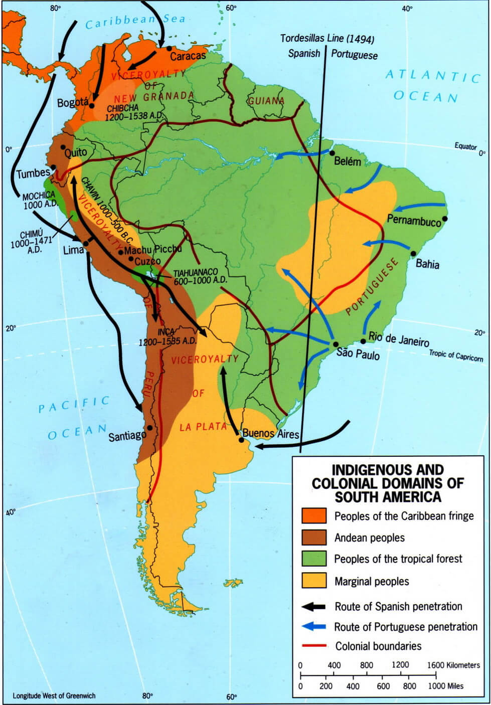
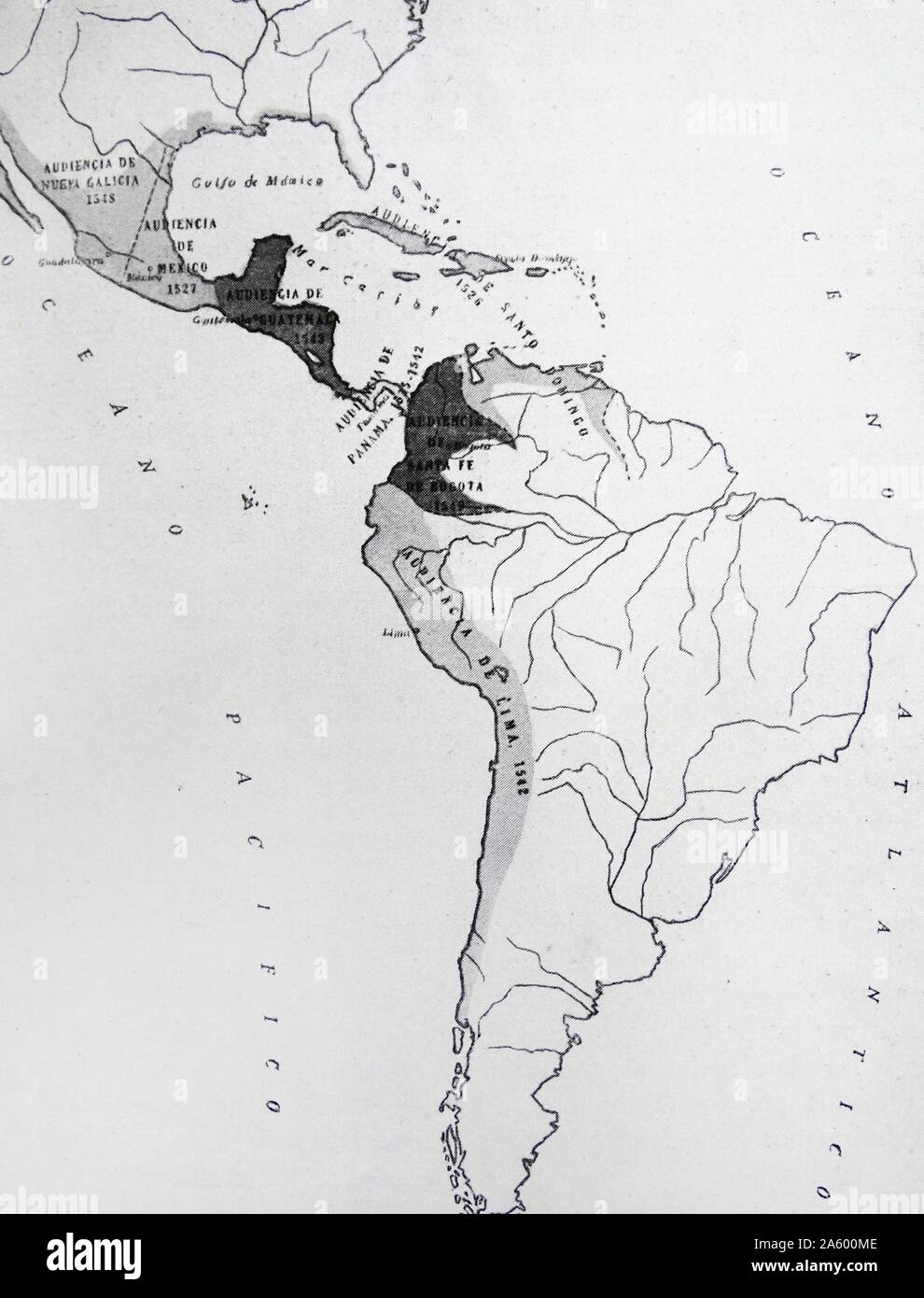
Spain didn’t just sit on their land; they tried to run it. They created viceroyalties—giant administrative regions that were about as manageable as herding cats on a unicycle. The Viceroyalty of New Spain covered Mexico, Central America, and the Caribbean. The Viceroyalty of Peru had all of western South America, including the silver-rich Potosí. Then, in the 18th century, Spain had an administrative crisis and birthed two more: the Viceroyalty of New Granada (Colombia, Venezuela, Ecuador) and the Viceroyalty of the Río de la Plata (Argentina, Uruguay, Paraguay, Bolivia). Why? Because managing Peru from Lima was like trying to control a snake with no hands. The borders were drawn by bureaucrats in Madrid who had never seen a mountain, which explains why many modern Latin American countries still have weird boundaries today. Seriously, look at Bolivia—it looks like someone spilled coffee and drew a line around it.
Portugal’s Sneaky Expansion: The Bandeirantes and Tordesillas’s Demise
Remember that Tordesillas line? Portugal ignored it faster than a teenager ignores a curfew. Starting in the 16th century, Brazilian settlers called bandeirantes (literally “flag bearers,” but really “aggressive adventurers with a flag”) ventured deep into the interior. They were part explorers, part slave raiders, and part professional line-crossers. They discovered gold in Minas Gerais and diamonds in Mato Grosso, and suddenly the Tordesillas line became a polite suggestion. By the time Portugal got around to formalizing the new borders in the 1750 Treaty of Madrid, Brazil had doubled in size. The funny part? The treaty basically said, “Whoever actually lives there gets it,” which was Spain’s way of admitting their cartography skills were terrible. When you look at a colonial map, Brazil’s shape is the ultimate “it’s not a bug, it’s a feature” story.
The Frenchie in the Room: French Guiana and the Caribbean
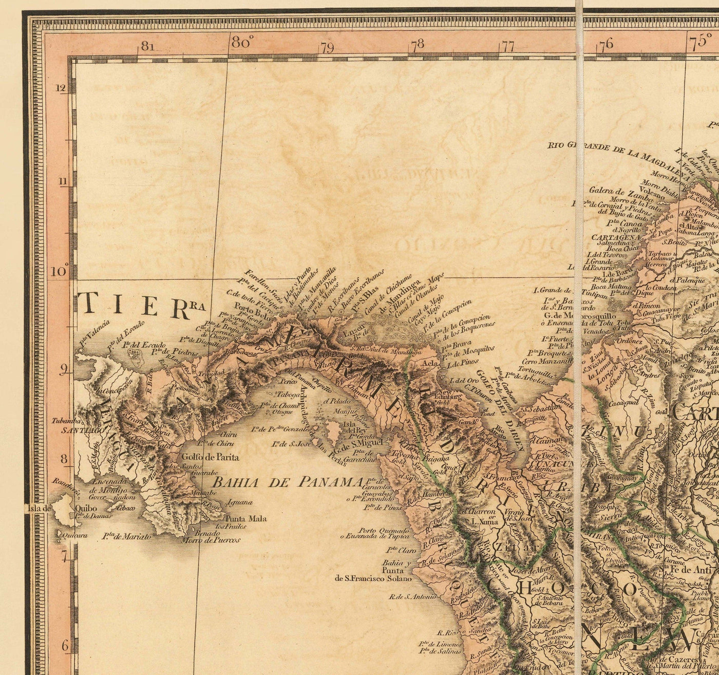
You might see a small chunk of South America labeled “French Guiana” and think, “Wait, what?” Yes, France got a piece of the colonial pie, mostly because nobody else wanted the mosquito-infested jungle. French Guiana became a place for France to dump prisoners (yes, Devil’s Island is there) and to grow sugar using enslaved labor. In the Caribbean, the French had a bigger presence: Haiti (then Saint-Domingue) was the richest colony in the world, producing half the world’s coffee and sugar, all thanks to brutal slavery. The French also claimed parts of the Caribbean islands like Martinique and Guadeloupe. So while Spain and Portugal were the main characters, France was that one friend who shows up late, steals the snack, and leaves a weird stain on the couch.
Britain, the Netherlands, and the Squatters
England (later Britain) and the Netherlands weren’t about to let Spain have all the fun. They snagged bits and pieces of the Caribbean—Jamaica, Barbados, the Bahamas—and also nibbled at the northern coast of South America. British Guiana (now Guyana) and Dutch Guiana (now Suriname) were born from this colonial land grab. These weren’t Spain’s “viceroyalties” but rather small, profitable plantation colonies. The British and Dutch were the colonists who showed up with a calendar and a business plan, focused on sugar, rum, and slaves. They had no interest in converting the locals to Anglicanism or Calvinism; they just wanted to make money. On a map, these territories look like tiny flags sticking out of the Spanish blob—annoying but persistent.
The Indigenous Elephants in the Room: They Were There First
Every colonial map is a massive exercise in erasure. Indigenous empires like the Aztecs, Incas, and Mayans had been running their own shows for centuries before Europeans arrived. The Aztecs had a trade network that rivaled Rome’s. The Incas built roads across the Andes that would make modern engineers weep. The Mayans invented zero and tracked the stars. Then the Spanish showed up with smallpox, horses, and an unshakable belief that God wanted them to own silver. The maps from this period often show “unexplored” or “terra incognita” for vast areas, which is a nice way of saying “we haven’t killed the people here yet.” When you study a colonial map quiz, remember that each red or blue blob represents the violent displacement of entire civilizations. Also, those boundaries were mostly ignored by indigenous peoples who continued to live their lives, speak their languages, and occasionally set fire to a Spanish encomienda. The map is a lie, but it’s the lie we study.
The Independence Era: Everyone Gets a Divorce
By 1810, the colonial map of Latin America was about to explode. Napoleon’s invasion of Spain created a power vacuum, and suddenly all those viceroyalties started screaming, “We want freedom, and also, we want to keep the mines.” Leaders like Simón Bolívar and José de San Martín (who were basically the rockstars of revolution) led rebellions that tore the Spanish empire apart. By 1825, Spain had lost everything except Cuba and Puerto Rico. Portugal’s colony, Brazil, got independence without a war because the Portuguese prince pranced down and declared himself emperor. The result? The birth of many new countries with borders that mostly followed the old colonial lines, which is why Colombia has a weird panhandle and Argentina looks like a boot kicking the Falklands. Modern maps of Latin America are essentially the colonial map after a messy breakup, with each country keeping the furniture and the grudges.
How to Ace Your Map Quiz (Without Crying)
If you’re staring at a blank map and need to label “Viceroyalty of New Spain” or “Portuguese Brazil,” here’s the trick: think of the map as a cartoon character. Brazil is the fat, happy guy on the right who ate all the cake. The Viceroyalty of Peru is the skinny, serious face of western South America. New Granada is the angry eyebrow above Ecuador. And the Río de la Plata is the boot kicking south. For the Caribbean, remember that Spain owned the big islands (Cuba, Hispaniola, Puerto Rico) while Britain and France took the smaller ones. If you see French Guiana, just remember: “France owns the jungle where they send people they don’t like.” And if you see a tiny sliver of the Netherlands in Suriname, know that it’s the colonial equivalent of a stubborn plant growing through concrete.
Conclusion
Colonial Latin America’s map is a glorious, tragic, and often hilarious testament to human ambition and terrible planning. From the Pope’s lazy line to the bandeirantes’ flag-planting sprees, from the violent erasure of indigenous empires to the comically awkward borders that remain today, this map is a living history lesson. It’s not just a collection of colors and names—it’s a story of who wanted what, who got in the way, and how the party ended with everyone going home angry. Next time you look at a colonial map of Latin America, laugh at the mess, respect the tragedy, and remember: the funny lines on paper once meant lives, gold, and arguments that still echo today. And if you pass the quiz, you’ll have the last laugh.
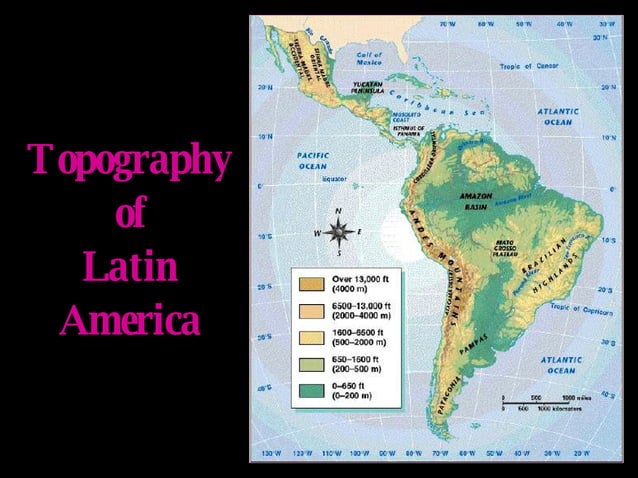
COLONIAL PERIOD: Latin American Geography | PPT
COLONIAL PERIOD: Latin American Geography | PPT
Getting Started - Colonial & Modern Latin American History Resources
Getting Started - Colonial & Modern Latin American History Resources ...
Symposium On Latin America In The Early Colonial Period At The Newberry

Symposium on Latin America in the Early Colonial Period at the Newberry ...
Rare Old Map Of South America By Faden, 1807 - Spanish Colonialism - B
Rare Old Map of South America by Faden, 1807 - Spanish Colonialism - B ...
Map Of Latin America And Its Major Cities

Map of Latin America and its Major Cities
Colonial South America
Colonial South America
COLONIAL PERIOD: Latin American Geography | PPT
COLONIAL PERIOD: Latin American Geography | PPT
Old Map Of South America By Coronelli 1690 - Brazil, Spanish Colonies

Old Map of South America by Coronelli 1690 - Brazil, Spanish Colonies ...
Colonial Latin America Map Quiz Diagram | Quizlet

Colonial Latin America Map Quiz Diagram | Quizlet
A Cartographic Analysis Of Colonial Latin America On Tumblr

A Cartographic Analysis of Colonial Latin America on Tumblr
A Map Of Colonial Latin America, With The Places Mentioned In The Text

A map of colonial Latin America, with the places mentioned in the text ...
Colonial Latin America Map Quiz Diagram | Quizlet

Colonial Latin America map quiz Diagram | Quizlet
7 Latin America Ideas | America, Cartography, Map

7 Latin America ideas | america, cartography, map
Imperialism In Latin America Map - Oconto County Plat Map

Imperialism In Latin America Map - Oconto County Plat Map
South America Countries Map
South America Countries Map
A America Latina Colonial Village

A America Latina Colonial Village
7 Maps Of The Spanish Colonial Empire - World History Encyclopedia

7 Maps of the Spanish Colonial Empire - World History Encyclopedia
Colonial South America
Colonial South America
A Cartographic Analysis Of Colonial Latin America On Tumblr

A Cartographic Analysis of Colonial Latin America on Tumblr
Rare Old Map Of South America By Faden, 1807 - Spanish Colonialism - B
Rare Old Map of South America by Faden, 1807 - Spanish Colonialism - B ...
Latin America & Colonies Diagram | Quizlet

latin america & colonies Diagram | Quizlet
A Cartographic Analysis Of Colonial Latin America — Riddled With

A Cartographic Analysis of Colonial Latin America — Riddled with ...
Colonial Latin America In Eighteenth Century : R/MapPorn

Colonial Latin America in Eighteenth Century : r/MapPorn
Colonial Settlers And Economic Development In Latin America – BSE Focus

Colonial settlers and economic development in Latin America – BSE Focus
Map Om The Spanish Colonial Communities In Colonial Mexico Under
Map Om The Spanish Colonial Communities In Colonial Mexico Under
COLONIAL PERIOD: Latin American Geography
COLONIAL PERIOD: Latin American Geography
Colonial South America
Colonial South America
Old Map Of South America By Coronelli 1690 - Brazil, Spanish Colonies

Old Map of South America by Coronelli 1690 - Brazil, Spanish Colonies ...
The History Of Latin America

The History of Latin America
A Cartographic Analysis Of Colonial Latin America: Photo

A Cartographic Analysis of Colonial Latin America: Photo
Colonial America Map - Sliding Puzzle On Sliding Tiles
colonial america map - sliding puzzle on Sliding Tiles
Map Of Colonial South America

Map of Colonial South America
Rare Old Map Of South America By Faden, 1807 - Spanish Colonialism - B
Rare Old Map of South America by Faden, 1807 - Spanish Colonialism - B ...
Historical Maps Of Latin America

Historical Maps of Latin America