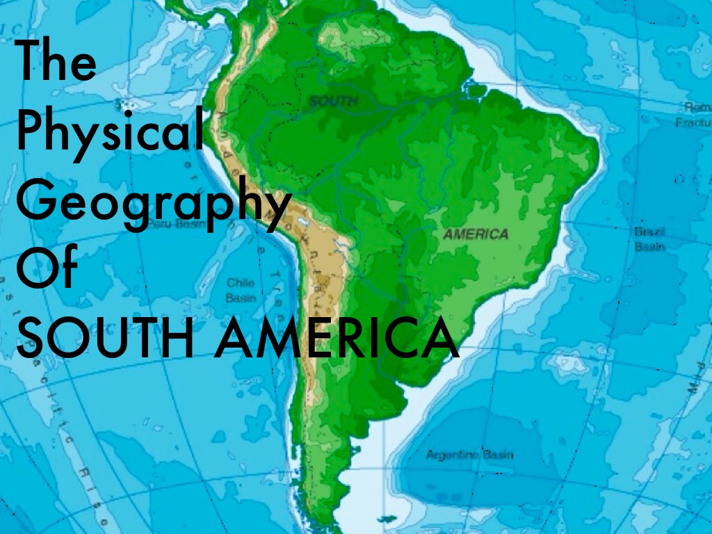
Geography of South America: A Comprehensive Physical Guide
South America is a continent of staggering geographical diversity, from the world's longest mountain range and largest rainforest to vast arid deserts and immense river systems. This guide will provide a detailed exploration of the continent's key physical features, including its major mountain ranges, river basins, climate zones, and unique ecosystems, offering a clear understanding of its remarkable landscape.
The Andes Mountains: The Continental Backbone
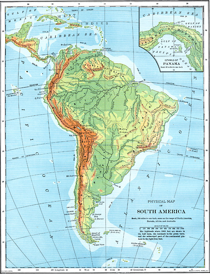
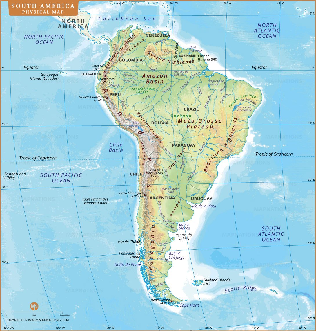
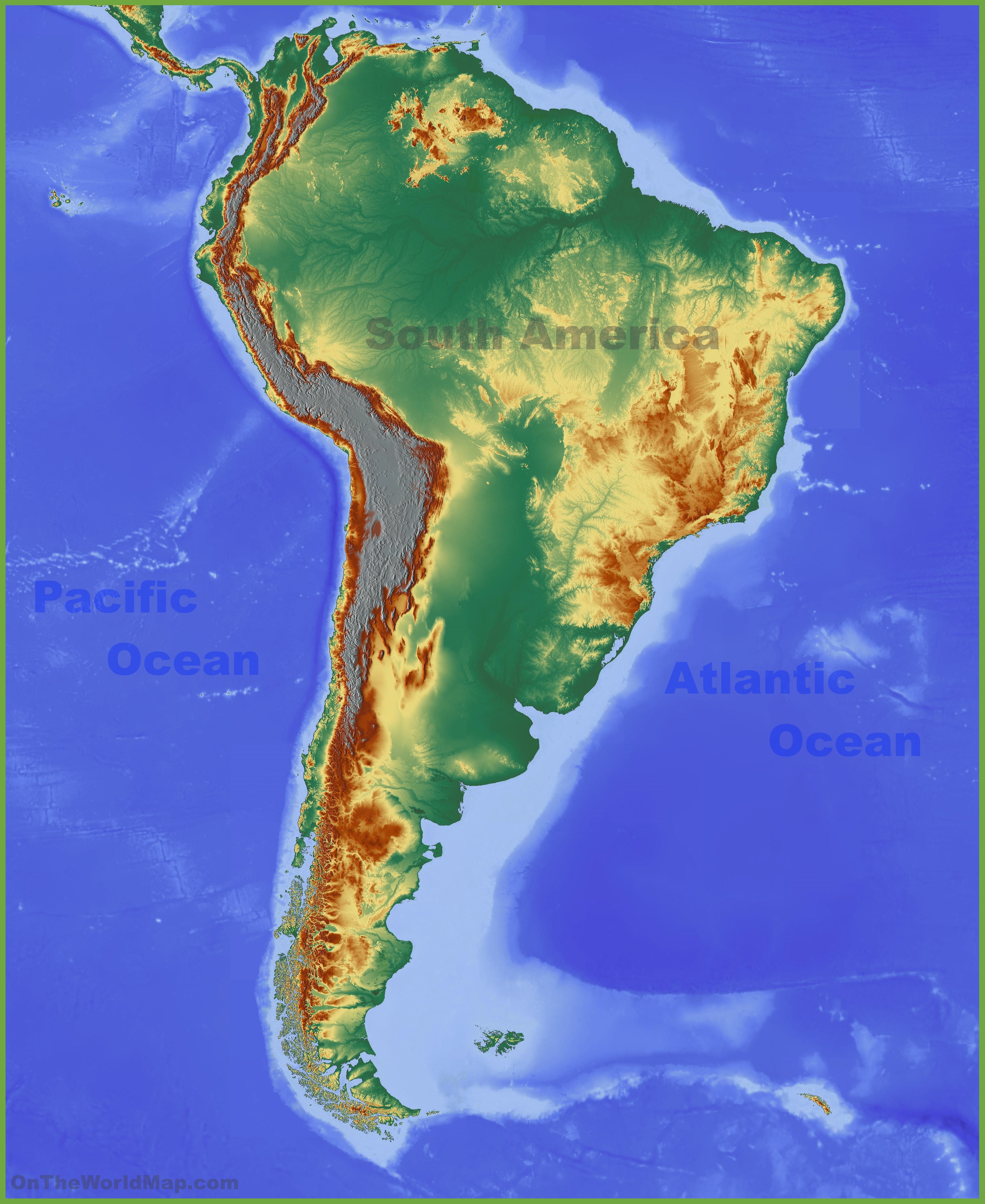
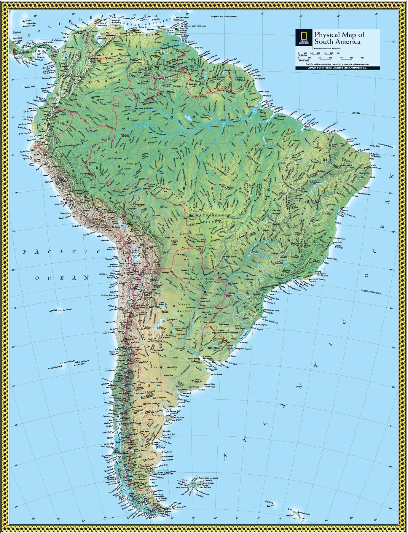
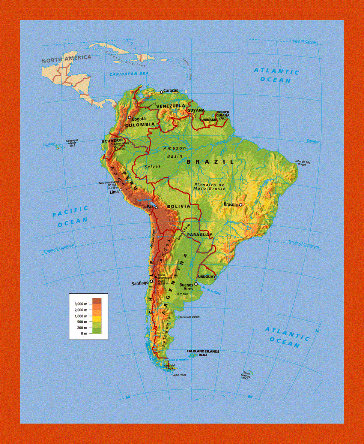
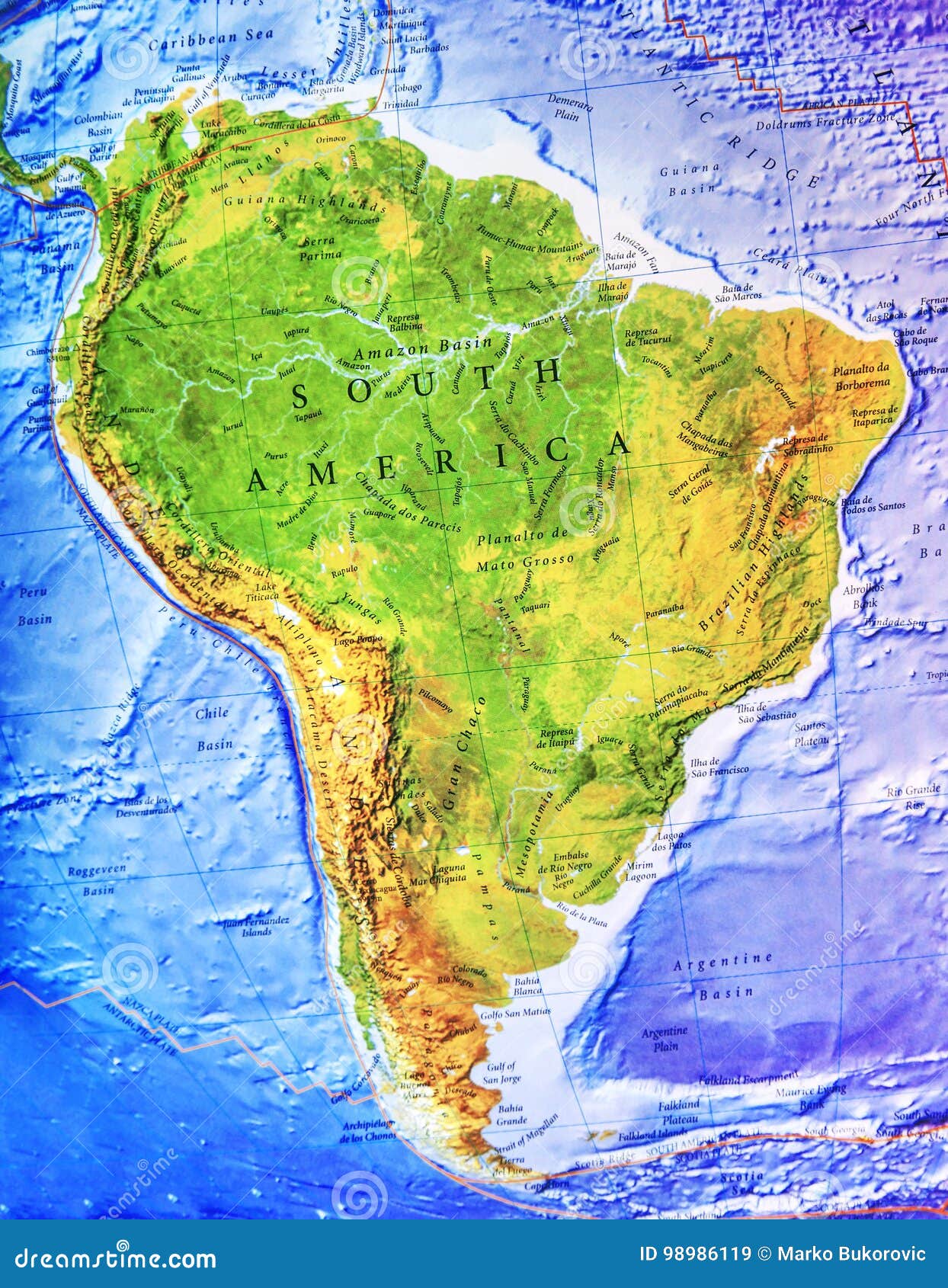
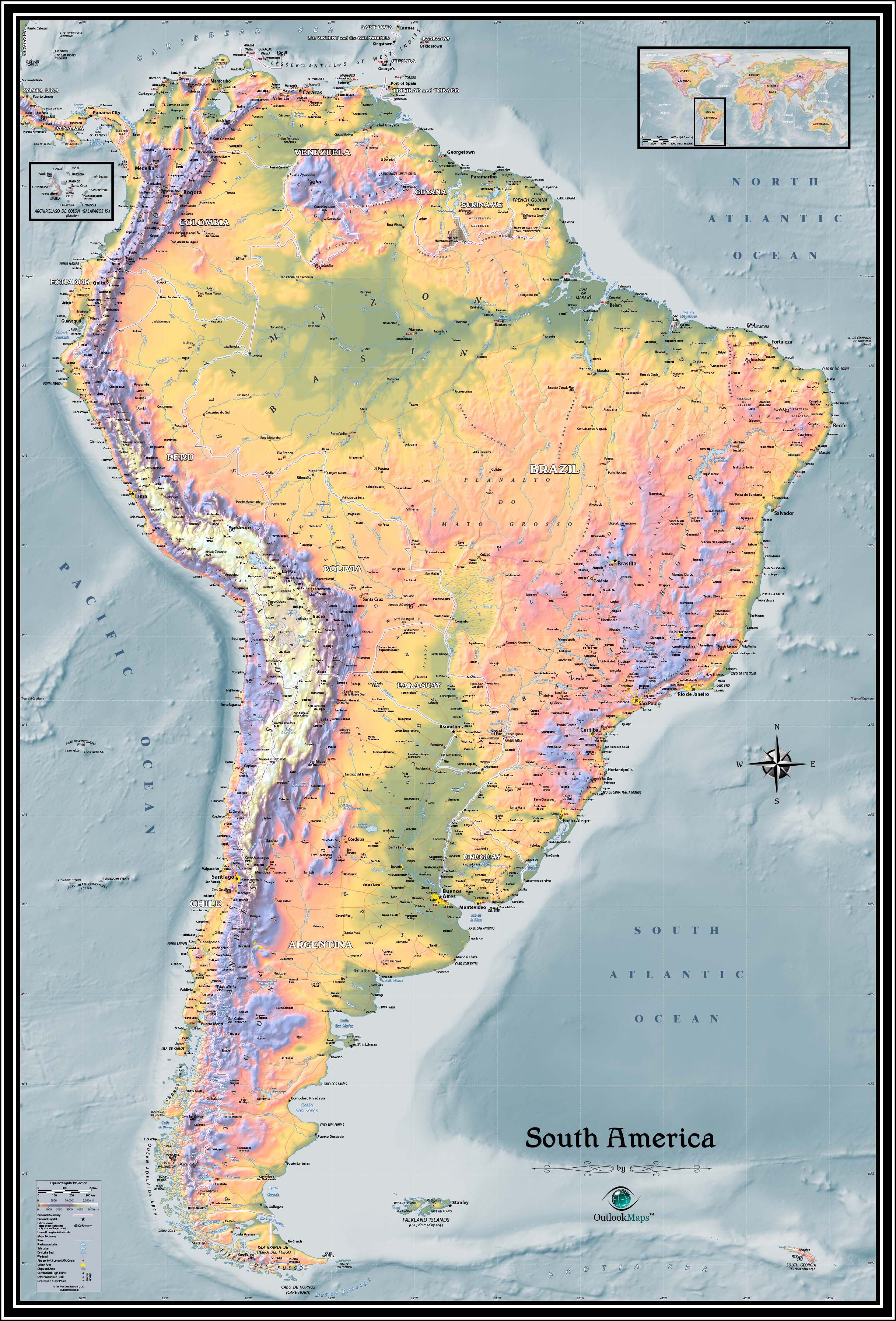
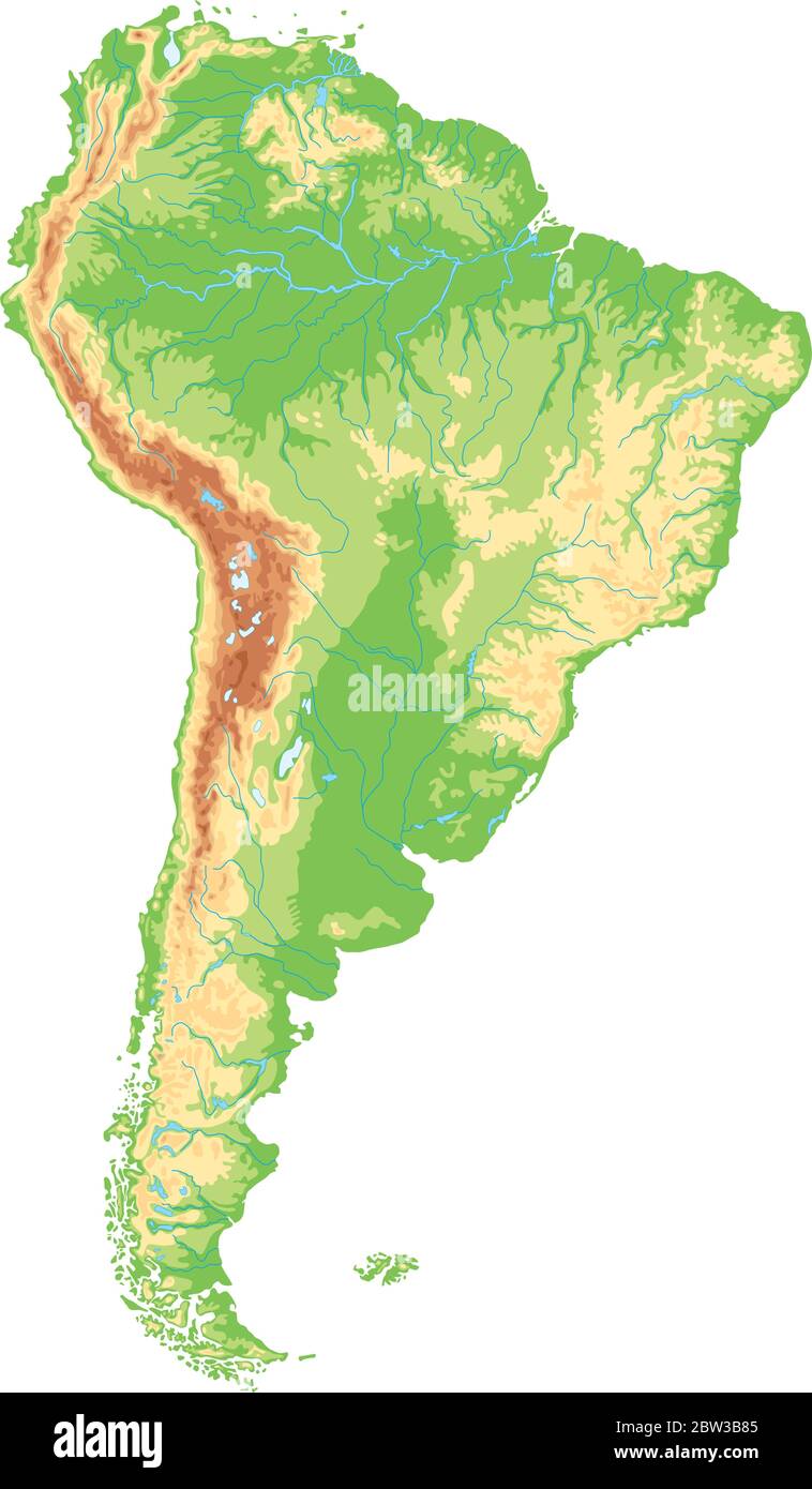
The Andes form the world's longest continental mountain range, stretching over 7,000 kilometers (4,300 miles) along the entire western edge of South America. This immense system is a product of the Nazca Plate subducting beneath the South American Plate, creating a region of intense volcanic activity and towering peaks. The range is divided into three principal sections: the Northern Andes (in Colombia, Ecuador, and Venezuela), which are characterized by high plateaus and deep valleys; the Central Andes (in Peru and Bolivia), where the range widens to include the vast Altiplano, a high-elevation plateau that contains Lake Titicaca; and the Southern Andes (in Chile and Argentina), where the mountains descend into Patagonia, featuring dramatic fjords and glaciers. The highest peak in the Andes, and the entire Western Hemisphere, is Mount Aconcagua, standing at 6,961 meters (22,837 feet) in Argentina.
The Amazon Basin and River System
Dominating the northern half of the continent is the Amazon Basin, the world's largest drainage basin, covering approximately 7 million square kilometers (2.7 million square miles). The Amazon River, which flows from the Andes in Peru to the Atlantic Ocean in Brazil, is the largest river by discharge volume of water and by the length of its navigable waterways. Its ecosystem, the Amazon rainforest, is the most biodiverse tropical rainforest on Earth, home to millions of species of plants, animals, and insects. The region also includes the massive Amazon River floodplain, which experiences periodic inundations that shape the landscape and create a unique environment for aquatic life. The river's mouth, a vast estuary near the city of Belém, is so wide that the island of Marajó, located within it, is roughly the size of Switzerland.
The Guiana and Brazilian Highlands
In contrast to the low-lying Amazon, two major highland regions break up the continent's topography. The Guiana Highlands in the northeast, straddling Venezuela, Guyana, Suriname, and French Guiana, are ancient geological formations composed of table-like plateaus called tepuis. These isolated mesas, such as Mount Roraima, are famous for their endemic species and as the inspiration for Arthur Conan Doyle’s *The Lost World*. The Brazilian Highlands, forming a vast plateau that covers much of central and southeastern Brazil, are another ancient shield region. This area is characterized by rolling hills, deep river valleys, and extensive plateaus such as the Serra do Mar and the Serra da Mantiqueira, which rise sharply from the Atlantic coast. The highlands are a crucial source of minerals and contain the headwaters of many major rivers, including the Paraná and the São Francisco.
Major Plains and River Basins
Beyond the Amazon, two other major lowland plains are essential to the continent’s geography. The Llanos are vast tropical grasslands in Colombia and Venezuela, located north of the Amazon and between the Andes and the Orinoco River. This flooded savanna region experiences a distinct wet and dry season, supporting large herds of grazing animals and a rich bird population. Farther south, the Pampas stretch across central Argentina and Uruguay. These fertile, temperate grasslands are the agricultural heartland of the continent, producing beef, wheat, and soybeans. The Paraná, Paraguay, and Uruguay river systems drain the Pampas, forming the Rio de la Plata estuary, one of the largest in the world, which empties into the Atlantic Ocean.
Climate Zones and Biomes
South America’s climate ranges from equatorial rainforest to polar ice caps. Along the west coast, the Atacama Desert in northern Chile is one of the driest places on Earth, created by a rain shadow effect from the Andes and the cold Humboldt Current. In central Chile, a Mediterranean climate supports vineyards and agriculture. The southern tip of the continent, in Patagonia, experiences cold, windy conditions, with glaciers and steppe-like vegetation. Meanwhile, the eastern coast of Brazil has a tropical climate with a wet summer season. This diversity gives rise to a wide array of biomes: the tropical rainforest of the Amazon, the seasonally flooded Pantanal (the world's largest tropical wetland), the Caatinga (a dry shrubland in northeastern Brazil), the temperate forests of southern Chile and Argentina, and the high-altitude puna grasslands of the Altiplano.
Lake Titicaca and Other Notable Water Bodies
Lake Titicaca, straddling the border between Peru and Bolivia, is the largest lake in South America by volume of water and the highest navigable lake in the world, at 3,812 meters (12,507 feet) above sea level. It is a remnant of an ancient inland sea, and its waters host unique species like the giant Titicaca water frog. The continent also features Maracaibo Lake in Venezuela, the largest lake by area in South America (though some consider it a tidal bay), and the glacial lakes of Patagonia, such as Buenos Aires and Argentino, known for their striking blue colors and icebergs. These bodies of water are vital for local ecosystems, transportation, and tourism.
The Southern Cone and Patagonia
The southernmost region of South America, known as the Southern Cone (comprising Chile, Argentina, and Uruguay), is defined by its temperate climate and dramatic landscapes. Patagonia, a vast region shared by Chile and Argentina, is a land of extremes: the arid steppe of the east meets the icy fjords, granite spires, and massive ice fields of the Andes in the west. The Patagonian Ice Fields are the largest ice masses in the Southern Hemisphere outside of Antarctica, feeding numerous glaciers like Perito Moreno. The region is also home to the Strait of Magellan, the Beagle Channel, and the Cape Horn archipelago, forming a crucial maritime passage around the southern tip of the continent.
Conclusion
The geography of South America is a tapestry of extreme contrasts and global significance. From the towering heights of the Andes to the sprawling immensity of the Amazon, from the stark dryness of the Atacama to the icy expanses of Patagonia, its landscapes define ecosystems, cultures, and economies. Understanding these physical characteristics—its mountains, rivers, plains, and climate zones—is essential to appreciating the continent’s natural beauty, its environmental challenges, and its role in the global biosphere. The continent’s geographical diversity remains one of its most defining and awe-inspiring features.
Geography

Geography
South America-physical Map | Stock Vector | Colourbox

South America-physical map | Stock vector | Colourbox
Physical Map Of South America
Physical Map Of South America
Geography Hunt South America At Isaac Dadson Blog
Geography Hunt South America at Isaac Dadson blog
South America Physical Map – Mountains, Rivers & Terrain Features
South America Physical Map – Mountains, Rivers & Terrain Features
Physical Map Of South America Physical South America Map | Premium

Physical Map Of South America Physical South America Map | Premium
South America Physical Geography Diagram | Quizlet

South America Physical Geography Diagram | Quizlet
South America's Physical Geography PowerPoint And Note Guide
South America's Physical Geography PowerPoint and Note Guide
South America Map With Major Cities And National Parks

South America Map with Major Cities and National Parks
Maps Of South America

Maps of South America
Test Your Geography Knowledge: South America: Physical Features Quiz

Test your geography knowledge: South America: physical features quiz ...
South America Physical Map Photos And Premium High Res Pictures - Getty
South America Physical Map Photos and Premium High Res Pictures - Getty ...
Physical Map Of South America - Ontheworldmap.com
Physical map of South America - Ontheworldmap.com
South America Physical Map

South america physical map
Geography Now South America At Martha Ehrlich Blog
Geography Now South America at Martha Ehrlich blog
The Physical Geography Of South America By Mariah
The Physical Geography Of South America by Mariah
66 Geography Of South America: Important Physical Geography Facts About

66 Geography of South America: Important physical geography facts about ...
Physical Map Of South America Physical South America Map | Premium
Physical Map Of South America Physical South America Map | Premium
Printable Physical Map Of South America
Printable Physical Map Of South America
Physical Geography And Features Of South America

Physical Geography and Features of South America
Physical Map Of South America Printable - Printable Free Templates
Physical Map Of South America Printable - Printable Free Templates
Physical Map Of South America Printable - Printable Free Templates

Physical Map Of South America Printable - Printable Free Templates
South America Physical Geography Map | PDF | Physical Geography | Earth

South America Physical Geography Map | PDF | Physical Geography | Earth ...
Physical Map Of South America

Physical Map Of South America
Latin America & The Caribbean - 548: Unit I: Basic Geography Of Latin
Latin America & the Caribbean - 548: Unit I: Basic Geography of Latin ...
Physical Geography And Features Of South America

Physical Geography and Features of South America
Physical Map South America , Physical Map Of South America – TLWK
Physical Map South America , Physical Map of South America – TLWK
Physical Map Of South America Physical South America Map | Premium
Physical Map Of South America Physical South America Map | Premium
PHYSICAL MAP SOUTH AMERICA Diagram | Quizlet

PHYSICAL MAP SOUTH AMERICA Diagram | Quizlet
Geographical Features South America At William Gainey Blog
Geographical Features South America at William Gainey blog
Physical Geography Of South America | PPT

Physical Geography Of South America | PPT
Physical Map Of South America Physical South America Map | Premium
Physical Map Of South America Physical South America Map | Premium
South America Physical Geography #1 Diagram | Quizlet

South America Physical Geography #1 Diagram | Quizlet
South America Physical 4 Diagram | Quizlet

South America Physical 4 Diagram | Quizlet