Southeast Asia Map Labeled: A Student's Comprehensive Guide to Countries, Capitals, and Geography
This guide will help you understand the political and physical geography of Southeast Asia by exploring a detailed, labeled map. Designed for students, it covers all eleven countries, their capitals, major landforms, and key bodies of water. By the end, you will be able to identify each nation, recall its capital city, and describe the region's unique geographical features that have shaped its history and culture.
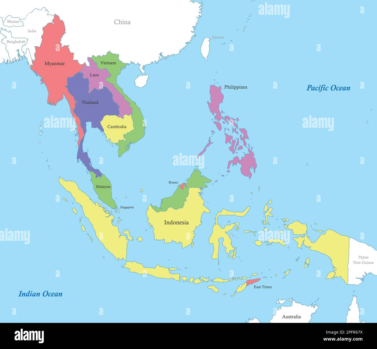
The Eleven Countries of Southeast Asia
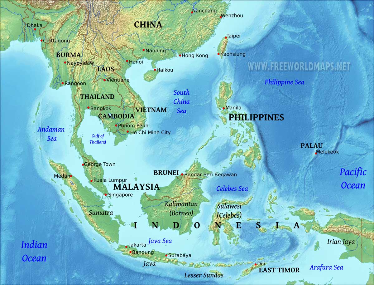
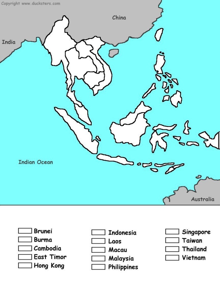
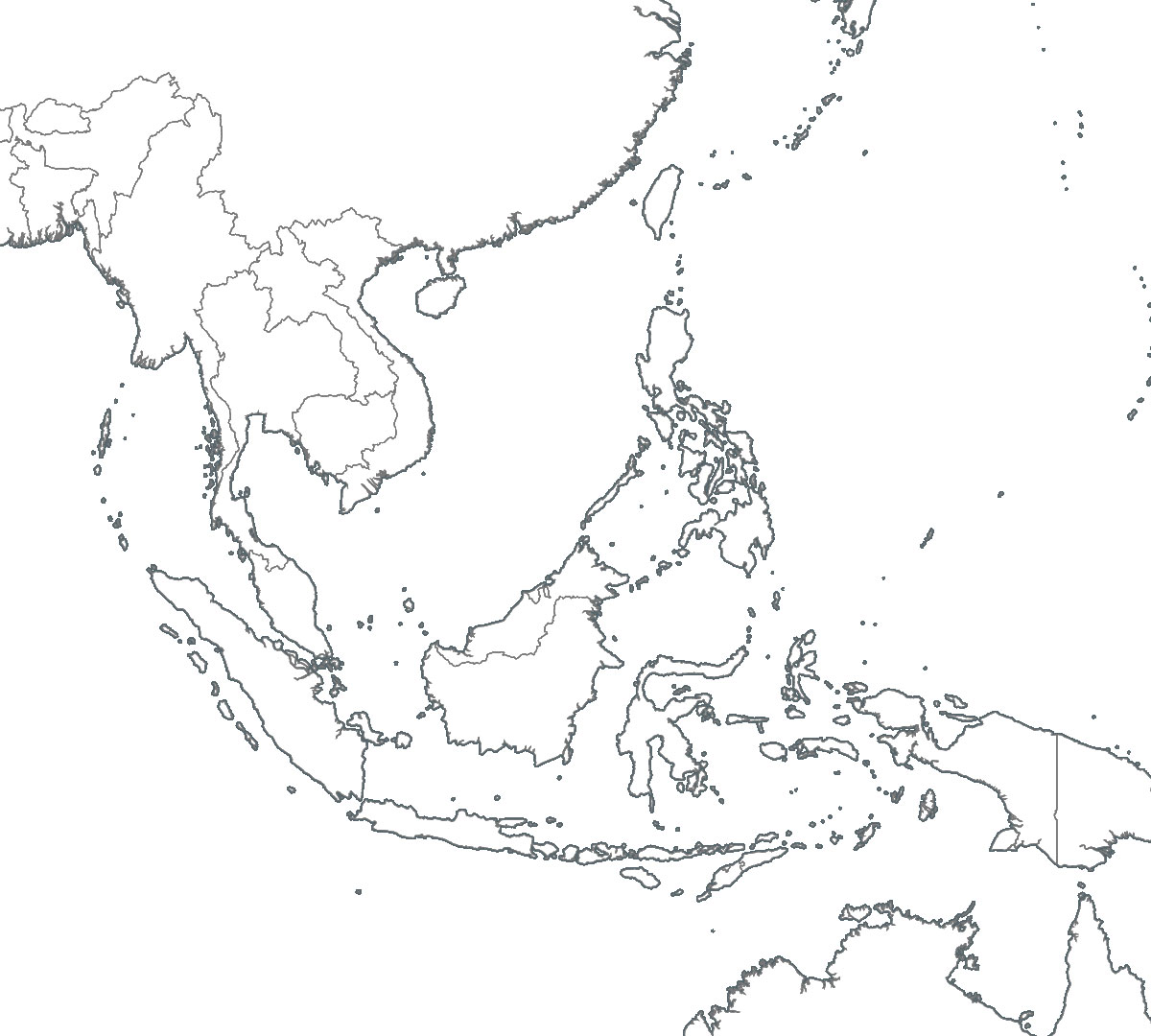
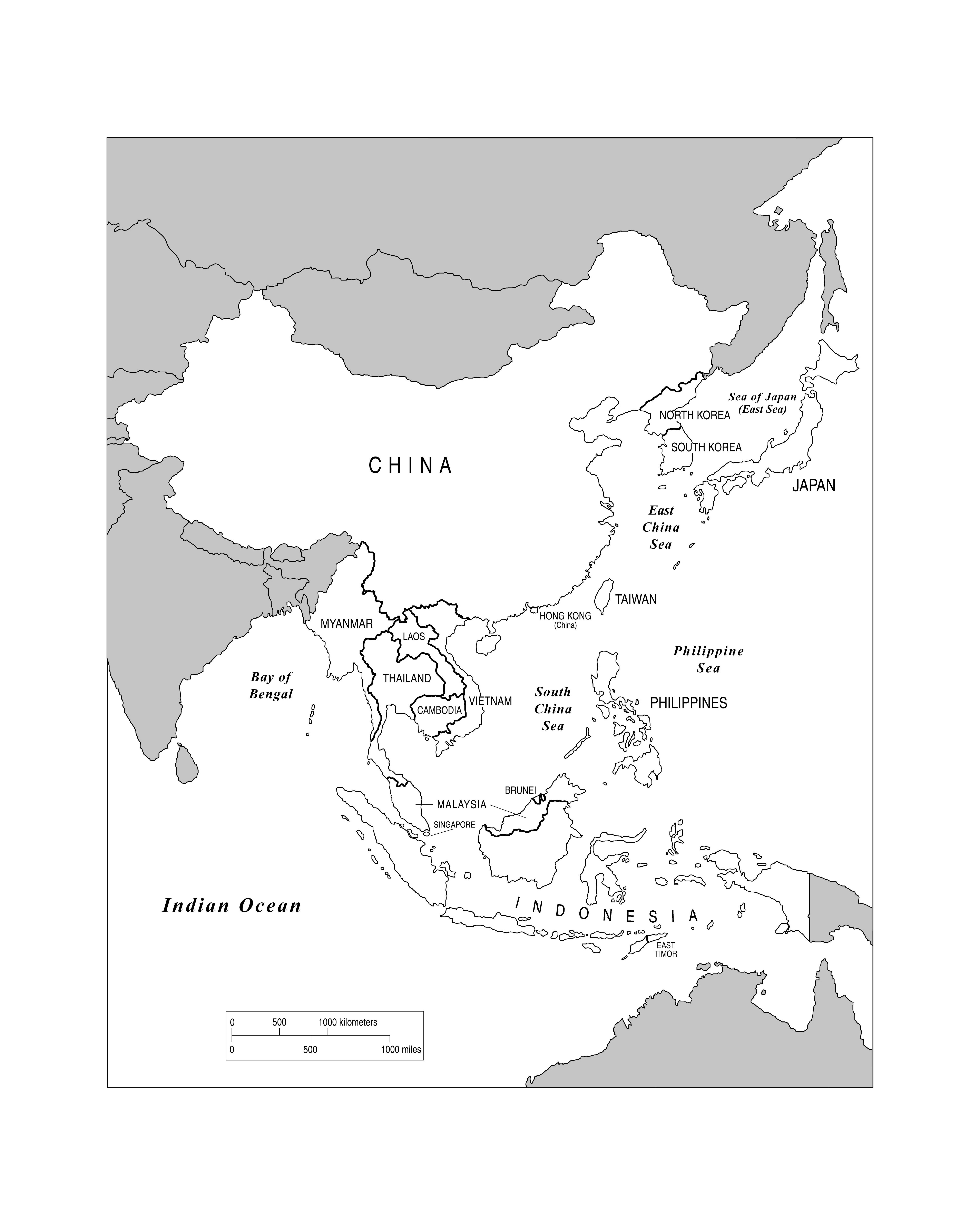
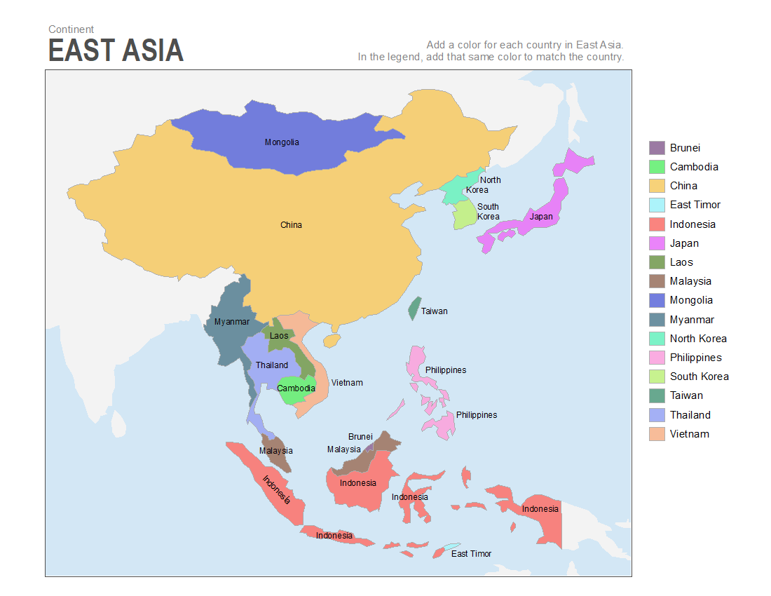
Southeast Asia is divided into two main geographical subregions: Mainland Southeast Asia and Maritime Southeast Asia. Mainland countries include Myanmar, Thailand, Laos, Cambodia, and Vietnam, which are connected to the Asian continent. Maritime countries are composed of thousands of islands, including Indonesia, the Philippines, Malaysia, Singapore, Brunei, and East Timor. When you look at a labeled map, note how the mainland nations stretch southward from China, while the maritime nations spread across the Pacific and Indian Oceans. This split greatly influences trade, climate, and cultural exchange.

Capitals and Major Cities on the Map
Every capital city on the Southeast Asia map represents a center of government, economy, and population. Bangkok (Thailand) is often marked as the region's most visited capital, while Hanoi (Vietnam) and Phnom Penh (Cambodia) reflect rich histories. Jakarta (Indonesia) is the largest city in Southeast Asia, located on the island of Java. Singapore is both a city and a country, highlighted on maritime maps as a tiny but powerful hub. Manila (Philippines) and Kuala Lumpur (Malaysia) also stand out due to their skylines and trade importance. Students should practice locating these capitals by comparing them with neighboring countries—for example, Vientiane (Laos) sits along the Mekong River near Thailand.
Major Rivers and Deltas
The Mekong River is the most significant waterway on any Southeast Asia map. It flows through China, Myanmar, Laos, Thailand, Cambodia, and Vietnam, ending in the fertile Mekong Delta. This delta is a key area for rice farming and is densely populated. Other important rivers include the Irrawaddy in Myanmar, which runs through the country's center, and the Red River in northern Vietnam, which flows past Hanoi. The Chao Phraya River in Thailand runs through Bangkok. When labeling a map, trace these rivers because they have historically defined settlement patterns and agricultural zones.
Mountain Ranges and Highlands
Mountain ranges create natural borders within Southeast Asia. The Annamite Range separates Laos and Vietnam, while the Tenasserim Hills run along the border of Myanmar and Thailand. On a physical map, you will see that northern Myanmar and Thailand contain high peaks, part of the Himalayan foothills. The island of Borneo (shared by Malaysia, Indonesia, and Brunei) features Mount Kinabalu, one of the tallest mountains in the region. Understanding these landforms helps explain why certain areas are isolated or difficult to travel across, influencing cultural diversity and development.
Maritime Boundaries and Island Groups
Maritime Southeast Asia includes thousands of islands. The largest archipelago is Indonesia, with over 17,000 islands, including Sumatra, Java, Borneo (Kalimantan), Sulawesi, and Papua. The Philippines consists of more than 7,000 islands, divided into three main groups: Luzon, Visayas, and Mindanao. The Strait of Malacca, located between the Malay Peninsula and Sumatra, is a critical shipping route shown on most maps. Students should note how small countries like Singapore and Brunei sit strategically along these sea lanes, which have made them wealthy trading hubs for centuries.
Climate Zones and Their Map Representation
Nearly all of Southeast Asia lies within a tropical climate zone, indicated on thematic maps by green and warm colors. The region experiences monsoon seasons—dry and wet—that affect agriculture and tourism. The equator runs through Indonesia, giving it a consistently hot and rainy climate. Mountain areas, however, like those in northern Laos or Myanmar, have cooler temperatures. When studying a climate overlay map, you will see that coastal areas are more prone to typhoons, especially the Philippines and Vietnam. This climatic information is essential for understanding the region's farming cycles and disaster preparedness.
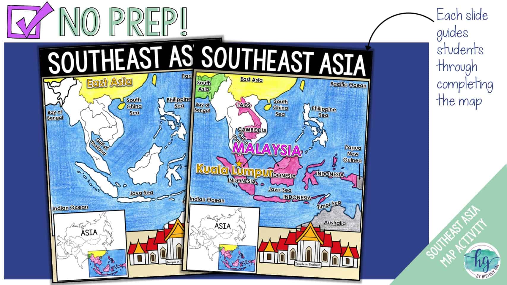
How to Use a Labeled Map for Study
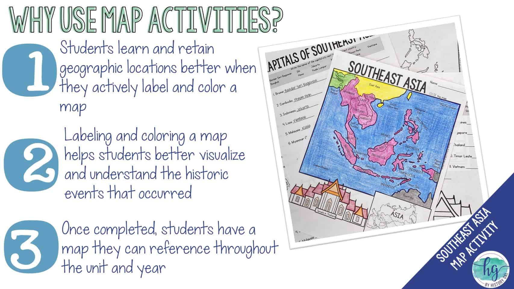
Begin by memorizing the eleven countries in order from north to south: Myanmar, Thailand, Laos, Cambodia, Vietnam, then the maritime nations: Malaysia, Singapore, Indonesia, Philippines, Brunei, and East Timor. Next, use a blank outline map to practice writing the capitals: Naypyidaw (Myanmar), Bangkok (Thailand), Vientiane (Laos), Phnom Penh (Cambodia), Hanoi (Vietnam), Kuala Lumpur (Malaysia), Singapore (Singapore), Jakarta (Indonesia), Manila (Philippines), Bandar Seri Begawan (Brunei), and Dili (East Timor). Finally, trace the major rivers and label the seas: South China Sea, Andaman Sea, Gulf of Thailand, and the Philippine Sea. This systematic approach will build a strong mental map of the region.
Conclusion
A labeled map of Southeast Asia is an invaluable tool for any student seeking to understand this diverse region. By mastering the countries, capitals, rivers, mountain ranges, and maritime zones, you gain a foundation for deeper studies in history, economics, and culture. Use visual aids like the images provided to test your recall and connect geography to real-world events. With practice, the complex layout of Southeast Asia will become clear and memorable, empowering you to discuss and analyze this dynamic part of the world with confidence.
Geography Map Of Southeast Asia
Geography Map Of Southeast Asia
Example Map Physical Map South And Southeast Asia - Labeled | PDF

Example Map Physical Map South and Southeast Asia - Labeled | PDF
Southeast Asia Countries Practice Map Quiz — Printable Worksheet

Southeast Asia Countries Practice Map Quiz — Printable Worksheet
Printable Southeast Asia Map

Printable Southeast Asia Map
Map Southeast Asia Countries
Map Southeast Asia Countries
Blank Map Of Southeast Asia To Label Jb7I7 - Large Map Of Asia
Blank Map Of Southeast Asia To Label Jb7I7 - Large Map of Asia
Southeast Asia Geographical Map Quiz

Southeast Asia Geographical Map Quiz
Southeast Asia Political Map 1992 Full Size
Southeast Asia Political Map 1992 Full Size
Southeast Asia Physical Map - Labelled Diagram
Southeast Asia Physical Map - Labelled diagram
GEOG 102 Southeast Asia Map Diagram | Quizlet

GEOG 102 Southeast Asia Map Diagram | Quizlet
5 Free Printable Southeast Asia Map Labeled With Countries PDF Download
5 Free Printable Southeast Asia Map Labeled With Countries PDF Download
South And Southeast Asia Map Areas — Printable Worksheet

South and Southeast Asia Map Areas — Printable Worksheet
Map Of Southeast Asia #2 By Jodi's Jewels | TPT
Map of Southeast Asia #2 by Jodi's Jewels | TPT
Southeast Asia Political Map Capitals Quiz

Southeast Asia Political Map Capitals Quiz
Southeast Asia Physical Map

Southeast Asia Physical Map
Map Of Southeast Asia By Jodi's Jewels | TPT
Map of Southeast Asia by Jodi's Jewels | TPT
Southeast Asia Map - Labelled Diagram
Southeast Asia Map - Labelled diagram
Maps Of Asia, Page 2 - Worksheets Library
Maps of Asia, page 2 - Worksheets Library
Map Of Southeast Asia (Southeastern Asia)

Map of Southeast Asia (Southeastern Asia)
Map Of Southeast Asia - Labelled Diagram
Map of Southeast Asia - Labelled diagram
Blank Map Of Southeast Asia To Label
Blank Map Of Southeast Asia To Label
South East Asia Countries Map Doodle Freehand Drawing

South East Asia Countries Map Doodle Freehand Drawing
Southeast Asia Map Practice - Labelled Diagram
Southeast Asia Map Practice - Labelled diagram
Printable Southeast Asia Map

Printable Southeast Asia Map
(PDF) Name: SOUTHEAST ASIA Labeled Political Map Date: Z O

(PDF) Name: SOUTHEAST ASIA Labeled Political Map Date: Z O ...
Southeast Asia Political Map: Countries — Printable Worksheet

Southeast Asia Political Map: Countries — Printable Worksheet
Map Of Southeast Asia #2 MOD | Social Studies Middle School, Teaching

Map of Southeast Asia #2 MOD | Social studies middle school, Teaching ...
5 Free Printable Southeast Asia Map Labeled With Countries Pdf Download
5 Free Printable Southeast Asia Map Labeled With Countries Pdf Download
Map Of Southeast Asia

Map Of Southeast Asia
Southeast Asia Map Political

Southeast Asia Map Political
South Asia Political Map Southeast Asia Political Map Continent Map Of Asia

South Asia Political Map Southeast Asia Political Map Continent Map Of Asia
Map Of Southeast Asia #2 | Social Studies Middle School, Teaching

Map of Southeast Asia #2 | Social studies middle school, Teaching ...
Southeast Asia Blank Map

Southeast Asia Blank Map