Southeast Asia Climate Zones: A Comprehensive Guide to Regional Climatic Patterns
This comprehensive guide explores the diverse climate zones of Southeast Asia, a region characterized by complex atmospheric interactions, monsoon systems, and topographical influences. Readers will gain an in-depth understanding of the primary climatic classifications, seasonal variations, and the distinct weather patterns that define the mainland and maritime archipelagoes, from tropical rainforests to monsoon savannas.
Overview of Southeast Asian Climatic Regions
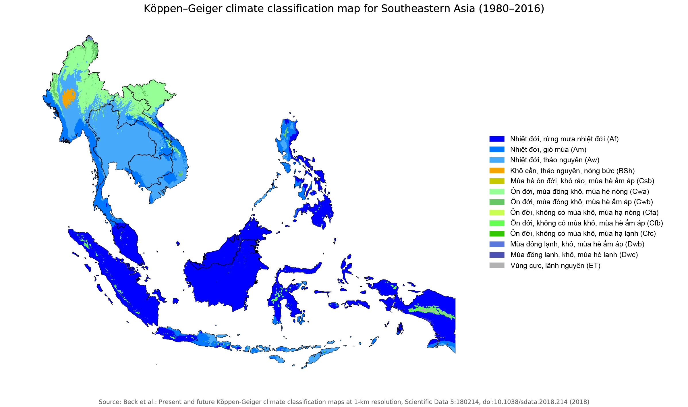
Southeast Asia spans latitudes from approximately 28°N to 10°S, encompassing both the Indochinese Peninsula and the extensive Malay Archipelago. The region’s climate is predominantly tropical, driven by its position near the equator and its exposure to warm ocean currents. The primary climatic divisions are determined by the interplay of the Asian monsoon system, the Intertropical Convergence Zone (ITCZ), and local topography such as mountain ranges and highlands. Broadly, the area can be categorized into equatorial rainforest climates, tropical monsoon climates, and tropical savanna climates, each with distinct temperature regimes, precipitation patterns, and seasonal cycles.
Equatorial Rainforest Climate Zone
Found predominantly in maritime Southeast Asia—including Indonesia, Malaysia, Brunei, southern Thailand, and the Philippines—the equatorial rainforest climate is characterized by consistently high temperatures and abundant rainfall year-round. Average monthly temperatures rarely dip below 26°C (79°F), and diurnal temperature ranges are minimal, often less than 5°C. Precipitation is heavy, typically exceeding 2,000 mm annually, with no distinct dry season. The ITCZ’s proximity ensures frequent convective thunderstorms, often occurring in the late afternoon. This climate supports the world’s most biodiverse tropical rainforest ecosystems, with dense canopy layers and high humidity levels averaging 80-90%. The equatorial zone’s weather is largely driven by the trade winds and the absence of significant seasonal wind shifts, resulting in relatively uniform climatic conditions throughout the year.
Monsoon Climate Zone of Mainland Southeast Asia
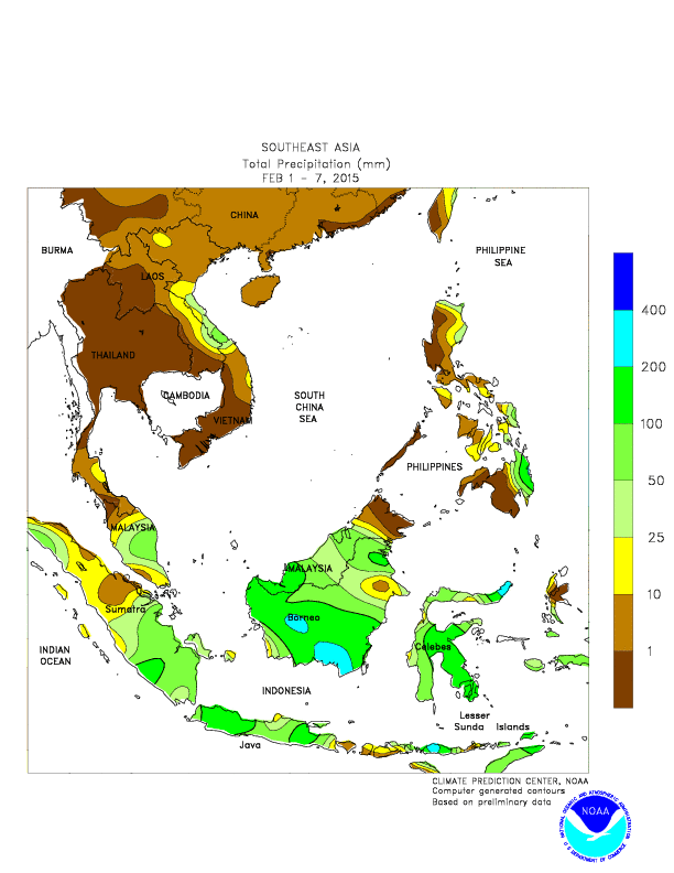
Mainland Southeast Asia—encompassing Thailand, Vietnam, Laos, Cambodia, and Myanmar—falls largely under the influence of the tropical monsoon climate. This zone is defined by pronounced seasonal wind reversals: the southwest monsoon from May to October brings warm, moist air from the Indian Ocean, resulting in heavy rainfall, while the northeast monsoon from November to February delivers cooler, drier air from the Asian interior. Annual rainfall totals range from 1,000 to 1,500 mm, with over 80% falling during the wet season. Temperatures vary more than in equatorial regions, with cooler months averaging 22-25°C (72-77°F) and hotter months reaching 30-35°C (86-95°F). The region experiences a distinct dry season, often lasting three to four months, which shapes agricultural calendars and water management strategies. Interannual variability is strongly tied to the El Niño-Southern Oscillation (ENSO), with El Niño events often producing droughts and La Niña leading to excessive rainfall and flooding.
Tropical Savanna and Transitional Climates
Interior regions of mainland Southeast Asia, particularly in eastern Myanmar, northeastern Thailand, and parts of Laos and Cambodia, exhibit a tropical savanna climate (Köppen classification Aw). These areas receive less annual rainfall—typically 800 to 1,200 mm—with a more pronounced dry season lasting up to five months. During the dry period, vegetation becomes sparse, and grasses dominate landscapes burnt by seasonal fires. The transition from wet to dry seasons can be abrupt, with April often being the hottest month before monsoon rains arrive. Coastal areas and deltaic regions, such as the Mekong and Red River deltas, represent transitional zones where equatorial and monsoon influences blend. These regions experience high humidity but with a more defined seasonality, supporting both rice paddies and mangrove ecosystems. The savanna climate supports a distinct dry deciduous forest, unlike the evergreen rainforests of the equatorial belt.
Topographical Influence on Local Climates
Topography plays a critical role in modifying climate across Southeast Asia. Major mountain chains—including the Annamite Range along the Vietnam-Laos border, the Tenasserim Hills of Myanmar, and the highlands of Borneo and New Guinea—create rain shadow effects and orographic precipitation. Windward slopes facing the monsoon receive upwards of 4,000 mm of rain annually, while leeward valleys may experience as little as 600 mm. The highlands, such as the Shan Plateau (Myanmar) and the Central Highlands of Vietnam, experience cooler temperatures, with annual averages ranging from 15-20°C, allowing for temperate crops like coffee and tea. The region’s many volcanoes and islands also contribute to localized weather systems, with land-sea breezes modulating daily temperature and precipitation cycles. The complex interplay between altitude and latitude means that even within a single country, climate conditions can vary dramatically from coastal plains to inland mountains.
Seasonal Variability and Climatic Extremes
Southeast Asia’s climate is subject to significant seasonal and interannual variability. The southwest monsoon typically peaks in August and September, bringing typhoon activity to the Philippines, Vietnam, and southern China. These tropical cyclones, known as typhoons in the Pacific, can cause catastrophic flooding, landslides, and storm surges. Conversely, the dry season, especially from January to March in northern regions, can lead to drought conditions and forest fires, impacting air quality across the region. The seasonal migration of the ITCZ also affects precipitation timing: when the ITCZ moves northward during the boreal summer, equatorial regions receive a secondary rainfall peak. Climate change is further altering these patterns, with rising sea surface temperatures intensifying monsoon rainfall in some areas while prolonging dry seasons in others. Understanding these cycles is essential for disaster preparedness, agriculture planning, and water resource management.
Conclusion
The climate zones of Southeast Asia form a complex mosaic shaped by latitude, monsoon dynamics, ocean influences, and topography. From the perpetually wet equatorial rainforests of the Malay Archipelago to the seasonally dry monsoon climates of the Indochinese Peninsula, each zone supports unique ecosystems and human livelihoods. The region’s weather extremes, driven by monsoons and typhoons, underscore the importance of climatic knowledge for sustainable development and risk mitigation. As global climate patterns evolve, continued monitoring and adaptation will be crucial for the millions of people whose lives and economies are intimately tied to Southeast Asia’s climatic rhythms.
South Asia Climate Map South Asia's Climate Hazard Hotspots IWMI

South Asia Climate Map South Asia's Climate Hazard Hotspots IWMI
Newsela | Climate Map Of Asia

Newsela | Climate map of Asia
South Asia Climate Zones Map Climate Impacts On Food Security And

South Asia Climate Zones Map Climate Impacts On Food Security And
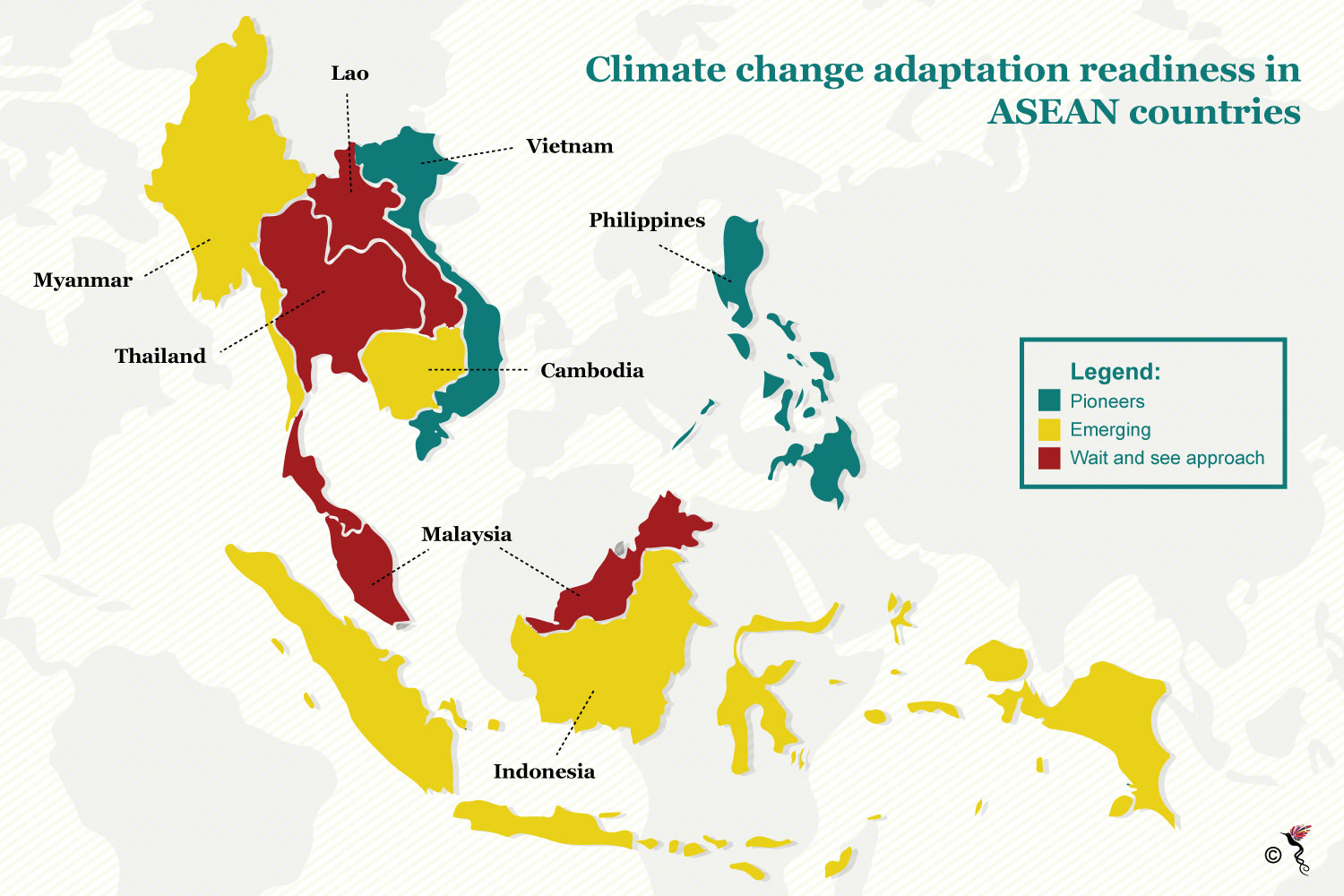
Southeast Asia: Climate Change Vulnerability (as Of Jan 2009) - Viet
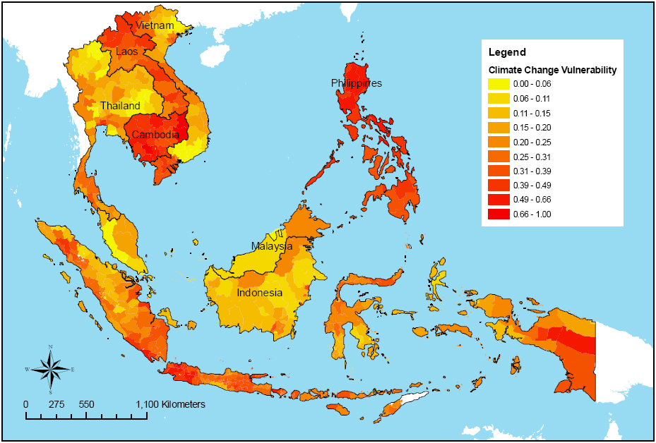
Southeast Asia: Climate change vulnerability (as of Jan 2009) - Viet ...
South Asia Climate Zones Map
South Asia Climate Zones Map
Colorful Climate Zones Map Of Asia PNG Free Download
Colorful Climate Zones Map of Asia PNG free download
South Asia Climate Zones Map Climate Impacts On Food Security And
South Asia Climate Zones Map Climate Impacts On Food Security And
Climate Map Of Southeast Asia Evaluation Of CMIP6 GCM Rainfall In

Climate Map Of Southeast Asia Evaluation Of CMIP6 GCM Rainfall In
Southeast Asia Climate Map

Southeast asia climate map
South Asia Climate Zones Map
South Asia Climate Zones Map
South Asia Climate Zones Map

South Asia Climate Zones Map
Climate Map Of Southeast Asia Evaluation Of CMIP6 GCM Rainfall In
Climate Map Of Southeast Asia Evaluation Of CMIP6 GCM Rainfall In
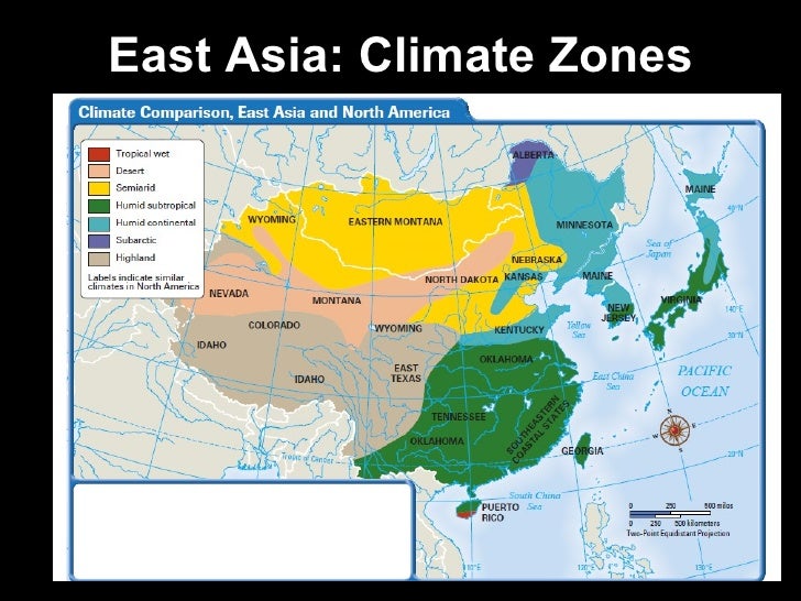
Asia Climate Map Climates Of East Asia Map By MsWeldonsWorld | TPT

Asia Climate Map Climates Of East Asia Map By MsWeldonsWorld | TPT
Southeast Asia Climate Map
Southeast asia climate map
Asia Climate Zones Map | Soar
Asia Climate Zones Map | Soar
Climate Map Of South Asia - Labelled Diagram
climate map of south asia - Labelled diagram
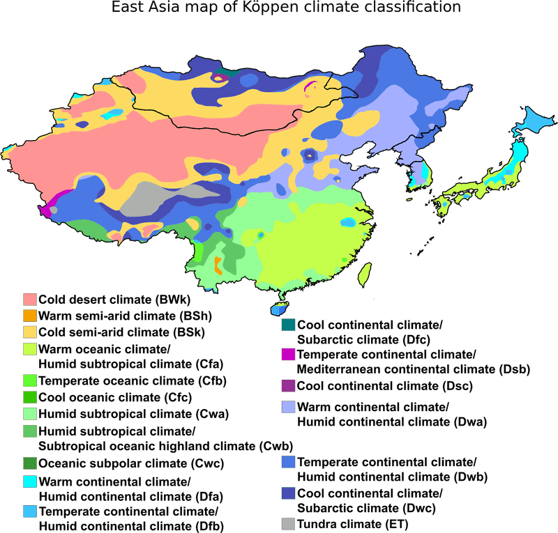
Southeast Asia Map Of Köppen Climate Classification

Southeast Asia Map of Köppen Climate Classification
South Asia Climate Zones Map
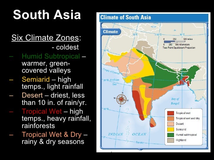
South Asia Climate Zones Map
South Asia Climate Zones Map
South Asia Climate Zones Map
Multiple Climate Hazard Map Of The Southeast Asia Region Source: Yusuf

Multiple climate hazard map of the Southeast Asia Region Source: Yusuf ...
Multiple Climate Hazard Map Of Southeast Asia | PreventionWeb

Multiple climate hazard map of Southeast Asia | PreventionWeb
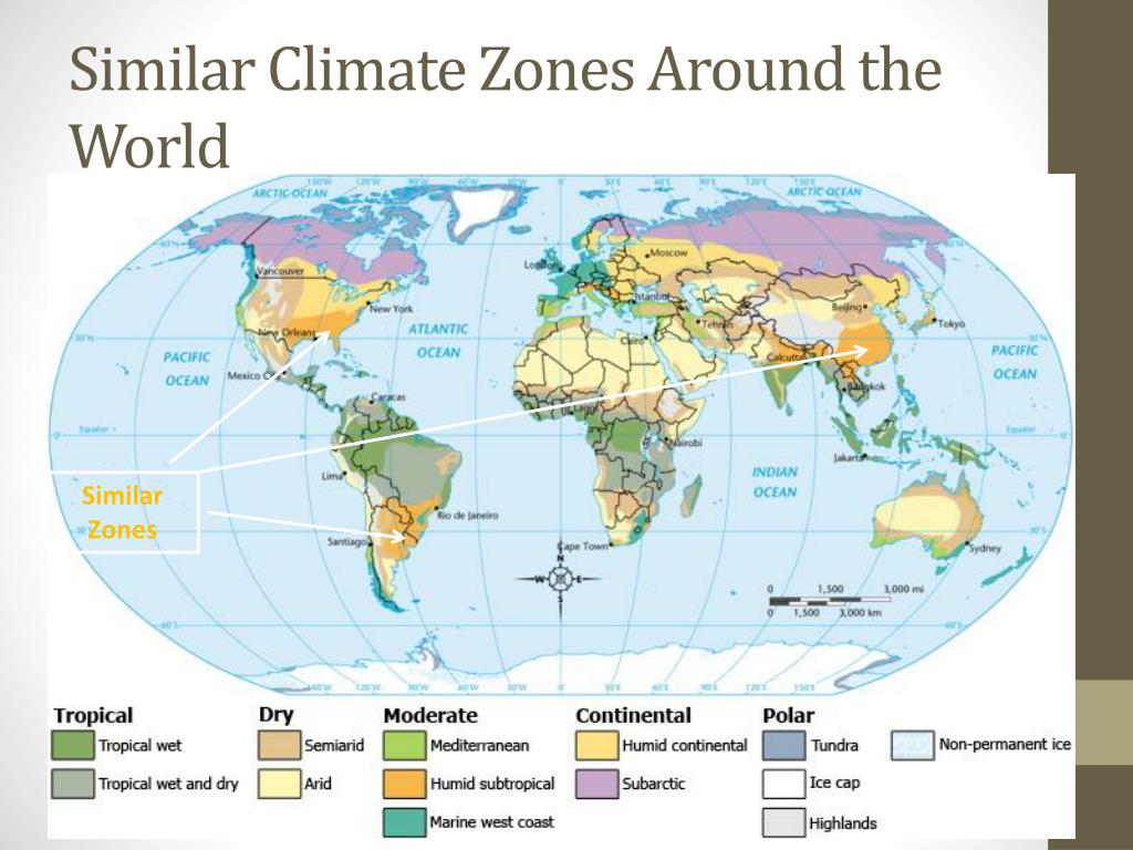
Asia Climate Zones Map, Vector Geographic Infographics Stock Vector
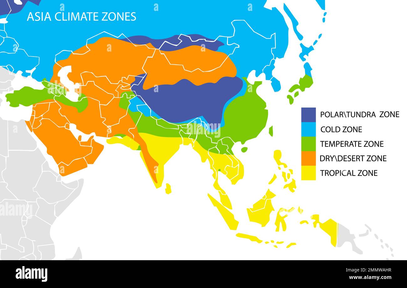
Asia climate zones map, vector geographic infographics Stock Vector ...
Southeast Asia Climate Map

Southeast asia climate map
South Asia Climate Zones Map

South Asia Climate Zones Map
South Asia Climate Zones Map Climate Impacts On Food Security And

South Asia Climate Zones Map Climate Impacts On Food Security And
Climate Map Of Southeast Asia

Climate Map Of Southeast Asia
South Asia Climate Zones Map
South Asia Climate Zones Map
South Asia Climate Zones Map Climate Impacts On Food Security And

South Asia Climate Zones Map Climate Impacts On Food Security And
South Asia Climate Zones Map

South Asia Climate Zones Map
Climate In Southeast Asia | PDF | Tropics | Forests

Climate in Southeast Asia | PDF | Tropics | Forests
Climate Map Of Southeast Asia
Climate Map Of Southeast Asia
Southeast Asia Climate Map
Southeast asia climate map
Climate Map Of Southeast Asia
Climate Map Of Southeast Asia